Mount Sabine Lookout Trail
View Photos
Mount Sabine Lookout Trail
Difficulty Rating:
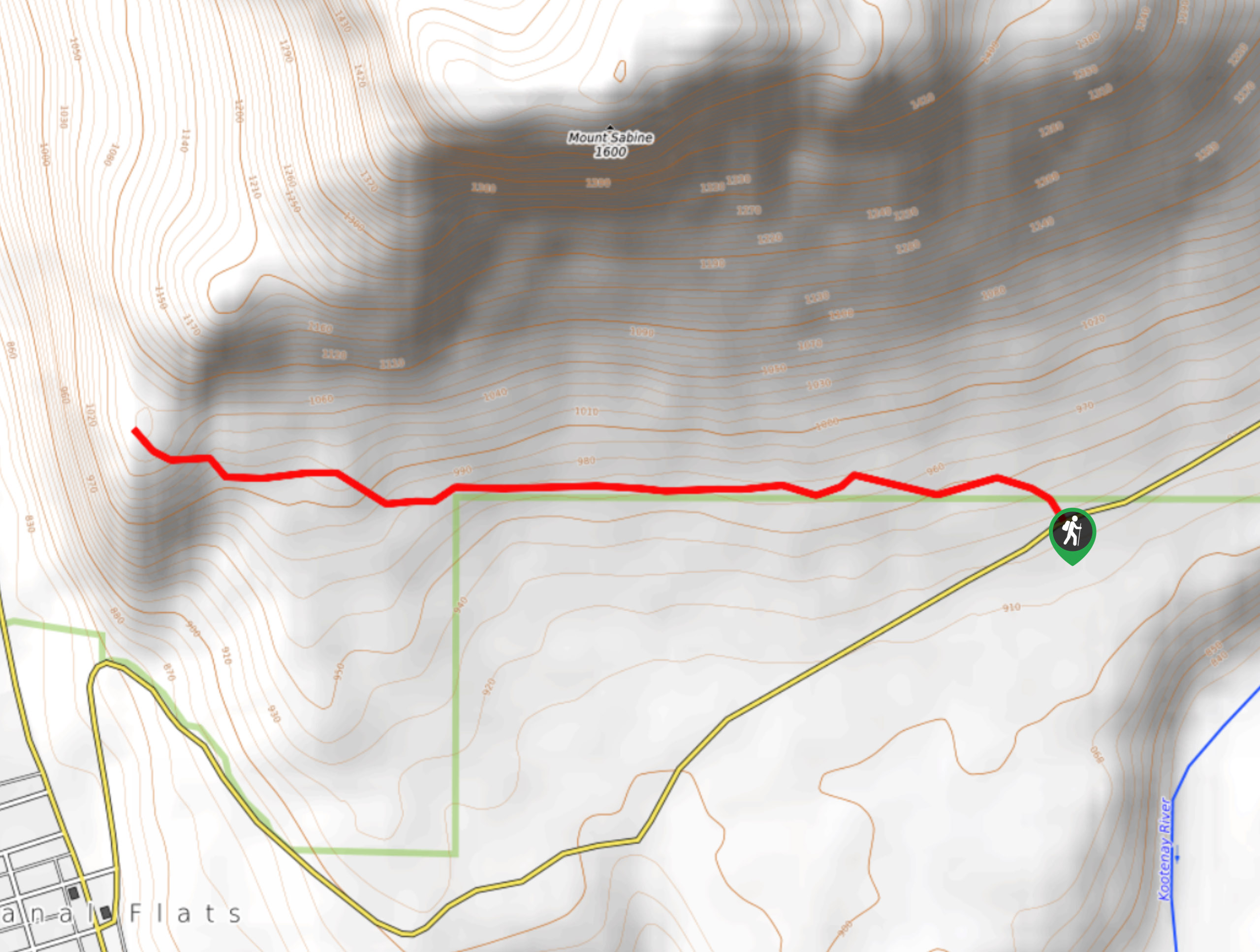
The Mount Sabine Lookout Trail is a 3.1mi out-and-back hiking route in Canal Flats, BC, that takes you along the forested southern slope of Mount Sabine to reach a scenic viewpoint overlooking the Kootenay River Valley. From there, you will have a great sightline over the town of Canal Flats, Columbia Lake, and the Purcell Mountains off in the distance. This trail offers quick access to some spectacular views, without the grind of a more difficult hiking route.
Getting there
To reach the Mount Sabine Lookout Trail from Canal Flats, drive north on Kootenay Forest Government Road for 2.1mi, where you will find the trailhead on the left.

About
| When to do | April-November |
| Backcountry Campsites | No |
| Pets allowed | Yes - On Leash |
| Family friendly | Older Children only |
| Route Signage | Average |
| Crowd Levels | Low |
| Route Type | Out and back |
Mount Sabine Lookout Trail
Elevation Graph
Weather
Mount Sabine Lookout Trail Description
If you are looking for an amazing hike with awesome views that is easy to access from town, then the Mount Sabine Lookout trail is the perfect half-day hiking option in Canal Flats. The trail can be found right off the Kootenay Forest Government Road and works through a beautiful stretch of forest along the lower slopes of Mount Sabine. Hiking to the west, you will gradually work your way up a gentle slope before arriving at the viewpoint. From here, you will experience amazing views that stretch out across the valley towards the distant Purcell Mountains, with the blue waters of Columbia Lake below you. For the effort required, this is a spectacular hiking route that is accessible for hikers of most skill levels.
Similar hikes to the Mount Sabine Lookout Trail hike

Spirit Trail Loop
The Spirit Trail Loop is a 10.1mi hiking circuit in the East Side Columbia Lake Wildlife Management Area,…

Mount Stevens and Teepee Mountain
The trek to Mount Stevens and Teepee Mountain is a steep 8.4mi out-and-back hiking route east of Wasa,…

Ram Creek Hot Springs
Hiking to the Ram Creek Hot Springs will take you on an 6.9mi out-and-back trail that runs along…
Comments