
Ptarmigan Lake Trail
View Photos
Ptarmigan Lake Trail
Difficulty Rating:
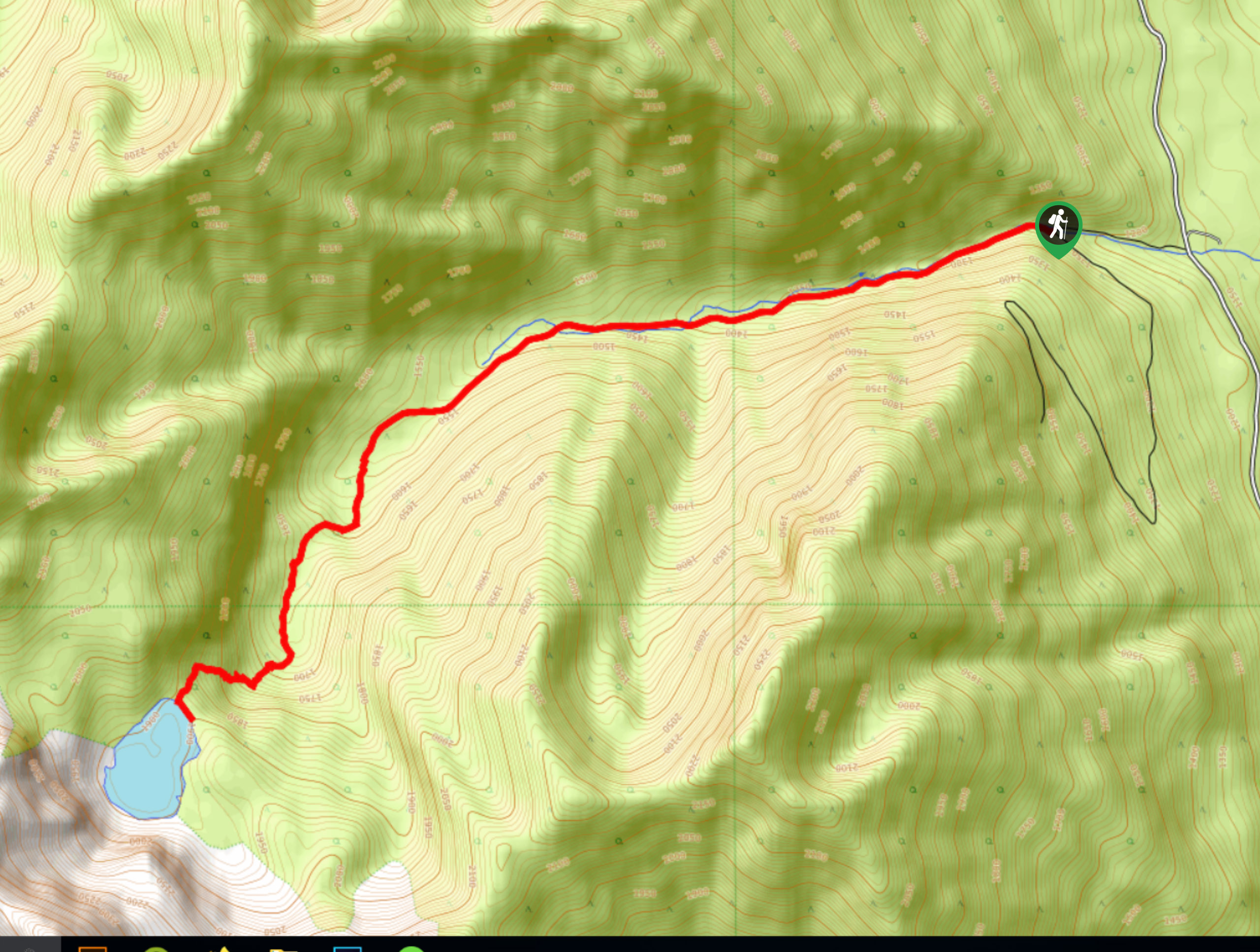
The Ptarmigan Lake Trail is an 7.1mi out-and-back hiking route near Whiteswan Lake Provincial Park that climbs steeply uphill to arrive at the pristine shores of a small alpine lake. Along the trail, you will pass through meadows and forests, before arriving at the water’s edge with a dramatic backdrop of vertical mountain cliffs. This hike offers spectacular views for the moderate amount of effort required to complete it.
Getting there
To reach the Ptarmigan Lake Trail from the Alice Lake Campground, drive east on Whiteswan Lake FSR for 5.7mi and turn left onto Moscow Creek Forest Road. After 3.6mi, turn left and continue for 2133ft before making a right to arrive at the trailhead.

About
| When to do | June-September |
| Backcountry Campsites | No |
| Pets allowed | Yes - On Leash |
| Family friendly | Older Children only |
| Route Signage | Average |
| Crowd Levels | Low |
| Route Type | Out and back |
Ptarmigan Lake Trail
Elevation Graph
Weather
Ptarmigan Lake Trail Description
Hiking the Ptarmigan Lake Trail is an amazing experience that will allow you to take in the natural beauty of this small alpine lake and its breathtaking surroundings. Although the trail is steep, it is not overly difficult and requires more time than technical skill to complete. This area can sometimes become washed out, so make sure to check trail conditions prior to setting out on your trek.
Initially, hikers will make their way along the road before breaking off through the forests and meadows that characterize the terrain in the area. Once you reach the edge of the lake, you will be greeted by a spectacular view of the shimmering water of the lake that is framed by the dramatic mountain peaks behind, including Blue Knight Peak. After exploring the area and taking in the spectacular scenery, head back along the same route to return to the trailhead.
Similar hikes to the Ptarmigan Lake Trail hike

Spirit Trail Loop
The Spirit Trail Loop is a 10.1mi hiking circuit in the East Side Columbia Lake Wildlife Management Area,…

Mount Stevens and Teepee Mountain
The trek to Mount Stevens and Teepee Mountain is a steep 8.4mi out-and-back hiking route east of Wasa,…

Ram Creek Hot Springs
Hiking to the Ram Creek Hot Springs will take you on an 6.9mi out-and-back trail that runs along…
Comments