
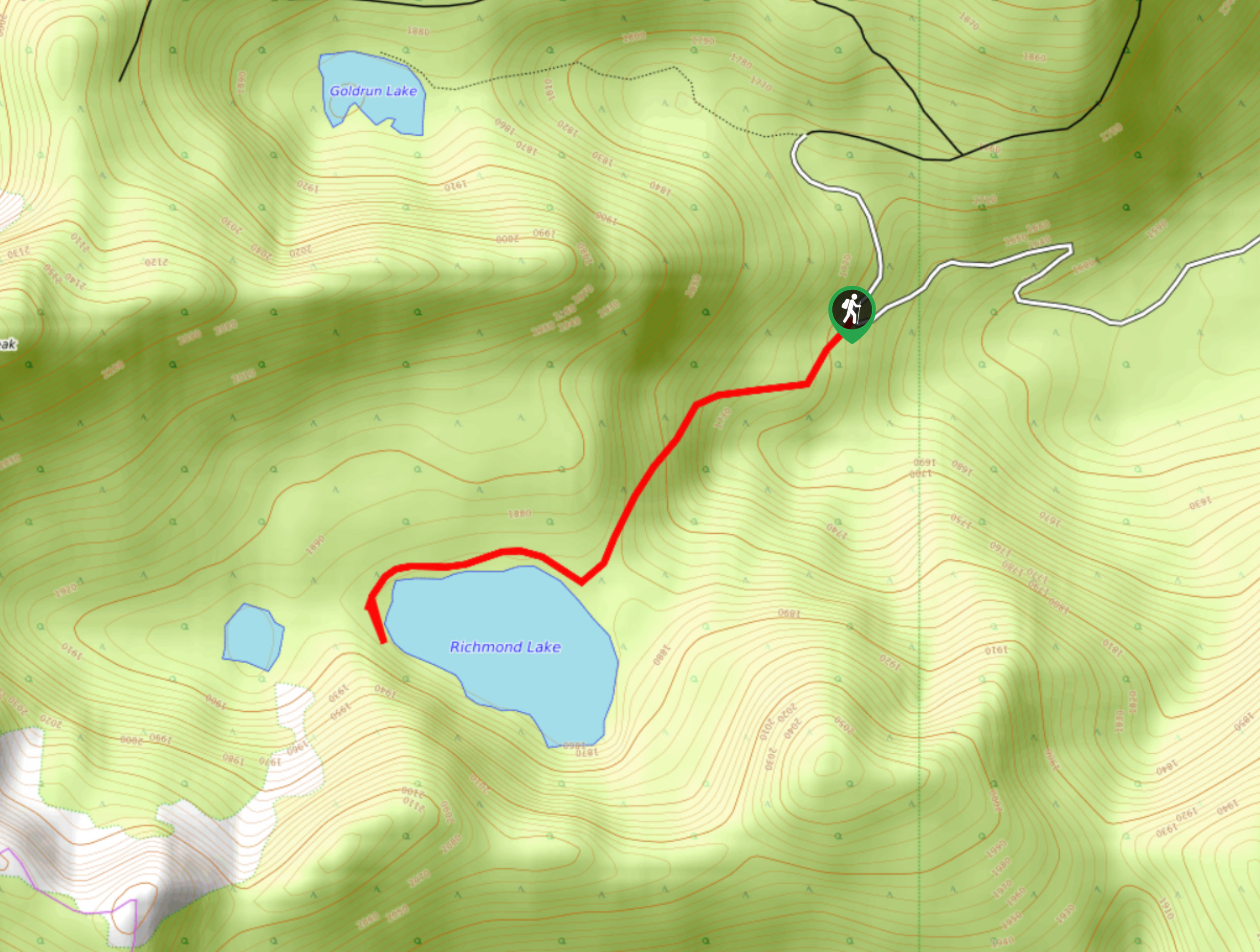
Richmond Lake Trail
View Photos
Richmond Lake Trail
Difficulty Rating:
The Richmond Lake Trail is a 1.9mi out-and-back hiking route near Cranbrook, BC, that will take you through a beautiful stretch of forest and over a small ridge to reach the shores of a picturesque woodland lake. Once at the lake, you will be surrounded by rugged peaks that can be explored to gain an impressive view over the surrounding area. This hike is a great family-friendly option to experience some amazing views and varied terrain.
Getting there
To get to the Richmond Lake Trail from Cranbrook, make your way northwest along King Street for 3.1mi and continue on Wycliffe Road. Turn left after 4.2mi onto Perry Creek Road and follow it for 3.4mi. Veer to the right to get on Perry Creek FSR and turn left at the first crossroad to stay on the road. After 1.1mi, make a slight right and continue on for 3.5mi. Head left at the fork, and you will find the trailhead on the left in 12.4mi.

About
| When to do | April-October |
| Backcountry Campsites | No |
| Pets allowed | Yes - On Leash |
| Family friendly | Yes |
| Route Signage | Average |
| Crowd Levels | Low |
| Route Type | Out and back |
Richmond Lake Trail
Elevation Graph
Weather
Richmond Lake Trail Description
Although short, the Richmond lake trail is big on picturesque scenery. The trail meanders through a charming stretch of forest and climbs slightly uphill to give you access to a small woodland lake that is nestled amongst the mountains. The views around the lake are spectacular, with the image of dense forests and rugged peaks reflecting off the calm water of the lake. For some added excitement, try climbing up the saddle to the west to get some sweeping views of the surrounding landscape from a rocky perch high above the lake. This quick half-day hike offers a world of possibilities for those looking for an easy route in the Cranbrook area.
Similar hikes to the Richmond Lake Trail hike

Spirit Trail Loop
The Spirit Trail Loop is a 10.1mi hiking circuit in the East Side Columbia Lake Wildlife Management Area,…

Ram Creek Hot Springs
Hiking to the Ram Creek Hot Springs will take you on an 6.9mi out-and-back trail that runs along…
Kimberley Nordic Centre Trail
The Kimberley Nordic Centre Trail is an 5.2mi hiking circuit in Kimberley, BC, that will take you through…
Comments