
Isadore Canyon Loop
View Photos
Isadore Canyon Loop
Difficulty Rating:
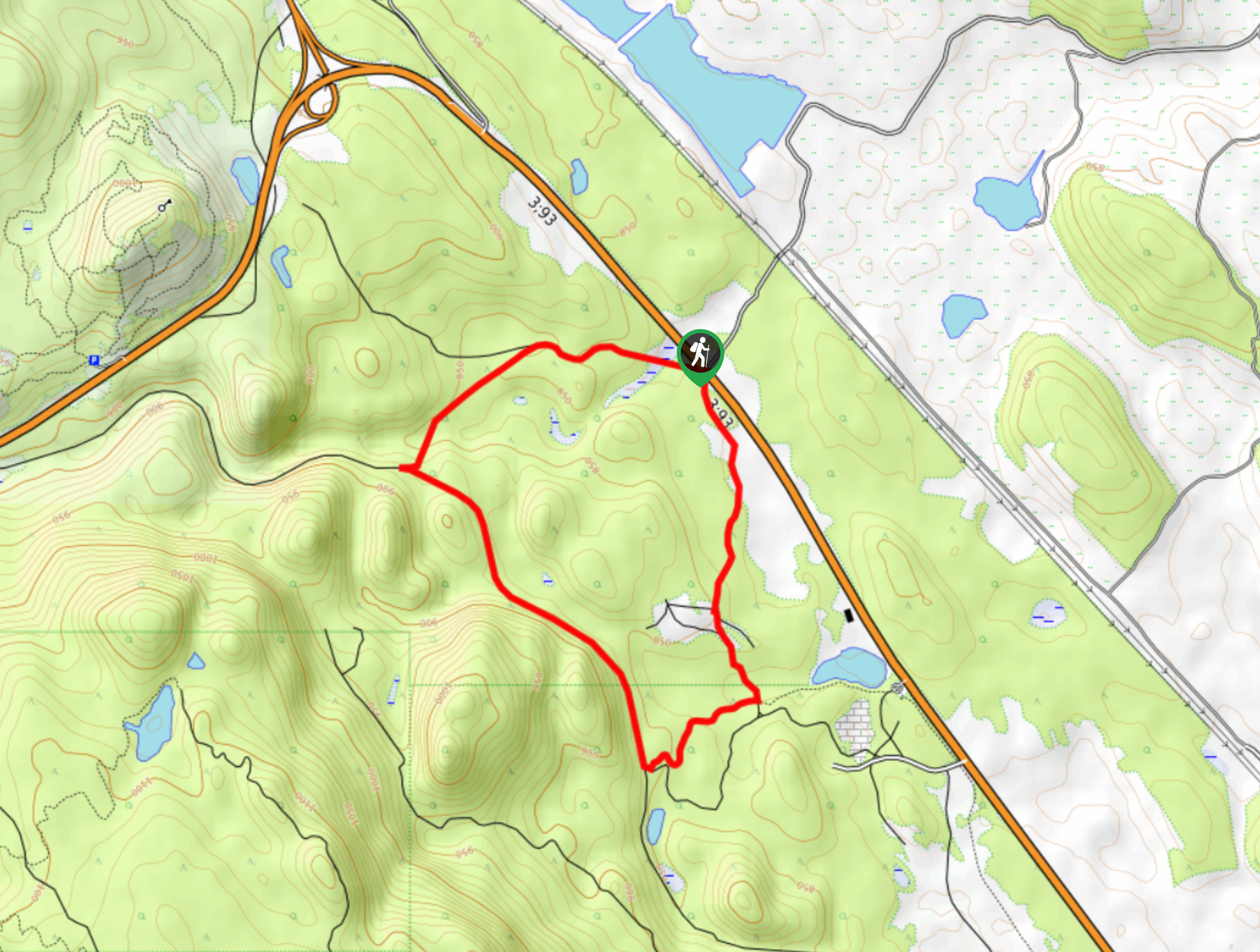
The Isadore Canyon Loop is a 3.6mi hiking circuit to the east of Cranbrook that traverses a mix of forested trails and rugged canyon terrain to reach two scenic viewpoints overlooking the valley. From the viewpoints, you will have a spectacular sightline that stretches east across the Kootenay River Valley towards the imposing Canadian Rockies that dominate the landscape. As parts of this trail are fairly new, hikers should make sure to bring a trail map or GPS in order to stay on the correct path.
Getting there
To get to the parking area for the Isadore Canyon Loop from Cranbrook, head northeast on BC-95 for 4.8mi and follow the signs for BC-3 E. Continue on it for another 1.7mi to find the trailhead on the right.

About
| When to do | April-September |
| Backcountry Campsites | No |
| Pets allowed | Yes |
| Family friendly | Older Children only |
| Route Signage | Poor |
| Crowd Levels | Low |
| Route Type | Circuit |
Isadore Canyon Loop
Elevation Graph
Weather
Isadore Canyon Loop Description
Hiking the Isadore Canyon Loop is a quick way to get some pretty amazing views of the flat valley landscape and rugged mountain scenery that characterizes this part of British Columbia. The moderate terrain and minor changes in elevation make this a great trail for some weekend family exploring in Cranbrook.
From the parking area, follow the trail into the forest cover to the south, making your way around the loop in a clockwise direction. As you gain some elevation along the trail, you will eventually arrive at the scenic viewpoints that look out over the Kootenay River valley. Take in the amazing views and try to spot any recognizable peaks, such as Mount Fisher, Lone Peak, and The Steeples. After taking in the views, continue along the forested trail and appreciate the tranquil setting that can be found through the unreal woodland landscape. Once you have completed the loop, you will arrive back at the parking area where you began your journey.
Similar hikes to the Isadore Canyon Loop hike

Spirit Trail Loop
The Spirit Trail Loop is a 10.1mi hiking circuit in the East Side Columbia Lake Wildlife Management Area,…

Mount Stevens and Teepee Mountain
The trek to Mount Stevens and Teepee Mountain is a steep 8.4mi out-and-back hiking route east of Wasa,…

Ram Creek Hot Springs
Hiking to the Ram Creek Hot Springs will take you on an 6.9mi out-and-back trail that runs along…
Comments