
Moyie Falls
View Photos
Moyie Falls
Difficulty Rating:
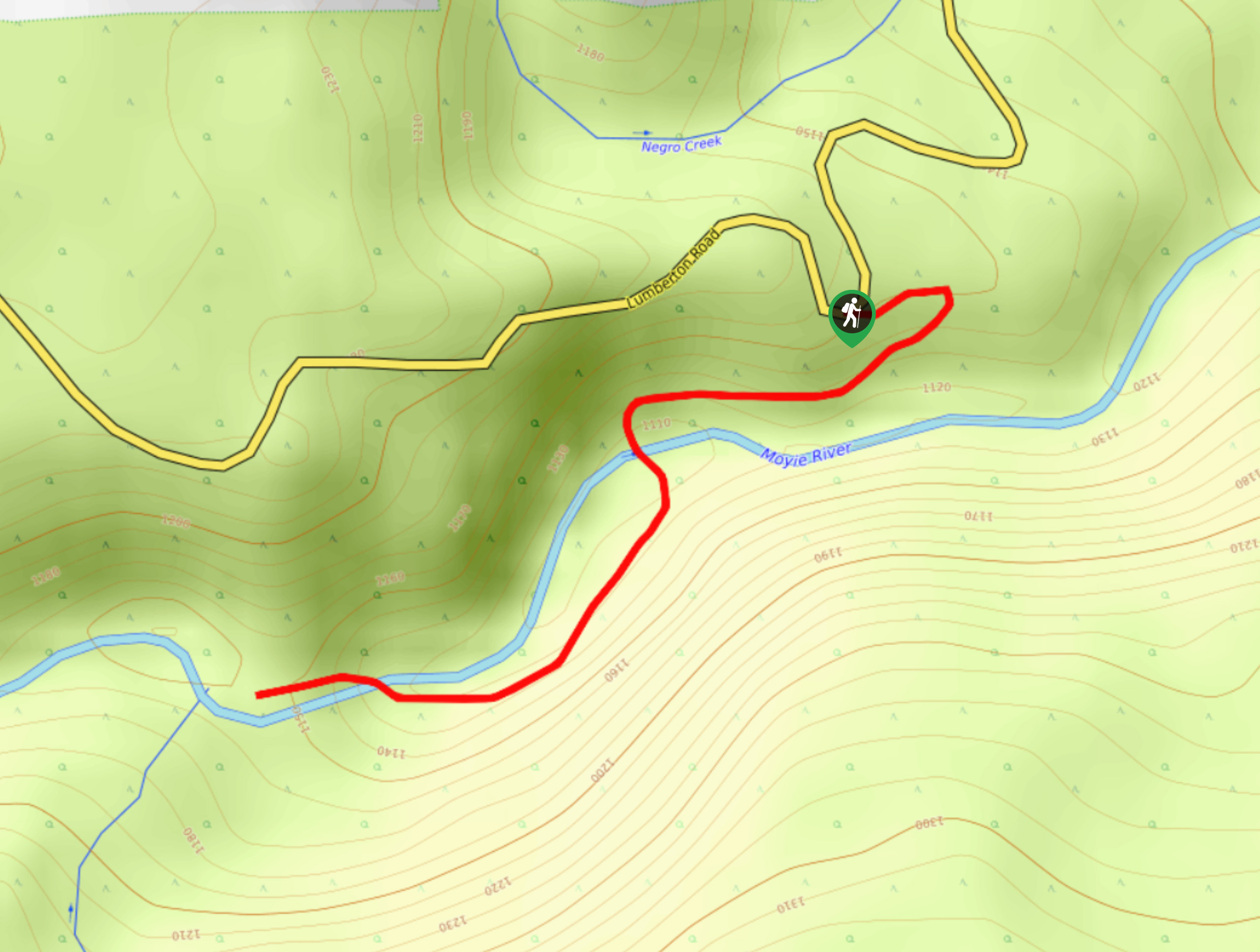
Making the trek to Moyie Falls will see hikers utilize a 1.4mi out-and-back hiking route near Cranbrook, BC, that follows closely alongside the rushing waters of the Moyie River until you reach the viewpoint overlooking the falls. The trail is relatively flat and short, making it accessible for hikers of almost any skill level. Timing this hike for the early spring will allow you to experience the full glory of the gushing waterfall, while doing it in the winter will allow you to view the cascading water after it has been frozen in place, encasing the massive rock formation of the falls with a sheet of ice.
Getting there
To get to the trailhead for Moyie Falls from Cranbrook, drive southwest on BC-95 for 7.6mi and turn right onto Lumberton Road. After 4.5mi, you will find the trailhead on the left.

About
| When to do | April-November |
| Backcountry Campsites | No |
| Pets allowed | Yes |
| Family friendly | Yes |
| Route Signage | Average |
| Crowd Levels | Low |
| Route Type | Out and back |
Moyie Falls
Elevation Graph
Weather
Moyie Falls Trail Description
Although it is a short route, the Moyie Falls trail is a fun hike through the forest that will give you a bit of fresh air and allow you to experience the beauty and raw power of the cascading Moyie Falls, also referred to as the Lumberton Falls. The trail sets out from the parking area and immediately enters into the shady cover of the forest. Very quickly, you will arrive at the edge of the Moyie River, which you will need to cross over to continue on your way to the falls. Use caution when crossing over the river and if the water is too high, you can always come back on another day. Continuing on the opposite bank of the river, you will eventually arrive at the viewpoint overlooking the falls. Spend some time relaxing in the area and taking in the sound of the torrenting water before heading back along the same trail to return to your vehicle at the parking area.
Similar hikes to the Moyie Falls hike

Spirit Trail Loop
The Spirit Trail Loop is a 10.1mi hiking circuit in the East Side Columbia Lake Wildlife Management Area,…

Ram Creek Hot Springs
Hiking to the Ram Creek Hot Springs will take you on an 6.9mi out-and-back trail that runs along…
Kimberley Nordic Centre Trail
The Kimberley Nordic Centre Trail is an 5.2mi hiking circuit in Kimberley, BC, that will take you through…
Comments