
Lois Creek Trail
View Photos
Lois Creek Trail
Difficulty Rating:
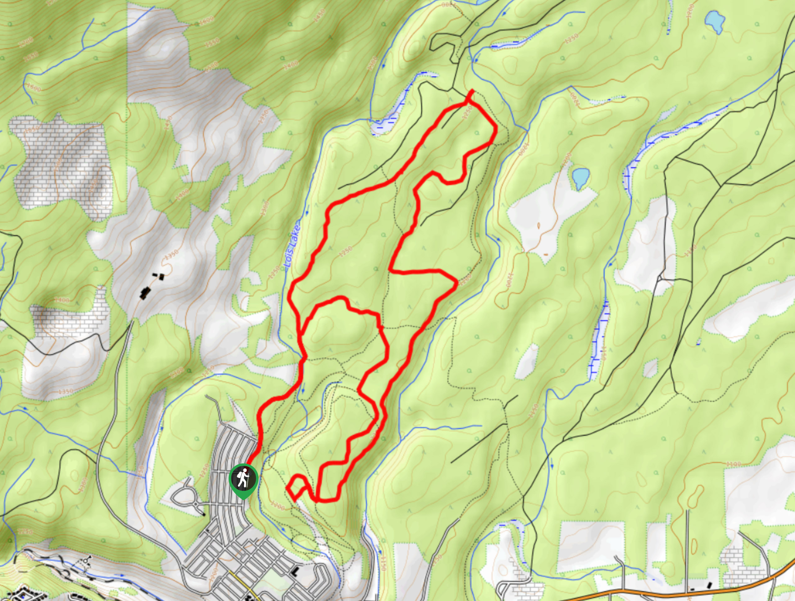
The Lois Creek Trail is a 7.9mi hiking circuit on the northeastern edge of Kimberley, BC, that takes you through a scenic forest that runs along the creek. This trail is a great multi-use route that is popular with various outdoor sports enthusiasts, including hikers, mountain bikers, trail runners, and snowshoers. Make sure to bring a GPS for your hike, as there are several intersecting trails that can make navigation a bit tricky.
Getting there
To reach the Lois Creek Trail from Kimberley, head north on Wallinger Avenue for 1804ft and turn left onto 4th Avenue. After 0.7mi, turn right onto Moyie Street and follow it for 623ft, before making a slight left onto 6th Avenue. Turn right onto Elko Street and you will find the trailhead straight ahead in 328ft.

About
| When to do | May-September |
| Backcountry Campsites | No |
| Pets allowed | Yes |
| Family friendly | Older Children only |
| Route Signage | Poor |
| Crowd Levels | Moderate |
| Route Type | Lollipop |
Lois Creek Trail
Elevation Graph
Weather
Lois Creek Trail Description
The Lois Creek Trail is a fun and easy way to spend some quality outdoor time in the Kimberley area and its extensive network of trails. Make sure to keep an eye out for other outdoor enthusiasts along the trail, and allow any bikers or trail runners to safely make their way around you. This route sets out from the trailhead and travels north through the forest alongside the waters of Lois Creek before meeting up with Kimberley Creek and following it south. Here, hikers will need to keep an eye on the GPS to stay on the correct path amidst the intertwined trails in the area. After reaching the edge of the city, the trail winds back through the forest to the north, meeting up with the original path and following it back to the trailhead. This hike is a great way to get out into the tranquil atmosphere of the forest and reconnect with nature.
Similar hikes to the Lois Creek Trail hike

Spirit Trail Loop
The Spirit Trail Loop is a 10.1mi hiking circuit in the East Side Columbia Lake Wildlife Management Area,…

Mount Stevens and Teepee Mountain
The trek to Mount Stevens and Teepee Mountain is a steep 8.4mi out-and-back hiking route east of Wasa,…

Ram Creek Hot Springs
Hiking to the Ram Creek Hot Springs will take you on an 6.9mi out-and-back trail that runs along…
Comments