
Apache Loop
View Photos
Apache Loop
Difficulty Rating:
The Apache Loop is a 4.0mi lollipop hiking route in Kimberley, BC that passes through the Kimberley Nature Park and provides some nice views of the surrounding area. The trail is forested, but it does feature a few viewpoints, from which you will be able to see across the valley and spot a few mountain tops. Make sure to bring a trail map or GPS, as there are several intersecting routes that will make navigation difficult in some places.
Getting there
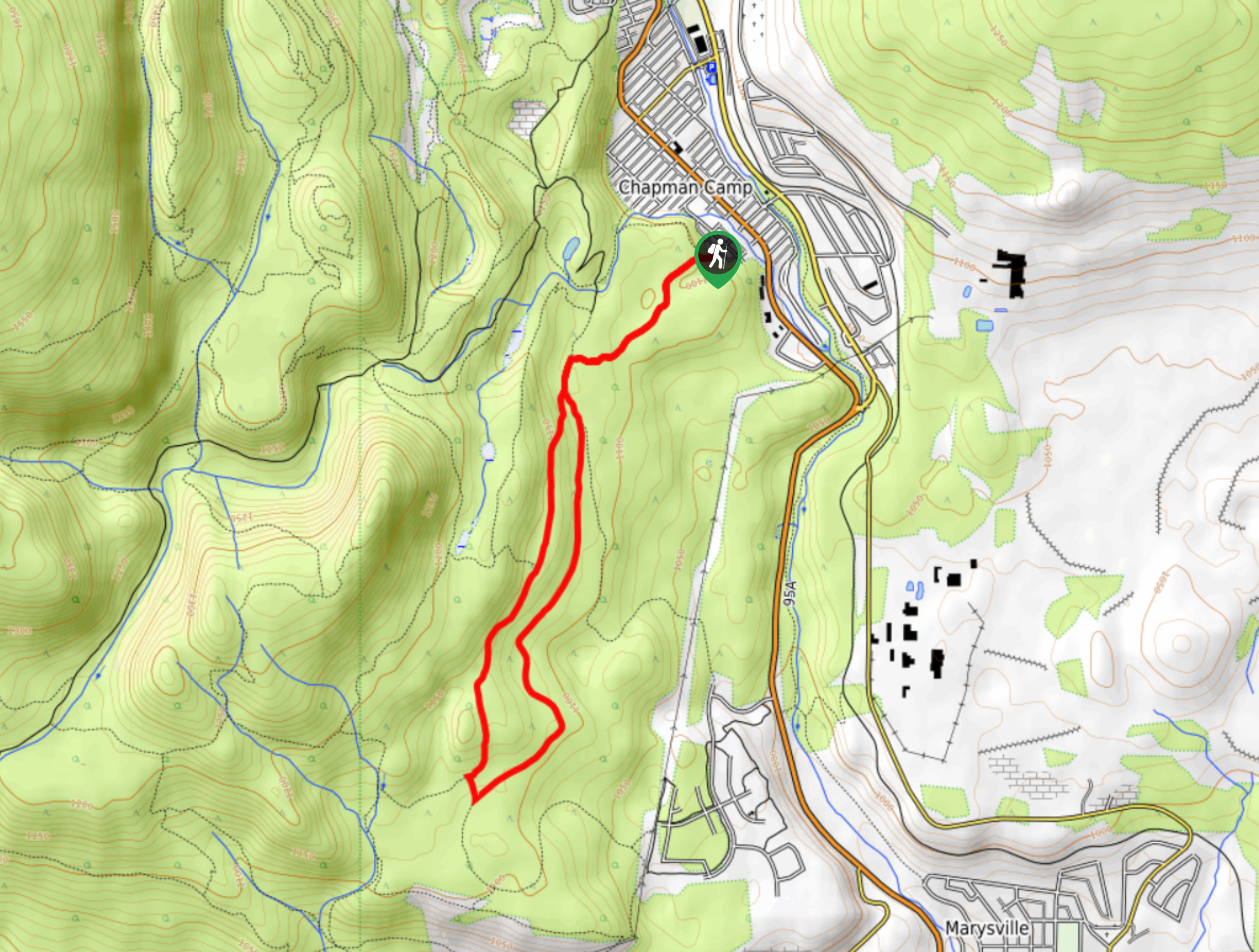
To get to the Apache Loop trailhead from the BC-95A highway in Kimberley, drive southeast and make a right turn onto Dalgren Street. Turn left after 459ft onto Dewolfe Avenue and follow it for 853ft. Make a right on Marsden Street and follow it until the end, where you will find the trailhead.

About
| When to do | April-October |
| Backcountry Campsites | No |
| Pets allowed | Yes |
| Family friendly | Older Children only |
| Route Signage | Average |
| Crowd Levels | Moderate |
| Route Type | Lollipop |
Apache Loop
Elevation Graph
Weather
Apache Loop Trail Description
As the Apache Loop is part of a dense network of multi-use routes in the area, you will need to keep an eye on the trail and follow along with a GPS in order to remain on track; otherwise, you will likely end up a bit further into the nature park than expected — which isn’t always a bad thing! Heading out from the trailhead on Marsden Street, follow the path to the southwest through the tree cover until you reach a fork in the trail. Follow the path to the right in order to complete the forested loop in a counterclockwise direction. Along the trail, you will pop in and out of the cover of the forest, so be prepared to get a bit of sun on this hike. Take in the intermittent views of the surrounding area as you work your way around the loop and eventually return to the trailhead.
Similar hikes to the Apache Loop hike

Spirit Trail Loop
The Spirit Trail Loop is a 10.1mi hiking circuit in the East Side Columbia Lake Wildlife Management Area,…

Mount Stevens and Teepee Mountain
The trek to Mount Stevens and Teepee Mountain is a steep 8.4mi out-and-back hiking route east of Wasa,…

Ram Creek Hot Springs
Hiking to the Ram Creek Hot Springs will take you on an 6.9mi out-and-back trail that runs along…
Comments