
Fish Lake
View Photos
Fish Lake
Difficulty Rating:
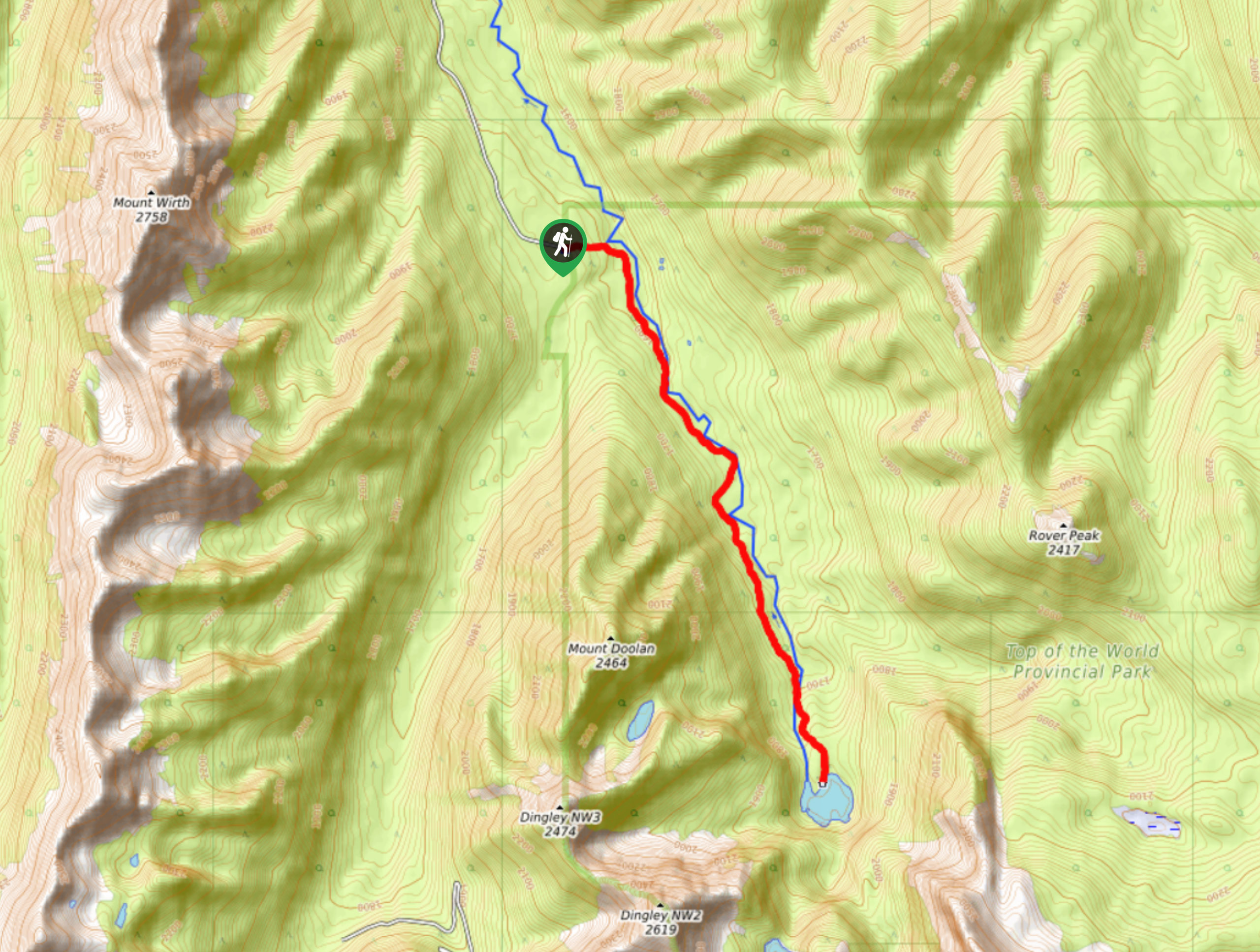
The trek to Fish Lake follows a 7.8mi out-and-back hiking route that will allow you to experience the impressive scenery within Top of the World Provincial Park. The route travels south through a dense stretch of forest that runs closely alongside the Lussier River before arriving at the calm waters of Fish Lake. Once there, you will be surrounded by an amazingly serene atmosphere with views of Mount Doolan and the peaks of Mount Dingley.
Getting there
To reach the Fish Lake trailhead from the Alice Lake Campground in Whiteswan Lake Provincial Park, drive southeast on Lussier River FSR for 5.2mi and turn right to stay on the road. Continue for another 13.8mi to reach the parking area.

About
| When to do | May-October |
| Backcountry Campsites | Fish Lake Cabin |
| Pets allowed | Yes |
| Family friendly | Older Children only |
| Route Signage | Average |
| Crowd Levels | Low |
| Route Type | Out and back |
Fish Lake
Elevation Graph
Weather
Fish Lake Trail Description
Fish Lake is a beautiful subalpine body of water that can be found within Top of the World Provincial Park, which is a real gem of an area when it comes to breathtaking scenery. A fairly non-technical route, the hike to Fish Lake will see you trek through the forest alongside the flowing waters of Lussier Creek before crossing over them on the final approach to the lake. As with any backcountry BC trail, make sure to bring bear spray and make plenty of noise along your journey to avoid any potentially dangerous encounters with bears.
Setting out from the parking area, the trail quickly enters into the heavy cover of the forest to the east before meeting up with the river and following it towards the south. The entirety of the hike will skirt along the edge of the water, so use it as your guide and enjoy the tranquil atmosphere of the forest as you inch closer to the lake. Eventually, you will cross over the river and arrive at the serene shores of Fish Lake, where you will experience breathtaking views across the crystal-clear water to the surrounding mountain peaks. Take some time to explore the area or set up camp if you are planning to stay the night before heading back along the same route through the forest to return to the trailhead.
Similar hikes to the Fish Lake hike

Spirit Trail Loop
The Spirit Trail Loop is a 10.1mi hiking circuit in the East Side Columbia Lake Wildlife Management Area,…

Mount Stevens and Teepee Mountain
The trek to Mount Stevens and Teepee Mountain is a steep 8.4mi out-and-back hiking route east of Wasa,…

Ram Creek Hot Springs
Hiking to the Ram Creek Hot Springs will take you on an 6.9mi out-and-back trail that runs along…
Comments