
Cranbrook Mountain Trail
View Photos
Cranbrook Mountain Trail
Difficulty Rating:
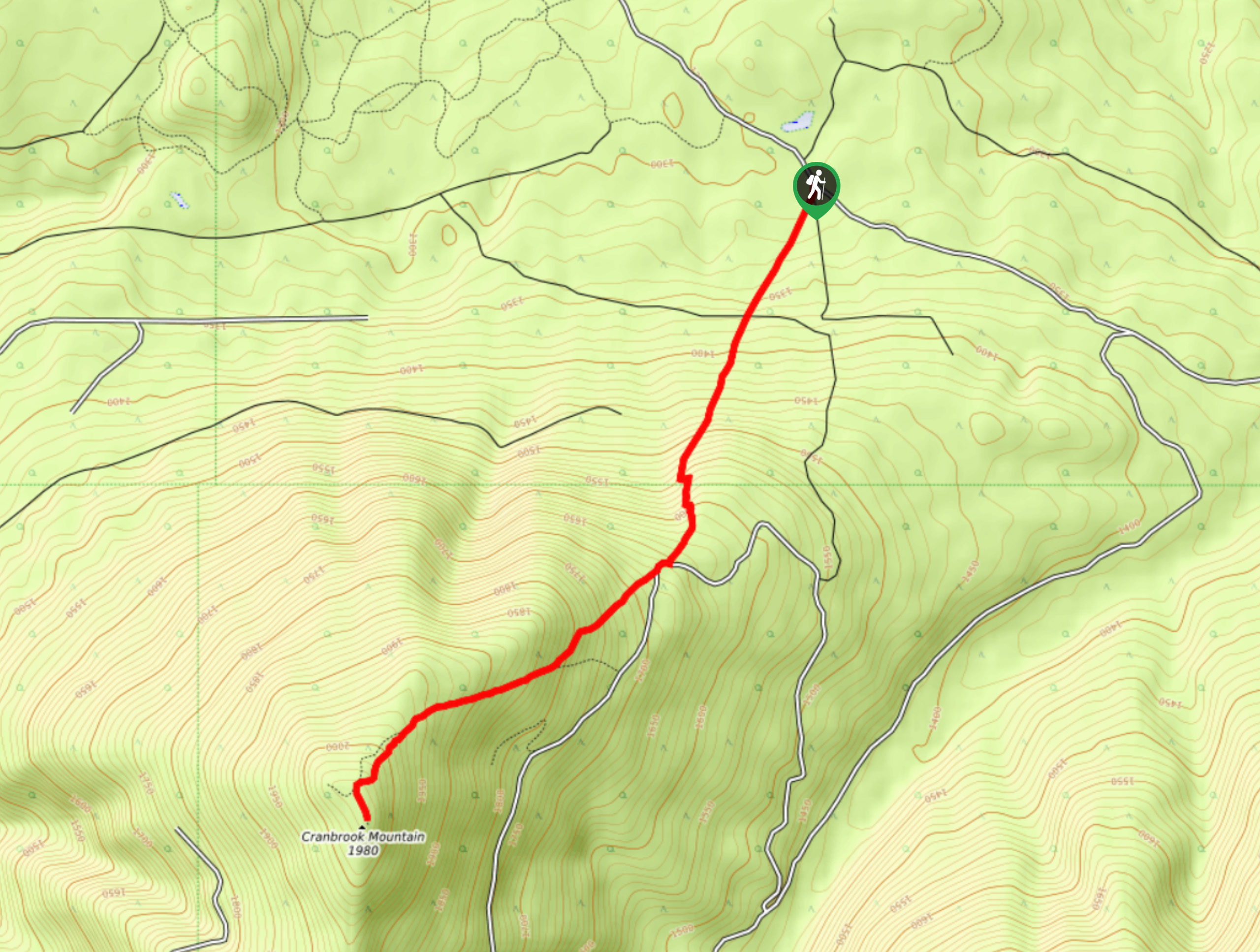
The Cranbrook Mountain Trail is an 5.5mi out-and-back hiking route near Cranbrook, BC, that will take you on a grind up the mountain for some views overlooking the Kootenay River Valley. Although the trail isn’t very technical or difficult, it does feature 2513ft of elevation gain that is pretty near constant until you reach the summit. Make sure to bring plenty of water and snacks to stay fuelled up while out on this tough uphill climb.
Getting there
To get to the parking area for the Cranbrook Mountain Trail from Cranbrook, head southeast on Gold Creek Road for 6.9mi, where you will make a right turn. Continue on for 1.7mi and turn right again. After another 1.9mi, you will find the trailhead on the left.

About
| When to do | April-September |
| Backcountry Campsites | No |
| Pets allowed | Yes |
| Family friendly | Older Children only |
| Route Signage | Average |
| Crowd Levels | Low |
| Route Type | Out and back |
Cranbrook Mountain Trail
Elevation Graph
Weather
Cranbrook Mountain Trail Description
The Cranbrook Mountain Trail is a fun hiking route that will take you through a nice variety of terrain, including thick forests, exposed trails and a beautiful viewpoint from the summit. The trail isn’t really technical, but you will constantly be working uphill, so make sure to wear proper hiking footwear and bring poles to help your knees on the descent.
The trail sets out from the side of the forest service road and immediately heads into the tree cover. After a short distance, you will break out into an open meadow and cross over several roads before re-entering the forest on the other side. After making your way through the trees, you will once again come to an open meadow, keeping its green expanse on your left and the thick brush of the forest on your right.
Continue climbing uphill as you work your way to the summit of Cranbrook Mountain. Once there, you can enjoy the amazing views that sweep across the Kootenay River Valley towards the east, where you will find the imposing wall of the Rocky Mountains. After taking in the sights, head back down the same route to return to the trailhead.
Similar hikes to the Cranbrook Mountain Trail hike

Spirit Trail Loop
The Spirit Trail Loop is a 10.1mi hiking circuit in the East Side Columbia Lake Wildlife Management Area,…

Mount Stevens and Teepee Mountain
The trek to Mount Stevens and Teepee Mountain is a steep 8.4mi out-and-back hiking route east of Wasa,…

Ram Creek Hot Springs
Hiking to the Ram Creek Hot Springs will take you on an 6.9mi out-and-back trail that runs along…
Comments