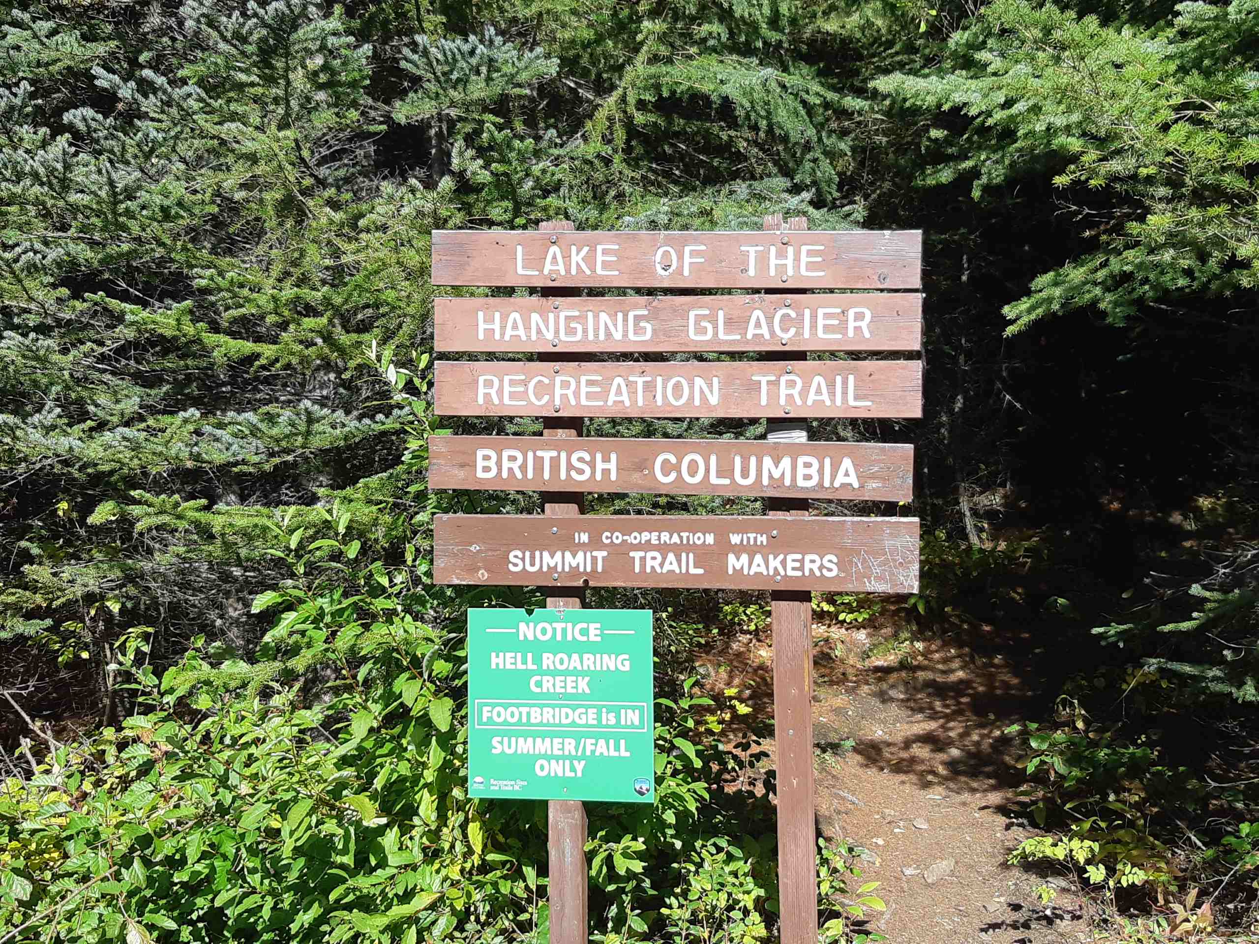
Lake of the Hanging Glacier
View Photos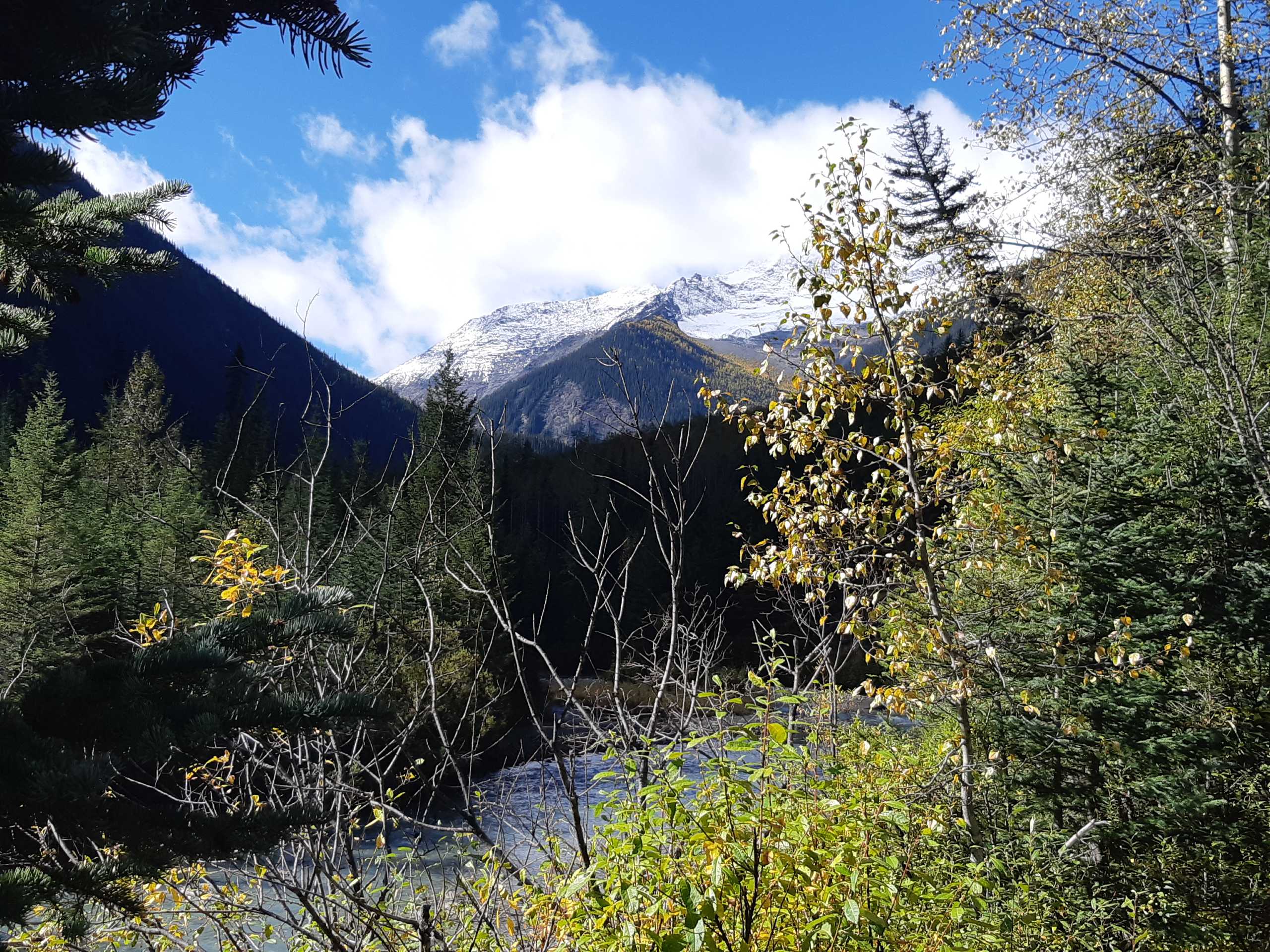
Lake of the Hanging Glacier
Difficulty Rating:
The trail leading to the Lake of the Hanging Glacier is a 9.9mi out-and-back hiking route that will take you on an amazing adventure through forests and over scenic river crossings to reach a picturesque glacial lake with surrounding mountains framing the backdrop. More technical than steep, this route is a challenging hike that will reward you with breathtaking scenery and unforgettable memories. It’s best to make the drive in with a 4x4 high clearance vehicle, as the road to the trailhead is fairly rough and rugged.
Getting there
To reach the Lake of the Hanging Glacier trailhead from Radium Hot Springs, drive west on Forsters Landing Road for 1.7mi and make a slight left onto Horsethief Creek Road. After 5.3mi, make a slight right on Forster Creek FSR and follow it for 1.1mi. Make a left on Horsethief Creek Road and follow it for another 5.9mi before turning left. Continue for 16.7mi to arrive at the trailhead.

About
| When to do | June-October |
| Backcountry Campsites | No |
| Pets allowed | Yes - On Leash |
| Family friendly | No |
| Route Signage | Average |
| Crowd Levels | Moderate |
| Route Type | Out and back |
Lake of the Hanging Glacier
Elevation Graph
Weather
Lake of the Hanging Glacier Trail Description
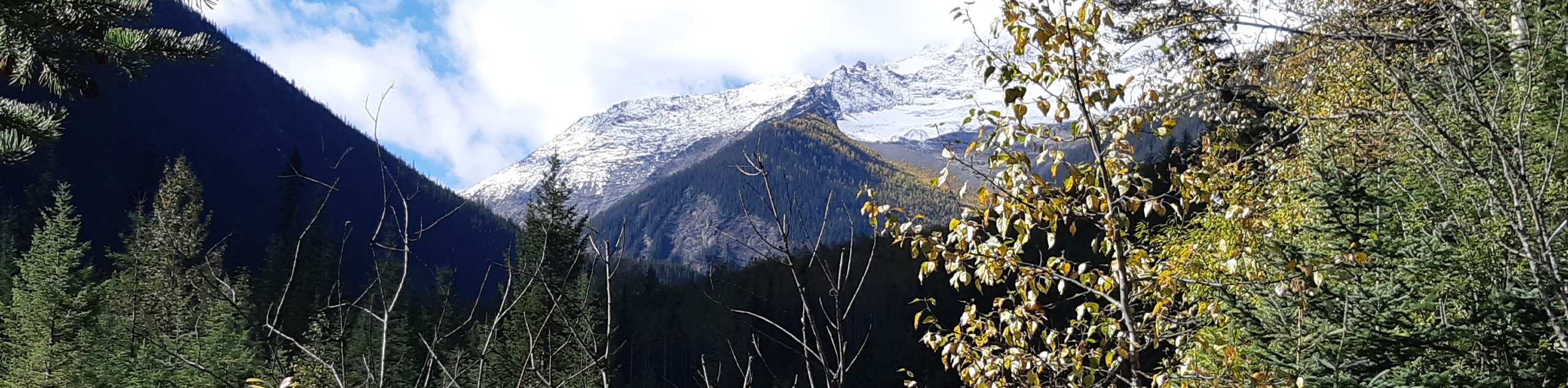
Hiking to the Lake of the Hanging Glacier is a spectacular outdoor experience that will allow you to visit a glacial lake that is nestled within some truly jaw-dropping terrain. The trail winds through the forest alongside Horsethief Creek before visiting the cascading waters of a spectacular waterfall. From here, the route turns south and climbs through the valley to reach the picturesque shores of the Lake of the Hanging Glacier.
Once there, take some time to explore the surrounding area and get up close with the melting glacier. Directly behind the lake, you will have the imposing rock formations of the Commander, Lieutenants, and Guardsmen peaks; to the west, you will find Glacier Dome, and to the east, you will be able to spot Granite Peak and Mount Maye. After taking in the amazing views of the surrounding mountains and the crystal-blue water of the lake, head back down the trail to return to your vehicle.
*Note: The bridge crossing Hell Roaring Creek is currently out and awaiting repairs. Attempting to cross the creek by foot can be dangerous, and you should only attempt it if you are experienced enough to do so.*
Similar hikes to the Lake of the Hanging Glacier hike

Spirit Trail Loop
The Spirit Trail Loop is a 10.1mi hiking circuit in the East Side Columbia Lake Wildlife Management Area,…

Mount Stevens and Teepee Mountain
The trek to Mount Stevens and Teepee Mountain is a steep 8.4mi out-and-back hiking route east of Wasa,…

Ram Creek Hot Springs
Hiking to the Ram Creek Hot Springs will take you on an 6.9mi out-and-back trail that runs along…
Comments