
Moe’s Canyon Loop
View Photos
Moe’s Canyon Loop
Difficulty Rating:
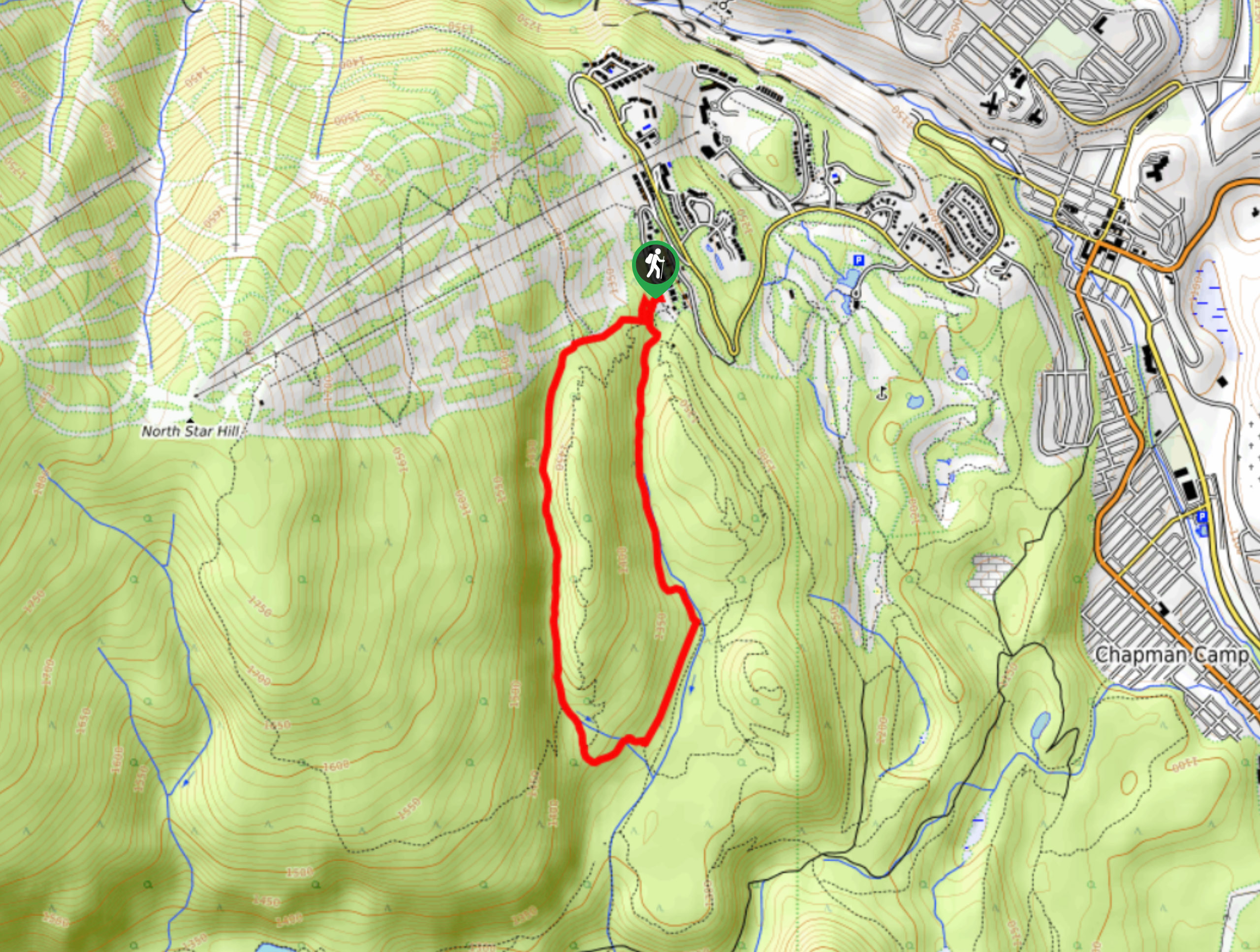
Moe’s Canyon Loop is a 2.9mi lollipop hiking route just west of Kimberley that sets out from the Kimberley Nordic Club and traverses some forested and rocky terrain. You can expect to experience an amazing forest setting with wild berry bushes and some rock falls scattered across the area along the route. Although a tiny bit overgrown, this trail is still accessible for the majority of hikers.
Getting there
To access Moe’s Canyon Loop from Kimberley, head northeast on BC-95A and turn left onto Burdett Street. After 951ft, make a slight right on Norton Avenue and follow it for 2953ft. Turn left onto Gerry Sorensen Way and continue on for 1.2mi, before making a slight left on North Star Drive. You will find the trail straight ahead in 1969ft.

About
| When to do | April-October |
| Backcountry Campsites | No |
| Pets allowed | Yes |
| Family friendly | Older Children only |
| Route Signage | Average |
| Crowd Levels | Moderate |
| Route Type | Lollipop |
Moe’s Canyon Loop
Elevation Graph
Weather
Moe’s Canyon Trail Description
Hiking the Moe’s Canyon Loop is an awesome way to get out and explore the natural beauty of the Kimberley area. The trail sets out from the Kimberley Nordic Club and heads southwest through some light tree cover before meeting up with a small creek. The trail follows the creek south to Iker’s Landing, a solid picnic spot with some nice views looking across the valley to the Rocky Mountains. From there, follow the loop to the southwest, before it turns back towards the north for the return leg of the hike. Along this last stretch, you will make your way past several rock falls that you can explore before arriving back at the trailhead and your parked vehicle.
Similar hikes to the Moe’s Canyon Loop hike

Spirit Trail Loop
The Spirit Trail Loop is a 10.1mi hiking circuit in the East Side Columbia Lake Wildlife Management Area,…

Mount Stevens and Teepee Mountain
The trek to Mount Stevens and Teepee Mountain is a steep 8.4mi out-and-back hiking route east of Wasa,…

Ram Creek Hot Springs
Hiking to the Ram Creek Hot Springs will take you on an 6.9mi out-and-back trail that runs along…
Comments