Mary’s Lunch Room
View Photos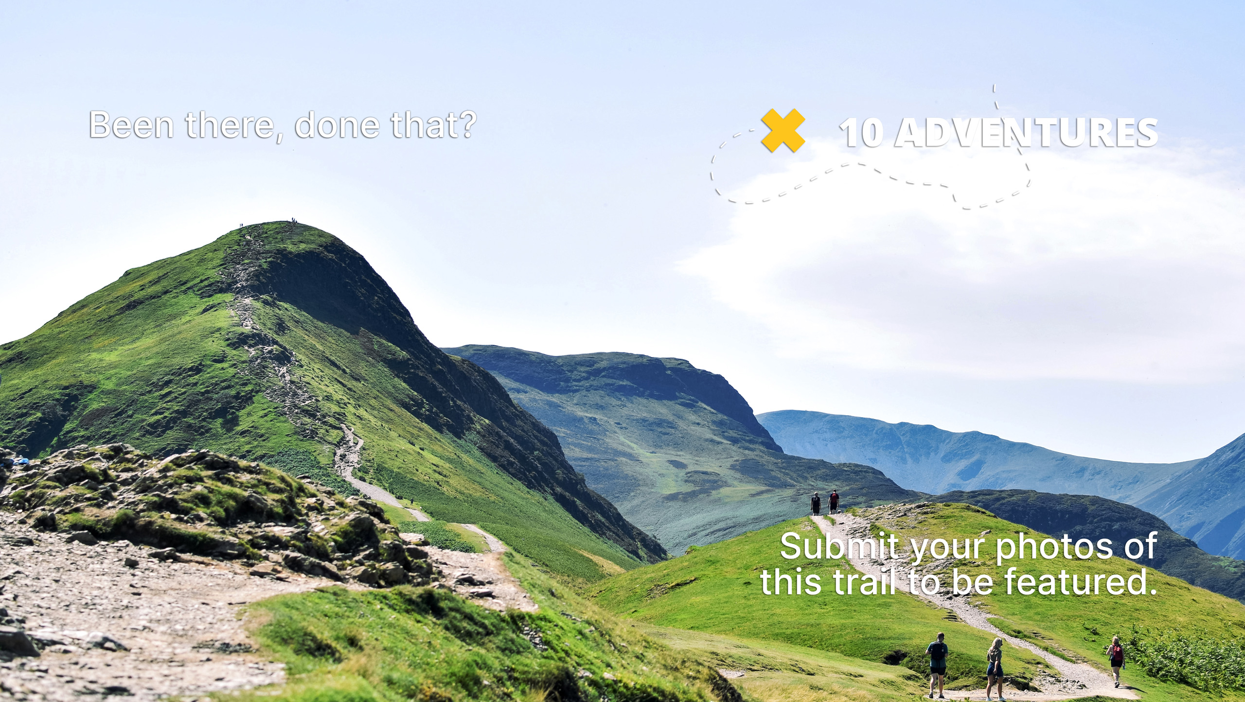
Mary’s Lunch Room
Difficulty Rating:
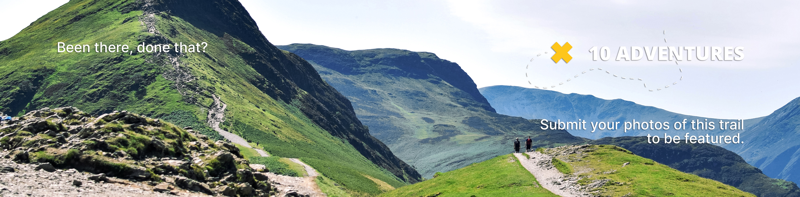
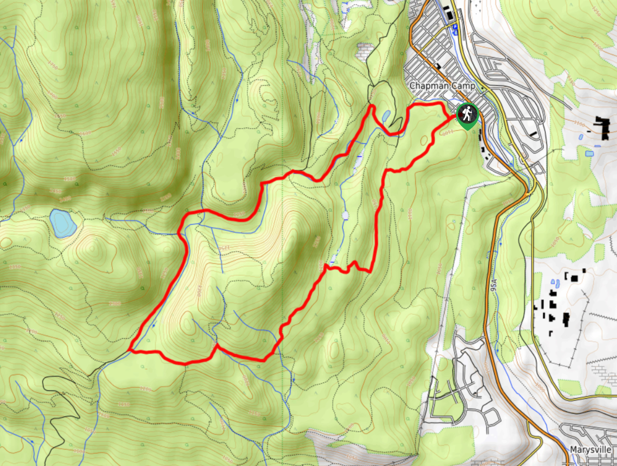
The Mary’s Lunch Room trail is an 7.1mi hiking circuit just outside of Kimberley, BC, that winds through the dense forests of the Kimberley Nature Park to arrive at a scenic viewpoint overlooking the Rocky Mountains. Along the way, hikers can expect well-maintained trails, a tranquil forest setting, and amazing views that sweep across the valley. Remember to bring bear spray and make plenty of noise along the trail, as black bears are frequently spotted in the area.
Getting there
To reach the trailhead for Mary’s Lunch Room from highway BC-95A in Kimberley, head southeast and turn right onto Dalgren Street. After 459ft, turn left onto Dewolfe Avenue and follow it for 853ft. Turn right onto Marsden Street, where you will find the trailhead at the end of the road.

About
| When to do | May-October |
| Backcountry Campsites | No |
| Pets allowed | Yes |
| Family friendly | Yes |
| Route Signage | Average |
| Crowd Levels | Moderate |
| Route Type | Circuit |
Mary’s Lunch Room
Elevation Graph
Weather
Mary’s Lunch Room Trail Description
The Mary’s Lunch Room trail is a great intermediate-length hike that will allow you to get out for some decent exercise along fairly easy and well-maintained trails, with some amazing views of the surrounding mountains. As this route is part of a dense network of hiking and mountain bike trails, it is best to bring a trail map or GPS to avoid getting lost.
Setting out on the trailhead off Marsden Street, follow the path to the southwest to begin the loop in a clockwise direction. After crossing over several small streams, you will arrive at a lookout with spectacular views across the valley to the rugged expanse of the Canadian Rockies. Once you have taken in the views and had a quick snack, continue west and cross over the creek, before turning north and completing the remainder of the trail loop through the dense forest. Eventually, you will arrive back at the trailhead on Marsden Street, where you will find your vehicle waiting to take you back home.
Similar hikes to the Mary’s Lunch Room hike

Spirit Trail Loop
The Spirit Trail Loop is a 10.1mi hiking circuit in the East Side Columbia Lake Wildlife Management Area,…

Mount Stevens and Teepee Mountain
The trek to Mount Stevens and Teepee Mountain is a steep 8.4mi out-and-back hiking route east of Wasa,…

Ram Creek Hot Springs
Hiking to the Ram Creek Hot Springs will take you on an 6.9mi out-and-back trail that runs along…
Comments