hikes in Kananaskis Trail
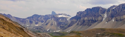
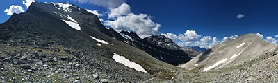
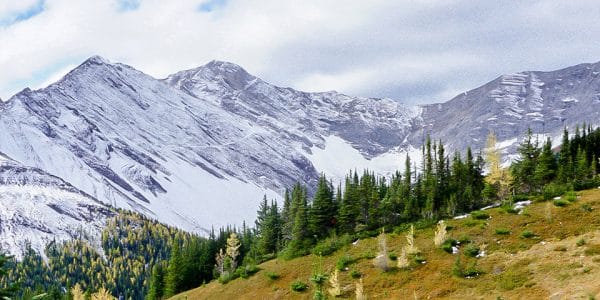
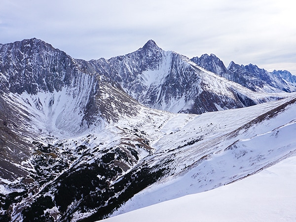
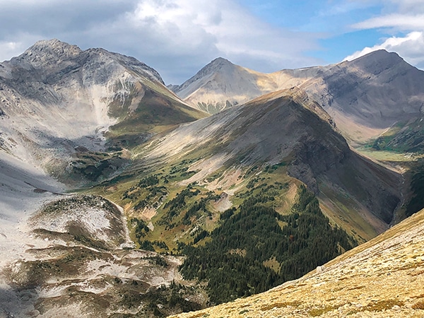
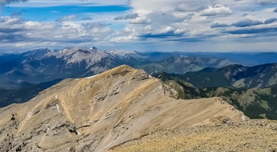
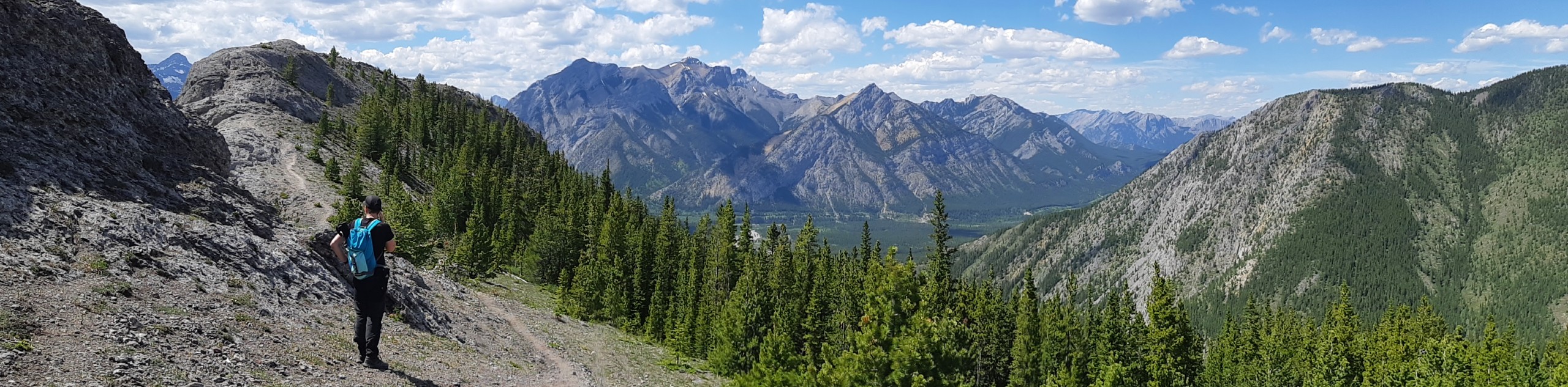
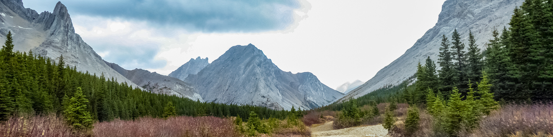
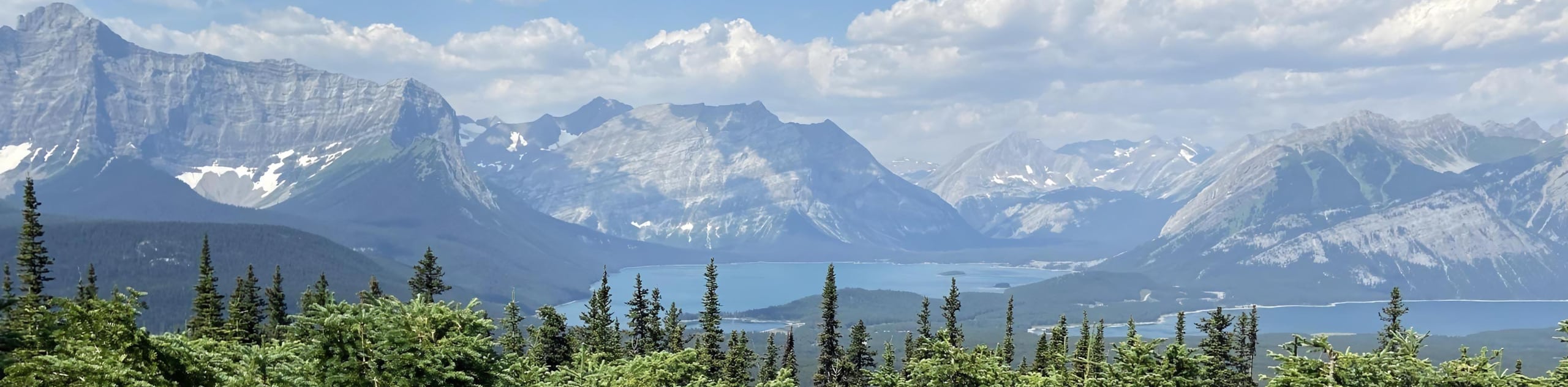
Nestled in the foothills of the Canadian Rockies, Kananaskis Country is one of Alberta’s finest gems. Tourists may flock to nearby Banff, but K-Country locals know that some of the most beautiful hiking trails in the Rockies are to be found in the Kananaskis Trail, which offers towering, craggy peaks, lush meadows, beautiful larch forests and hikes that you’ll never forget.
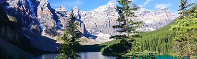
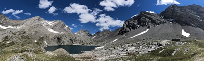
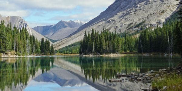
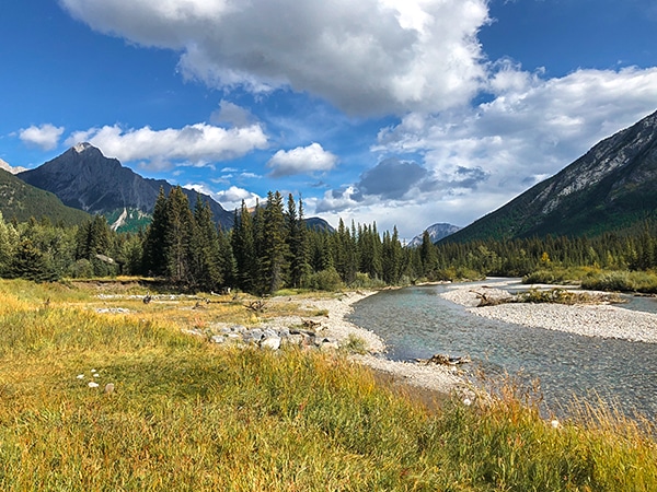
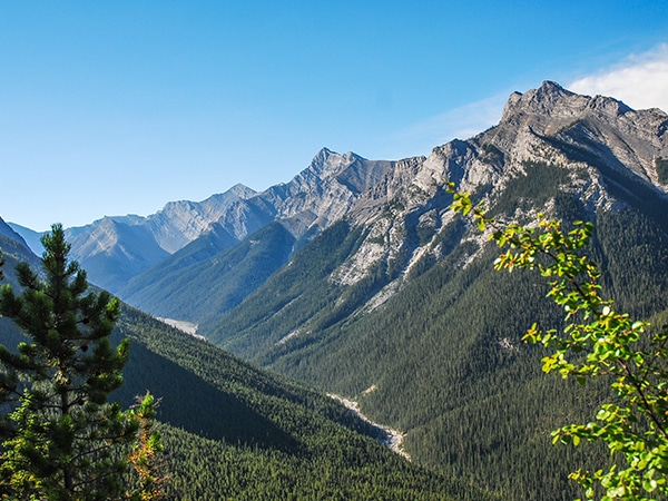
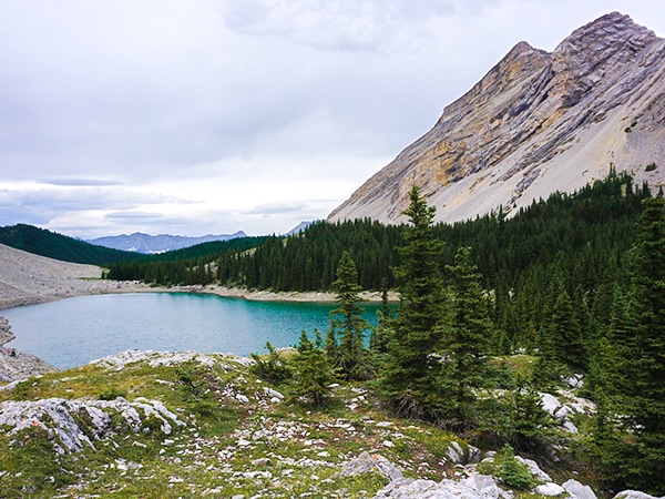
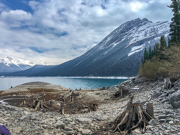
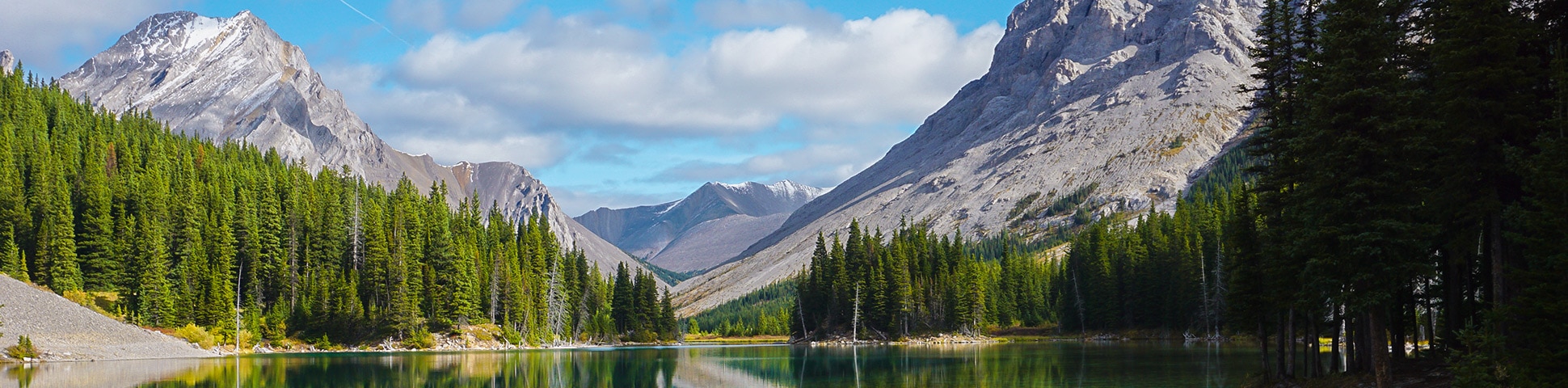
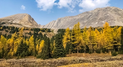
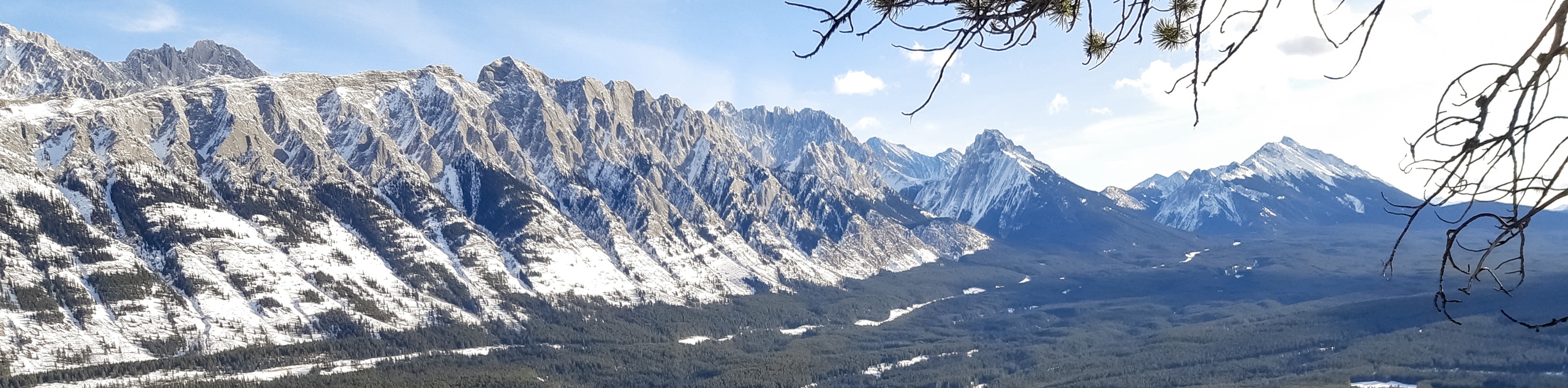
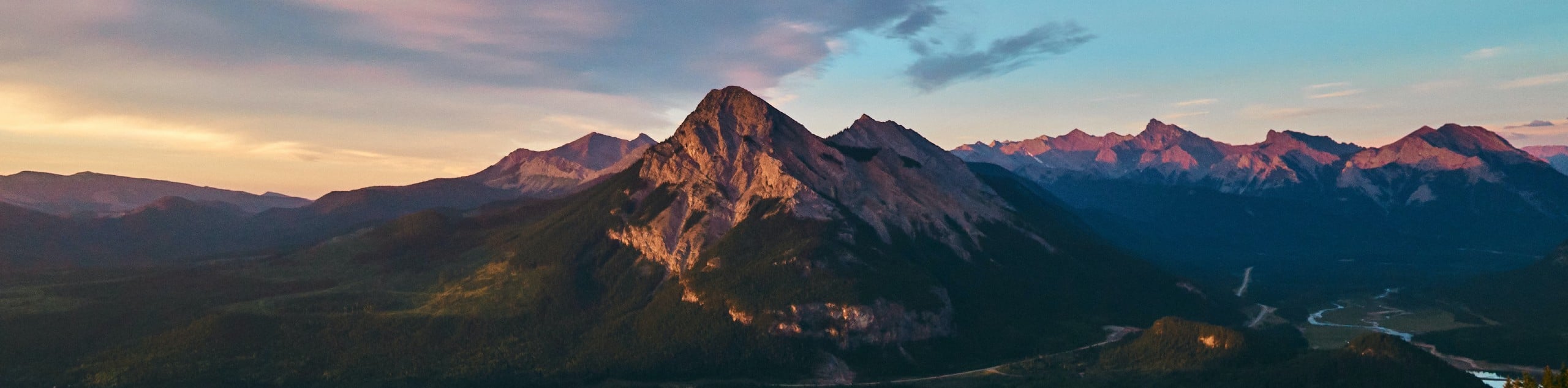
Kananaskis Trail offers everything you might expect from classic Rocky Mountain scenery, including pristine emerald lakes that reflect the looming peaks in their crystal waters. A hiking trip here is the ideal way to get out in the wild, and you won’t have to go far to feel like you’ve left the rest of the world behind. Hiking trails in Kananaskis Country are much less crowded than in the most popular areas of Banff and Jasper, and you’ll find a wonderful variety of flora, fauna and local wildlife. Come in autumn when the larches turn and the forests blaze in a sea of gold.
Fewer visitors means more opportunities to catch a glimpse of some rare and wonderful wildlife, and kids will love the chance to see some of the large animals out of the trails. Expect to see bighorn sheep, white-tailed deer, moose, elk and mountain goats. Black bears and grizzly bears roam the forests here, but are rarely seen. More common are red squirrels, marmots, chipmunks and a wide variety of beautiful birds.
Don’t follow the crowds – take a local tip and come to Kananaskis for your next Rocky Mountain adventure. The mountains may not be quite so tall here, but the views are just as breathtaking, and we’re confident you’ll want to come back again and again. To give you a little inspiration, here are our favorite hikes in Kananaskis Trail.
Types Of Hiking In Kananaskis Trail
Kananaskis County, and particular the Kananaskis Trail region, is a wonderful spot for a family hiking or backpacking trip. You’ll find plenty of easy, family friendly trails with so much to see and do along the way. From tumbling waters and pleasant creeks to wildflower meadows and atmospheric larch forests, the landscape here is simply stunning. Kids will enjoy hiking to beautiful, pristine lakes, and there are plenty of easy backpacking routes that will get older children excited about an adventure out in the wild.
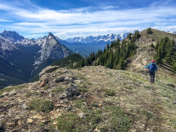
Kananaskis Country may be in the foothills of the Canadian Rockies, but you’ll find no shortage of epic hike. If you’re looking for a challenge, climb high onto wild, lonely ridges and gaze out at the majesty of the mountains. You’ll find a wide range of challenging day hikes that will require strength, stamina and plenty of energy, but you can be sure of some epic rewards when you finally emerge at the summit of your hike.
Easy Hikes In Kananaskis Trail
Ptarmigan Cirque Hike: This lovely hike begins at Highwood Pass, high in the alpine amid the larch forests. The views over the Ptarmigan Cirque are simply magnificent, with opportunities for absolutely incredible family photos. Kids will love this hike, but take care on the initial ascent, which can be slippery. After that, it’s one of the best easy hikes in Kananaskis Trail.
Rawson Lake Hike: The route to Rawson Lake is one of the best hikes in Kananaskis Trail, taking you up a series of switchbacks through the forest to a picture-perfect lake. The route is initially steep, but levels off as you reach the stunning lake, allowing you to appreciate the glorious scenery in all its majesty.
Family Hikes In Kananaskis Trail
Troll Falls Hike: The hike to Troll Falls is one of the classic family hikes in Kananaskis Trail! The path passes through lush forest, beautiful meadows and by a rushing creek, before arriving at the falls themselves. This route is wonderful in summer, but can also be a good option for snowshoeing in winter, as the falls freeze into a dramatic wall of ice.
Elbow Lake Hike: This lovely, family-friendly hike is perfect for a day out with young kids, and an excellent option for an easy backpacking trip. Elbow Lake is simply stunning, with views over the emerald waters and the Mount Rae massif in the distance. This hike provides magnificent views for relatively little effort and is one of our favorite family hikes in the Kananaskis region.
Day Hikes In Kananaskis Trail
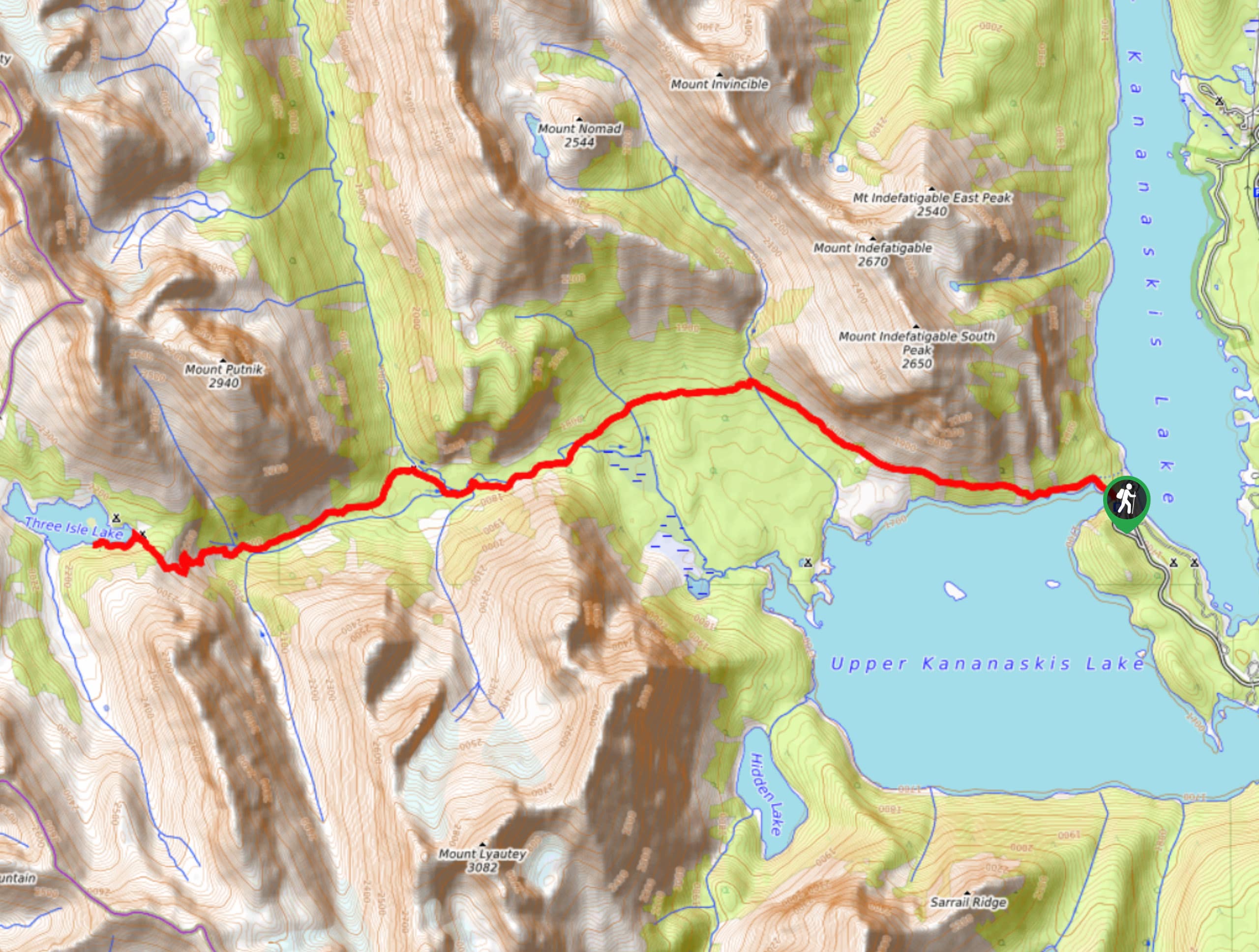
Lillian and Galatea Lakes Hike: The beautiful hike contains plenty of variety, making it one of our favorite day hikes in Kananaskis Trail. The first part of the route passes through lush forest up to Lillian Lake, before opening up to magnificent views as you near the Upper and Lower Galatea Lakes. If you’re a beginner hiker, this route also makes an excellent first backpacking trip in the Canadian Rockies.
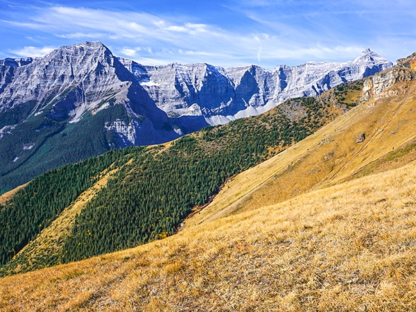
Pocaterra Ridge Hike: This magnificent hike is a stunner, and without doubt, one of the best day hikes in Kananaskis Trail. The climb up through the larch forest is steep but satisfying, and although the ascent of the ridge can be challenging, you’ll be treated to a remarkable view from the craggy summit. This hike can also be easily shortened or extended, depending on your fitness levels and the amount of time you have.
Challenging Hikes In Kananaskis Trail
Guinn’s Pass Hike: This hike is simply stunning, and one of our favorite challenging hikes in Kananaskis Trail. The trail ascends steadily but surely up the Galatea Valley, crisscrossing over Galatea Creek. You’ll pass by beautiful alpine lakes before emerging to fantastic views from Guinn’s Pass. Make sure to start early so you can visit both the Lower and Upper Galatea Lakes.
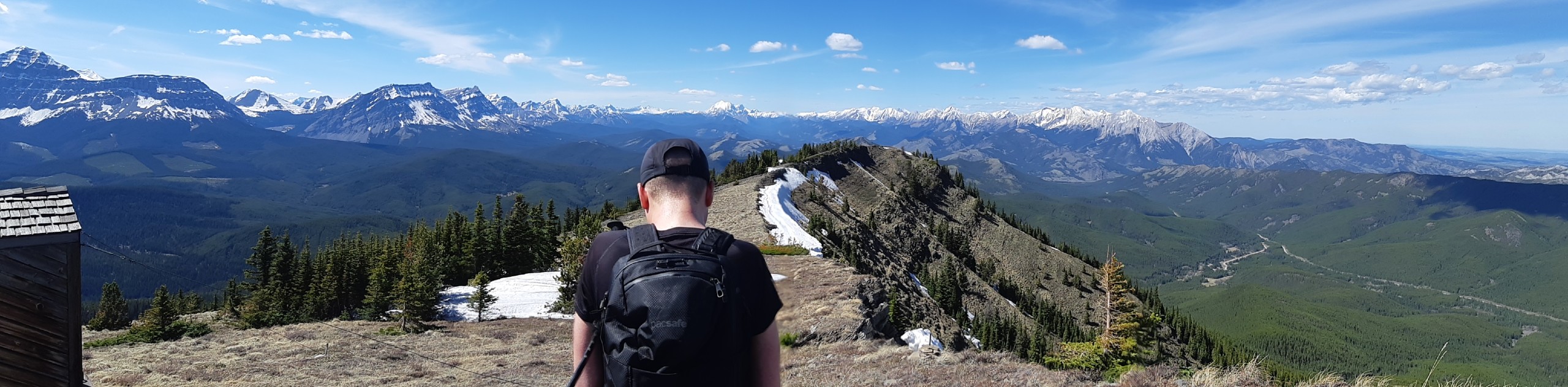
Centennial Ridge and Mount Allen Summit Hike: This fantastic hike follows the highest maintained trail in the Canadian Rockies, meaning that you’ll truly feel as though you’re on top of the world! This is a challenging hike and a good test of endurance, but the views are simply incredible. Make sure to bring plenty of water as the route is quite exposed and it’s important to stay hydrated on warm days.
Best Hikes In Kananaskis Trail
Wasootch Ridge Hike: Looking for a place to really get away from it all? This wild, lonely ridge is the perfect place for a wonderful hike in Kananaskis Trail, and the perfect place to spend an afternoon gazing on the majesty of the mountains. The hike up to the ridge is quite steep, and some scrambling is required in places, but the view from the top is simply magical.
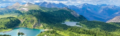
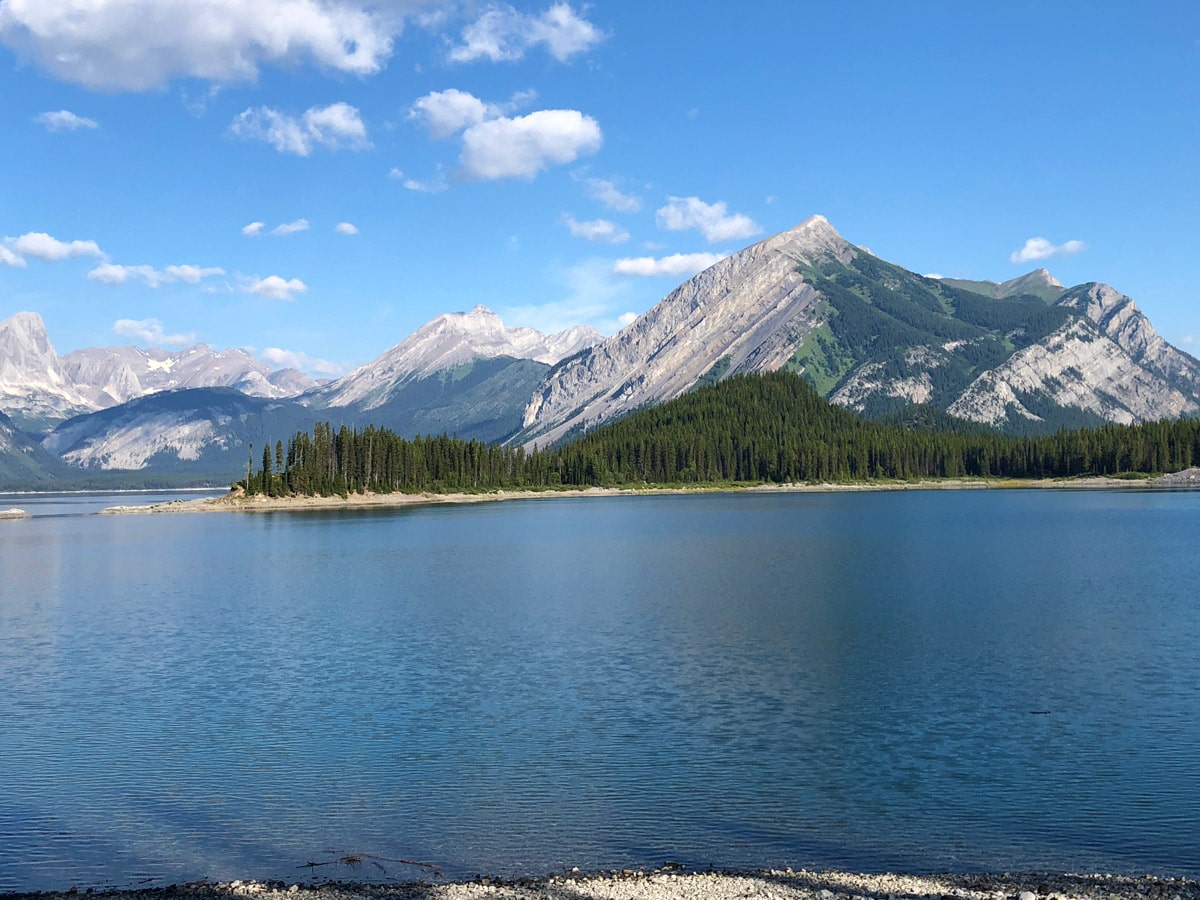
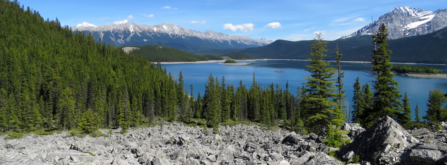
Upper Kananaskis Lake Hike: This wonderful route is an ideal option for the shoulder season, when you can avoid the crowds and enjoy the wonderful trail and forest in complete peace! It’s a relatively easy route with options to extend into a low-key backpacking route, or to link up with Rawson Lake. Whatever you choose, you’ll have a fantastic view over Upper Kananaskis Lake.
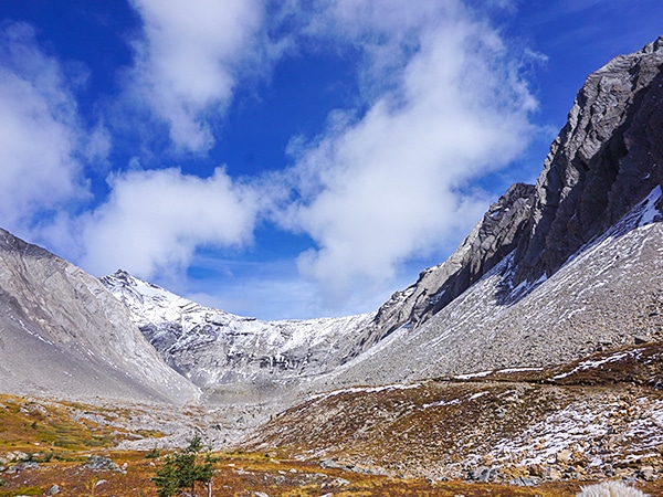
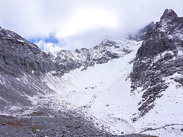
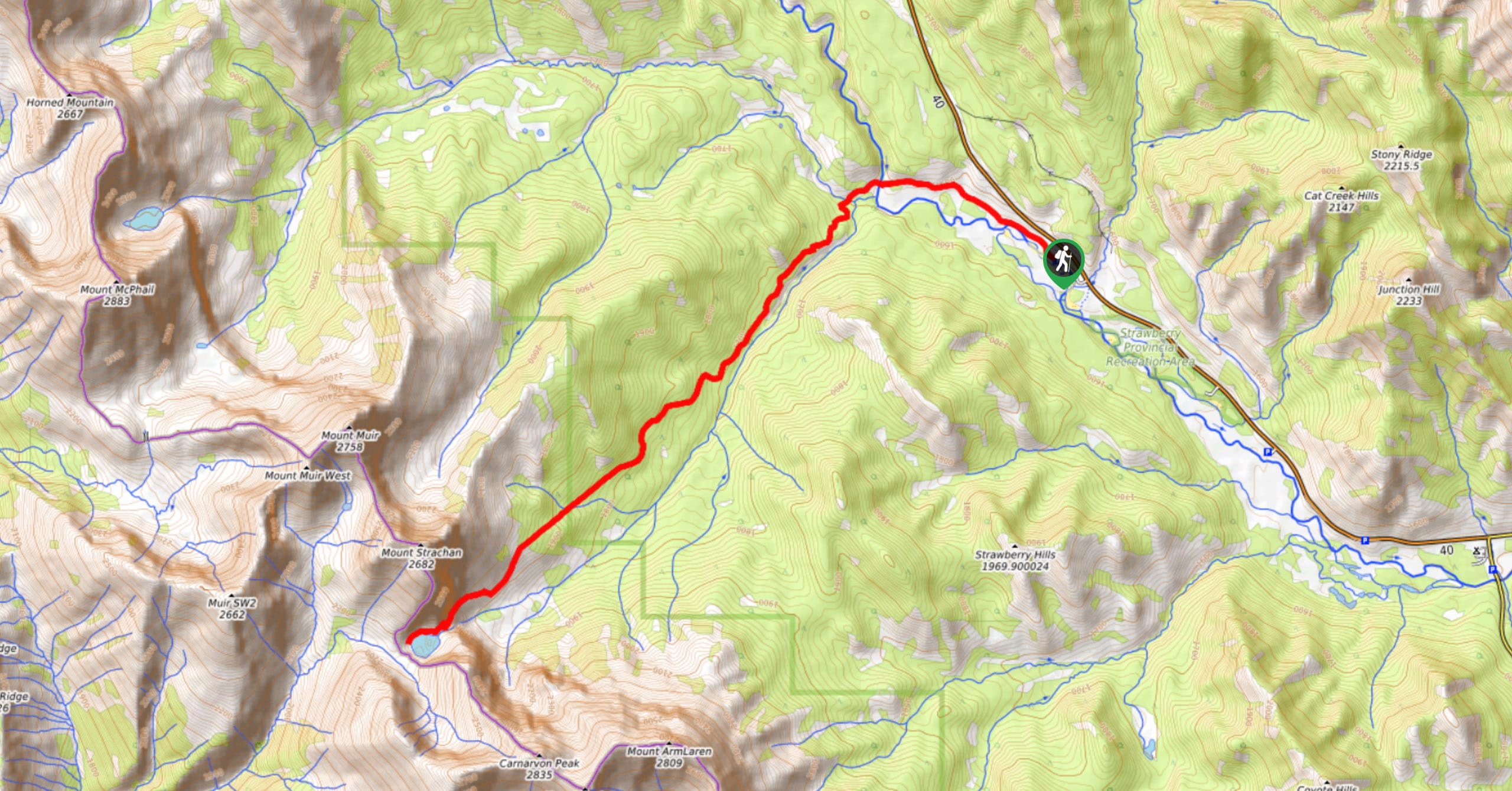
Rae Glacier Hike: The route up to the Rae Glacier is a fabulous, varied hike just perfect for hikers with a little adventure in their soul! You’ll pass by the gorgeous emerald Elbow Lake before hiking up a creek bed and scrambling over boulders to reach the glacier. Rae Glacier itself might not be the most spectacular glacier in the Rockies, but the views over the region are simply magnificent.
Opal Ridge Hike: The steep hike up onto Opal Ridge is not for the faint of heart, and some scrambling and use of your hands may be required. However, this is a wonderful hike with fantastic views, and the perfect way to spend a day in the Kananaskis region. From the high point of the ridge you’ll feel as though you’re floating on top of the earth. Don’t forget your hiking poles to help with the tough descent.
Picklejar Lakes Hike: The route to Picklejar Lakes is often voted as one of the best hikes in the Kananaskis region, offering varied terrain and magnificent views. It’s a good intermediate hike, and an excellent option if you’re a novice hiker hoping to push yourself a little harder. Follow the path all the way to the third Picklejar Lake for the best views.
King Creek Ridge Hike: If you’re an adventurous hiker in search of a challenge, try this epic hike up King Creek Ridge. It’s a truly spectacular route, offering views over the Opal Range, Mount Wintour and the valley of the Kananaskis Lakes. Try to come early in the season when the wildflowers dot the trail and the meadows are a vibrant green. This is one of the best hikes in Kananaskis Trail.
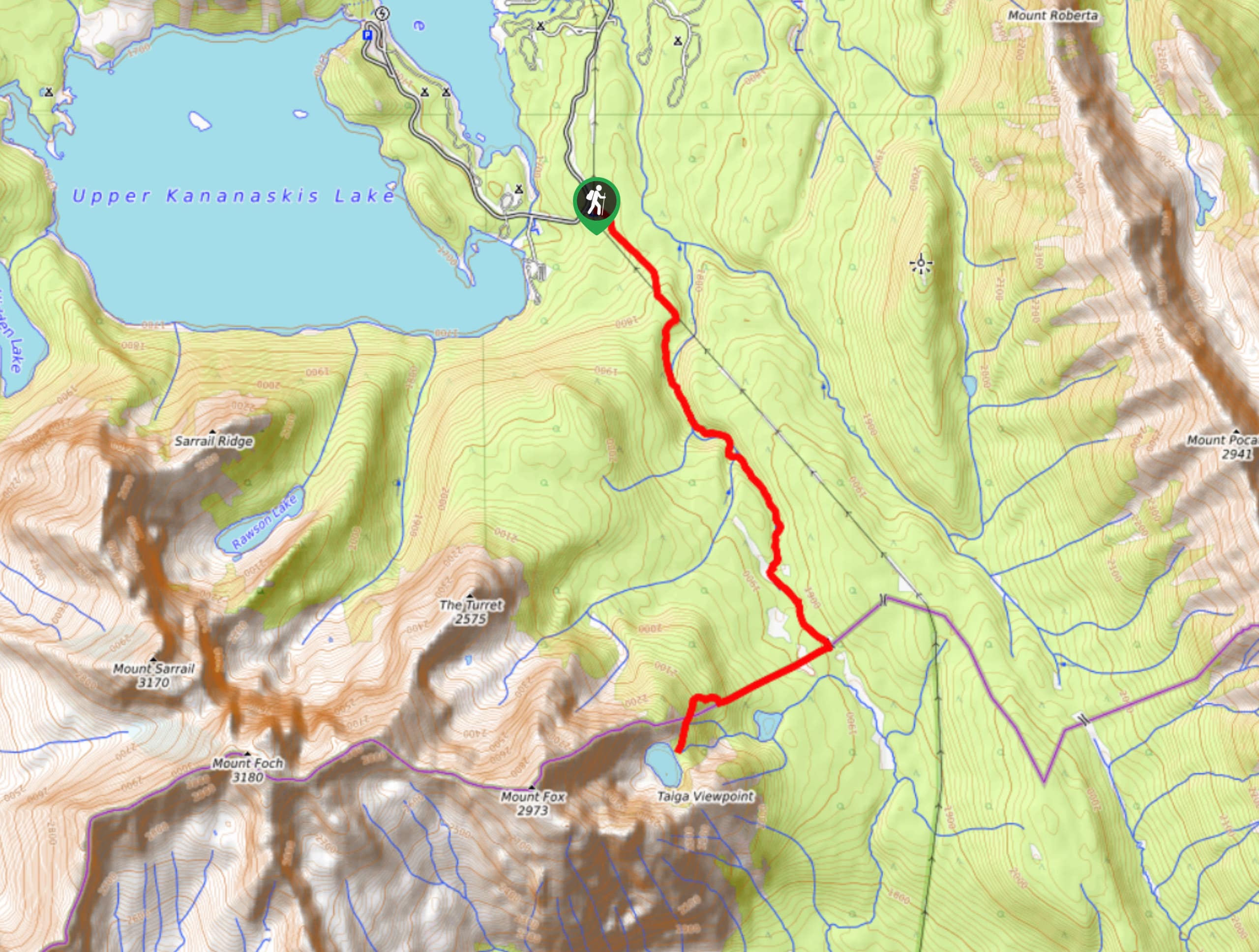
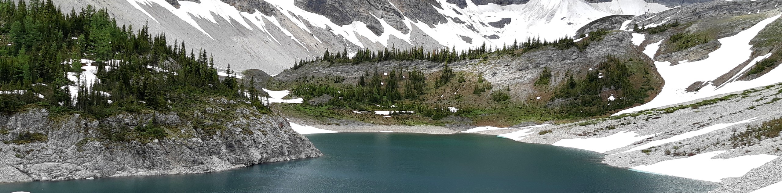
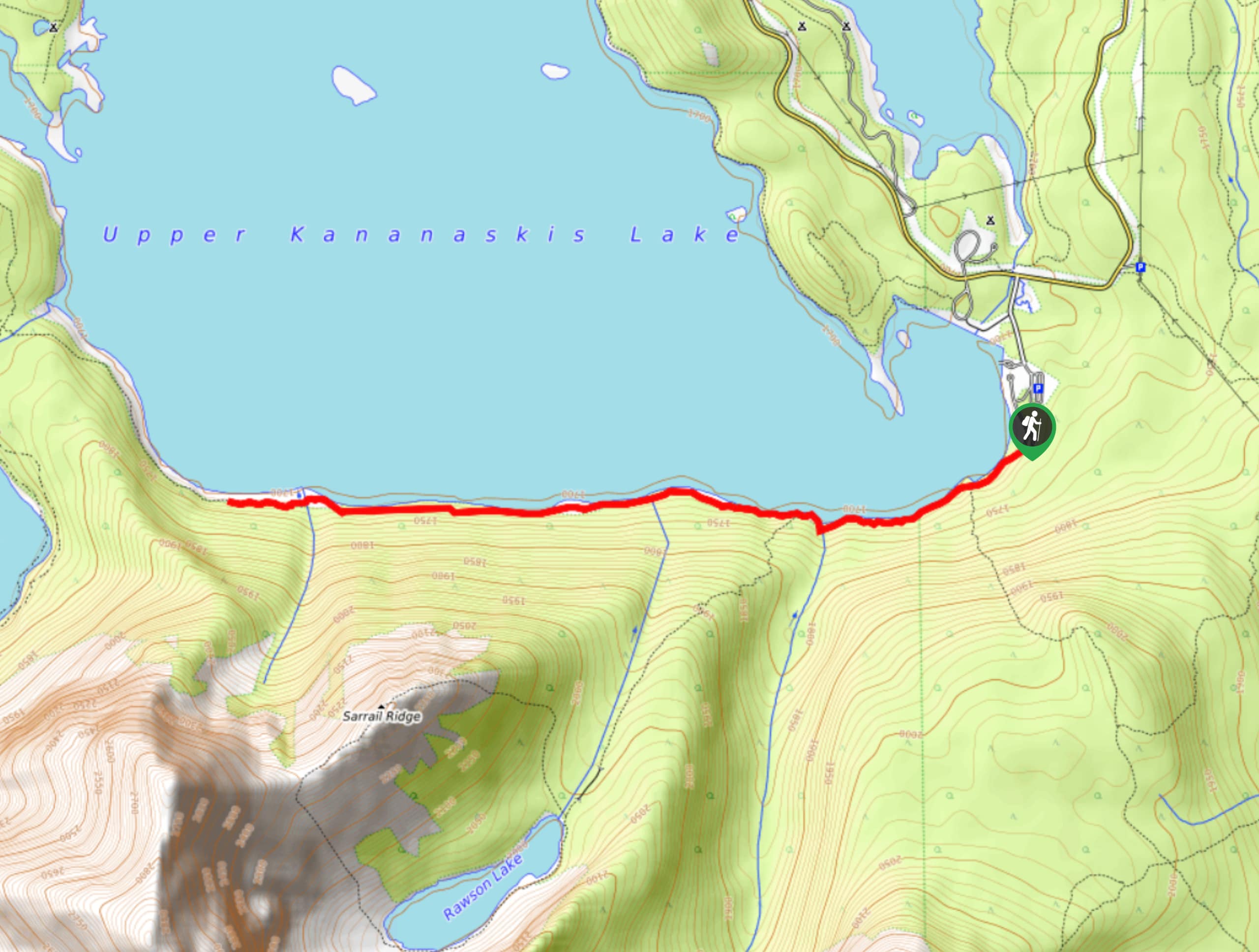
Sarrail Ridge Via Rawson Lake Hike: If you’re dreaming of turquoise lakes, craggy gray peaks and mountainsides clothed in lush, green forest, head out on this spectacular challenging hike in Kananaskis Trail. Be warned – this hike is steep, and you’ll need to be fit and have plenty of stamina to make it all the way to the top. However, the jaw-dropping view is your reward, and we’re sure it’s one you’ll never forget.
When Is The Best Time To Hike In Kananaskis Trail?
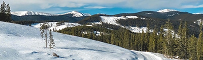
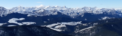
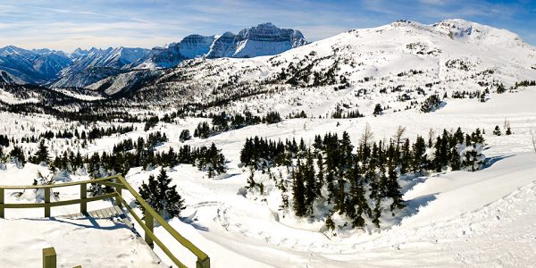
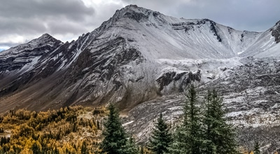
Kananaskis Country is a year-round hiking destination, with plenty of things to do whether you visit in the peak of summer or the depths of winter. However, the main hiking season runs from May to October, although some lower-elevation trails are accessible in early spring or late autumn, and higher elevation trails can remain covered in snow until mid-June. We think the best time to hike in Kananaskis Trail is in the autumn. This region is well known for its stunning larch forests, and in autumn they turn to a vibrant gold color, transforming the landscape and providing even more spectacular views. However, it’s also possible to hike in Kananaskis in winter, when the snows cover the trails. Grab your snowshoes or micro spikes and head out into a magical winter wonderland where the boughs of the trees are heavy with pristine snow and the waterfalls and lakes freeze over.
Other Outdoor Activities In Kananaskis Trail
Like many destinations in the Canadian Rockies, you’ll find plenty of other outdoor activities along Kananaskis Trail in addition to hiking! If you’re an adventurous, experienced hiker, you may want to tackle some of the fantastic scrambling routes – the perfect way to get up close and experience the majestic, craggy peaks of the Rockies. For longer, multi-day hikes, try some of these epic backpacking routes, with plenty of variety to suit all levels of experience and fitness. In winter, Kananaskis Trail dons a cloak of white, pristine snow, just perfect for snowshoeing and cross-country skiing. Other popular activities include horseback riding, mountain biking, climbing and fishing.
How To Plan A Trip To Kananaskis Trail
If this article has got you reaching for your hiking boots, then it’s time to start planning your next adventure in Kananaskis Country! In addition to putting together a list of all of our favorite hikes, we’ve also come up with an ultimate guide to planning your trip to Kananaskis Country, complete with all the information you’ll need to make your adventure a success. Start dreaming of those beautiful trails today!
Frequently-Asked-Questions About Kananaskis Trail
Are there bears in Kananaskis?
Like other parts of the Canadian Rockies, the Kananaskis region is an important habitat for both black bears and grizzly bears. Although encounters with hikers are rare, it’s important to take precautions and make sure you know what to do if you see one on the trail. Bring bear spray with you (and ensure you know how to use it), stay alert and make plenty of noise on the trail, and always pack food in bear-proof containers when camping.
Is Kananaskis a Provincial Park?
Kananaskis Country is a park system that includes five provincial parks, four wildland provincial parks, one ecological reserve and several provincial recreation areas.
How far is it from Calgary to Kananaskis?
Kananaskis is approximately a one-hour drive from Calgary, over a distance of 46 miles.
What does Kananaskis mean?
According to popular legend, and the testimony of John Palliser, an early explorer of the region, the name Kananaskis is taken from the Cree word meaning ‘meeting of the waters’. However, the Cree peoples never actually inhabited this region, and this is not the correct etymology, although the Cree word ‘nakiska’ (meaning meeting place) does give its name to an area inside Kananaskis. Another theory suggests that the word Kananaskis is derived from the name of a native man named Kin-e-ah-kis who was attacked or killed at the confluence of the Bow and Kananaskis Rivers following an altercation over a woman.
Do you need to pay an admission fee to visit Kananaskis Country?
Yes, after a recent visitor increase, Alberta Parks has introduced the Kananaskis Conservation Pass for visiting the Kananaskis Country. The annual pass costs $90 and a daily pass costs $15. Visit the Alberta Parks website to find out more.
Read MoreThe best hikes in Kananaskis Trail
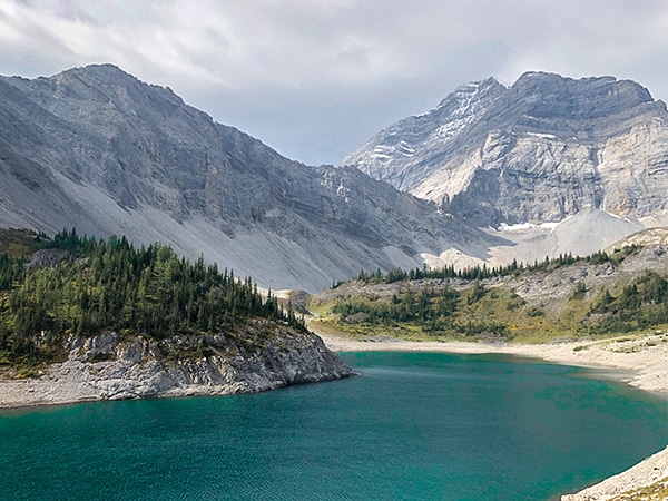
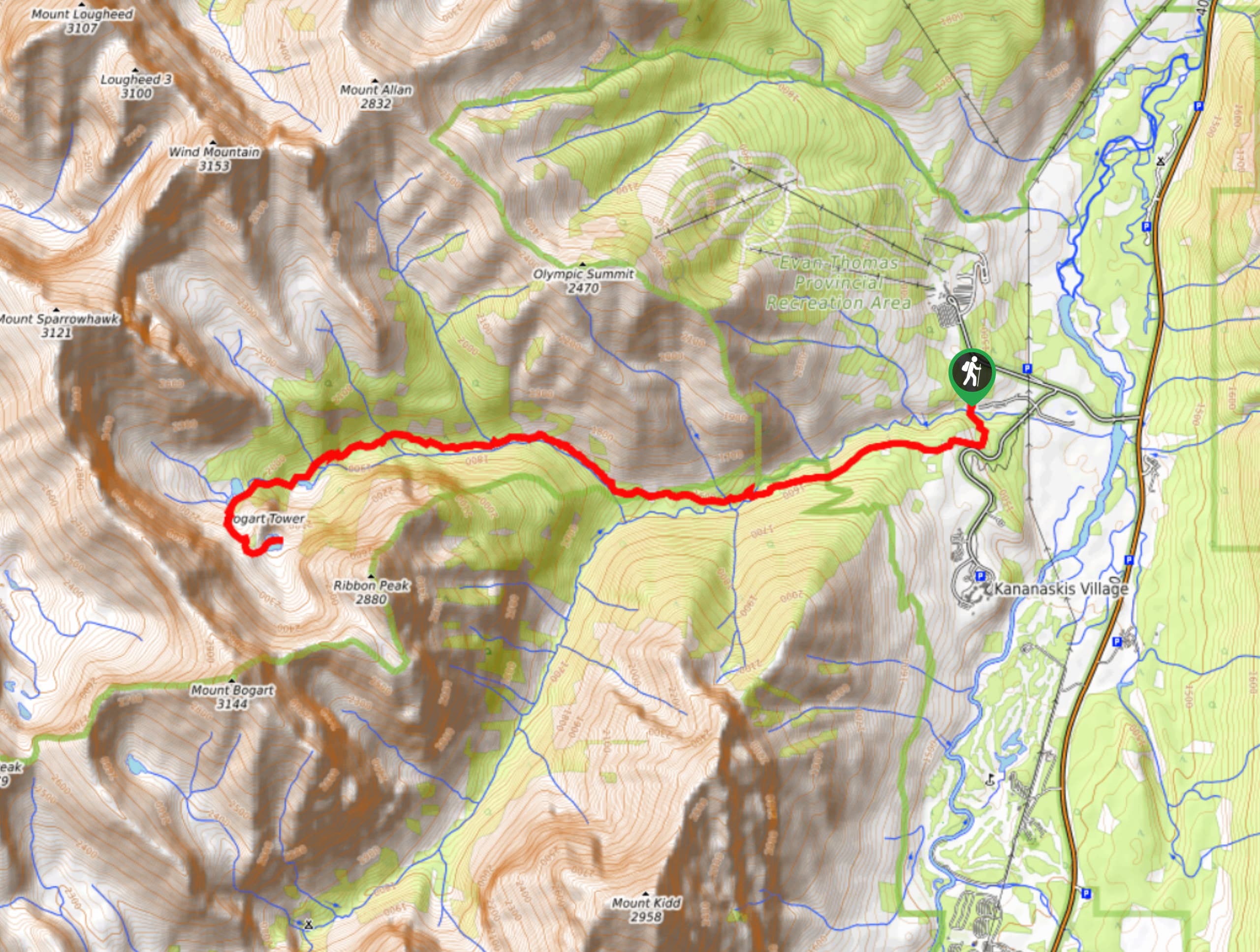
01. Lillian and Galatea Lakes
Difficulty
The hike to Galatea Lakes is spectacular. The first bit to Lillian Lake is through… Read More
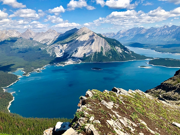
02. Sarrail Ridge Hike via Rawson Lake
Difficulty
The hike to Sarrail Ridge offers some of the most stunning views in the Canadian… Read More
03. Pocaterra Ridge Hike
Difficulty
This wonderful hike along Pocaterra Ridge is a stunner! A challenging hike, but with spectacular… Read More
04. Rawson Lake
Difficulty
The hike to Rawson Lake is one of the most popular in the Kananaskis Lakes… Read More
05. Troll Falls Hike
Difficulty
Troll Falls is a classic, family-friendly hike near Nakiska, that’s popular year-round. While Troll Falls… Read More
06. Opal Ridge
Difficulty
The hike along Opal Ridge is a wonderful hike. This steep hike requires the use… Read More
07. Wasootch Ridge
Difficulty
Wasootch Ridge is an easy choice as one of the best hikes near Canmore. Once… Read More
08. Picklejar Lakes
Difficulty
Some Calgarians rate Picklejar Lakes as their absolute favourite hike in the Canadian Rockies. It’s… Read More
09. Upper Kananaskis Lake Trail
Difficulty
The hike around Upper Kananaskis Lake offers tremendous views, varied terrain and limited elevation gain… Read More
10. Guinn's Pass
Difficulty
The trail to Guinn’s Pass is spectacular, offering stunning views. This hike takes in Lillian… Read More
Yes, there are more than 10
Kananaskis Trail is so beautiful that we can not give you only 10 hikes. So here is a list of bonus hikes in Kananaskis Trail that you should take a look at as well
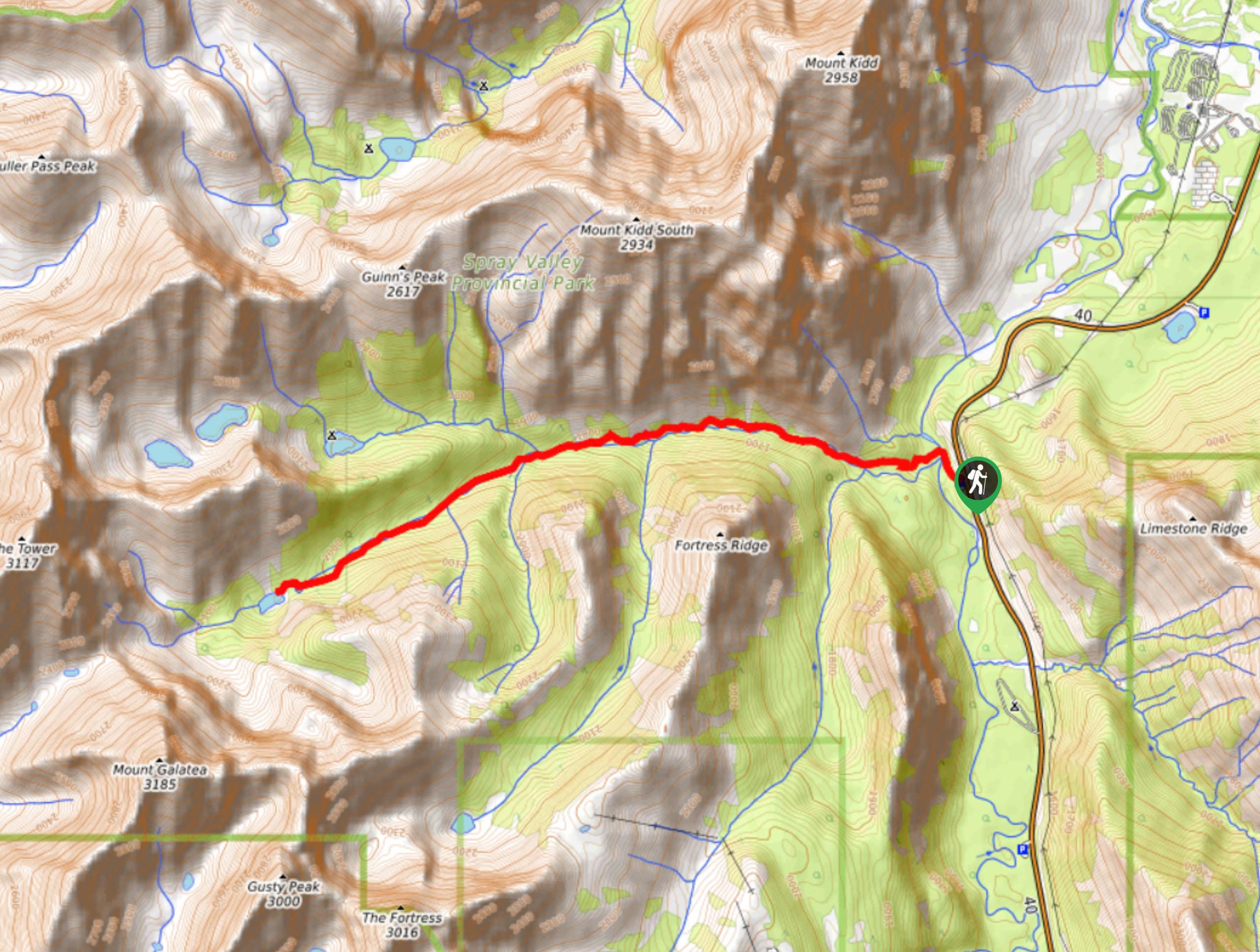
11. Rae Glacier
Difficulty
The hike to Elbow Lake is a wonderful, family-friendly hike in the Highwood Area. Adventurous… Read More
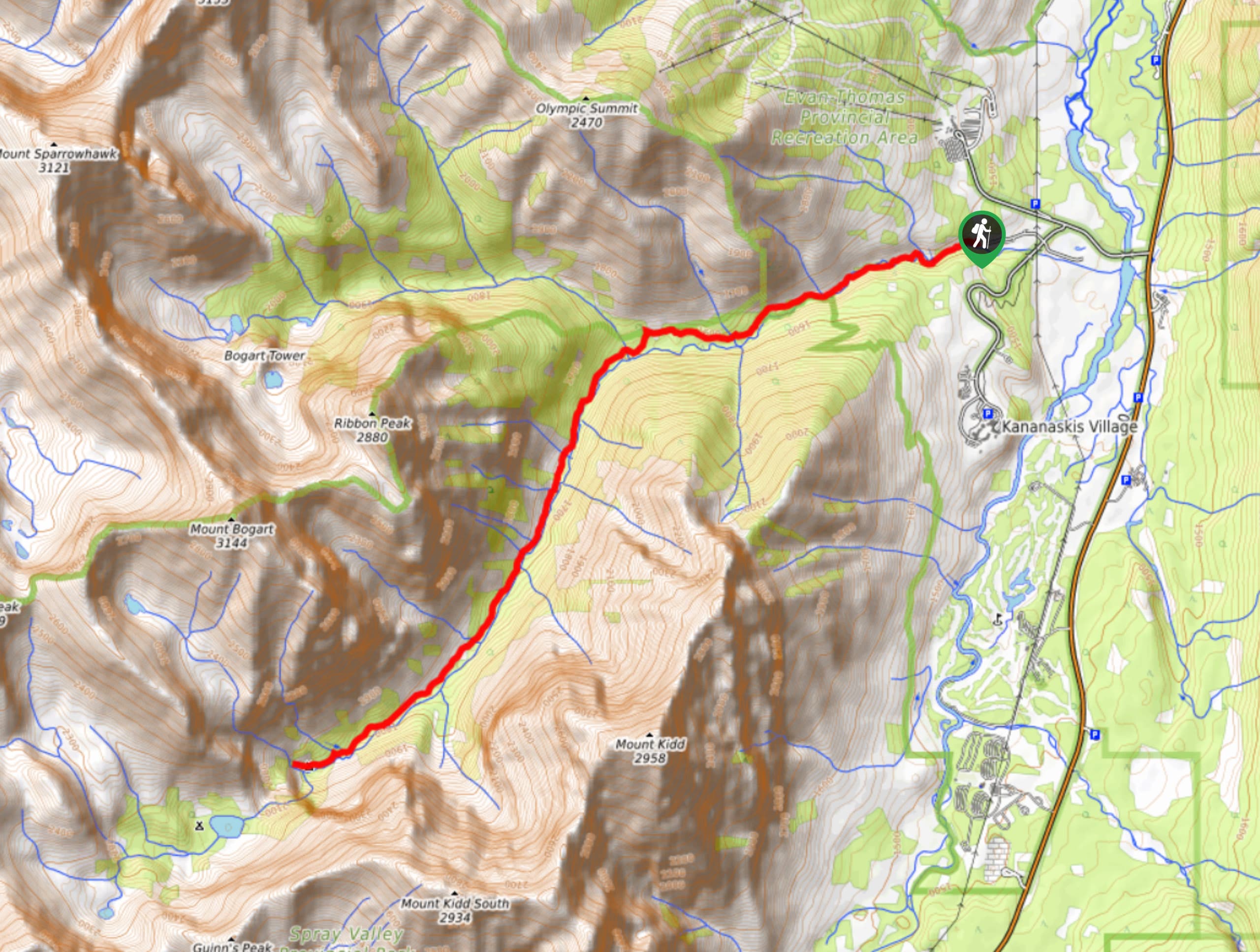
12. King Creek Ridge
Difficulty
The hike up King Creek Ridge is spectacular – offering the chance to get up… Read More
13. Pocaterra Cirque
Difficulty
Pocaterra Cirque may often be passed up for other nearby, well-known hikes, but this little… Read More
14. Ptarmigan Cirque
Difficulty
The hike to Ptarmigan Cirque is a family favourite and is especially great for little… Read More
15. Raspberry Ridge Hike
Difficulty
Raspberry Ridge is a great trail to hike if you are staying at Cataract Creek… Read More
16. Centennial Ridge and Mount Allan Summit
Difficulty
The Centennial Ridge and Mount Allan Summit is the highest maintained trail in the Canadian… Read More
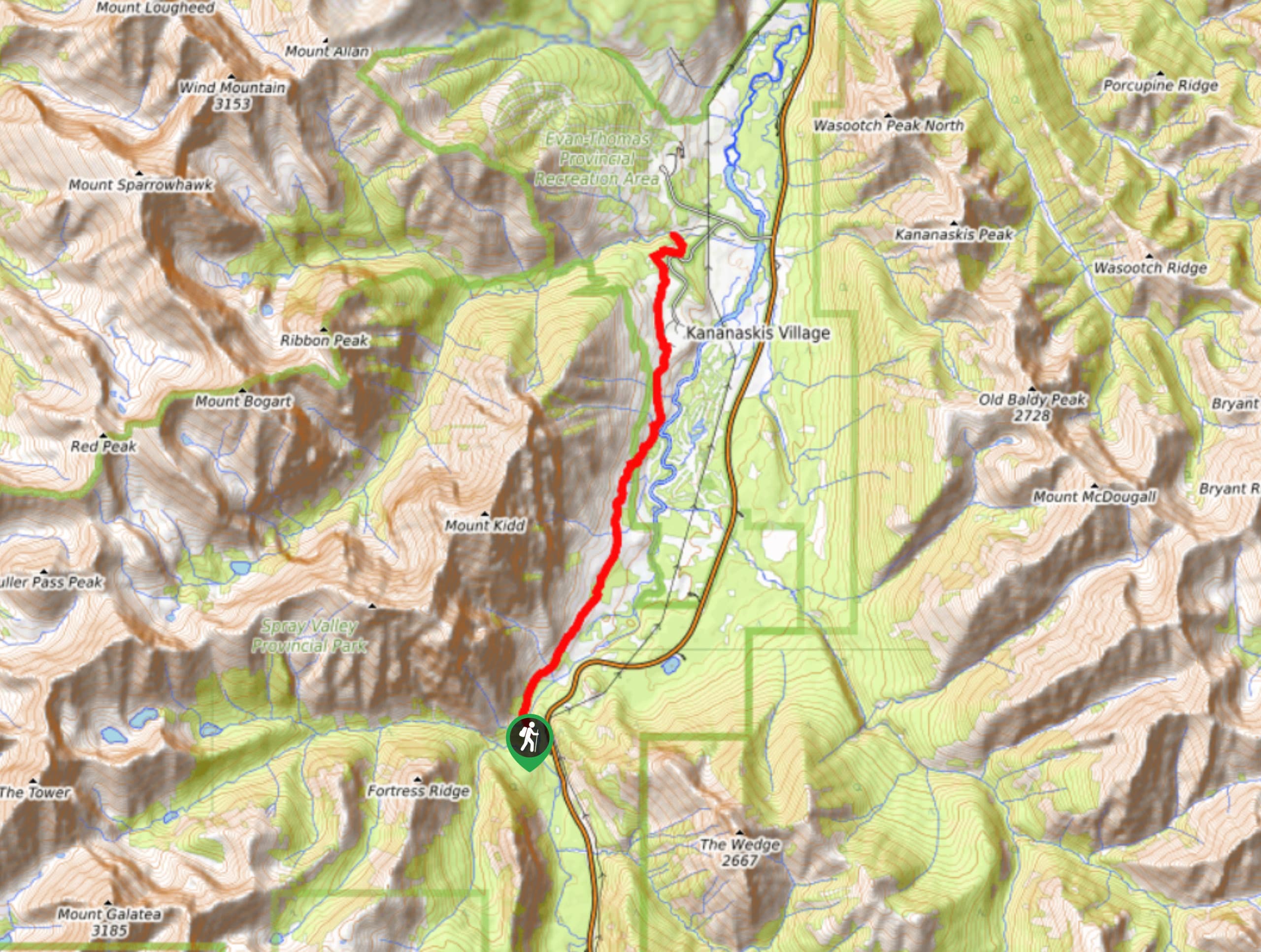
17. Elbow Lake
Difficulty
The hike to Elbow Lake is a wonderful, family-friendly hike in the Highwood Area. It’s… Read More
18. Mount Burke
Difficulty
Mount Burke is an underrated, bigger version of Prairie Mountain that isn’t as well-known. On… Read More
19. Arethusa Ridge
Difficulty
Arethusa Cirque is a gem of a hike, being an overlooked neighbour to nearby Ptarmigan… Read More
20. Little Lawson Hike
Difficulty
The Little Lawson Peak route (also known as South Lawson) is a straightforward trail that… Read More
21. Prairie View Trail
Difficulty
Prairie View is a must-do in the Barrier Lake and Highway 40 area. It is… Read More
22. Porcupine Ridge Hike
Difficulty
Porcupine Ridge is a challenging hike up a stunning ridge in the centre of Kananaskis.… Read More
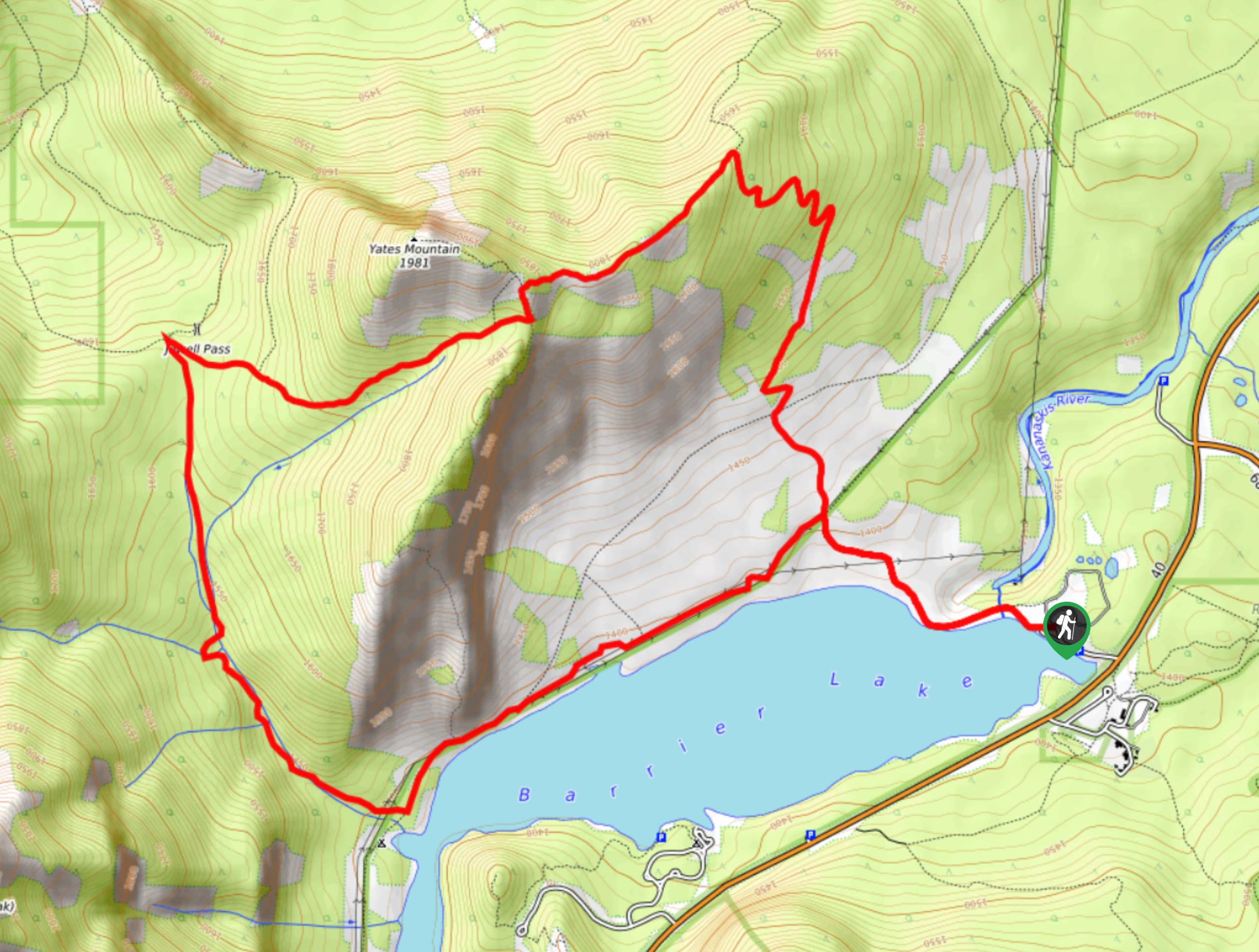
23. Barrier Lake Trail
Difficulty
The Barrier Lake trail is a smooth and gentle multi-use trail that sees hikers, backpackers,… Read More
24. Carnarvon Lake Hike
Difficulty
The hike to Carnarvon Lake involves steady inclines, chain sections, and 857m of elevation gain… Read More
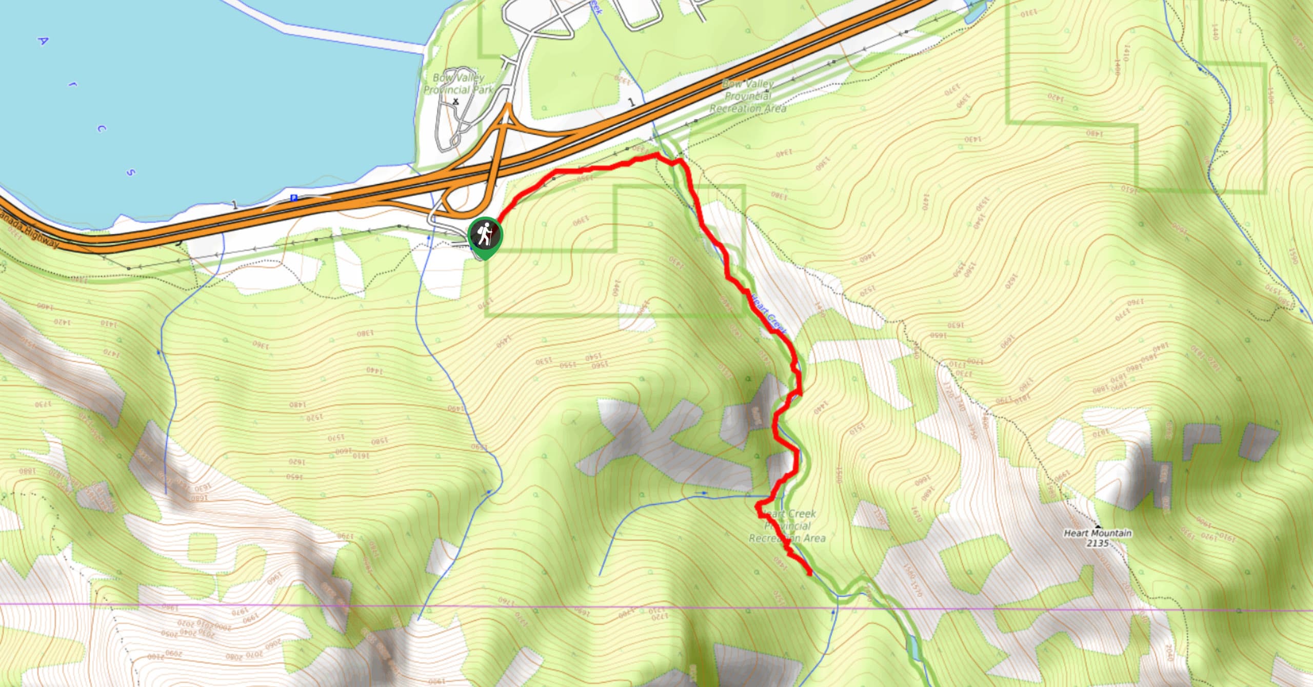
25. Heart Creek Trail
Difficulty
The trail up Heart Creek is a popular access point for rock climbers; however, the… Read More
26. Frozen Lake Trail
Difficulty
The trail to Frozen Lake follows the Elk Pass and Elk Lake trail for the… Read More
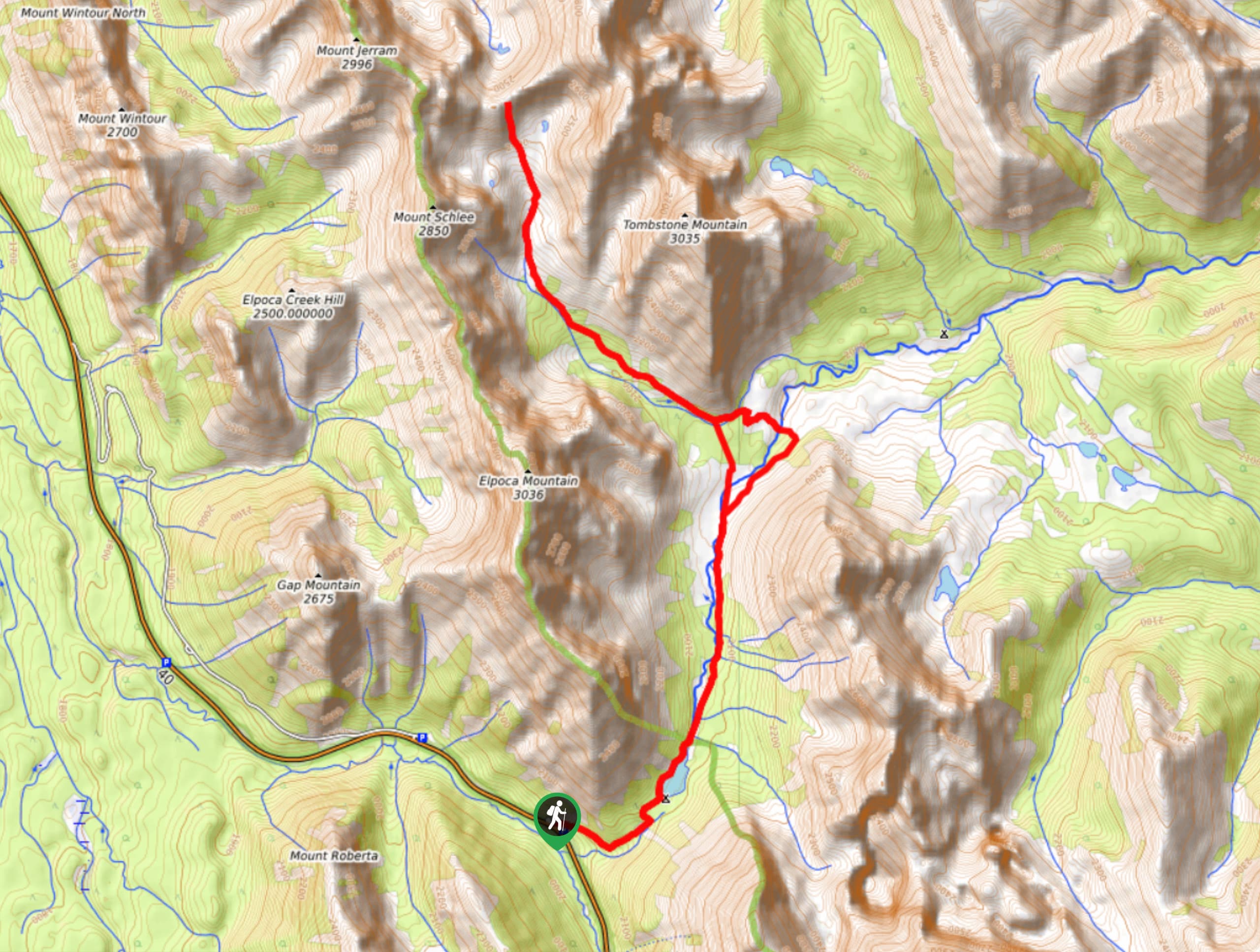
27. Galatea Lakes Hike
Difficulty
The hike to Galatea Lakes follows a beautiful trail that winds up through the forest… Read More
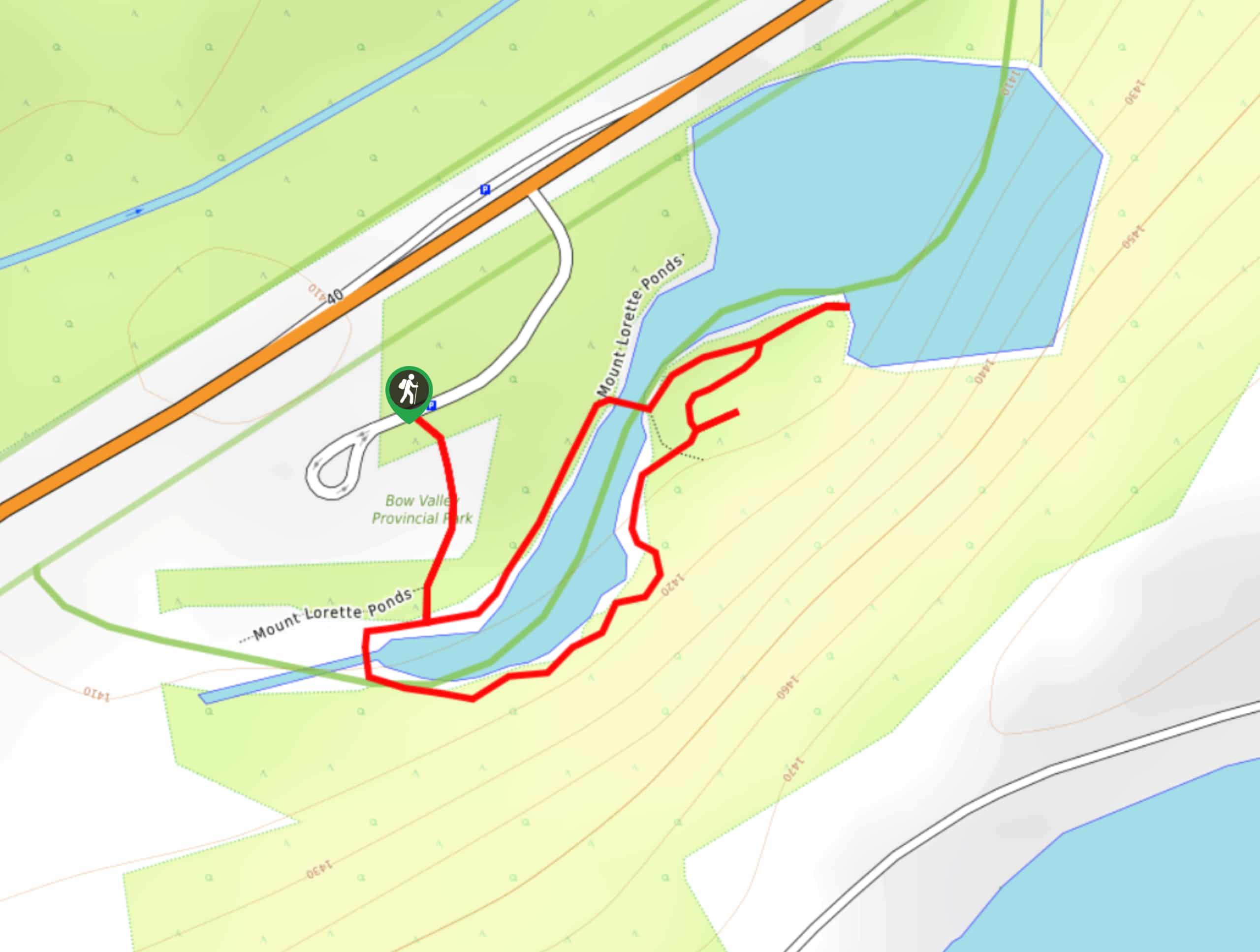
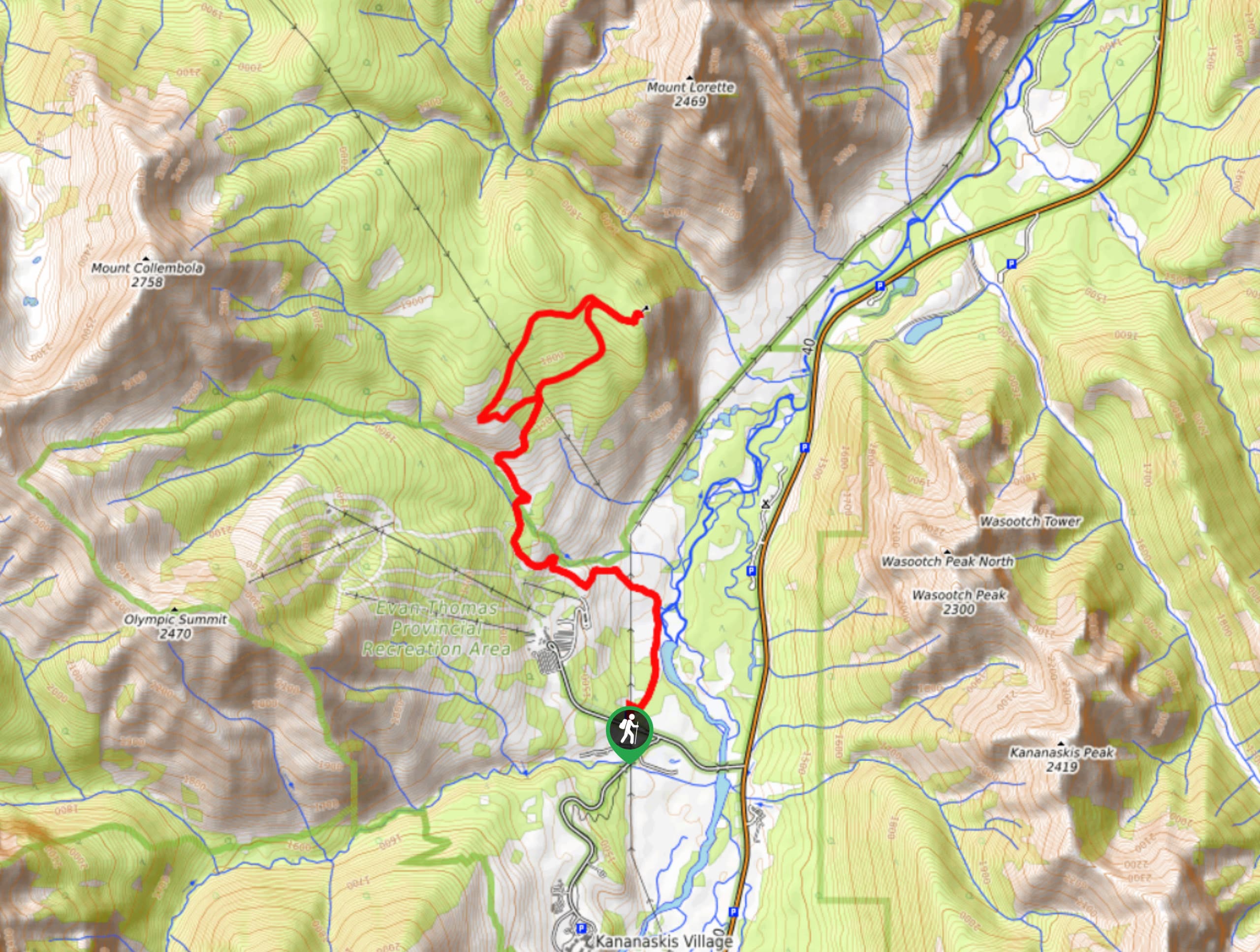
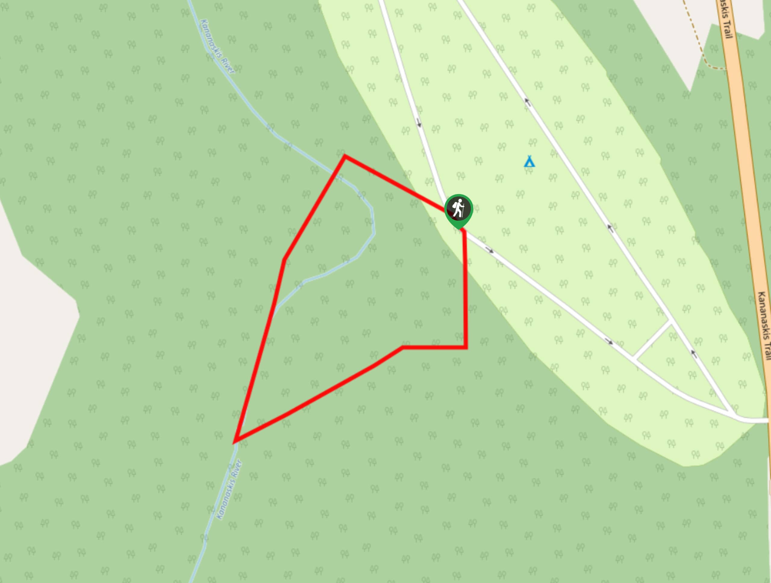
28. Mount Lorette Ponds Trail
Difficulty
The trail around the Mount Lorette Ponds is a great way to take a quick… Read More
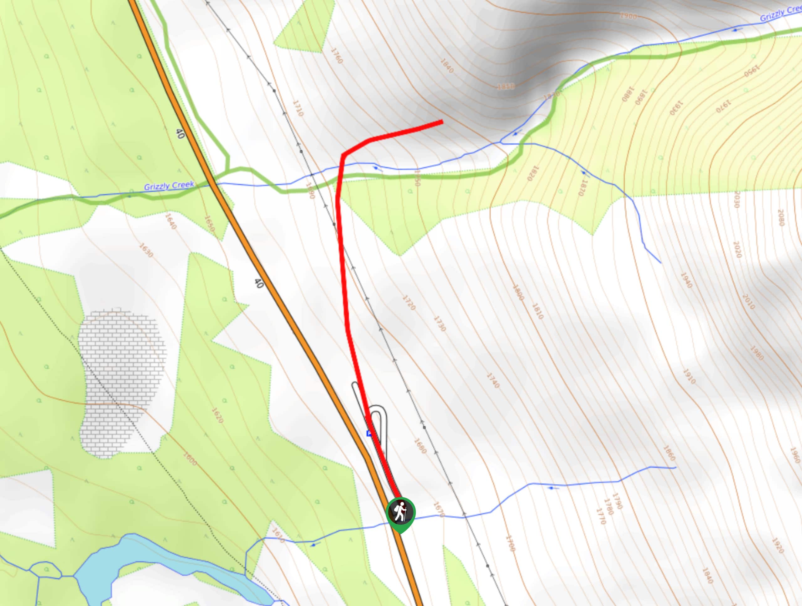
29. Grizzly Creek Trail
Difficulty
The trail up Grizzly Creek in Kananaskis is an easy and quick way to explore… Read More
30. Canoe Meadows Widow Maker Trail
Difficulty
The Canoe Meadows Trail is commonly used as an access point for river surfers and… Read More
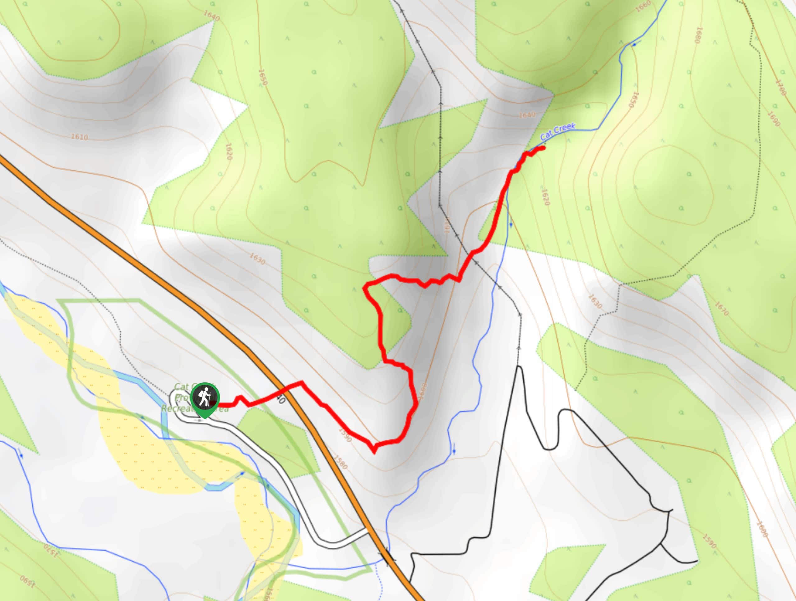
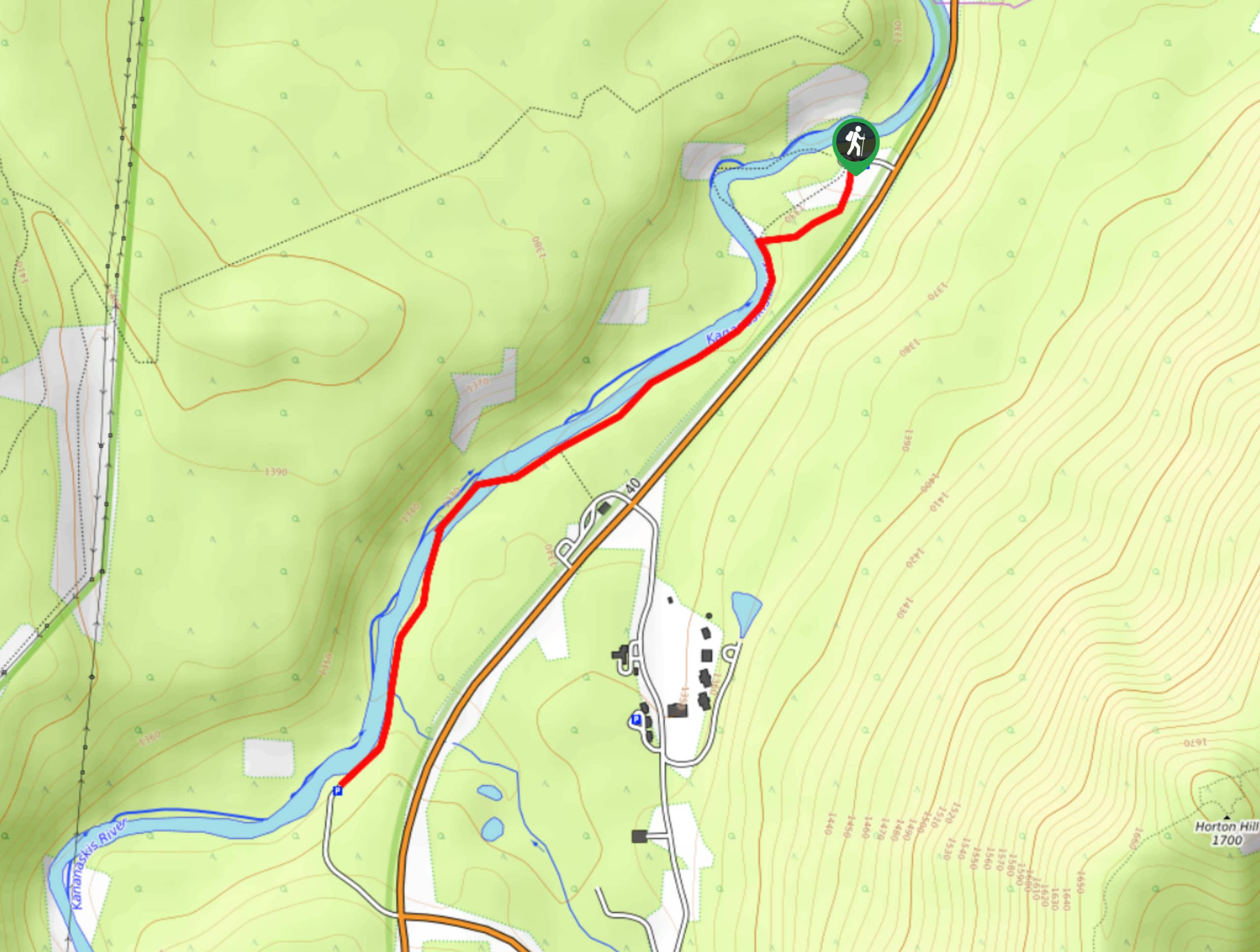
31. Cat Creek Waterfall Hike
Difficulty
The trail to Cat Creek Waterfall is a beautiful forested trail that is perfect for… Read More
32. Short Upper Kananaskis Lake Hike
Difficulty
The Upper Kananaskis Lake hike is a beautiful way to explore the lake without feeling… Read More
33. Three Isle Lake
Difficulty
The trail to Three Isle Lake leaves from the ever-popular Kananaskis Lakes area. There are… Read More
34. Edworthy Falls Hike
Difficulty
The trail to Edworthy Falls is an exciting trail with many options to enjoy different… Read More
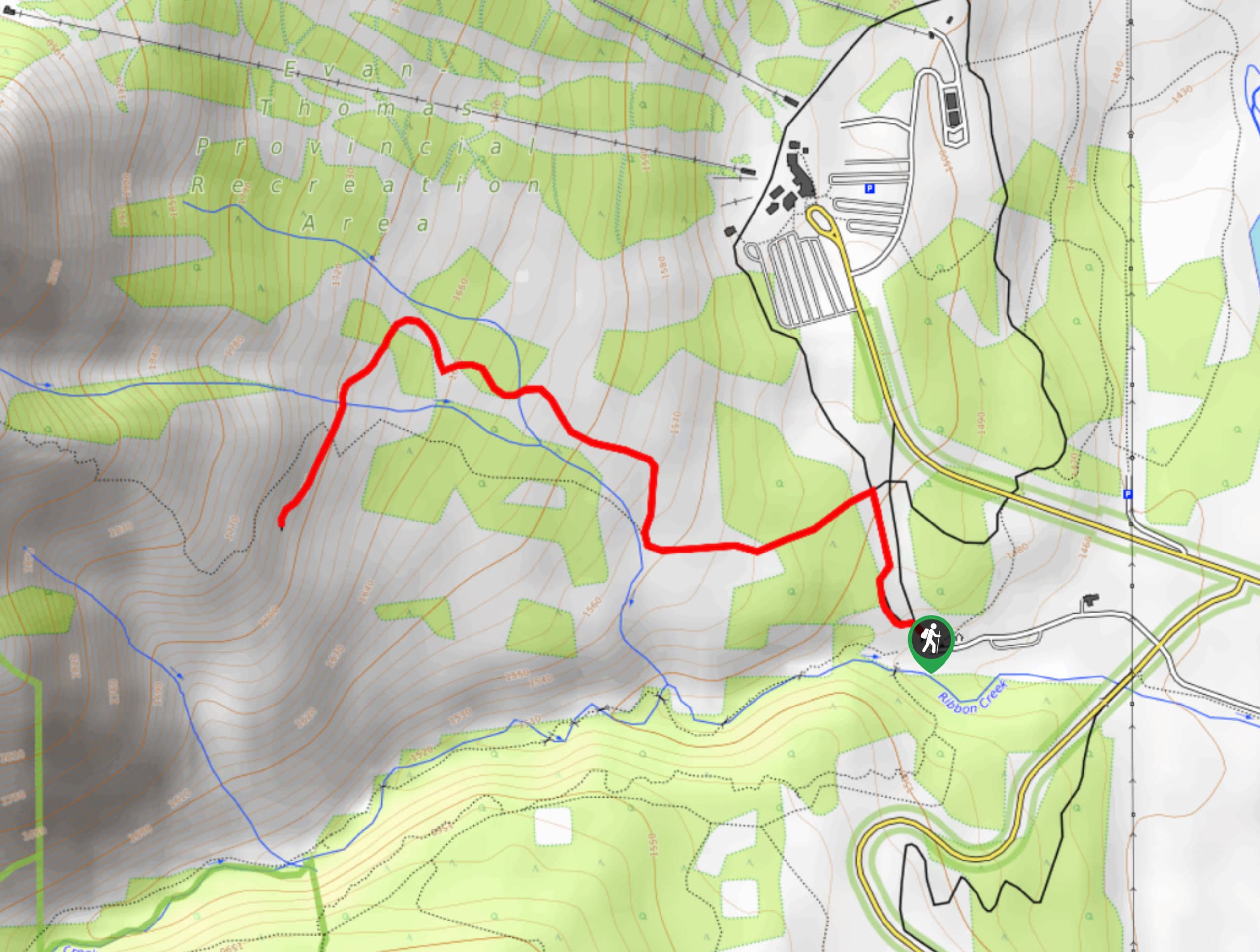
35. Ribbon Falls Hike
Difficulty
The hike to Ribbon Falls is a stunning half-day hike in a popular area. It… Read More
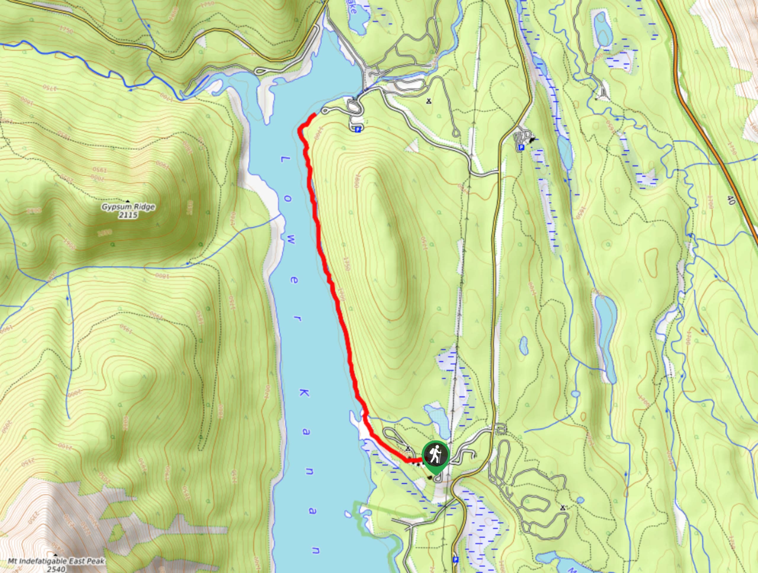
36. Lower Kananaskis Lake Trail
Difficulty
The Lower Kananaskis Lake trail follows the lakeshore between William Watson Lodge and Canyon Creek… Read More
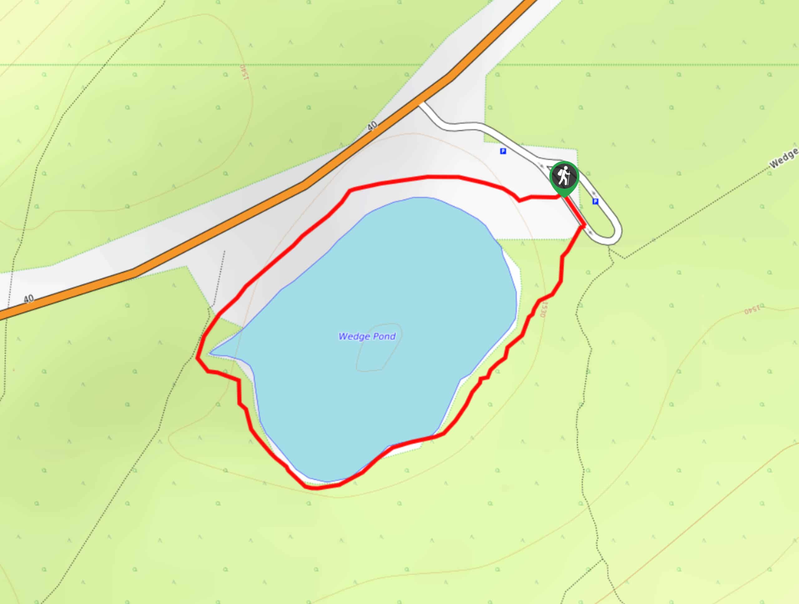
37. Wedge Pond Trail
Difficulty
Hiking the Wedge Pond trail is as relaxed as things get in Kananaskis. The 1km… Read More
38. Coal Mine Trail
Difficulty
The Coal Mine trail takes hikers to a now defunct mine site with amazing views.… Read More
39. Hidden Lake Trail
Difficulty
There’s an element of uncontained excitement when making your way to a destination with the… Read More
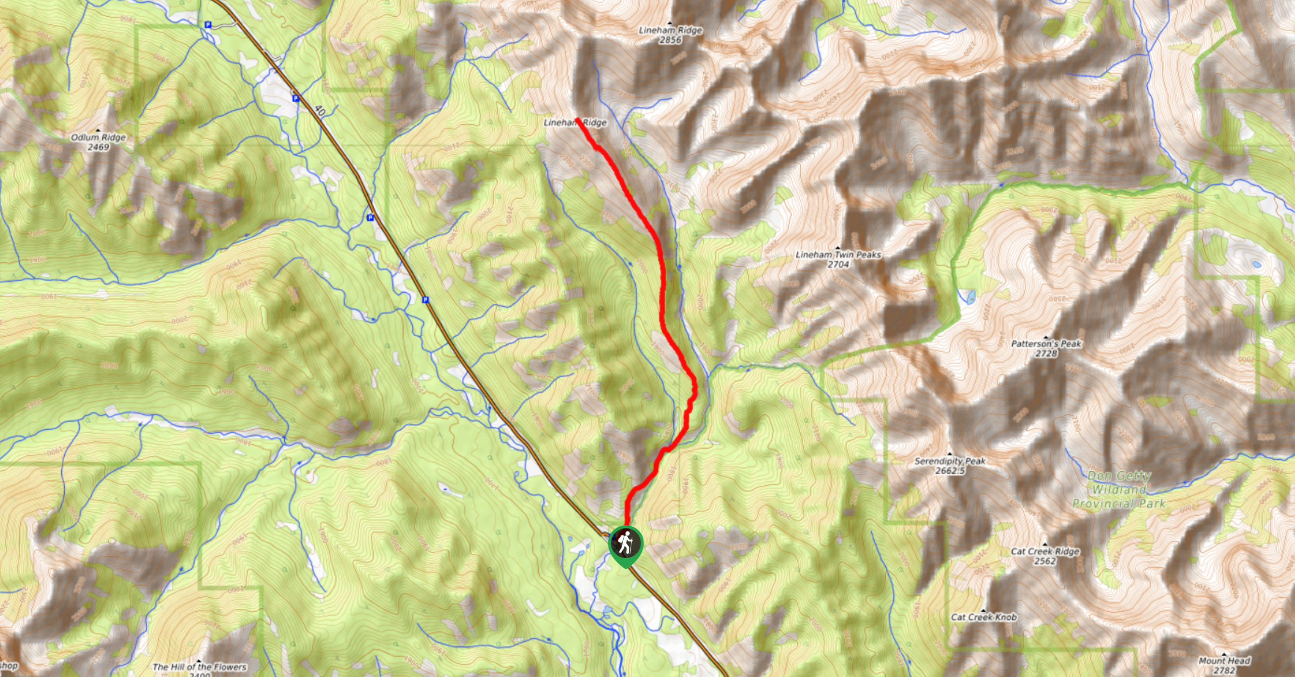
40. Lineham Ridge Trail
Difficulty
The Lineham Ridge hike in Kananaskis is a beautiful trail that opens up above the… Read More
41. Piper Pass Trail
Difficulty
Piper Pass is a challenging full-day hike reserved for those with some route-finding skills and… Read More
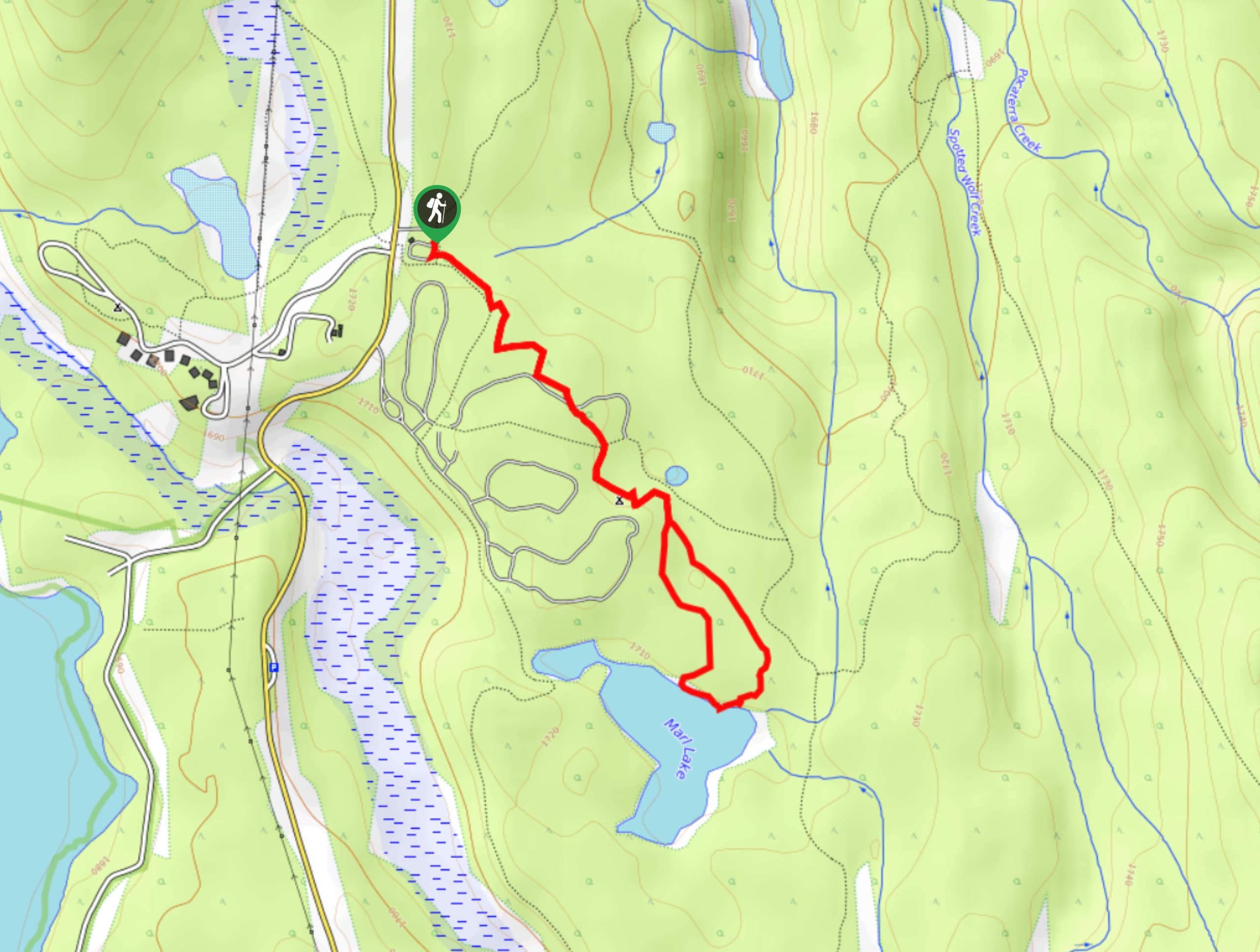
42. Marl Lake Trail
Difficulty
The Marl Lake trail is a moderately trafficked trail near Lower Kananaskis Lake that is… Read More
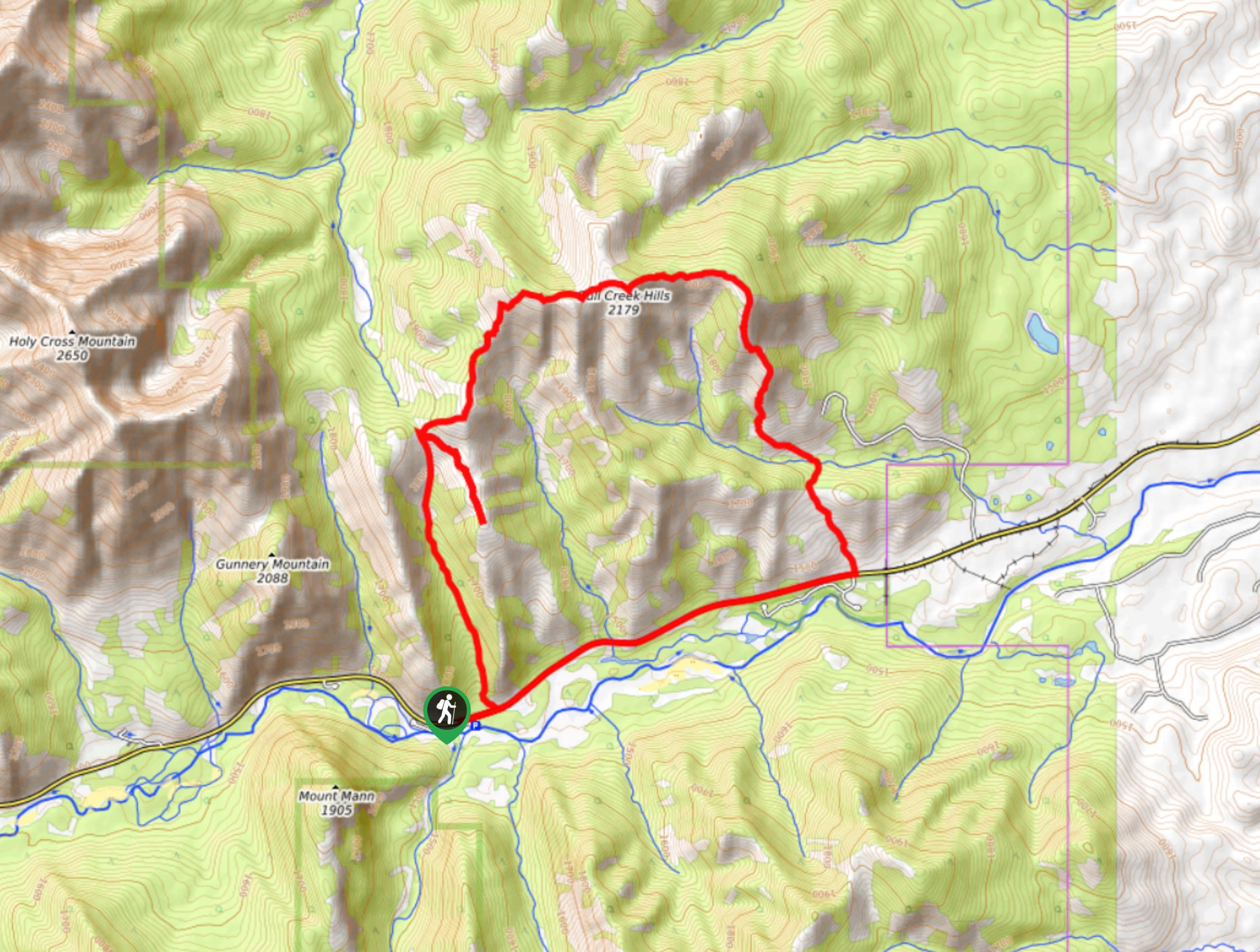
43. Bull Creek Hills Loop
Difficulty
The Bull Creek Hills Loop trail calls for hikers who have decent route-finding skills and… Read More
44. Kananaskis Fire Lookout Trail
Difficulty
The trail to the Kananaskis Fire Lookout follows the Mount Tyrwhitt trail up an old… Read More
45. Hummingbird Plume Lookout
Difficulty
The Hummingbird Plume Lookout trail is a beautiful half to full-day hike that has many… Read More
46. Memorial Lakes Hike
Difficulty
The trail to Memorial Lakes begins in the central Kananaskis Village area, following the Ribbon… Read More
47. Terrace Trail
Difficulty
The Terrace Trail South is a great connecting trail that links Ribbon Creek with Galatea… Read More
48. Eau Claire Hiking Trail Loop
Difficulty
This short and sweet trail is a great way to stretch the legs along Highway… Read More
49. Lost Lake Hike
Difficulty
Hiking to Lost Lake begins on a very popular trail that leads to Lillian and… Read More
Are we missing your favourite hike?
Tell us! If you've got photos, a GPS track and know the hike, we'd love to share your favourite hike with the rest of the 10Adventures community.