
Short Upper Kananaskis Lake Hike
View Photos
Short Upper Kananaskis Lake Hike
Difficulty Rating:
The Upper Kananaskis Lake hike is a beautiful way to explore the lake without feeling crowded at the day use area. Hiking along the shore gives new perspectives to the surrounding mountains and has plenty of options to extend your hike.
Getting there
From the town of Canmore, travel towards the Nordic Centre and continue onto the Spray Lakes road. This gravel road can be rough, and you will remain on it for 37.3mi before turning right onto Kananaskis Lakes Trail. Follow this road to the Upper Kananaskis Lake day use area.

About
| When to do | May-October |
| Backcountry Campsites | Point Backcountry |
| Pets allowed | Yes - On Leash |
| Family friendly | Yes |
| Route Signage | Average |
| Crowd Levels | Extreme |
| Route Type | Out and back |
Short Upper Kananaskis Lake Hike
Elevation Graph
Weather
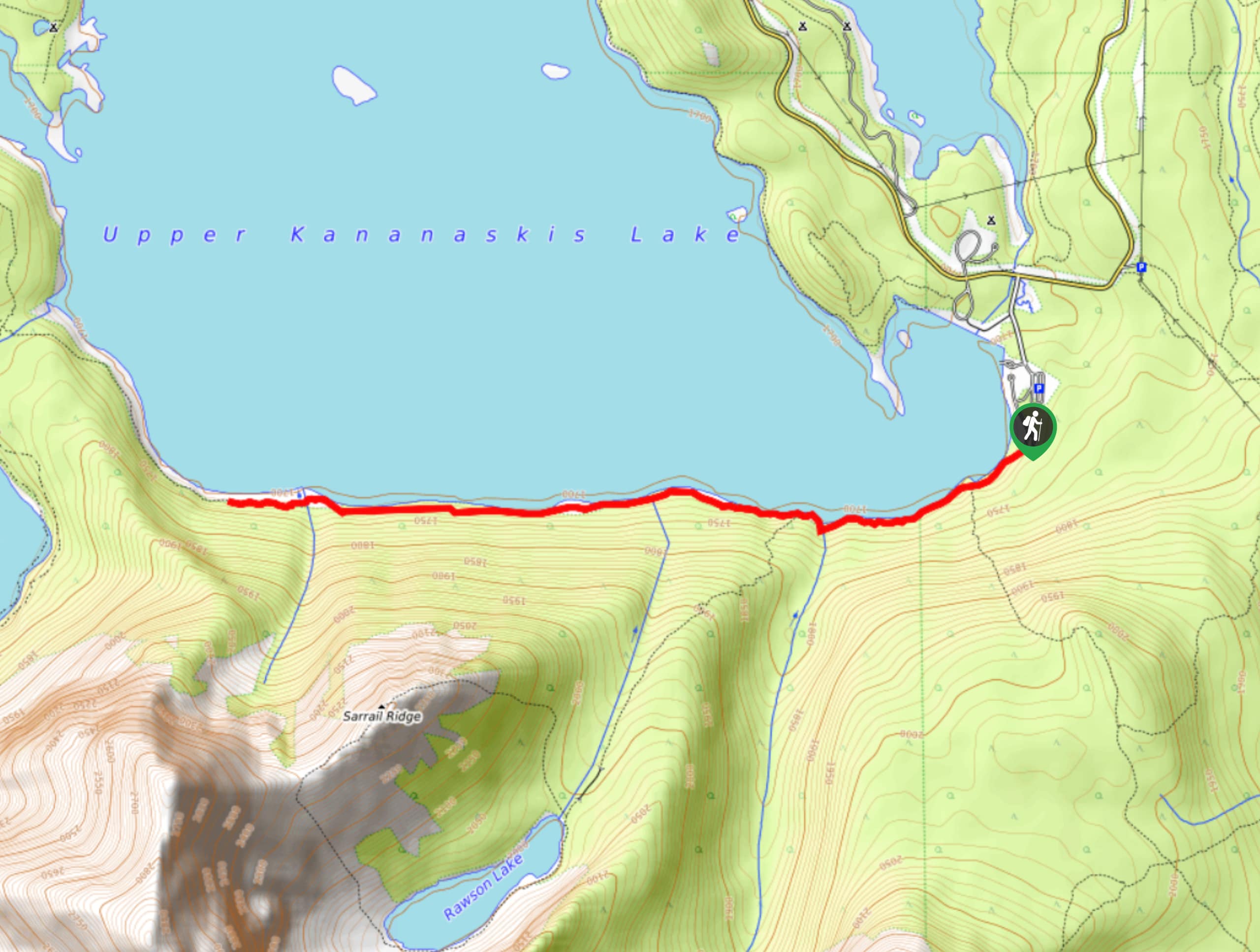
Short Upper Kananaskis Lake Trail Description
From the day use area, walk towards the lake and begin hiking around the left shore. Follow this trail over rolling elevation for almost 2.5mi. You will pass a junction to Rawson Lake, which is an excellent way to extend your trip. Just before the Rawson Lake trail junction you will cross a footbridge with an impressive waterfall. The best part of this hike is that you may hike along the lakeshore for as long as you please before turning back. Continuing further than suggested here takes you to the Hidden Lake junction and eventually the Point Backcountry campsite.
Find other amazing hikes in Kananaskis Country
- Kananaskis – Smith Dorrien Trail: Chester Lake, Tent Ridge, Burstall Pass, West Wind Pass and Rummel Lake.
- Bragg Creek and Sheep River Provincial Park: Prairie Mountain, Powderface Ridge, Nihahi Ridge and ForgetMeNot Ridge.
- Kananaskis Trail: Troll Falls, Rawson Lake, Wasootch Ridge, Sarrail Ridge and Pocaterra Ridge.
Similar hikes to the Short Upper Kananaskis Lake Hike hike
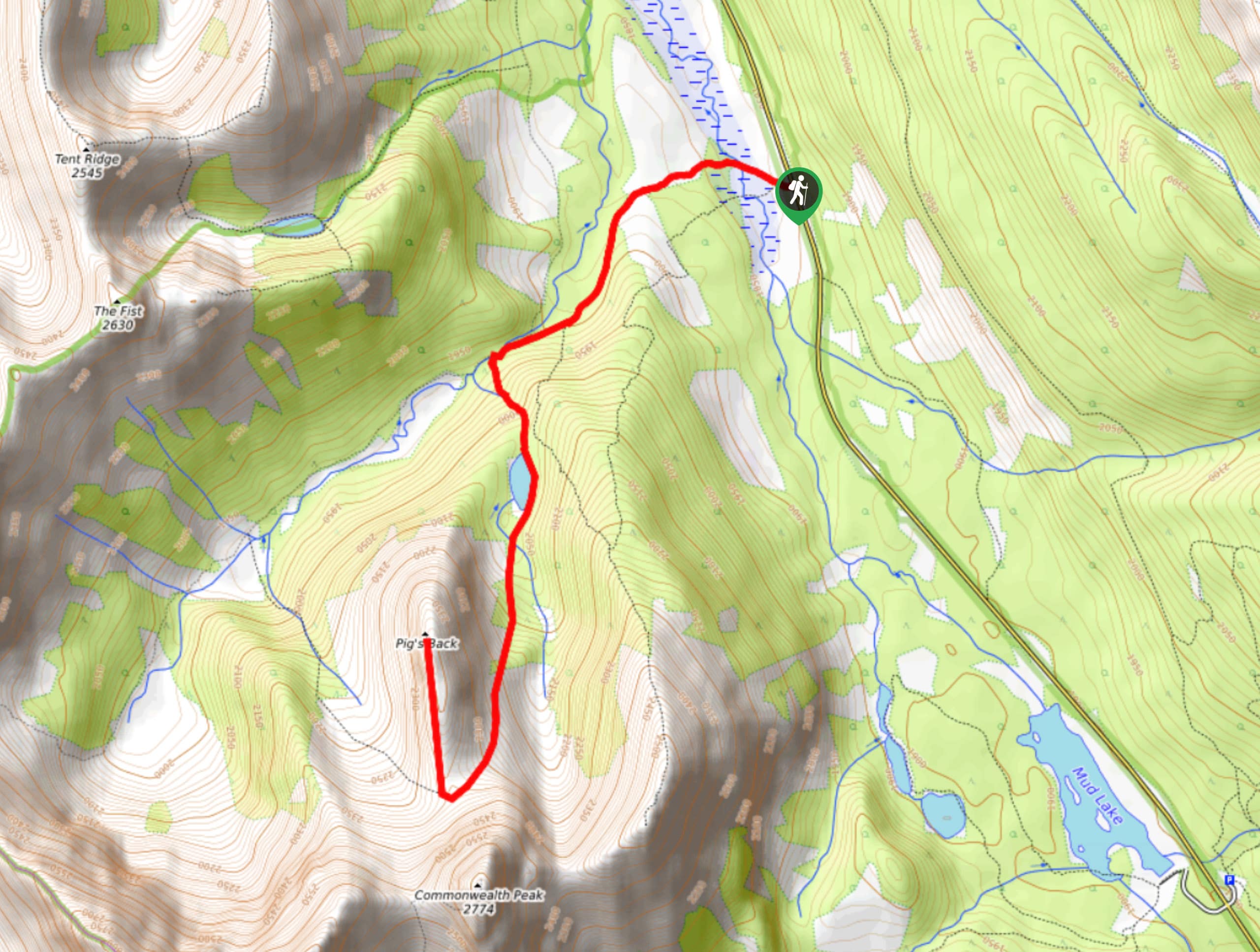
Pig’s Back Trail
The Pig’s Back is a route to a prominent feature along the Commonwealth Ridge Traverse. You will hike up Commonwealth…
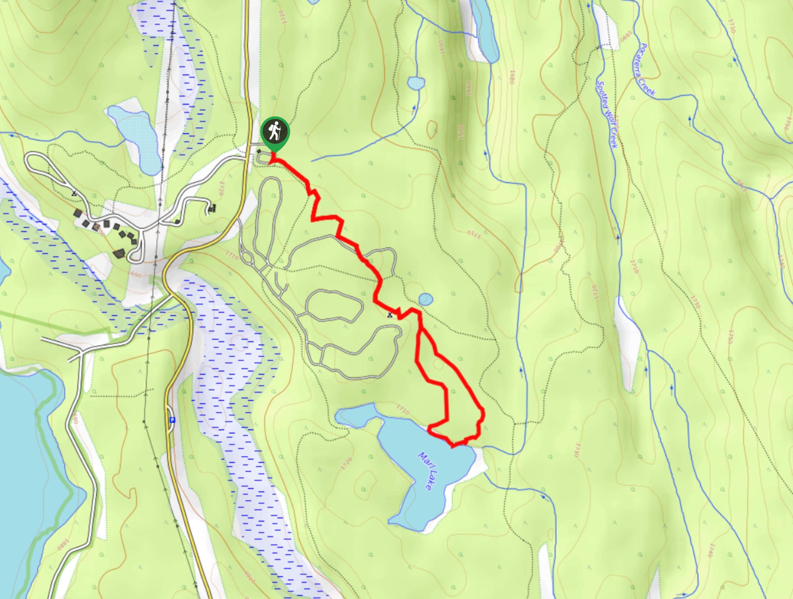
Marl Lake Trail
The Marl Lake trail is a moderately trafficked trail near Lower Kananaskis Lake that is accessible for all abilities. It…
Tryst Lake Trail
The trail to Tryst Lake is used year-round by many different types of adventurers. The summer trail is easy to…
Comments