
Pig’s Back Trail
View Photos
Pig’s Back Trail
Difficulty Rating:
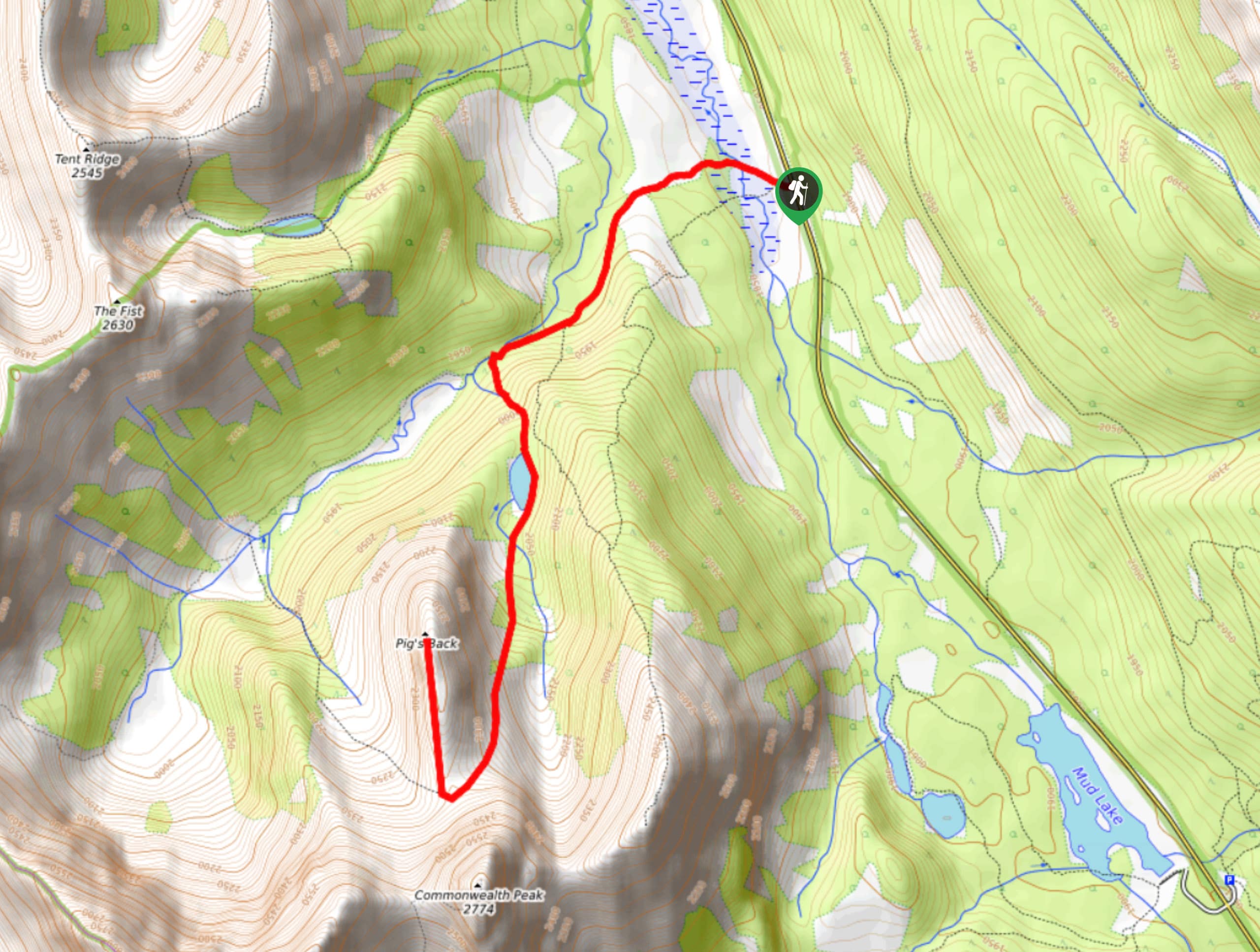
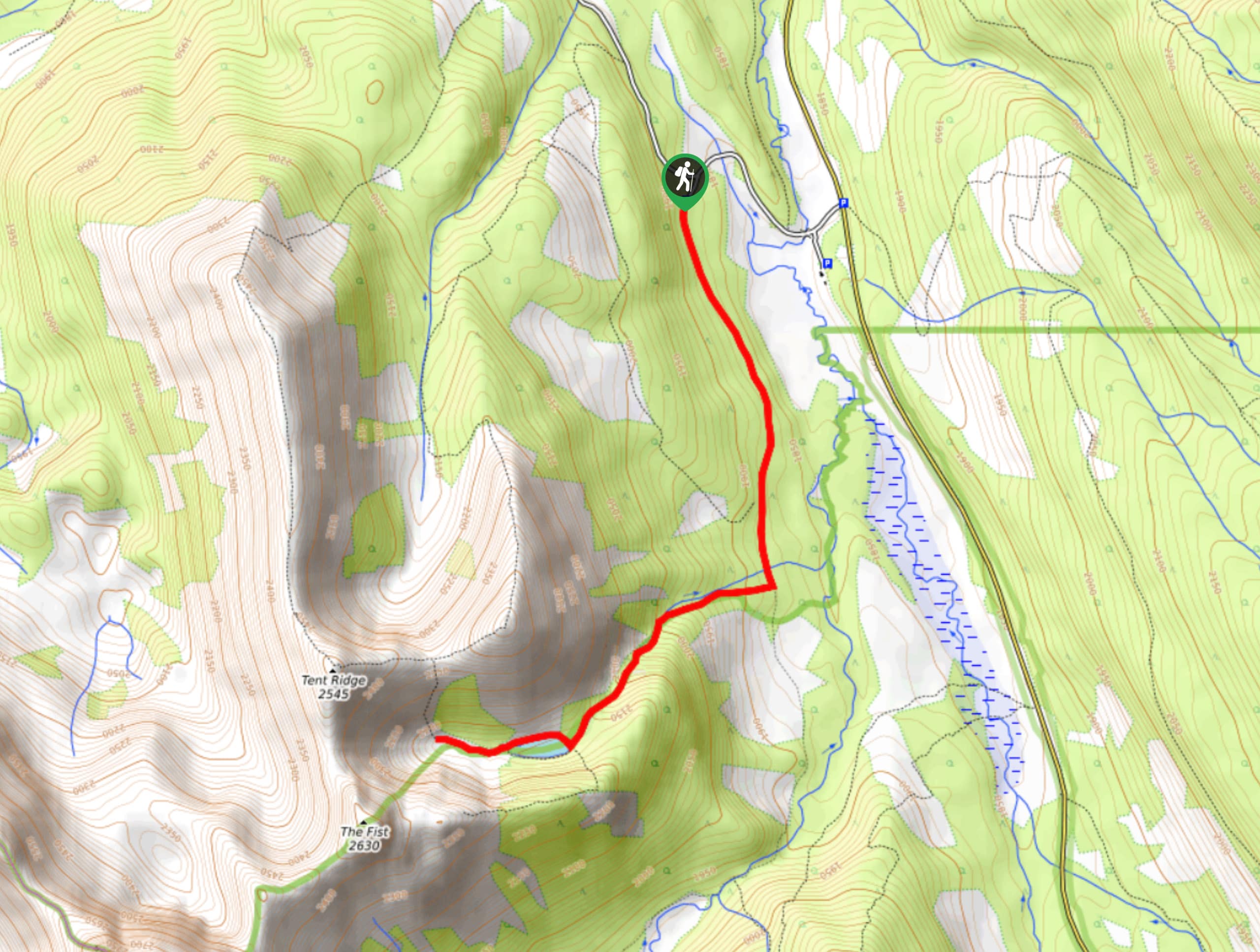
The Pig’s Back is a route to a prominent feature along the Commonwealth Ridge Traverse. You will hike up Commonwealth Creek before reaching Commonwealth Lake and finally the Pig’s Back. There is some route-finding required, so make sure you are familiar with your objective before setting out for the day.
Getting there
Turn onto Highway 40 at the Stoney Nakoda Resort and Casino off of the Trans Canada Highway. Follow Highway 40 for 31.1mi before turning right onto Kananaskis Lakes Trail. In 1.2mi, turn onto the Smith-Dorrien/Spray Lakes Road toward Canmore. Stay on this road for 14.9mi before pulling over onto the shoulder on the left side of the road below Mount Smuts and Mount Birdwood.

About
| When to do | June-September |
| Backcountry Campsites | No |
| Pets allowed | Yes - On Leash |
| Family friendly | Older Children only |
| Route Signage | Poor |
| Crowd Levels | Moderate |
| Route Type | Out and back |
Pig’s Back Trail
Elevation Graph
Weather
Pig’s Back Trail Description
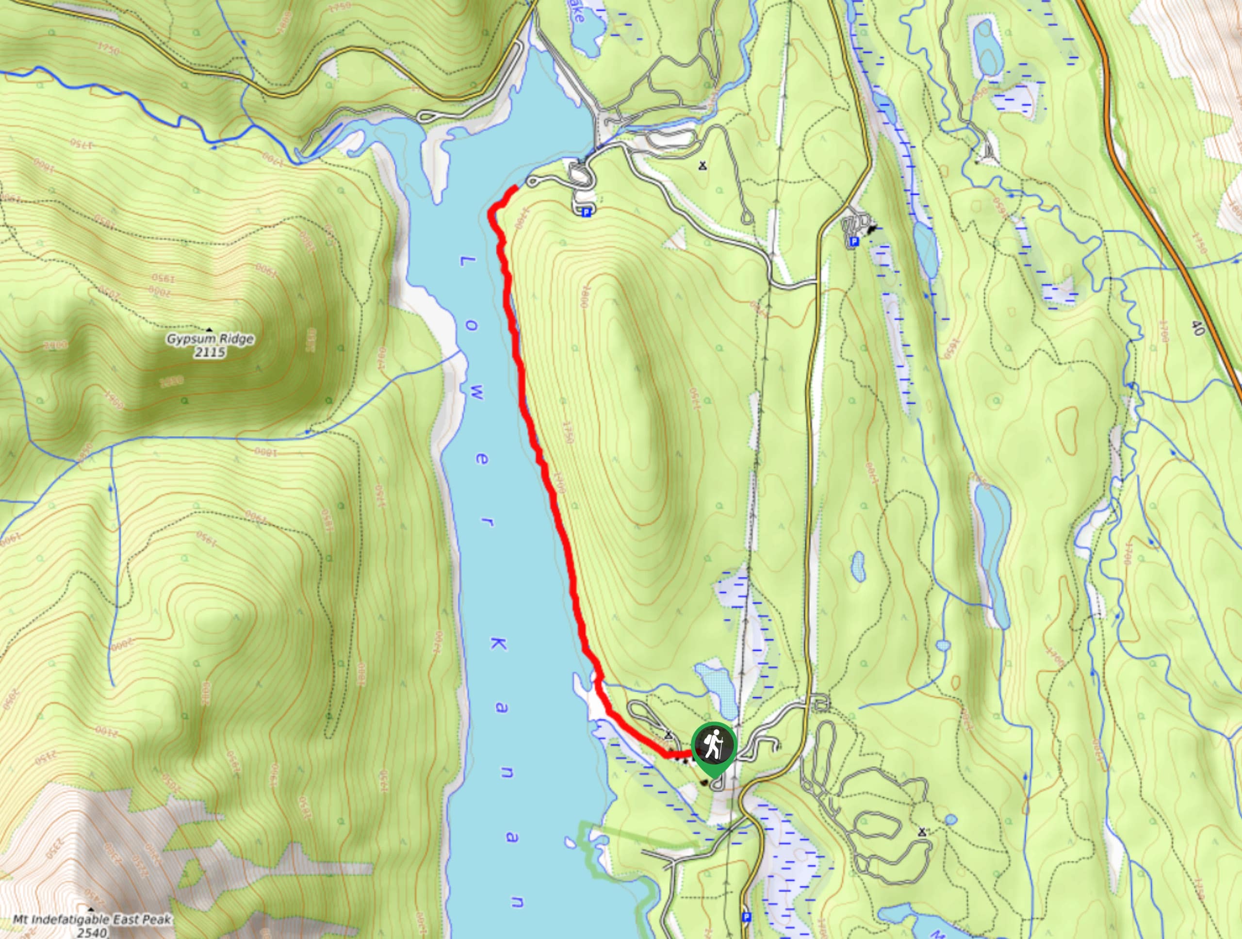
The Pig’s Back trail in Kananaskis starts from the pullout on the Spray Lakes Road. Find a trail that leads west from the road between Mount Smuts and Mount Birdwood along Commonwealth Creek. Depending on where you park, you might see two trails leading up the valley, stay on the right, closer to the creek. You will be on the Commonwealth Ridge route, however, after 1.1mi there will be a trail to the left, which you will avoid. Stay straight, and after 1.4mi from the trailhead, you will take the trail to the left for Commonwealth Lake. Pass by the beautiful lake before continuing to the Pig’s Back. The Pig’s Back is a prominent feature that is visible from the lake, so you should be able to gain the ridge that is part of the Commonwealth ridge traverse route, before heading northeast to the clear feature that is the Pig’s Back.
Similar hikes to the Pig’s Back Trail hike
Tryst Lake Trail
The trail to Tryst Lake is used year-round by many different types of adventurers. The summer trail is easy to…
Hidden Lake Trail
There’s an element of uncontained excitement when making your way to a destination with the name Hidden Lake. Just hearing…
Lower Kananaskis Lake Trail
The Lower Kananaskis Lake trail follows the lakeshore between William Watson Lodge and Canyon Creek campground. The trail has educational…
Comments