Little Lawson Hike
View Photos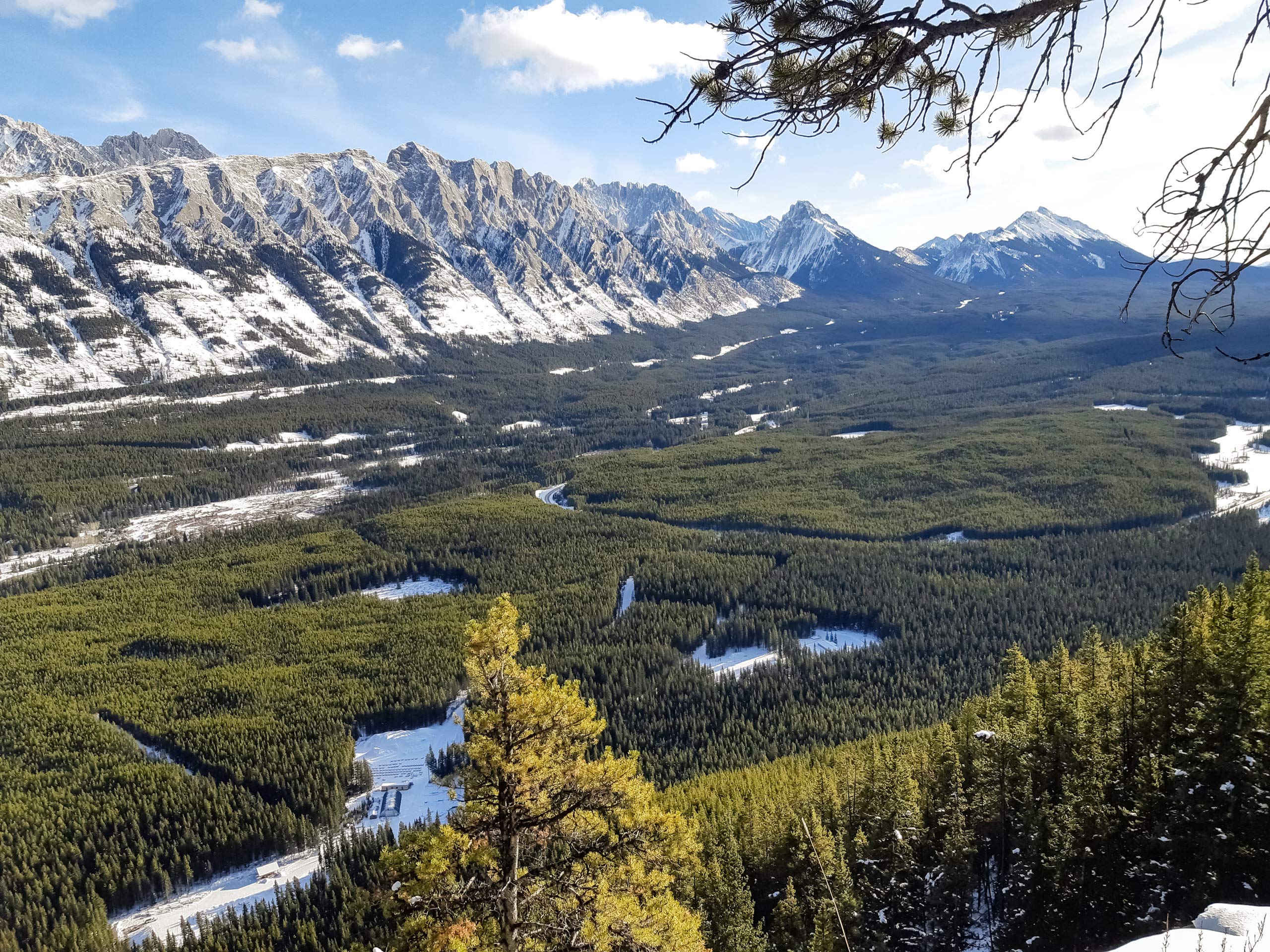
Little Lawson Hike
Difficulty Rating:
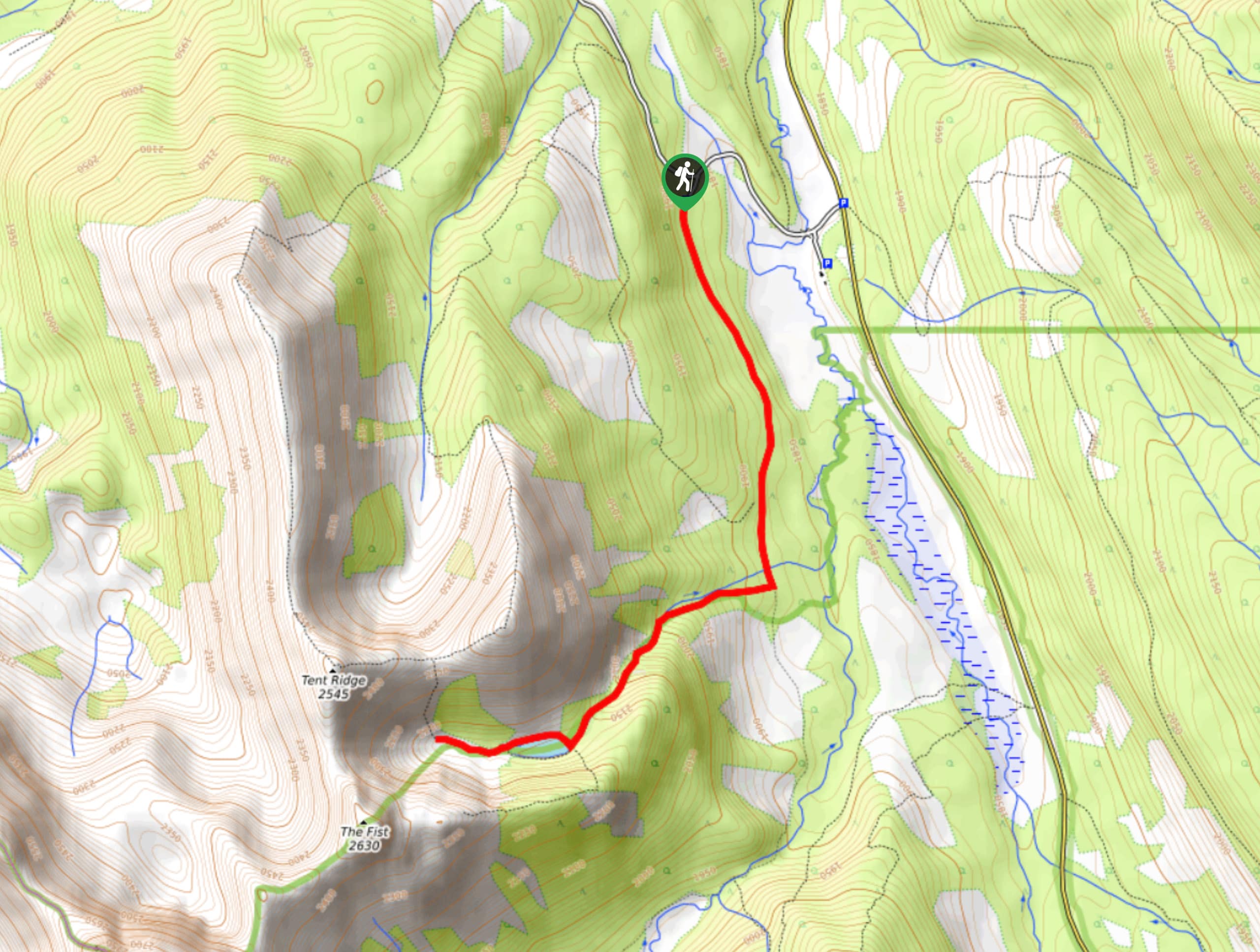
The Little Lawson Peak route (also known as South Lawson) is a straightforward trail that takes users to an incredible viewpoint. The trail travels straight up the ridge from the highway, making it very easy to follow. It is a great option in the early and late season as it isn’t dangerous and it rarely has snow along the ridge during hiking season.
Getting there
From Canmore, follow signs to the Nordic Centre and make your way onto the Spray Lakes Road. Continue on Spray Lakes Road until Penstock Loop road at Kent Creek. Park on the left side of the highway at a pullout and find the trail in the woods.

About
| When to do | April-October |
| Backcountry Campsites | No |
| Pets allowed | Yes - On Leash |
| Family friendly | Older Children only |
| Route Signage | Average |
| Crowd Levels | High |
| Route Type | Out and back |
Little Lawson Hike
Elevation Graph
Weather
Little Lawson Hike Description
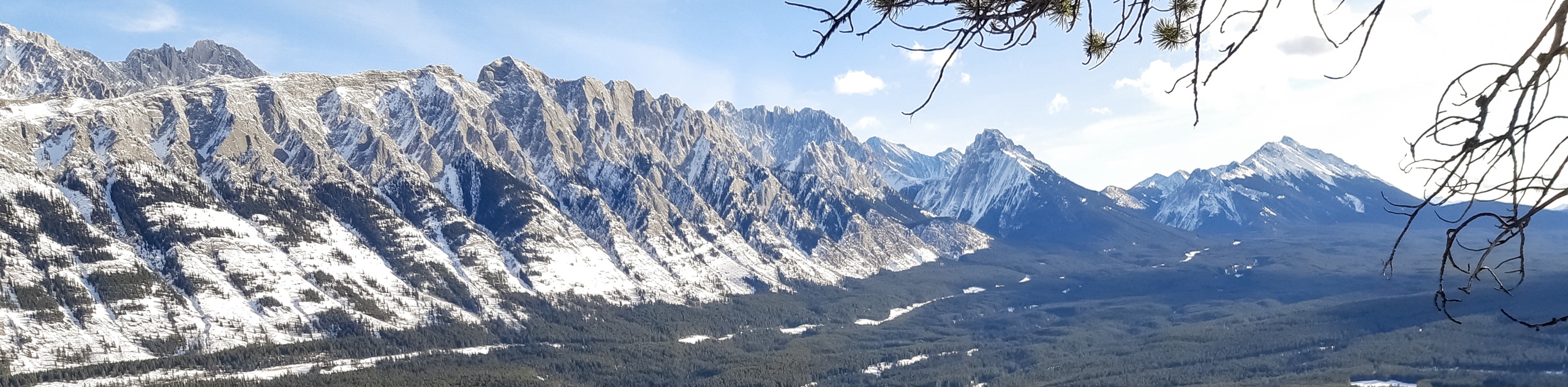
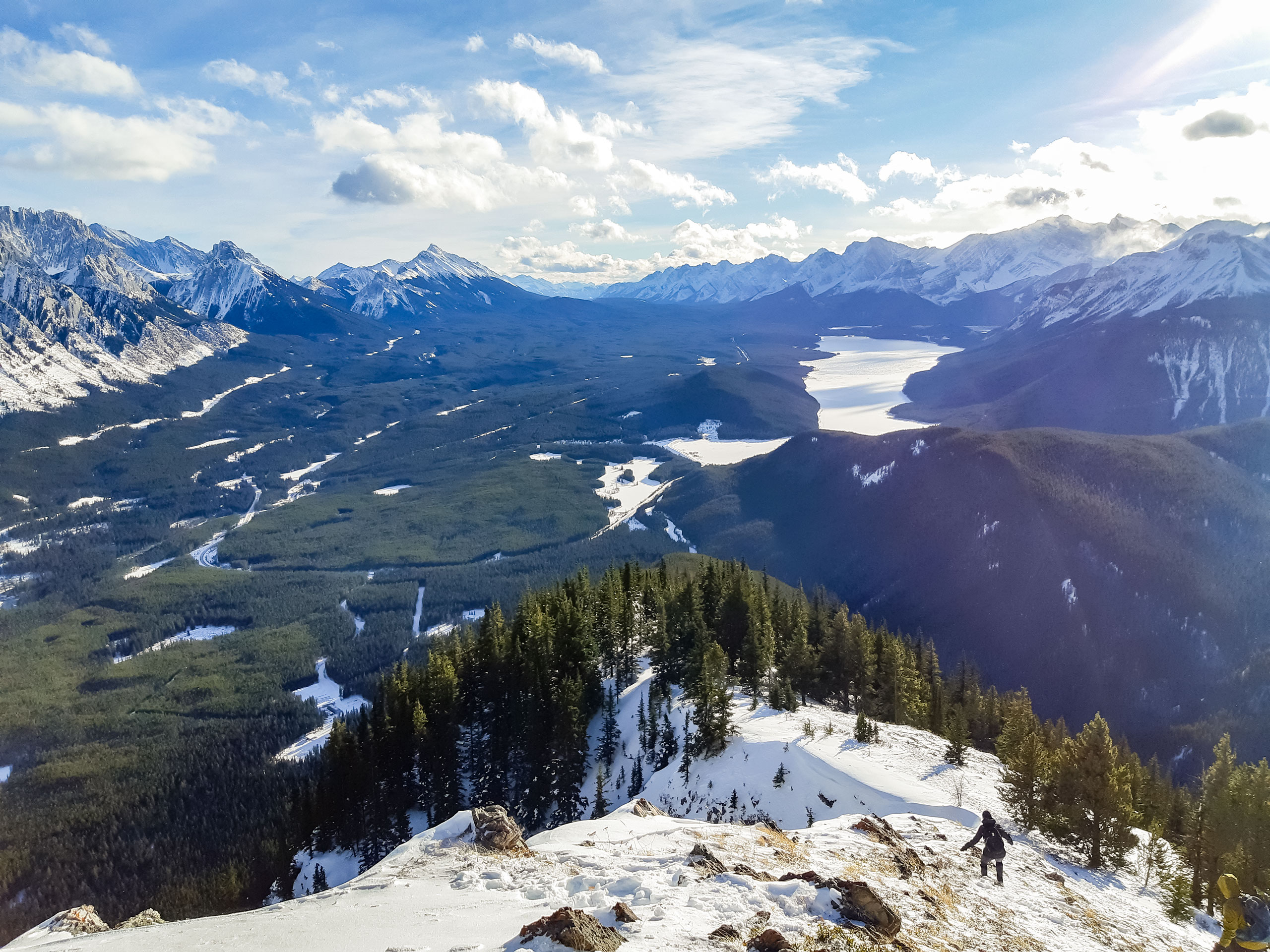
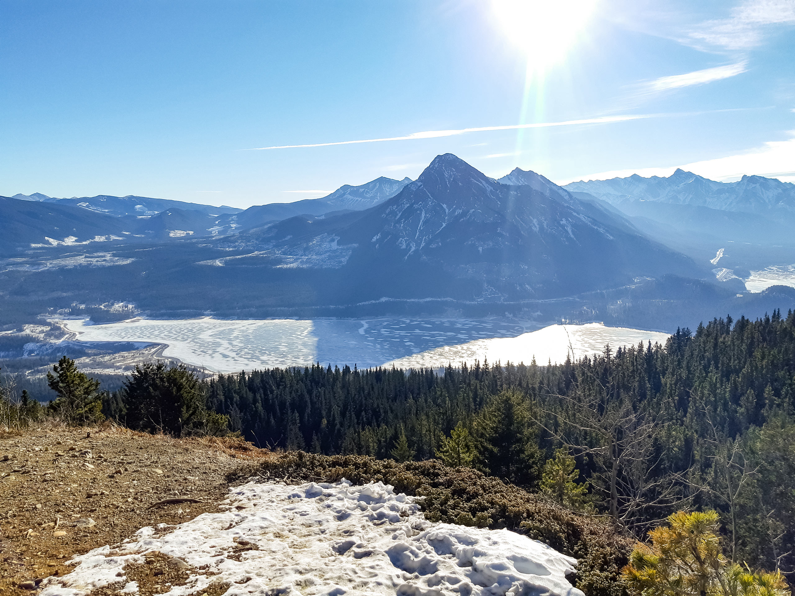
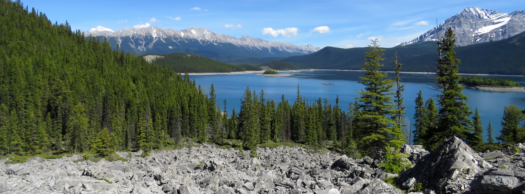
Little or South Lawson is a beautiful ridge walk that is generally known for its long season. The trail follows the Penstock Loop to start before turning into the South Lawson Route. It climbs through the forest up the ridge on easy terrain. As you gain the ridge, the views continue to open up. The final summit ridge has dramatic views looking over to Kananaskis Lakes and Sarrail Ridge. Take in the panorama off the summit before returning the way you came.
Similar hikes to the Little Lawson Hike hike
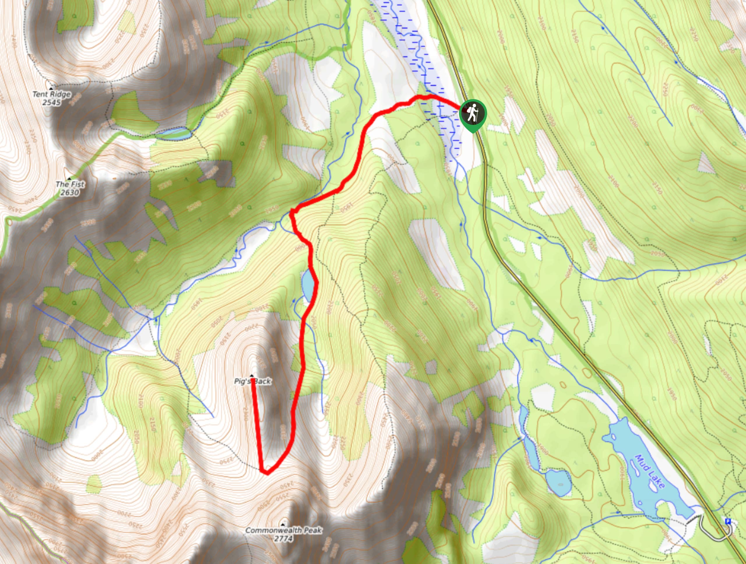
Pig’s Back Trail
The Pig’s Back is a route to a prominent feature along the Commonwealth Ridge Traverse. You will hike up Commonwealth…
Tryst Lake Trail
The trail to Tryst Lake is used year-round by many different types of adventurers. The summer trail is easy to…
Hidden Lake Trail
There’s an element of uncontained excitement when making your way to a destination with the name Hidden Lake. Just hearing…
Comments