Skookumchuck Narrows
View Photos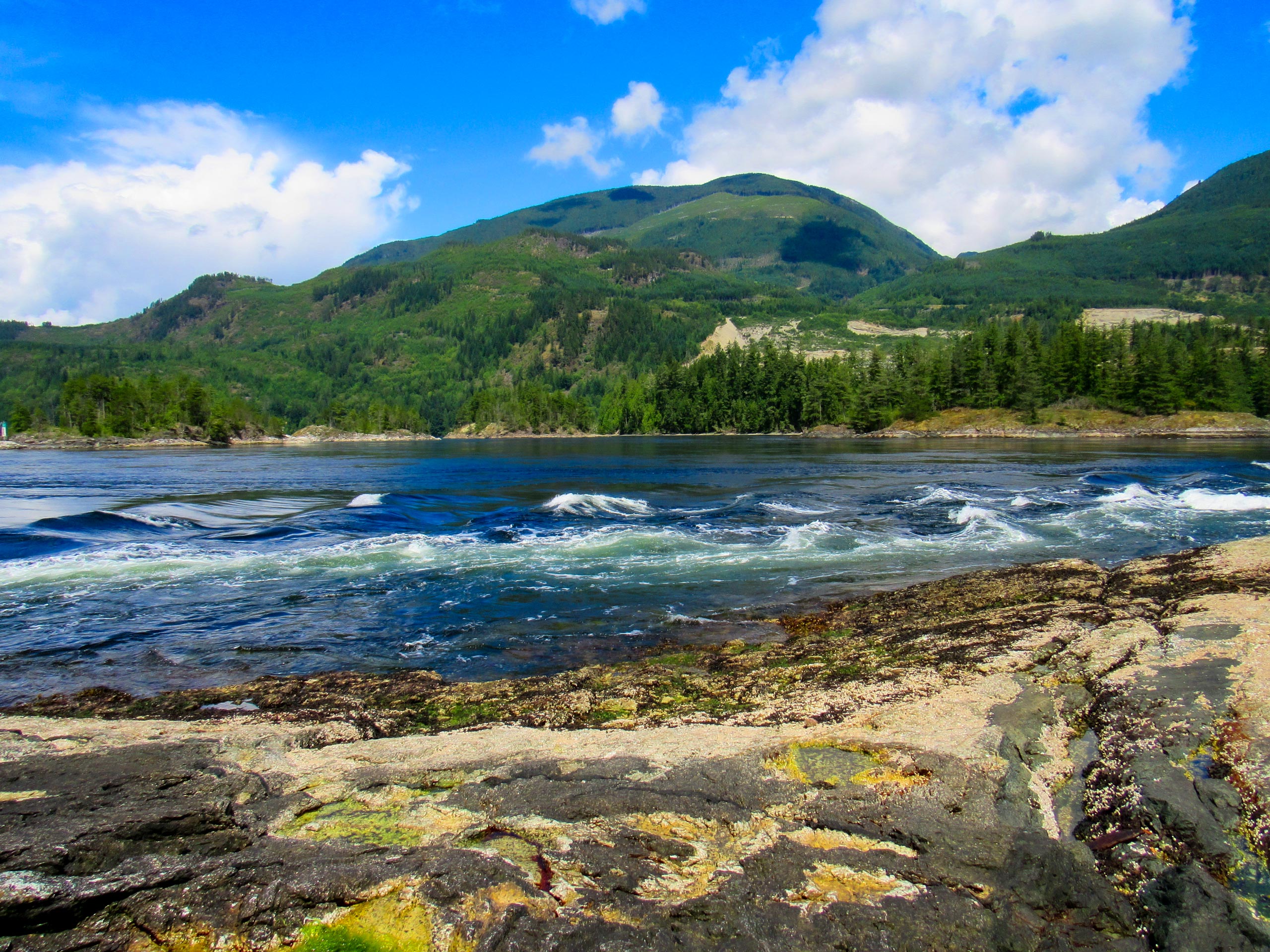
Skookumchuck Narrows
Difficulty Rating:
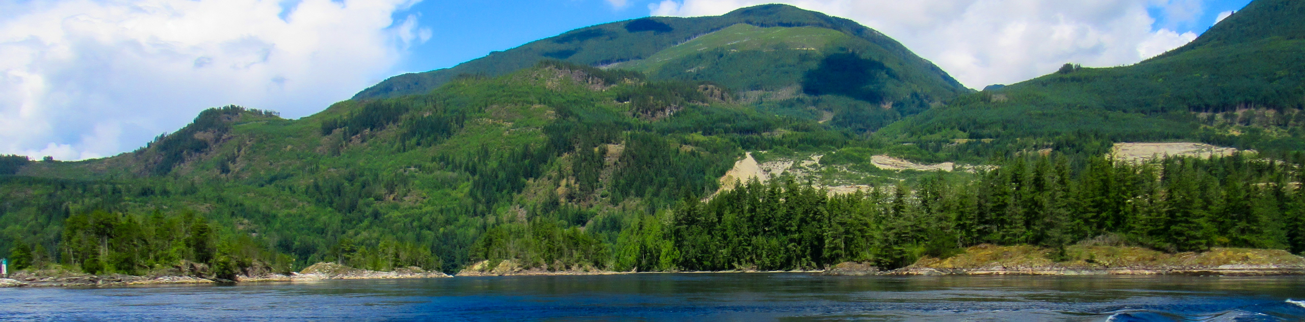
The Skookumchuck Narrows trail is a 4.8mi out-and-back hiking route within Skookumchuck Narrows Provincial Park that will take you from the town of Egmont to a scenic viewpoint looking out over the Sechelt Islets and the rushing water of the narrows. Along the trail, you will experience an amazing forest setting and pass by the calm waters of Brown Lake before arriving at the viewpoints overlooking violent rapids and swirling whirlpools. Make sure to time your hike with the tide for the best viewing experience along this unique stretch of water.
Getting there
To reach the parking area for the Skookumchuck Narrows from Sechelt, head west on BC-101 for 32.7mi and turn right onto Egmont Road. After 3.4mi, turn left to enter the parking area.

About
| When to do | Year-Round |
| Backcountry Campsites | No |
| Pets allowed | Yes - On Leash |
| Family friendly | Yes |
| Route Signage | Average |
| Crowd Levels | Moderate |
| Route Type | Out and back |
Skookumchuck Narrows
Elevation Graph
Weather
Skookumchuck Narrows Trail Description
The Skookumchuck Narrows present a unique opportunity for hikers to witness interesting tidal activities like rapids and whirlpools, and as such, the trail can become fairly busy with foot traffic at specific times. If you are looking to view these events, make sure to look into tidal times and arrive early to the trailhead to secure parking. Additionally, the latter half of this trail near the viewpoints is a bit technical, with rocks and roots covering the path. This may limit mobility for some hikers, which should be kept in mind when planning your trip.
Crowds aside, the Skookumchuck Narrows Trail is a fantastic hiking route that will take you to several viewpoints from which you can watch the tidal activity. Along the route, you will pass through a scenic forest setting with large trees and a plentiful amount of ferns scattered across the forest floor that provide a real West Coast rainforest vibe. Eventually, you will pass by the tranquil waters of Brown Lake before continuing on to the viewing platforms, where you can watch the swirling whirlpools and adventurous kayakers attempt to navigate the rapids. This hike is a great way to get out and explore the natural beauty that can be found along the Sunshine Coast.
Setting out from the parking area, make your way across Egmont Road and follow along the road. As you pass by the Skookumchuck Bakery, stop in to grab a sweet treat to accompany your hike through the wilderness. Roughly 2625ft from Egmont Road, you will find the trailhead splitting off into the forest on the right. Follow the well-maintained path to the southeast, where you will pass by the heavily wooded shores of Brown Lake in 1km.
After passing by the lake and traversing the rocky/root-covered terrain along the second half of the trail, you will arrive at the first viewpoint overlooking the Skookumchuck Narrows. From here, you will be able look out across the rushing water and see the whirlpools that swirl around with the movement of the tide. Head further south along the trail for about 1640ft to reach the Roland Point viewing area, where you will have a better sightline across the rapids towards the Sechelt Islets. After taking in the views of the torrenting water and watching a few kayakers attempt to brave their current, head back along the same route to return to the parking area, having completed the hike to Skookumchuck Narrows.
Insider Hints
Arrive early to secure parking at the trailhead.
Stop in at the Skookumchuck Bakery near the parking area to enjoy a sweet snack on the trail.
Time your hike with the tide to witness whirlpools and powerful rapids from the viewpoints.
Similar hikes to the Skookumchuck Narrows hike

Malaspina Switchback Trail
The Malaspina Switchback Trail is a 4.3mi out-and-back hiking route in Powell River, BC, that will take you…

Holly Branch Loop Hike
The Holly Branch Loop is a 3.7mi lollipop hiking route near Powell River, BC, that will take you…

Stillwater Bluffs Trail
The Stillwater Bluffs Trail is a 1.9mi lollipop hiking route along the Sunshine Coast that provides some amazing…
Comments