Smuggler Cove
View Photos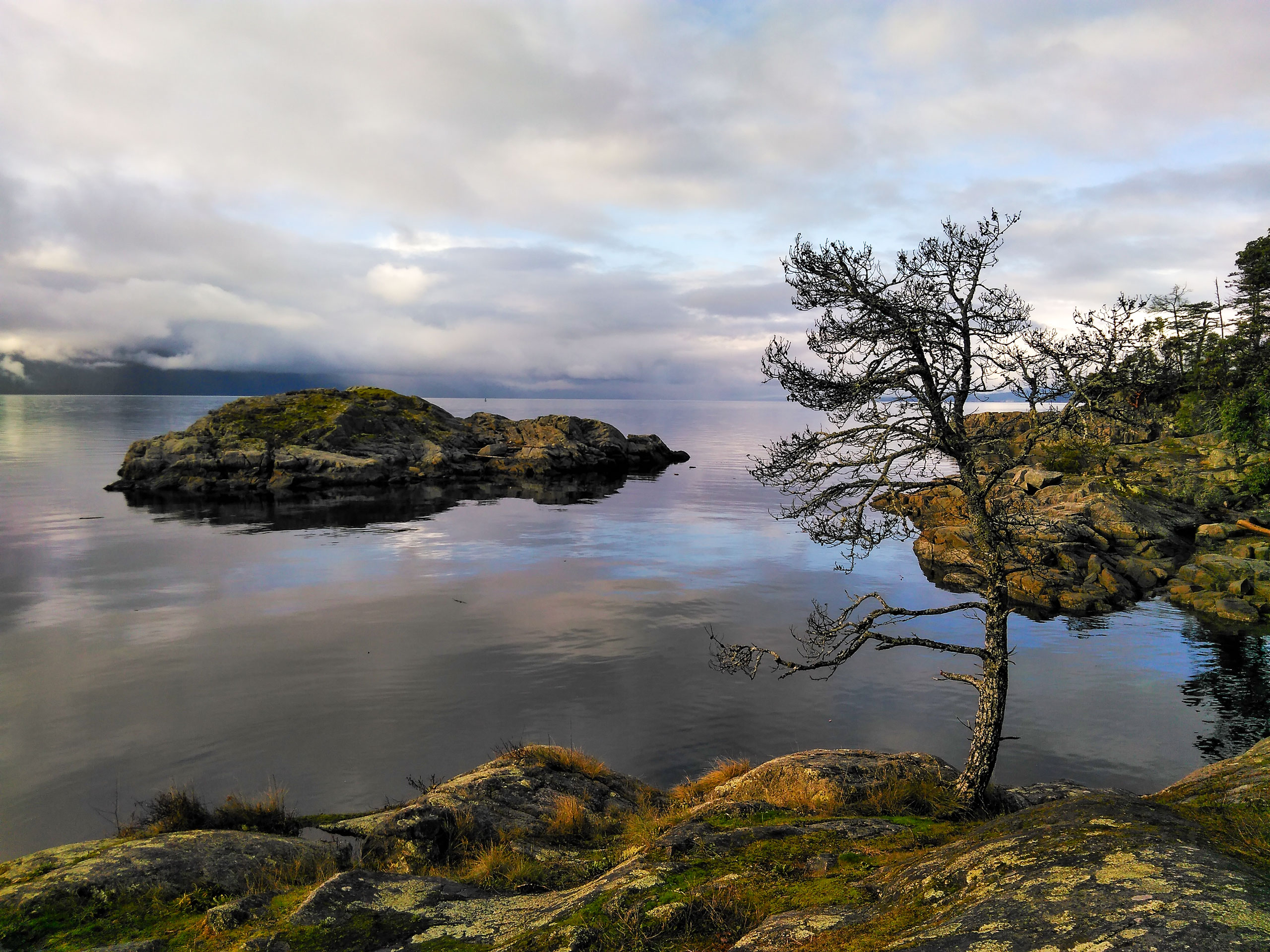
Smuggler Cove
Difficulty Rating:
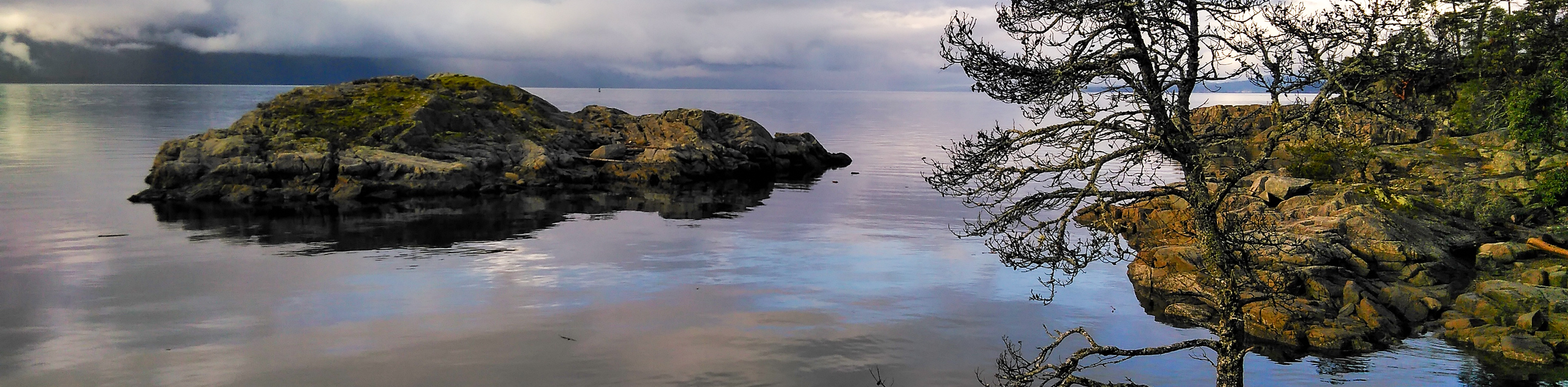
The trail to Smuggler Cove is a 2.3mi lollipop hiking route that will take you through the forests of Smuggler Cove Marine Provincial Park to arrive at a viewpoint overlooking the coast. Along the trail, you will experience a charming forest setting with a wooden boardwalk and breathtaking views across the Strait of Georgia. With relatively easy terrain and picturesque scenery, this scenic hike is sure to be a family favourite where you can create lasting memories on the Sunshine Coast.
Getting there
To reach the Smuggler Cove trailhead from Halfmoon Bay, drive northwest on BC-101 for 0.9mi and turn left onto Brooks Road. After 2.1mi, you will find the trailhead on the right.

About
| When to do | May-October |
| Backcountry Campsites | No |
| Pets allowed | Yes - On Leash |
| Family friendly | Yes |
| Route Signage | Average |
| Crowd Levels | Moderate |
| Route Type | Lollipop |
Smuggler Cove
Elevation Graph
Weather
Smuggler Cove Trail Description:
Smuggler Cove is a popular hiking route within Smuggler Cove Marine Provincial Park, which means that you will need to contend with the crowds if you are looking to experience the amazing coastal views along the trail. Make sure to arrive early or on off-peak days to both secure parking at the trailhead and beat out the crowds to enjoy a bit of solitude along the trail. While the route is very well-maintained, certain areas are covered in roots and rocks, which may make travel difficult for some hikers. As such, this trail might not be the best option for less-mobile hikers or families with strollers.
While the trail may be a busy one, the breathtaking views of the coastal landscape will certainly be enough to make you forget about the throngs of people and enjoy a beautiful day out by the water’s edge. The trail passes through a beautiful forest setting and a marshy area along a boardwalk before arriving at the edge of the water. From here, hikers can continue along the trail to experience views across the water from several scenic viewpoints. Across the Strait of Georgia, you will be able to see Texada Island to the northwest and the rest of the Sunshine Coast stretching out to the north. This hike is an easy adventure with some amazing views that the entire family is sure to enjoy.
Setting out from the trailhead, follow the path as it leads into the thick cover of the forest to the north. After walking along the shady path for 591ft, you will come to a wooden boardwalk that passes through a stretch of marshy landscape. Make your way along the boardwalk, keeping the swamp on your right, as you cross over a small creek and continue through the forest. After roughly 1640ft, you will cross over the creek once again as you begin your approach to the edge of Smuggler Cove.
About 656ft from the creek crossing, you will come to a junction in the trail. Keep right at the fork and continue through the forest to the northwest. Along this part of the hike, you will pass by several viewpoints overlooking the sheltered inlets of the cove, as you make your way closer to the rocky edge of the water.
1640ft after the trail junction, you will come to another fork in the trail. Keep left to follow a short loop around the point that will provide some amazing views looking out across the Strait of Georgia, with Texada Island to the northwest and the rest of the Sunshine Coast spreading out to the north. After completing the loop, go left at the junction to head back along the same route through the amazing forest landscape to return to the Smuggler Cove trailhead.
Trail Highlights
Strait of Georgia
Inhabited by indigenous peoples for thousands of years and named after King George III of Britain, the Strait of Georgia is an arm of the Salish Sea that lies between Vancouver Island and the Mainland of British Columbia. Roughly 149.1mi long, this body of water is characterized by narrow channels and archipelagoes at either end, with the Gulf and San Juan islands to the south, and the Discovery Islands to the north.
Texada Island
Known as the “Jewel of the Georgia Strait”, Texada Island is the largest island within the body of water, with an area of roughly 300km². Once a booming area for the mining industry, the island has seen a steady decline in population since the mid 20th century and is now largely a cottage and camping destination.
Frequently Asked Questions
Why is it called Smuggler Cove?
A possible origin of the name Smuggler Cove comes from the story of Larry Kelly who was a former Confederate soldier during the United States Civil War. Known as “King of the smugglers”, Kelly became infamous for charging Chinese immigrants $100 per person to be smuggled into the United States by boat.
Insider Hints
Time this hike with the sunset for some breathtaking views across the water.
Make sure to arrive early, as parking at the trailhead is limited.
Parts of the trail are covered in roots/rocks and are not suitable for strollers or wheelchairs.
Similar hikes to the Smuggler Cove hike

Malaspina Switchback Trail
The Malaspina Switchback Trail is a 4.3mi out-and-back hiking route in Powell River, BC, that will take you…

Holly Branch Loop Hike
The Holly Branch Loop is a 3.7mi lollipop hiking route near Powell River, BC, that will take you…

Stillwater Bluffs Trail
The Stillwater Bluffs Trail is a 1.9mi lollipop hiking route along the Sunshine Coast that provides some amazing…
Comments