
Haywire Bay to Lost Lake Hike
View Photos
Haywire Bay to Lost Lake Hike
Difficulty Rating:
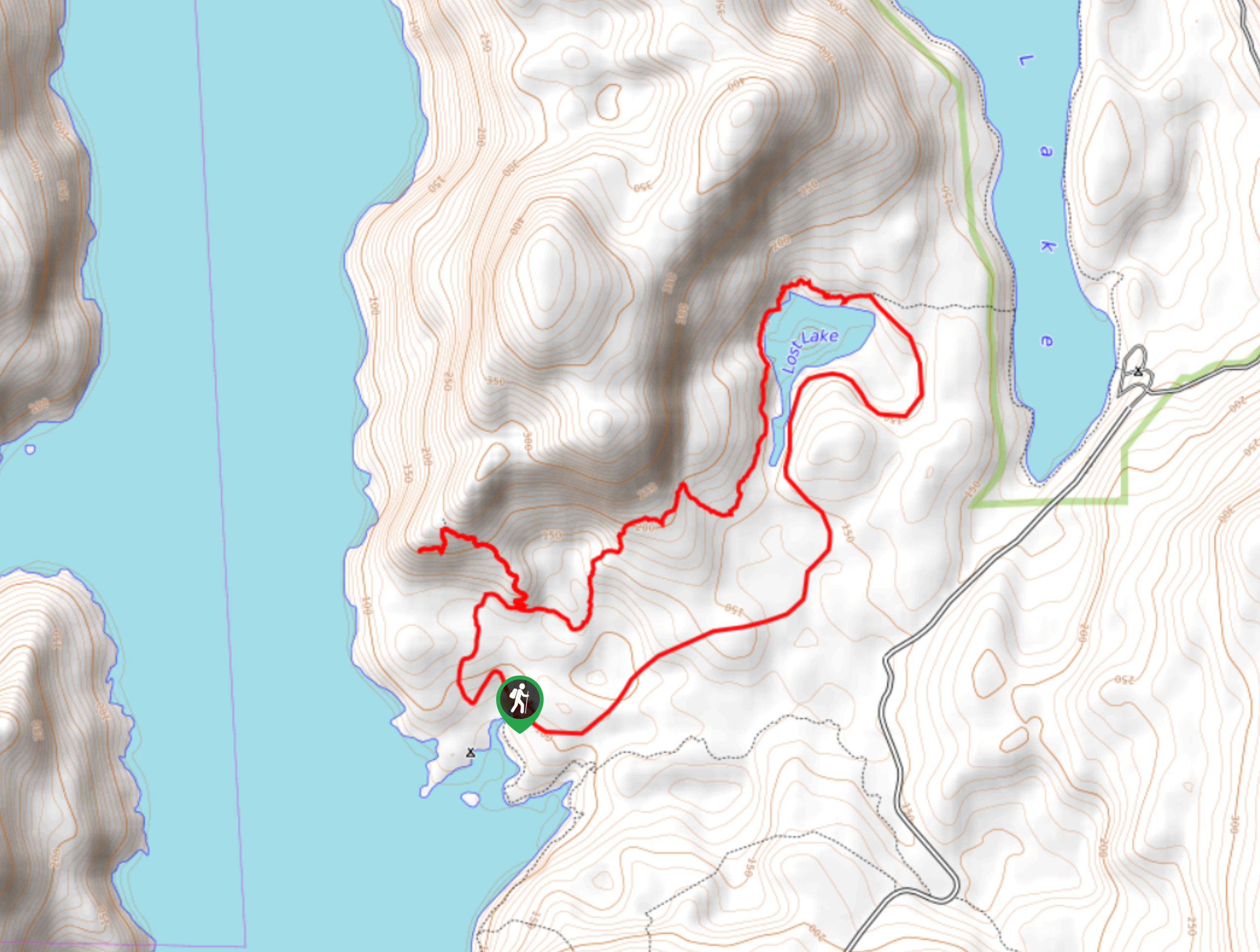
The hike from Haywire Bay to Lost Lake Hike follows a 6.0mi lollipop route that will take hikers through an amazingly atmospheric stretch of forest to the shores of Lost Lake. You will experience a deep sense of relaxation along the trail as you make your way through the dense cover of the moss-covered trees and sit on the small viewing bench next to the lake to take in the amazing scenery. It should be noted that the lake itself is better for viewing than swimming due to the lakeside vegetation.
Getting there
To get to the Haywire Bay to Lost Lake trailhead from Powell River, head north for 1.5mi on Manson Ave and make a right on Cassiar St. After 984ft, make a left turn onto Yukon Ave and continue along it for 0.6mi. Turn right on Haslam Street and continue for 1.4mi, making a slight left and following the road for a further 2.2mi. Make a left turn and follow the road for 1.0mi to arrive at the Inland Lake Outdoor Learning Centre. Park here and continue north on foot for about 1640ft to reach the trailhead.

About
| When to do | April-October |
| Backcountry Campsites | No |
| Pets allowed | Yes |
| Family friendly | Older Children only |
| Route Signage | Average |
| Crowd Levels | Low |
| Route Type | Lollipop |
Haywire Bay to Lost Lake Hike
Elevation Graph
Weather
Haywire Bay to Lost Lake Trail Description
The trek from Haywire Bay to Lost Lake is a relaxing adventure through the deep woods northeast of Powell River that will allow you to reconnect with nature and forget about the outside world. The route sets out from the trailhead and you immediately get the sense of being completely surrounded by the thick cover of the trees.
Follow the trail in a counterclockwise direction to make your way through the moss and fern covered forest to the swampy shores of Lost Lake. This body of water isn’t really suitable for swimming due to the marshy conditions, so hikers looking for better lakeside access should try some of the hiking trails around Inland Lake to the east.
Continue around the marshy edges of Lost Lake and take in the amazing views across the calm water. After working around the northern edge of the lake, follow the trail to the south as you continue through the forest on a path leading you back towards the trailhead where you began.
Similar hikes to the Haywire Bay to Lost Lake Hike hike

Malaspina Switchback Trail
The Malaspina Switchback Trail is a 4.3mi out-and-back hiking route in Powell River, BC, that will take you…

Holly Branch Loop Hike
The Holly Branch Loop is a 3.7mi lollipop hiking route near Powell River, BC, that will take you…

Stillwater Bluffs Trail
The Stillwater Bluffs Trail is a 1.9mi lollipop hiking route along the Sunshine Coast that provides some amazing…
Comments