
Kingfisher and McFall Creek Loop Hike
View Photos
Kingfisher and McFall Creek Loop Hike
Difficulty Rating:
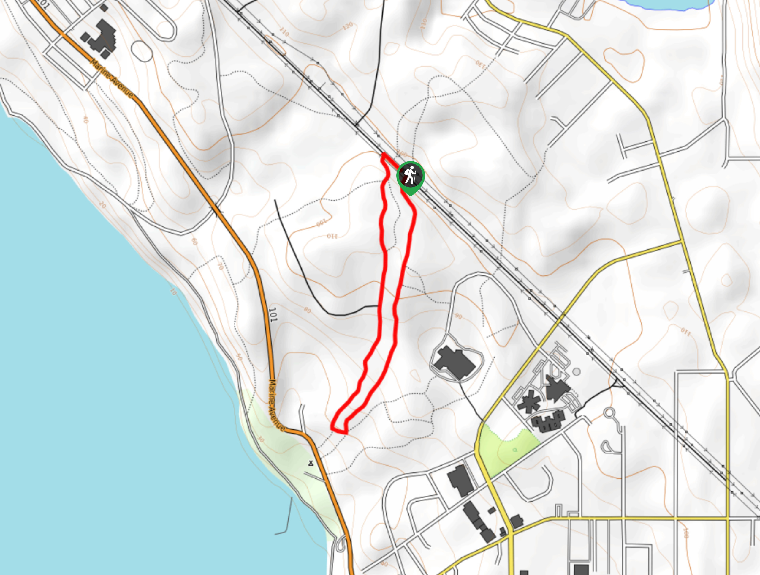
The Kingfisher and McFall Creek Loop is a 1.4mi lollipop hiking route that loops through an amazingly scenic West Coast temperate rainforest environment. Along the trail, you will be surrounded by an abundance of plant and animal life, as you cross over wooden bridges and bubbling forest streams that dissect the thick underbrush around you. While this is a fairly accessible hike, there are a few steps and uneven areas that might make travel difficult for less-mobile hikers.
Getting there
To get to the trailhead for the Kingfisher and McFall Creek Loop from Powell River, head north on Joyce Avenue for 1.2mi and make a left turn. Continue on for 0.7mi, where you will find the trailhead on the left.

About
| When to do | Year-Round |
| Backcountry Campsites | Willingdon Beach Campground |
| Pets allowed | Yes - On Leash |
| Family friendly | Yes |
| Route Signage | Average |
| Crowd Levels | Moderate |
| Route Type | Lollipop |
Kingfisher and McFall Creek Loop Hike
Elevation Graph
Weather
Kingfisher and McFall Creek Trail Description
Hiking the Kingfisher and McFall Creek Loop is a spectacular rainforest excursion that will allow you to fully appreciate the natural beauty of this type of landscape. The trail sets out from the side of the road and heads south to be immediately met with a junction. Follow the path to the left to enter the tree cover and begin the loop through the atmospheric rainforest. If you are able to time this hike for right after a good rainwall, the moss-covered trees and abundant plant life will be dripping with moisture, and the steam rising up from the forest floor will make the setting feel almost magical. As you work your way through the forest, you will cross over small streams and stretches of boardwalk that span the forest floor. Reaching the most southern point of the trail near Willingdon Beach, the trail will turn back to the north on the return loop that will bring you back to the trailhead where you began your hike.
Similar hikes to the Kingfisher and McFall Creek Loop Hike hike

Malaspina Switchback Trail
The Malaspina Switchback Trail is a 4.3mi out-and-back hiking route in Powell River, BC, that will take you…

Holly Branch Loop Hike
The Holly Branch Loop is a 3.7mi lollipop hiking route near Powell River, BC, that will take you…

Stillwater Bluffs Trail
The Stillwater Bluffs Trail is a 1.9mi lollipop hiking route along the Sunshine Coast that provides some amazing…
Comments