Bosumarne Falls
View Photos
Bosumarne Falls
Difficulty Rating:
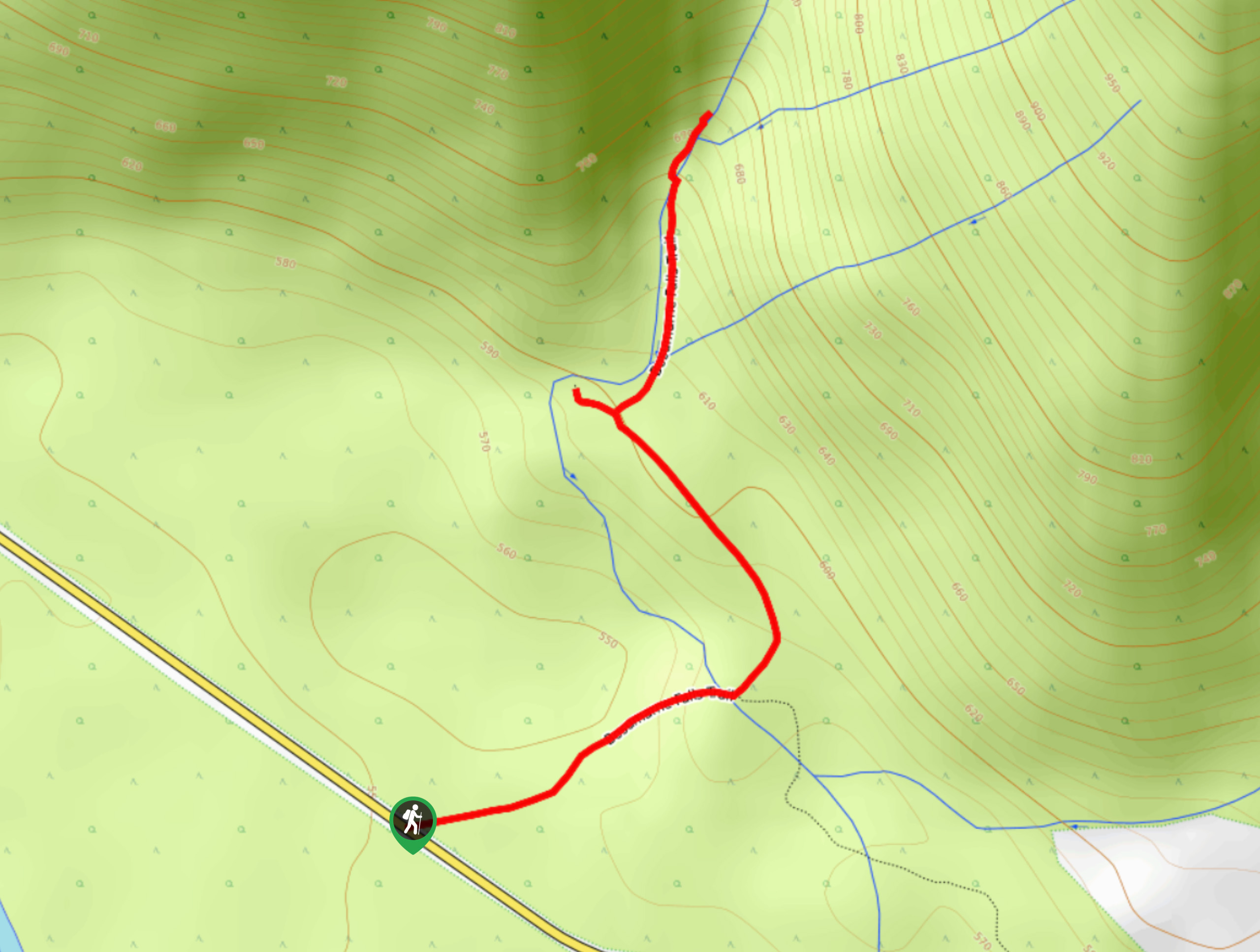
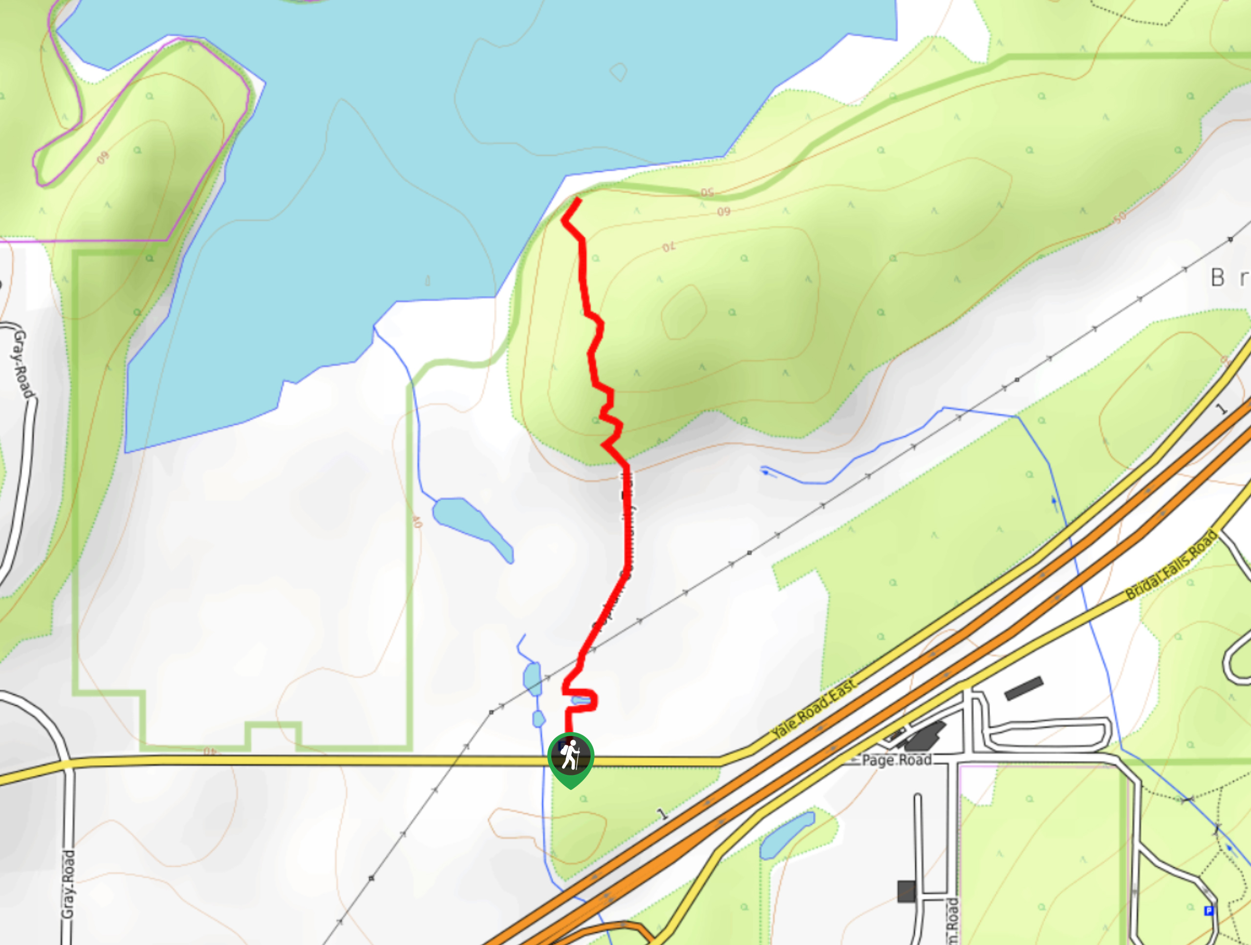
The short trek to Bosumarne Falls is a quick little adventure through a scenic stretch of forest that will take you to two viewpoints overlooking charming waterfalls. Along the 1.7mi trail, you will experience manageable variations in terrain that range from thick brush to rocky ground before arriving at the Lower Bosumarne Falls. A short distance further along the trail will bring you the main falls, where you can take in the beauty of the cascading water. This is a great hike for families.
Getting there
To get to the trailhead for the Bosumarne Falls from Chilliwack, drive south on Vedder Road and take the second exit at the roundabout to make your way onto Chilliwack Lake Road. Drive straight for 23.0mi, where you will find the trailhead on the left.

About
| When to do | Year-Ropund |
| Backcountry Campsites | NO |
| Pets allowed | Yes |
| Family friendly | Yes |
| Route Signage | Average |
| Crowd Levels | Moderate |
| Route Type | Out and back |
Bosumarne Falls
Elevation Graph
Weather
Bosumarne Falls Description
The hike to Bosumarne Falls is a short trail that will take you through a scenic stretch of forest to visit two vantage points where you can view both the Bosumarne Falls and the Lower Bosumarne Falls. This family-friendly hike is situated just outside of Chilliwack Lake Provincial Park, making it an ideal addition to a fun weekend of camping in the area. The trail itself has some minor changes in elevation and transitions between brush and rocky terrain, making for an easy to follow but interesting route. This hike is perfect for hikers of all skill levels, including families and beginners.
Similar hikes to the Bosumarne Falls hike
Popkum Community Trail
Hike along the Popkum Community Trail for a fun and educational experience where you can learn about the wildlife and…
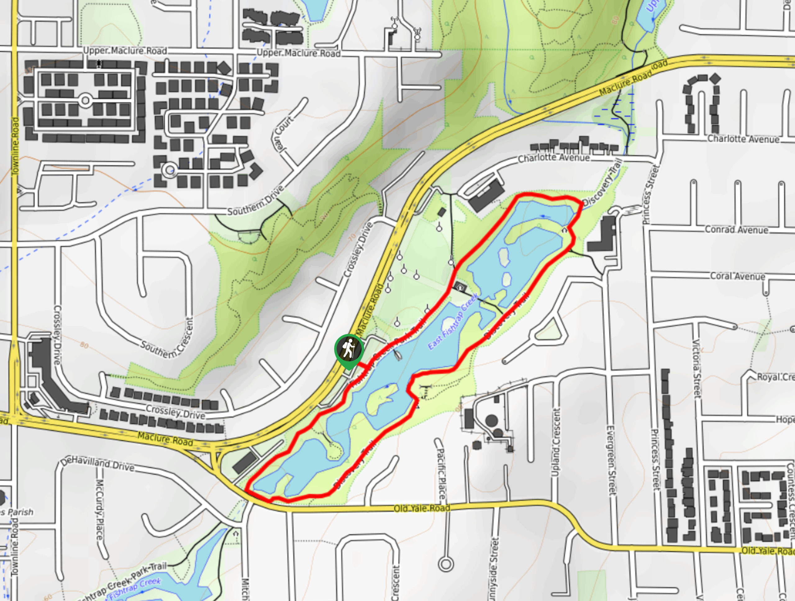
Fishtrap Creek Loop
Hiking the Fishtrap Creek Loop in Abbotsford is a great way to get out and explore the natural beauty of…

Matsqui Trail
The Matsqui Trail is a 16.7mi multi-use trail that travels alongside the Fraser River and provides nice views…
Comments