Popkum Community Trail
View Photos
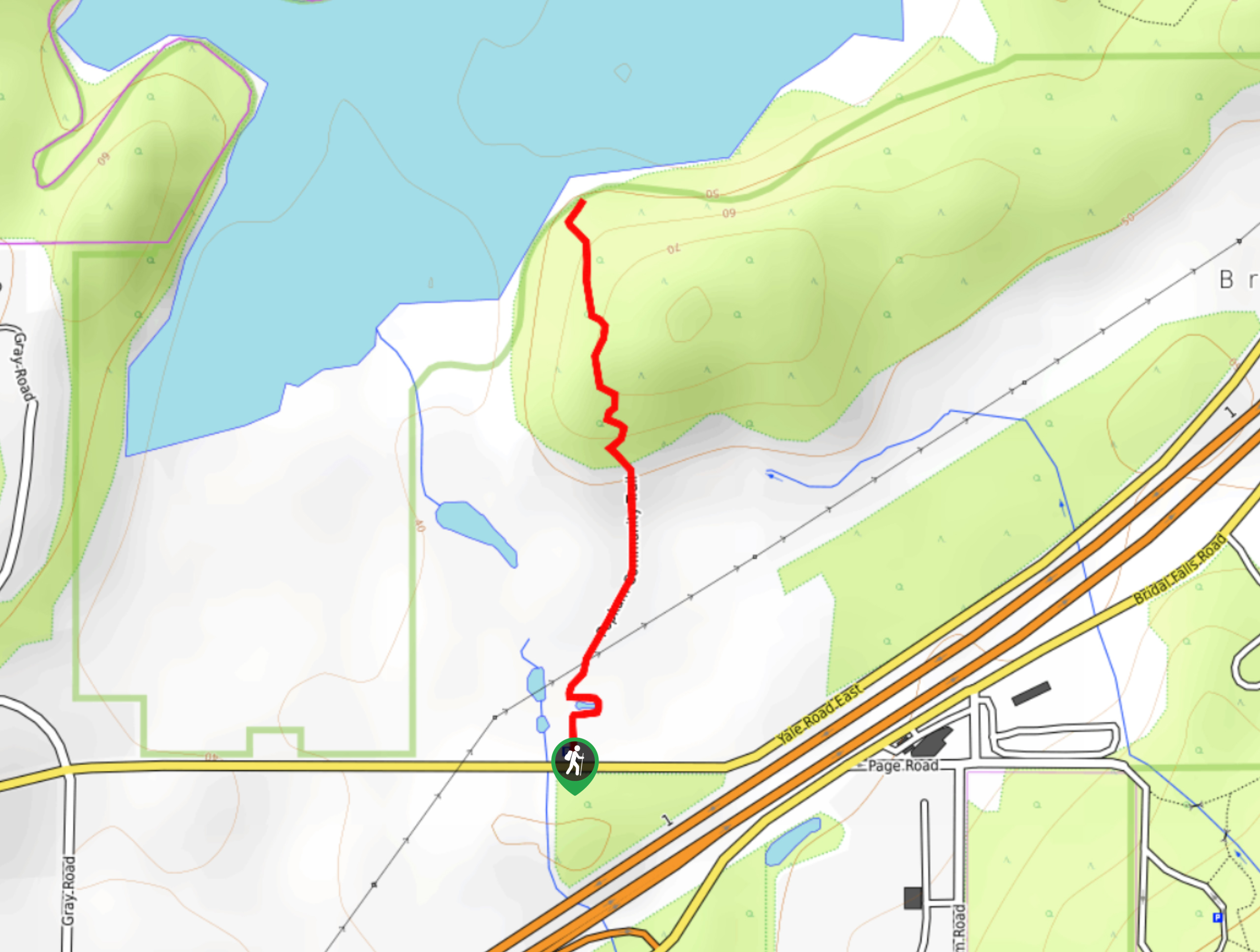
Popkum Community Trail
Difficulty Rating:
Hike along the Popkum Community Trail for a fun and educational experience where you can learn about the wildlife and ecosystem of the Cheam Wetlands. This 1.0mi trail utilizes a gravel path and a boardwalk to take hikers to a lookout over woodland setting around Cheam Lake. With amazing scenery and little change in elevation, this is a perfect day hike that the entire family will enjoy.
Getting there
To reach the parking area for the Popkum Community Trail from Agassiz, drive south on BC-9 for 3.1mi and take the third exit on the roundabout onto Yale Road. You will find the parking area on the left in 2789ft.

About
| When to do | Year-Round |
| Backcountry Campsites | N |
| Pets allowed | Yes - On Leash |
| Family friendly | Yes |
| Route Signage | Average |
| Crowd Levels | Moderate |
| Route Type | Out and back |
Popkum Community Trail
Elevation Graph
Weather
Popkum Community Trail Description
The Popkum Community Trail is a short hiking route in Cheam Wetlands Regional Park that travels along a relatively flat path to reach a viewpoint over the calm waters of Cheam Lake. This beautifully scenic route is full of interpretive signs that provide a wealth of information on the wildlife in the area, making it a great option for a nature excursion with young kids. Along the trail you will pass by butterfly and hummingbird habitats, a rose garden, and a small pond that is home to a number of amphibians. Continuing on the trail, you will traverse a boardwalk before reaching a scenic viewpoint overlooking the lake. This popular route can be enjoyed by hikers of all ages and skill levels – just make sure to arrive early, as parking at the trailhead is limited.
Similar hikes to the Popkum Community Trail hike
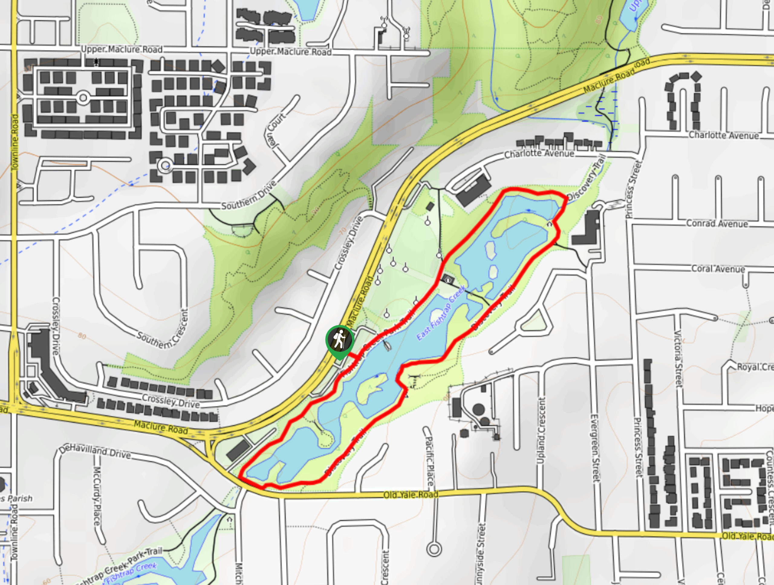
Fishtrap Creek Loop
Hiking the Fishtrap Creek Loop in Abbotsford is a great way to get out and explore the natural beauty of…

Matsqui Trail
The Matsqui Trail is a 16.7mi multi-use trail that travels alongside the Fraser River and provides nice views…
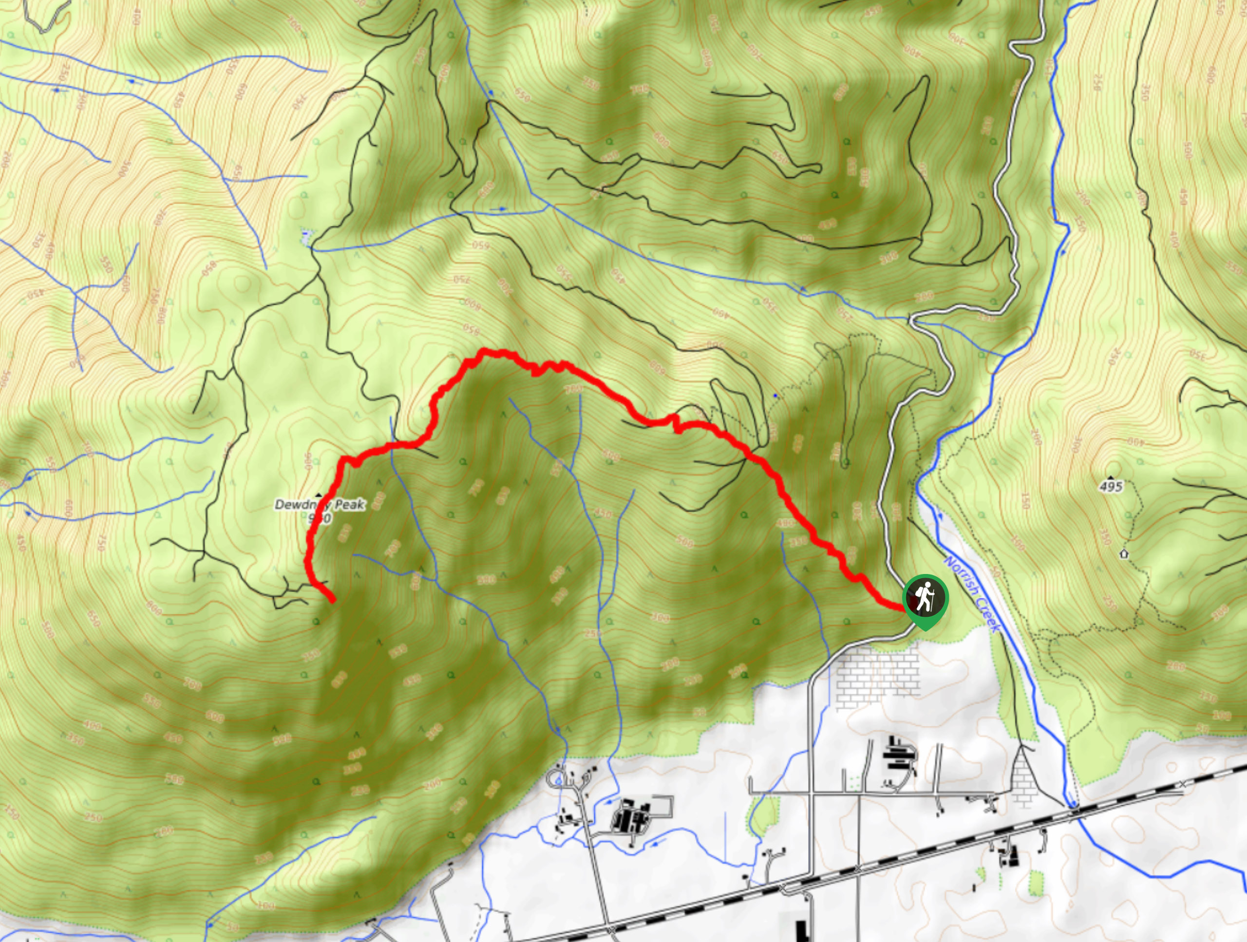
Dewdney Grind Trail
Hiking the Dewdney Grind is a challenging affair due to the steep incline and heavily-forested nature of the trail. Along…
Comments