Vedder Mountain Ridge Trail
View Photos
Vedder Mountain Ridge Trail
Difficulty Rating:
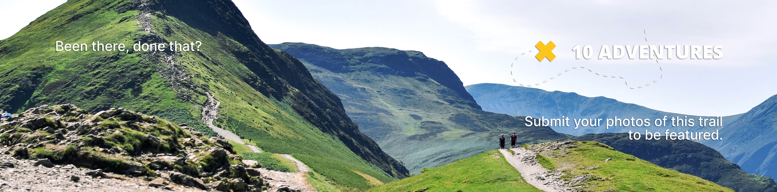
The Vedder Mountain Ridge Trail is a moderate out-and-back hiking route near Chilliwack that has a beautiful woodland setting and nice views over the valley and surrounding mountains. Climb uphill along the gentle incline of this trail as it leads to a great lookout over the surrounding landscape. The mild incline, easy terrain, and nice views make this an ideal route for all types of hikers.
Getting there
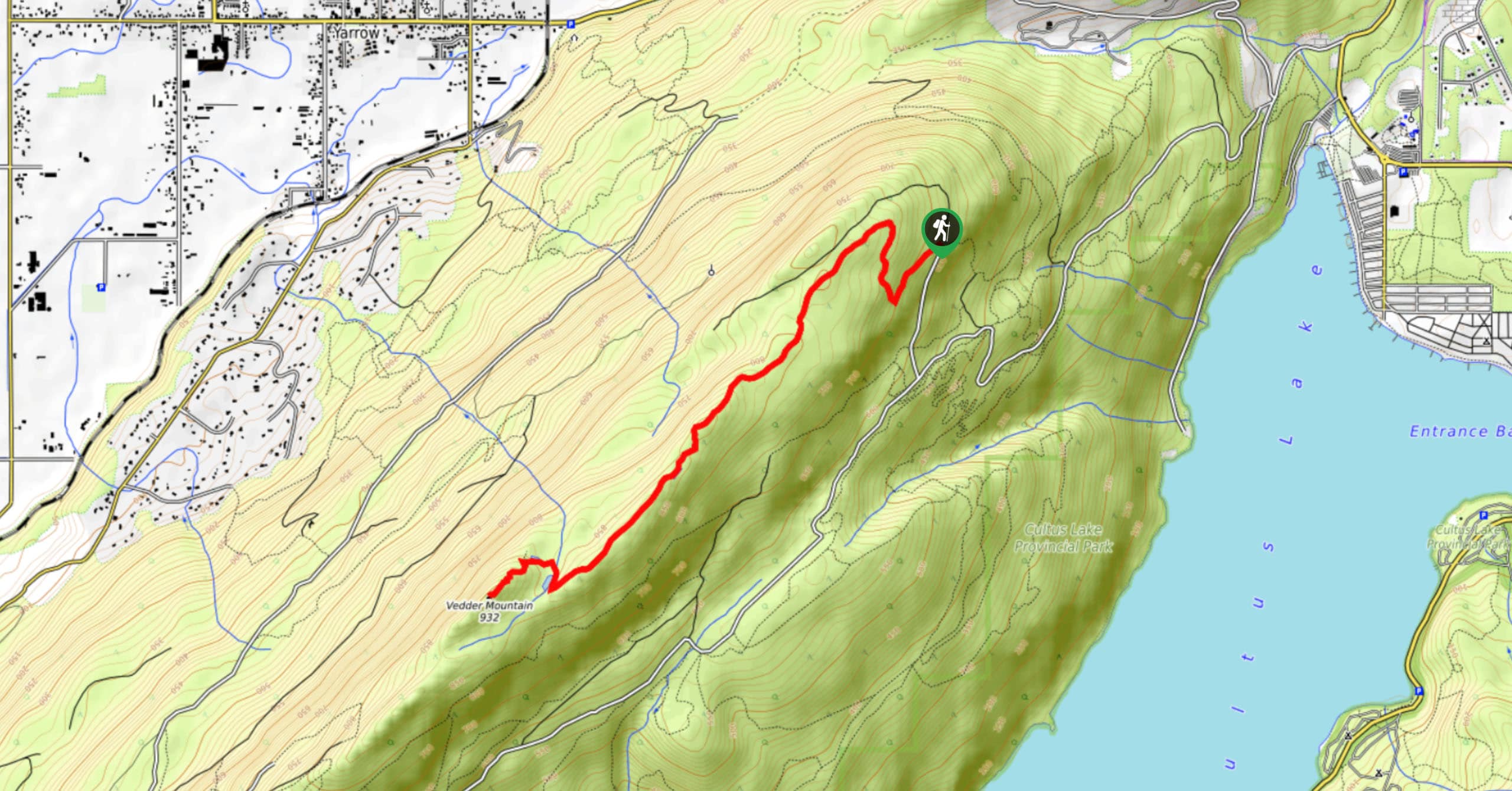
To reach the parking area for the Vedder Mountain Ridge Trail from Chilliwack, head southeast on Vedder Road for 3.4mi and take the 1st exit at the roundabout onto Vedder Mountain Road. After 2461ft, take the 2nd exit at another roundabout to get onto the Columbia Valley Highway. After 1.4mi, make a slight right onto Parmenter Road and then another right onto Vedder Mountain FSR. In 1969ft you will need to turn left to stay on the road, following it for another 1.9mi before turning right. Here, you will find the trailhead in 2461ft.

About
| When to do | Year-round |
| Backcountry Campsites | No |
| Pets allowed | Yes |
| Family friendly | No |
| Route Signage | Average |
| Crowd Levels | Moderate |
| Route Type | Out and back |
Vedder Mountain Ridge Trail
Elevation Graph
Weather
Vedder Mountain Ridge Trail Description
The Vedder Mountain Ridge Trail is a popular hiking route to the southwest of Chilliwack, BC that climbs gently uphill along a forested ridge to a lookout on the summit of Vedder Mountain. Note that you can drive further up the access road to cut your hike down, but this should only be done in high-clearance, 4×4 vehicles. There is no parking lot, so you will need to park along the side of the road.
The majority of this trail follows easy stretches of terrain through the forest and has a gentle incline almost the entire way to the summit. The trail is easy to follow. Bring microspikes early or late season as it can get slick with ice in some sections.
Once you reach the peak, there is a bit of a climb up the rock face with some ropes to assist you. From there, you will enjoy views of nearby mountains and the peaceful valley. This trail is an awesome half-day hike with scenic views and easy to navigate terrain, making it great for hikers of all skill levels.
Other Amazing Hikes in Fraser Valley
Check out our guides to Lindeman Lake, Bridal Veil Falls, Cascade Falls, Elk Mountain Trail or Hicks Lake Hike. Or see all our hikes in Fraser Valley on 10Adventures.
Similar hikes to the Vedder Mountain Ridge Trail hike

Chipmunk Creek Trail
Hike along the Chipmunk Creek Trail to experience the feeling of solitude along the trail while taking in scenic views…

Matsqui Trail
The Matsqui Trail is a 16.7mi multi-use trail that travels alongside the Fraser River and provides nice views…

Flora Peak Trail
The Flora Peak Trail is an 7.1mi out-and-back hiking route that will take you through dense forests and…
Comments