Radium Lake Trail
View Photos
Radium Lake Trail
Difficulty Rating:
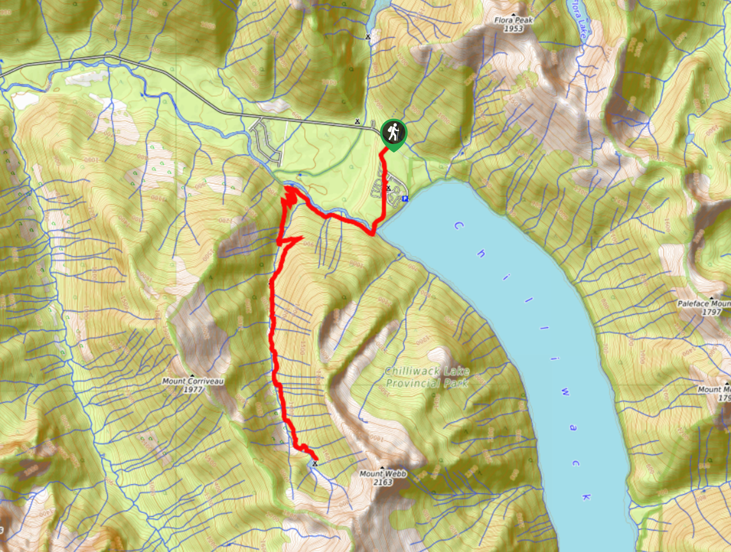
The Radium Lake Trail is a 10.9mi out-and-back hiking route that climbs through an alpine valley along a densely forested path to reach the calming waters of Radium Lake. From the campground next to the lake you will have the opportunity to camp out in the beautiful alpine terrain, or simply take in the amazing mountain views before making the return journey. This challenging route is perfect for experienced hikers or casual hikers looking to push themselves with a longer, but not so technical route.
Getting there
To reach the parking area for the Radium Lake Trail from Chilliwack, make your way southeast along Vedder Road and take the second exit at the roundabout to get on Chilliwack Lake Road. Continue on for 24.7mi, where you will find the parking lot on your left and the trailhead across the road.

About
| When to do | June-October |
| Backcountry Campsites | Radium Lake Campground |
| Pets allowed | Yes - On Leash |
| Family friendly | No |
| Route Signage | Average |
| Crowd Levels | Moderate |
| Route Type | Out and back |
Radium Lake Trail
Elevation Graph
Weather
Radium Lake Trail Description
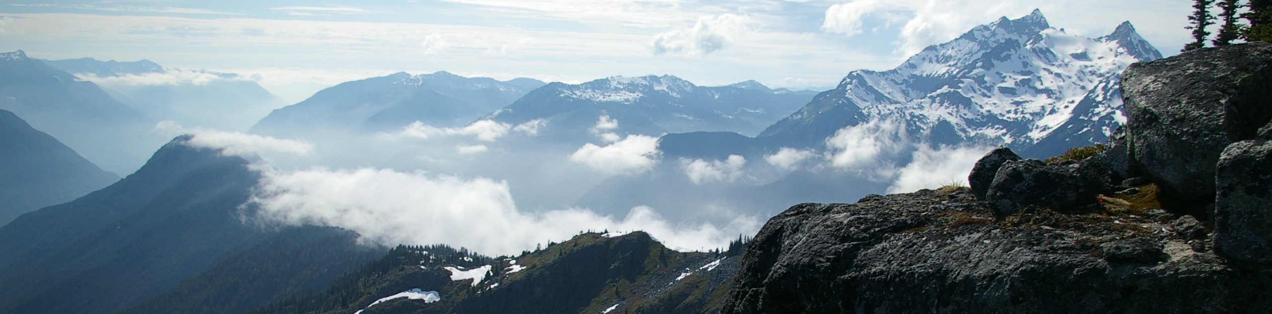
The Radium Lake Trail is a picturesque hiking route in Chilliwack Lake Provincial Park that follows closely along the Chilliwack River before cutting south through the valley to reach the pristine alpine lake. This 10.9mi out-and-back is a challenging hike up the alpine valley and offers little in the way of views due to the dense tree coverage along the route. This is still a very scenic hike through the woods; however, the real reward comes when you break out of the forest and into the alpine terrain on the approach to the lake. From here, you will have amazing views over the calm waters of Radium Lake and Mount Webb standing tall above you. Note that early or late season can bring snow on the trail, making it hard to complete. This route can be a bit tough, but it’s an awesome experience that is waiting for you in Chilliwack Lake Provincial Park.
Similar hikes to the Radium Lake Trail hike
Williams Peak Trail
Hiking the Williams Peak Trail is a physically demanding adventure in the Fraser Valley that climbs up a steep ridge…

Chipmunk Creek Trail
Hike along the Chipmunk Creek Trail to experience the feeling of solitude along the trail while taking in scenic views…

Flora Peak Trail
The Flora Peak Trail is an 7.1mi out-and-back hiking route that will take you through dense forests and…
Comments