Mount Cheam
View Photos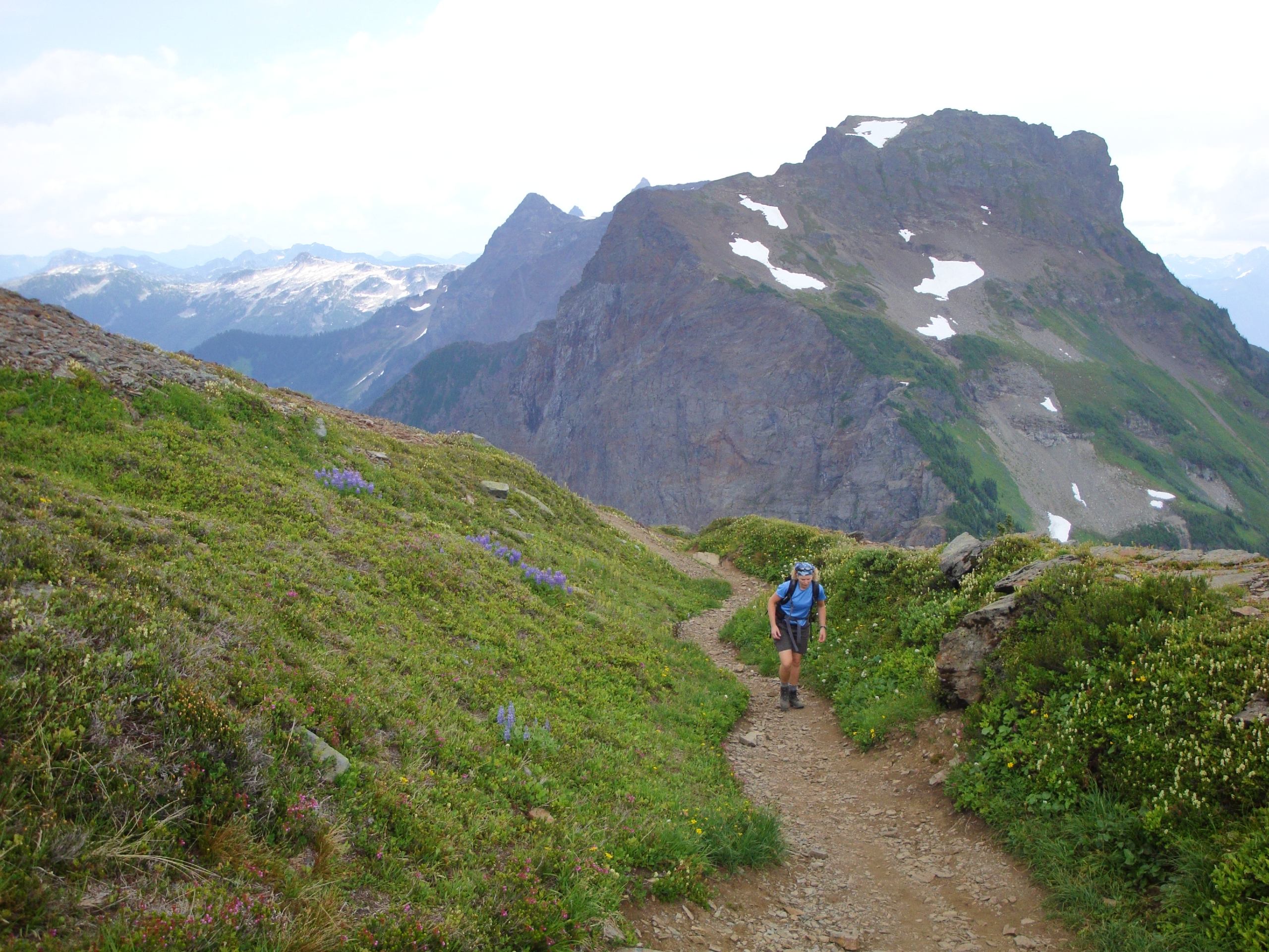
Mount Cheam
Difficulty Rating:
The hike to Cheam Peak is an 5.2mi out-and-back hiking route near Bridal Falls, BC that climbs steeply uphill to provide hikers with amazing views of the Fraser Valley. Along the trail you will cross over mountain streams and hike through beautiful alpine meadows before traversing a ridge on the way to summit the peak. Once there, your views will stretch in every direction, including east to west across the many communities of the Fraser Valley and south toward the Canada-United States border.
Getting there
To get to the parking area for the Cheam Peak trail from Chilliwack, drive south along Vedder Road for 3.2mi and take the second exit on the roundabout onto Chilliwack Lake Road. Continue on for 16.7mi and make a left onto Foley Creek FSR. Make another left after 1.2mi to continue on the same road. After another kilometre it will veer right and turn into Chipmunk Creek FSR. Turn right in 2789ft to stay on the road, following it for 6.8mi to reach the trailhead.

About
| When to do | July-October |
| Backcountry Campsites | No |
| Pets allowed | Yes - On Leash |
| Family friendly | No |
| Route Signage | Average |
| Crowd Levels | High |
| Route Type | Out and back |
Mount Cheam
Elevation Graph
Weather
Mount Cheam Trail Description
The Cheam Peak Trail is a challenging hiking route near Bridal Falls, BC that climbs uphill at a fairly steep grade, rewarding you with spectacular views from the summit. The road leading up to the trailhead is in pretty rough shape and will likely require a 4×4 or high clearance vehicle in order to safely make it the entire way. If you must take a smaller car, go slowly and drive carefully! The lower portion of the trail is easy enough to traverse; however, the push to the summit is fairly steep and is covered in snow late/early in the season. Wear proper hiking footwear and bring crampons or microspikes to help with your footing in these conditions. Additionally, bears are frequently seen in this area, so always travel in groups, make lots of noise, and bring bear spray.
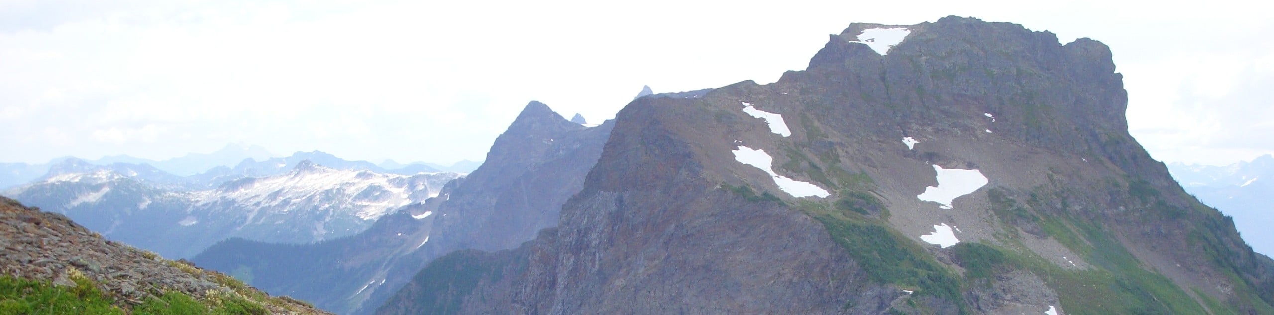
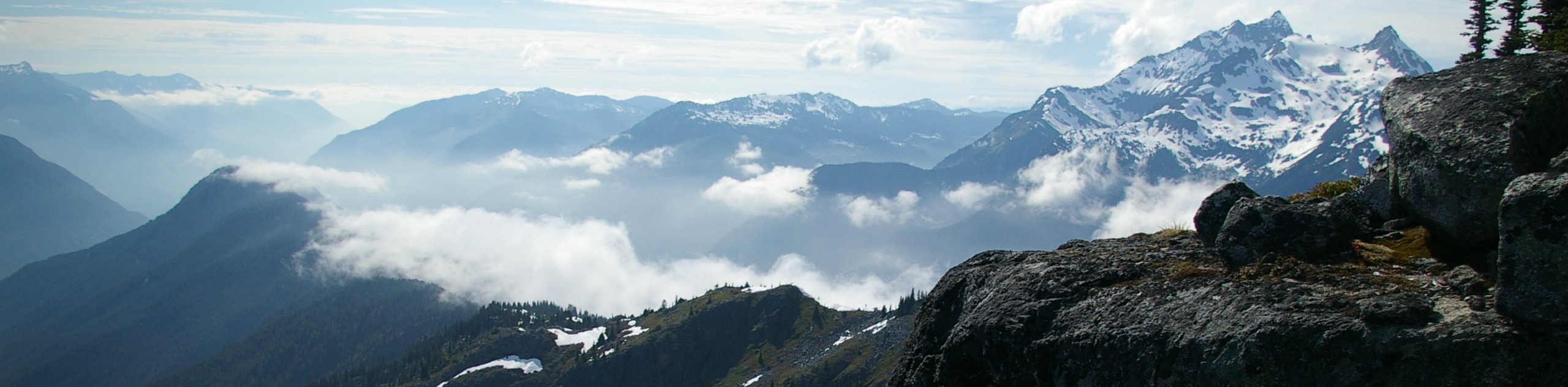
This hiking trail is truly spectacular, with fantastic views that stretch out across countless mountain peaks and over the peaceful valleys of the surrounding area. Along the trail, you will hike through scenic alpine meadows where you can see beautiful wildflowers if you plan to hike in the late summer. Climbing up higher, the trail branches off from a route to nearby Lady Peak and sets off towards the summit of Cheam Peak. This route is not overly technical but it is steep. The grind is worth it, as you will have amazing 360° views that span the length of the Fraser Valley and include a host of rugged peaks, including Mount Baker to the south and Four Brothers Mountain to the northeast.
Leaving your vehicle behind at the trailhead, follow the path northeast as you cross over several mountain streams and hike through the trees. The trail opens up into a beautiful alpine meadow as your course turns more directly to the east and passes by Spoon Lake on your right. From here, the trail will become very steep. Take the path to the right to begin your climb along a series of switchbacks up the mountain. Eventually, you will arrive at a fork in the trail, with the right path leading to Lady Peak.
At the junction, follow the trail to the left to begin your final push to the summit of Cheam Peak. Climbing along the ridge, you will have some amazing views overlooking the Fraser Valley. As you reach the summit, you can gaze out in all directions at the amazing scenery before you, with Lady Peak and Mount Baker off to the south and the various communities of the Fraser Valley spread out from east to west. Be careful not to get too close to the edge of the lookout as sections are known to break away, which has led to several deaths. After appreciating the breathtaking views, head back down the Cheam Peak trail to return to your vehicle for the bumpy trip home.
Other Amazing Hikes in Fraser Valley
Check out our guides to Lindeman Lake, Bridal Veil Falls, Cascade Falls, Elk Mountain Trail or Hicks Lake Hike. Or see all our hikes in Fraser Valley on 10Adventures.
Insider Hints
Bring bear spray and travel in groups as bears are frequently seen on the trail.
It’s best to use a high clearance vehicle for the drive in as the road is very rough.
Bring microspikes or crampons to gain better traction in snowy/icy conditions.
Don’t chance it too close to the edge- the ground is unstable and prone to breaking off.
Similar hikes to the Mount Cheam hike
Williams Peak Trail
Hiking the Williams Peak Trail is a physically demanding adventure in the Fraser Valley that climbs up a steep ridge…

Chipmunk Creek Trail
Hike along the Chipmunk Creek Trail to experience the feeling of solitude along the trail while taking in scenic views…

Flora Peak Trail
The Flora Peak Trail is an 7.1mi out-and-back hiking route that will take you through dense forests and…
Comments