Mount Slesse Memorial Trail
View Photos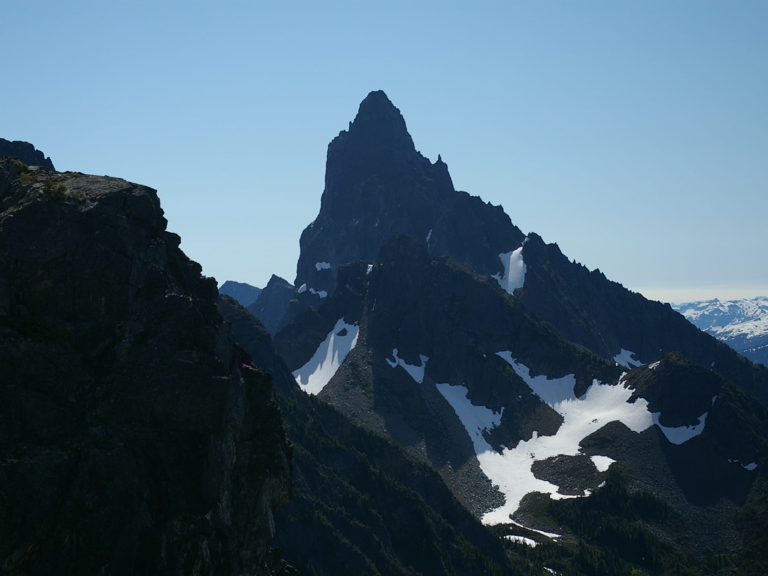
Mount Slesse Memorial Trail
Difficulty Rating:
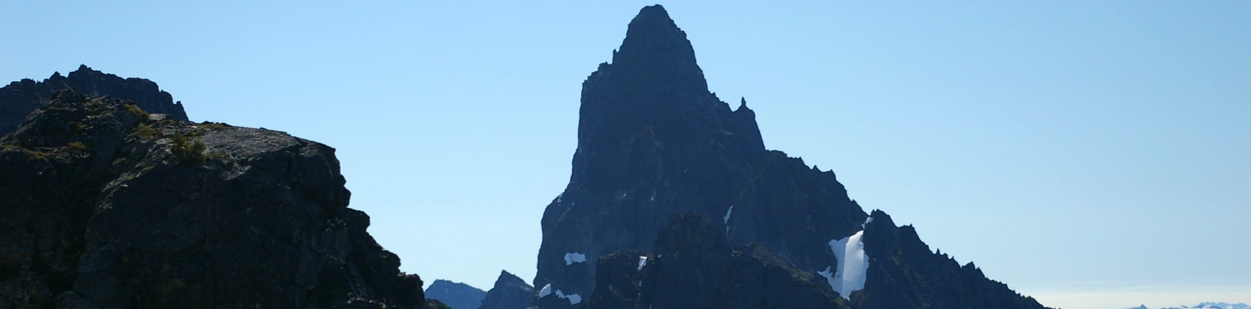
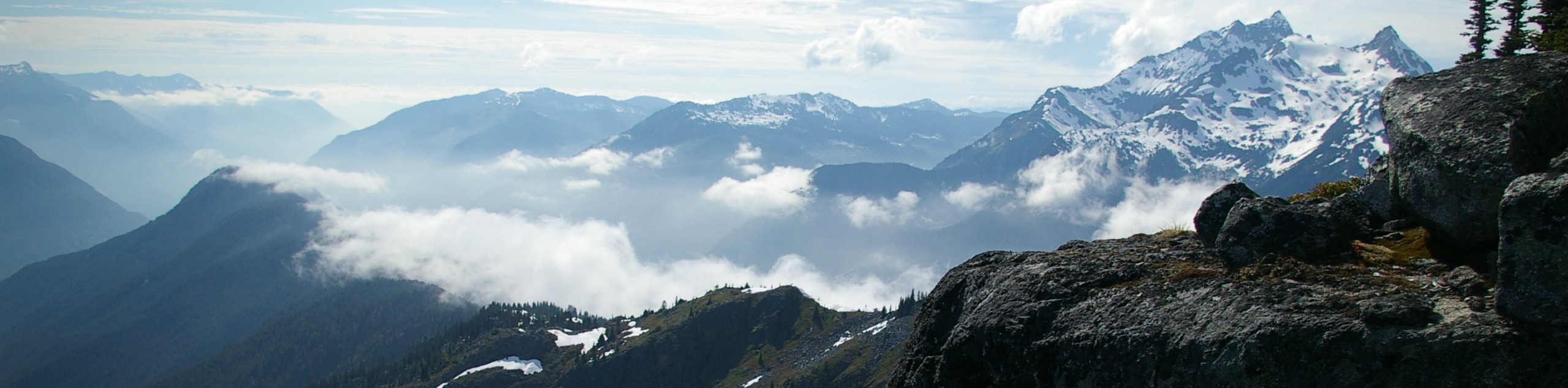
The Mount Slesse Memorial Trail is a 9.5mi out-and-back hiking route that travels through the dense forest to visit the crash site of Trans Canada Flight 810. This popular hiking route climbs uphill to the memorial where hikers can still see remnants of the 1959 crash before working up to the end of the trail to experience views of Slesse Mountain and Mount Rexford. This trail is perfect for anyone looking to mix in a bit of history with their hike.
Getting there
To get to the trailhead for the Mount Slesse Memorial Trail from Chilliwack, head southeast on Vedder Road and take the second exit at the roundabout to get onto Chilliwack Lake Road. Continue straight for 18.6mi and make a right turn onto Nesakwatch Creek FSR. After following the road for 1476ft, turn right and continue on for 3.6mi to reach the trailhead.

About
| When to do | June-October |
| Backcountry Campsites | No |
| Pets allowed | Yes |
| Family friendly | No |
| Route Signage | Average |
| Crowd Levels | Moderate |
| Route Type | Out and back |
Mount Slesse Memorial Trail
Elevation Graph
Weather
Mount Slesse Memorial Trail Description
The Mount Slesse Memorial Trail is a well-marked and moderately trafficked hiking route in the Fraser Valley that winds through the backcountry on the way to Slesse Mountain. The road to access the trailhead is a bit rough, we recommended making the trip in a high clearance vehicle in order to avoid damaging your car. The trail itself climbs uphill through the dense forest and eventually arrives at a memorial for the Trans Canada Airlines flight 810 that crashed in the area on December 9, 1956. From this point in the trail, hikers will have views that stretch across the valley toward Mount Rexford.
Setting out on the trail, pass by the wooden trail sign and hike into the dense forest cover. After crossing the bridge over Nesakwatch Creek, the trail will climb up a series of switchbacks before following a steady incline along the rocky trail. Eventually, you will enter the area where the plane crash occurred, finding a plaque memorial in front of Slesse Mountain. To the left of the plaque you will be able to pick up the trail, following it out of the tree cover and up the steep hill to reach Propeller Cairn, a makeshift memorial to the crash utilizing one of the propellers. From this point, you will have amazing views of the imposing Slesse Mountain that stretch across the valley to Mount Rexford on the other side. After taking in the views, head back down the trail to return to your vehicle.
Other Amazing Hikes in Fraser Valley
Check out our guides to Lindeman Lake, Bridal Veil Falls, Cascade Falls, Elk Mountain Trail or Hicks Lake Hike. Or see all our hikes in Fraser Valley on 10Adventures.
Similar hikes to the Mount Slesse Memorial Trail hike
Williams Peak Trail
Hiking the Williams Peak Trail is a physically demanding adventure in the Fraser Valley that climbs up a steep ridge…

Chipmunk Creek Trail
Hike along the Chipmunk Creek Trail to experience the feeling of solitude along the trail while taking in scenic views…

Flora Peak Trail
The Flora Peak Trail is an 7.1mi out-and-back hiking route that will take you through dense forests and…
Comments