
Sumas Mountain Trail
View Photos
Sumas Mountain Trail
Difficulty Rating:
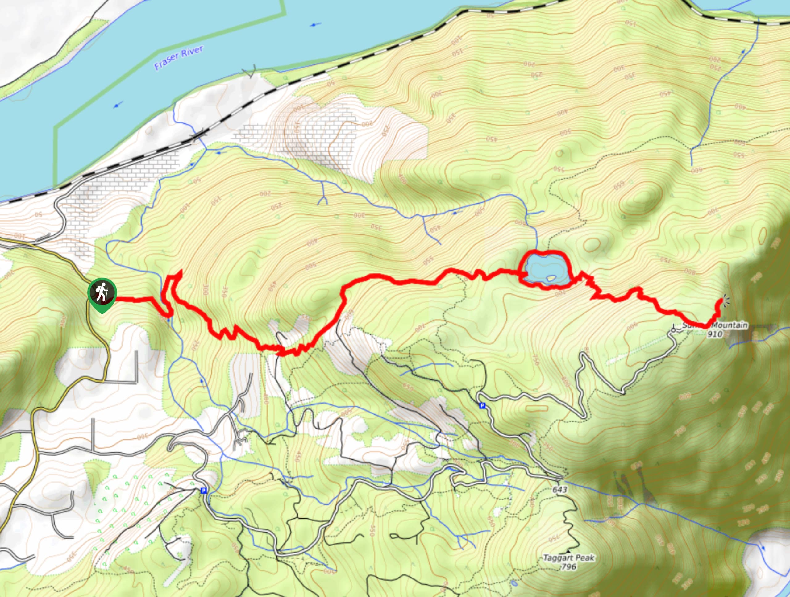
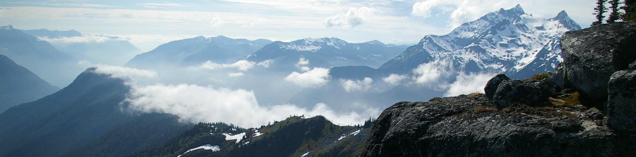
The Sumas Mountain Trail is a 10.5mi out-and-back hiking route that climbs through the forests near Abbotsford, BC. Experience the calm waters of Chadsey Lake before continuing on to the summit of Sumas Mountain. From the viewpoint atop the mountain you will enjoy views over the Fraser Valley, including the Fraser River and the cities of Chilliwack, Mission, and Abbotsford. This is a tough uphill grind along a narrow trail, but it rewards with views at the top.
Getting there
To get to the trailhead for the Sumas Mountain Trail from Abbotsford, drive north on BC-11 for 1.1mi and turn right onto Clayburn Road. Follow it for 1.5mi and turn left to stay on the road. Continue on for 2.7mi, as it turns into Straiton Road and then Dawson Road. Make a left onto Sumas Mountain Road and follow it for 2.7mi to find the trailhead on your left.

About
| When to do | May-October |
| Backcountry Campsites | No |
| Pets allowed | Yes - On Leash |
| Family friendly | No |
| Route Signage | Average |
| Crowd Levels | Moderate |
| Route Type | Out and back |
Sumas Mountain Trail
Elevation Graph
Weather
Sumas Mountain Trail Description
The Sumas Mountain Trail is a popular out-and-back hiking route near Abbotsford in the Fraser Valley that climbs uphill through a scenic stretch of forest to the calm waters of Chadsey Lake before continuing on to the summit of Sumas Mountain. We recommend bringing a 4×4 or high-clearance vehicle as the road to the trailhead isn’t in great shape. This trail is connected to a dense network of hiking routes just to the south, so hikers should bring along a trail map or GPS in order to stay on the correct path. This route can also become fairly wet and muddy, so proper hiking footwear is recommended to stay both dry and comfortable over the long incline of this trail. Additionally, the forested nature of the trail and its proximity to water makes this route prone to bugs. Bring bug spray during warmer seasons.
Setting out from the trailhead off Sumas Mountain Road, follow the trail into the dense forest cover as it crosses over a creek and begins to climb uphill. As you meander through the forest, you will notice a steady gain in elevation the entire way up to Chadsey Lake. Reaching the fork in the trail at the lake’s edge, follow the path to the right to skirt around the southern side of the lake. Here, you will gain another 656ft in elevation as you make the final push to the summit. When you reach the viewpoint atop Sumas Mountain, you will have great views over the Fraser River, Chilliwack to the east, and Mission and Abbotsford to the west. When you’ve taken in the sights, head back down the trail and make your way around the north side of the lake for a bit of variation, returning to your vehicle to wrap up your hike along the Sumas Mountain Trail.
Other Amazing Hikes in Fraser Valley
Check out our guides to Lindeman Lake, Bridal Veil Falls, Cascade Falls, Elk Mountain Trail or Hicks Lake Hike. Or see all our hikes in Fraser Valley on 10Adventures.
Similar hikes to the Sumas Mountain Trail hike
Williams Peak Trail
Hiking the Williams Peak Trail is a physically demanding adventure in the Fraser Valley that climbs up a steep ridge…

Chipmunk Creek Trail
Hike along the Chipmunk Creek Trail to experience the feeling of solitude along the trail while taking in scenic views…

Flora Peak Trail
The Flora Peak Trail is an 7.1mi out-and-back hiking route that will take you through dense forests and…
Comments