
Flora Lake Trail
View Photos
Flora Lake Trail
Difficulty Rating:
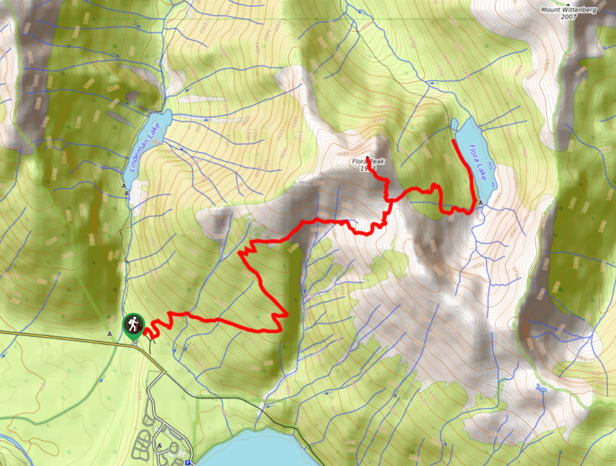
The Flora Lake Trail is a difficult 9.5mi out-and-back hiking route that will take hikers through the dense forests of Chilliwack Lake Provincial Park to summit Flora Peak and descend to Flora Lake. From the summit, you will have panoramic views of the surrounding area, including nearby mountain ridges and a commanding sightline over Chilliwack and Flora lakes. Hiking down to the lake, you will be greeted with scenic waterside views and a tranquil setting that can’t be matched, making this a perfect hike for a day at the lake.
Getting there
To get to the parking area for the Flora Lake Trail from Chilliwack, drive south on Vedder Road for 3.2mi and take the second exit at the roundabout onto Chilliwack Lake Road. Follow this for 24.7mi and turn left to enter the parking area and access the trailhead.

About
| When to do | July-October |
| Backcountry Campsites | Flora Lake Campground |
| Pets allowed | Yes - On Leash |
| Family friendly | No |
| Route Signage | Average |
| Crowd Levels | Moderate |
| Route Type | Out and back |
Flora Lake Trail
Elevation Graph
Weather
Flora Lake Trail Description
The Flora Lake Trail is a difficult hiking route that can be found within the beautiful Chilliwack Lake Provincial Park. It offers the opportunity to summit Flora Peak before continuing on to the lake itself. With an elevation gain of 5577ft, this route is a real leg burner; however, the amazing 360° views from Flora Peak are well worth the grind and you’ll also have the added bonus of being able to soak your feet in the cool waters of the lake. Although it won’t fully negate the effects of the long uphill climb, it’s one of the little things that make this such a great hike.
Setting out on the trail from the parking area off Chilliwack Lake Road, follow the path through the forest as it climbs uphill along a series of switchbacks towards the northeast. As you meander through the dense forest and cross over several streams, you will eventually break through the tree cover into a meadow and come to a junction in the trail leading left. Follow this to continue on a route that will take you to the summit of Flora Peak.
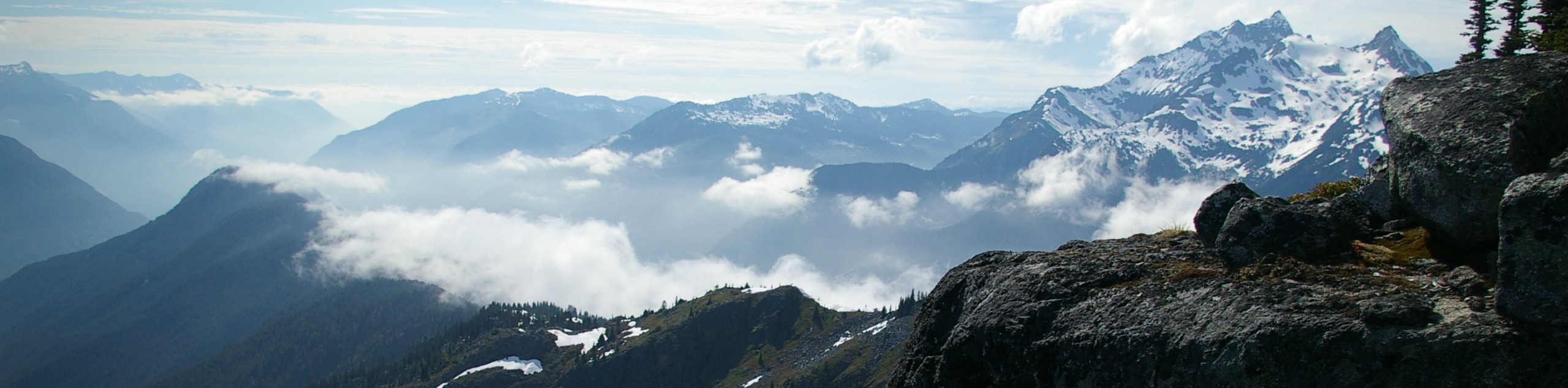
This climb isn’t overly difficult, but when you reach the summit you will have panoramic views overlooking Flora and Chilliwack lakes as well as numerous nearby mountains, including Mount Wittenberg and Williams Peak. After enjoying the sights, head back down to the main trail and follow it left to descend along the trail to the edge of Flora Lake.
Take some time to explore the area around the lake and bask in the peaceful waterside atmosphere. After you’ve taken in the views, make your way back along the same route to complete your journey on the Flora Lake Trail.
Other Amazing Hikes in Fraser Valley
Check out our guides to Lindeman Lake, Bridal Veil Falls, Cascade Falls, Elk Mountain Trail or Hicks Lake Hike. Or see all our hikes in Fraser Valley on 10Adventures.
Similar hikes to the Flora Lake Trail hike
Williams Peak Trail
Hiking the Williams Peak Trail is a physically demanding adventure in the Fraser Valley that climbs up a steep ridge…

Chipmunk Creek Trail
Hike along the Chipmunk Creek Trail to experience the feeling of solitude along the trail while taking in scenic views…

Flora Peak Trail
The Flora Peak Trail is an 7.1mi out-and-back hiking route that will take you through dense forests and…
Comments