
Island 22 Regional Park Trail
View Photos
Island 22 Regional Park Trail
Difficulty Rating:
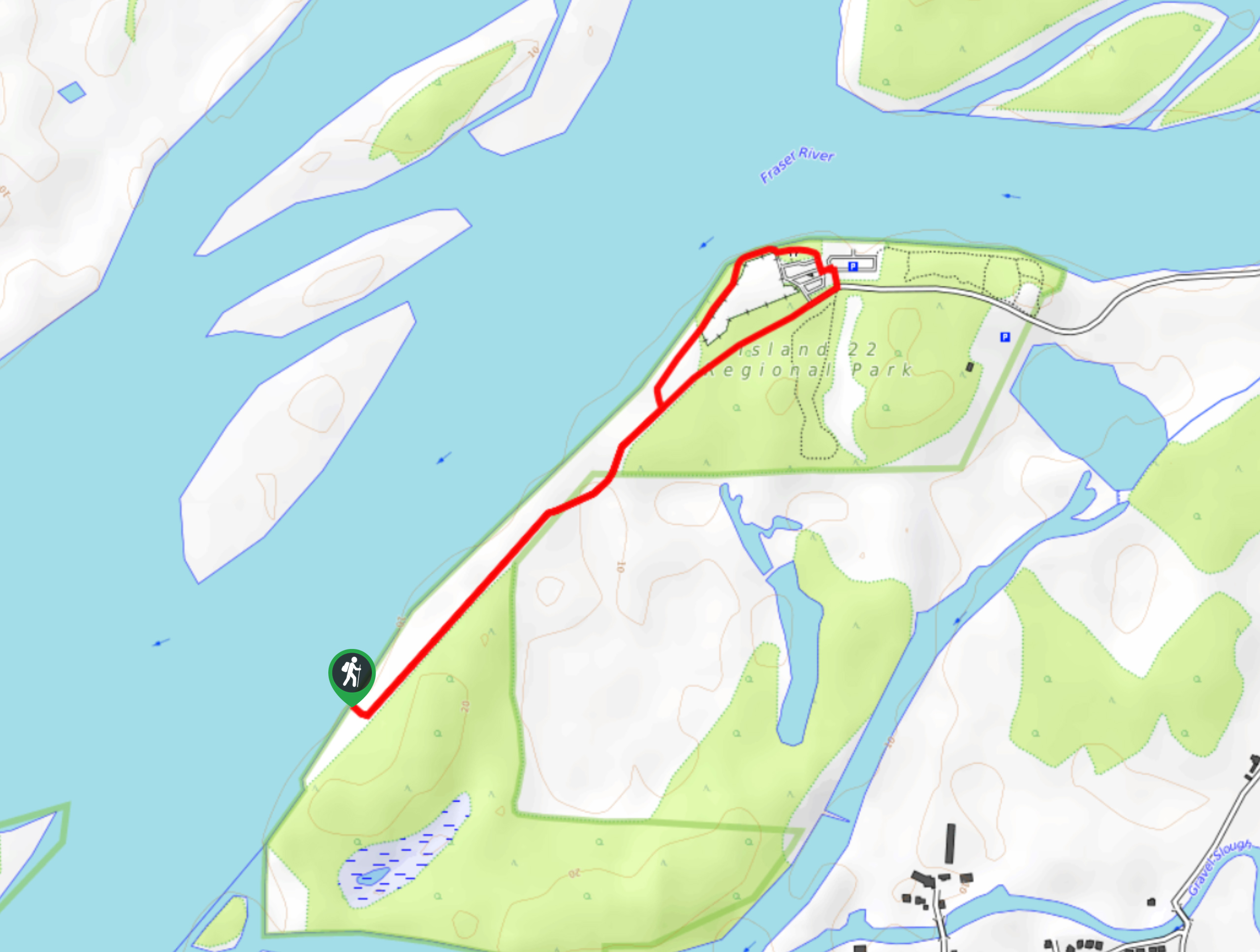
The Island 22 Regional Park Trail is a 2.0mi out-and-back hiking route that is popular with families and dog walkers due to the flat terrain and beach areas. Following closely alongside the Fraser River, this trail will provide you with scenic views of the valley and its surrounding mountains. This is a very easy walking route that almost anyone can enjoy.
Getting there
To reach the parking area for Island 22 Regional Park from Chilliwack, drive north on Young Road for 2.2mi and turn left onto Cartmell Road. Continue on for 1.2mi, where you will find the parking lot on your right.

About
| When to do | Year-Round |
| Backcountry Campsites | No |
| Pets allowed | Yes - On Leash |
| Family friendly | Yes |
| Route Signage | Average |
| Crowd Levels | Moderate |
| Route Type | Lollipop |
Island 22 Regional Park Trail
Elevation Graph
Weather
Island 22 Regional Park Trail Description
The Island 22 Regional Park Trail is a scenic hiking route along the banks of the Fraser River that offers beautiful views over the rushing waters of the river as well as the surrounding mountains that line the valley. Popular with dog walkers due to the off-leash area and sandy beach, this trail is largely flat and paved, making it a pleasant stroll along the river’s edge for hikers of all skill levels, including families with young children. During the summer months there is a parking fee of $5, but the scenic views along the trail are worth the small price of admission.
Similar hikes to the Island 22 Regional Park Trail hike
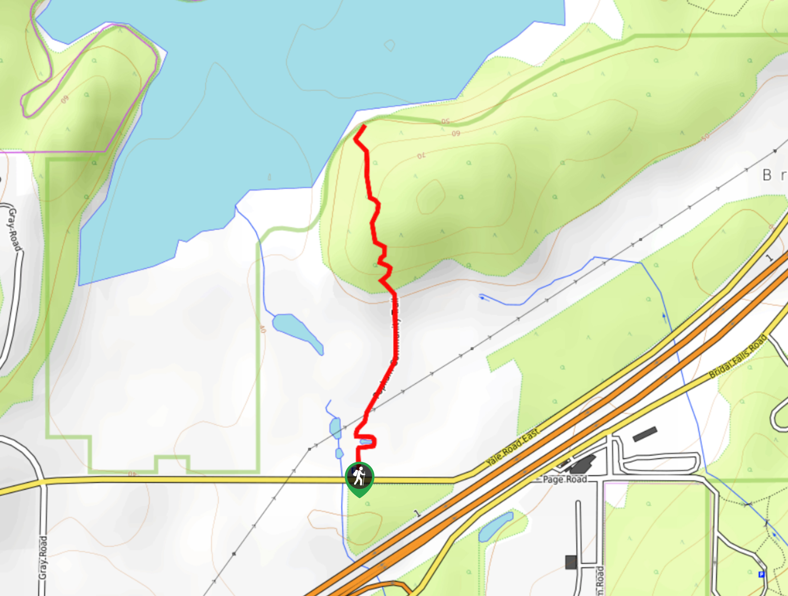
Popkum Community Trail
Hike along the Popkum Community Trail for a fun and educational experience where you can learn about the wildlife and…
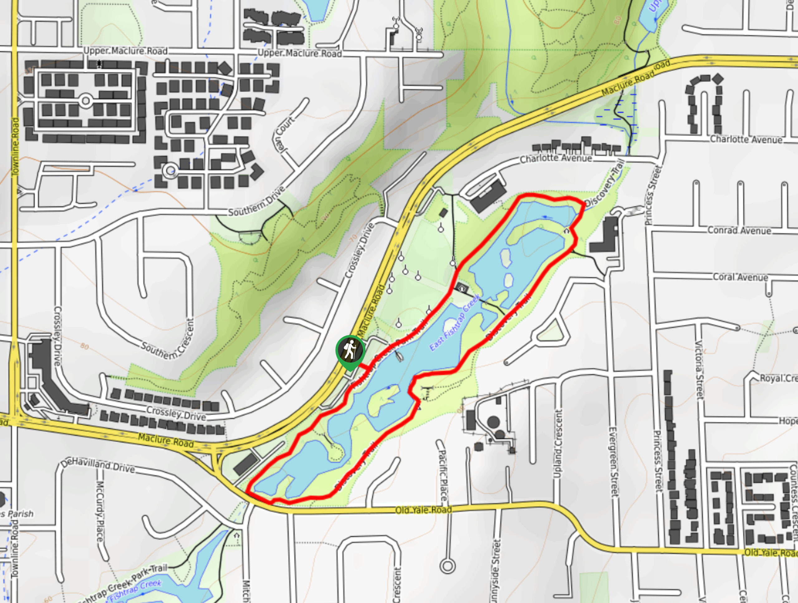
Fishtrap Creek Loop
Hiking the Fishtrap Creek Loop in Abbotsford is a great way to get out and explore the natural beauty of…

Matsqui Trail
The Matsqui Trail is a 16.7mi multi-use trail that travels alongside the Fraser River and provides nice views…
Comments