
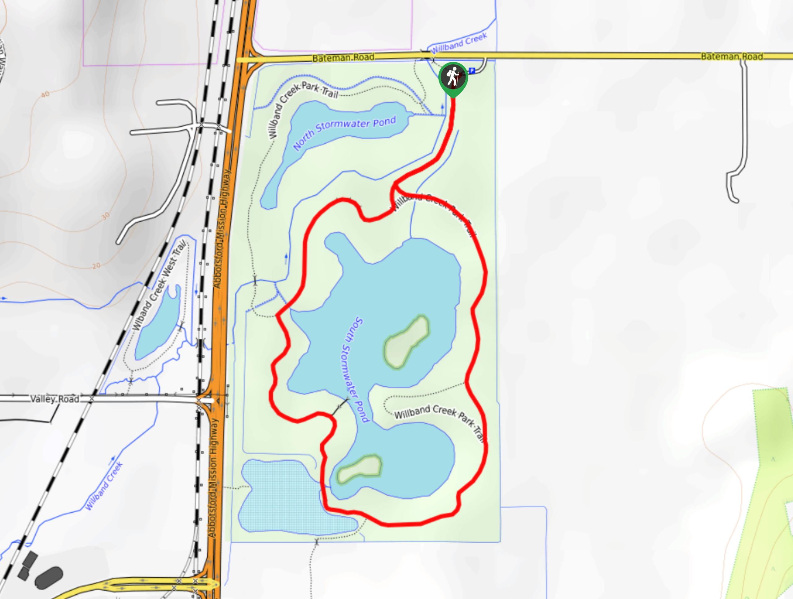
Willband Creek Park
View Photos
Willband Creek Park
Difficulty Rating:
Hiking through Willband Creek Park is a fun outdoor experience in a scenic wetland landscape with the opportunity to see wildlife. This 1.5mi trail loops around the water’s edge and provides great sightlines from the various viewpoints around the marsh. This hike is perfect for getting the family out to enjoy nature while learning about the various animal species found in this unique ecosystem.
Getting there
To reach the parking lot for Willband Creek Park from Abbotsford, drive north on BC-11 and make a right turn onto Bateman Road. Continue on for 1476ft to find the parking area on your right.

About
| When to do | Year-Round |
| Backcountry Campsites | No |
| Pets allowed | Yes - On Leash |
| Family friendly | Yes |
| Route Signage | Average |
| Crowd Levels | Moderate |
| Route Type | Lollipop |
Willband Creek Park
Elevation Graph
Weather
Willband Creek Park Description
The Willband Creek Park trail is a popular hiking route through a marshy area near Abbotsford that provides scenic views and the opportunity to spot various species of birds. With a distance of only 1.5mi, this short trail is perfect for families with young children, as the route is very flat and loops around the beautiful wetlands.
Along the trail you will meander alongside a creek before following closely along the water’s edge to a viewing platform on the water. Here, hikers will be able to spot a number of bird species like herons, ducks, swans, and geese. This is a perfect weekend outing that the whole family will enjoy.
Similar hikes to the Willband Creek Park hike
Popkum Community Trail
Hike along the Popkum Community Trail for a fun and educational experience where you can learn about the wildlife and…
Fishtrap Creek Loop
Hiking the Fishtrap Creek Loop in Abbotsford is a great way to get out and explore the natural beauty of…

Matsqui Trail
The Matsqui Trail is a 16.7mi multi-use trail that travels alongside the Fraser River and provides nice views…
Comments