
Mount Thom
View Photos
Mount Thom
Difficulty Rating:
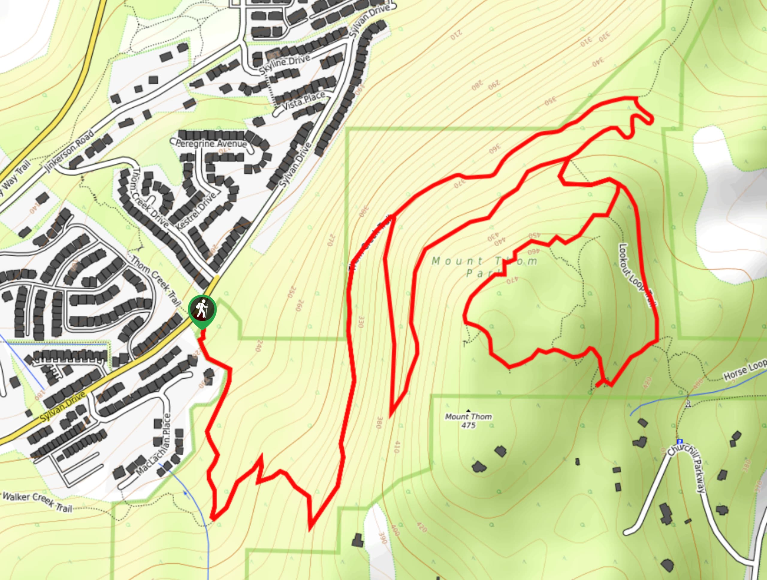
The hike to Mount Thom is a heavily-trafficked out-and-back route that is part of a network of multi-use trails near the town of Promontory in the Fraser Valley. Hiking along this forested route will take you on a moderate climb to the summit, where you will have picturesque views overlooking the valley. This is a great route for both casual and experienced hikers as the terrain is varied but not overly difficult.
Getting there
To get to the Mount Thom trailhead from Chilliwack, drive southeast on Vedder Road and turn left onto Knight Road. After 2461ft, make another right onto Chilliwack River Road and follow it for 0.9mi before turning left onto McGuire Road. Continue on for 0.8mi and turn right onto Prest Road. Pass straight through the roundabout and continue along Teskey Way for 2.1mi, turning left onto Jinkerson Road. In 919ft, turn right onto Thom Creek Drive and follow it for 1476ft. Make a right onto Sylvan Drive and you will find the trailhead on your left.

About
| When to do | March-November |
| Backcountry Campsites | No |
| Pets allowed | Yes - On Leash |
| Family friendly | Older Children only |
| Route Signage | Average |
| Crowd Levels | High |
| Route Type | Out and back |
Mount Thom
Elevation Graph
Weather
Mount Thom Trail Description:
The hike to Mount Thom is a heavily-trafficked, multi-use route near Chilliwack that is popular with hikers, runners, and horseback riders. The trail winds uphill toward the summit of Mount Thom, climbing a modest 1496ft over the course of the 4.3mi route. From the summit, hikers will have sweeping views that overlook the Fraser Valley as well as the numerous mountain peaks that dot the landscape. If you are in the Chilliwack area, this moderate forested trail is a great bang for your buck hike, with great views and little required effort.
Other Amazing Hikes in Fraser Valley
Check out our guides to Lindeman Lake, Bridal Veil Falls, Cascade Falls, Elk Mountain Trail or Hicks Lake Hike. Or see all our hikes in Fraser Valley on 10Adventures.
Similar hikes to the Mount Thom hike

Chipmunk Creek Trail
Hike along the Chipmunk Creek Trail to experience the feeling of solitude along the trail while taking in scenic views…

Matsqui Trail
The Matsqui Trail is a 16.7mi multi-use trail that travels alongside the Fraser River and provides nice views…

Flora Peak Trail
The Flora Peak Trail is an 7.1mi out-and-back hiking route that will take you through dense forests and…
Comments