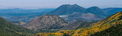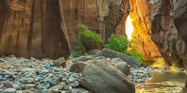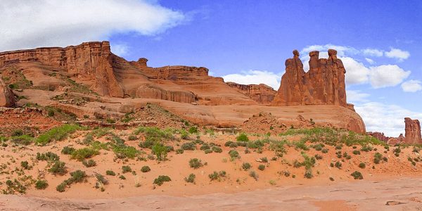
hikes in Zion National Park
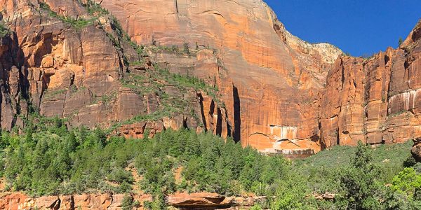
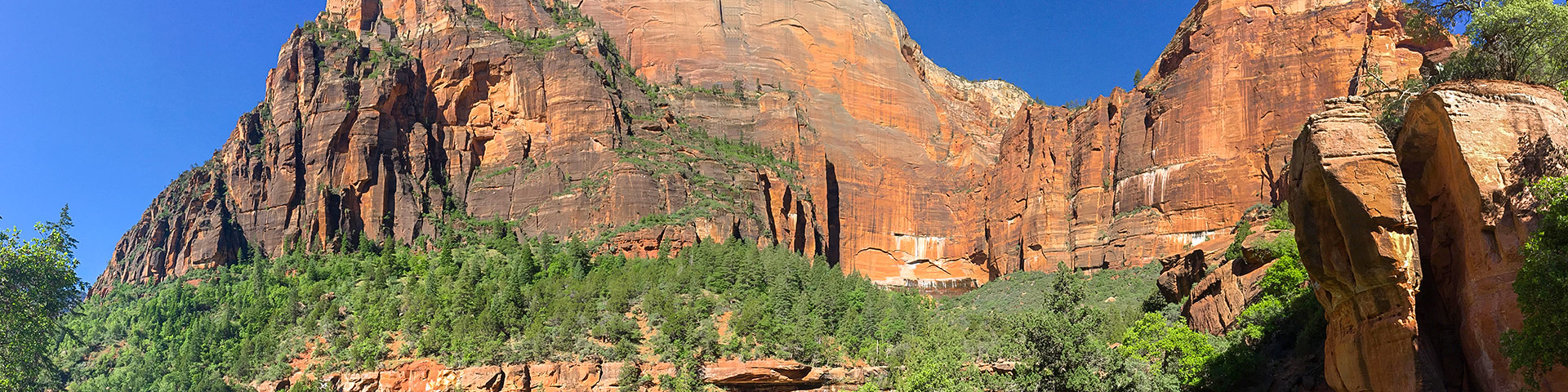
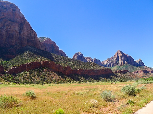
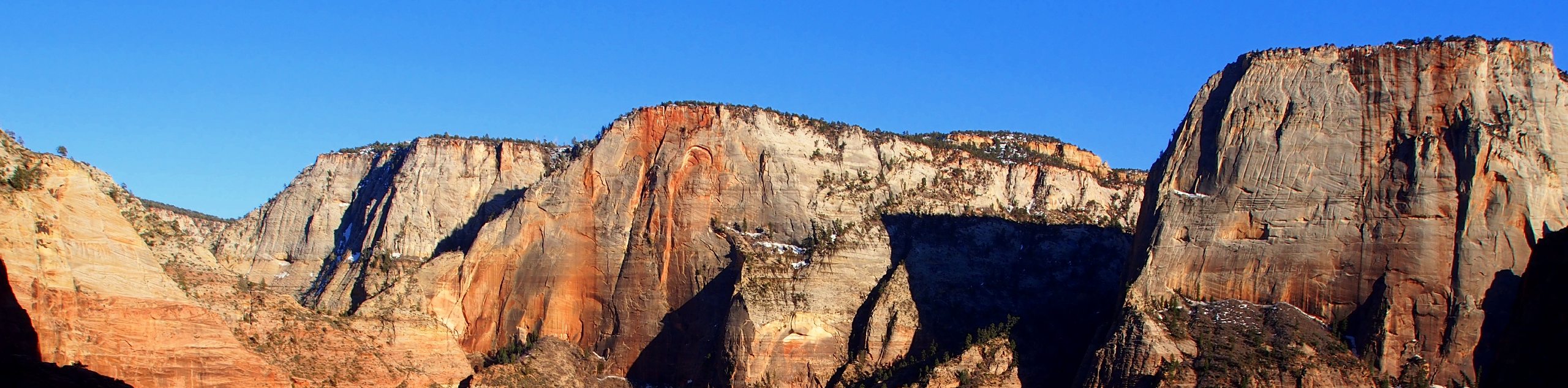
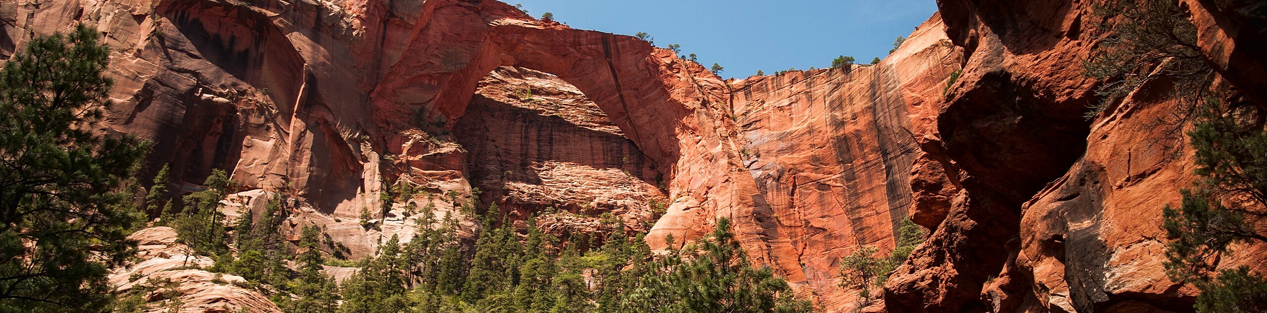
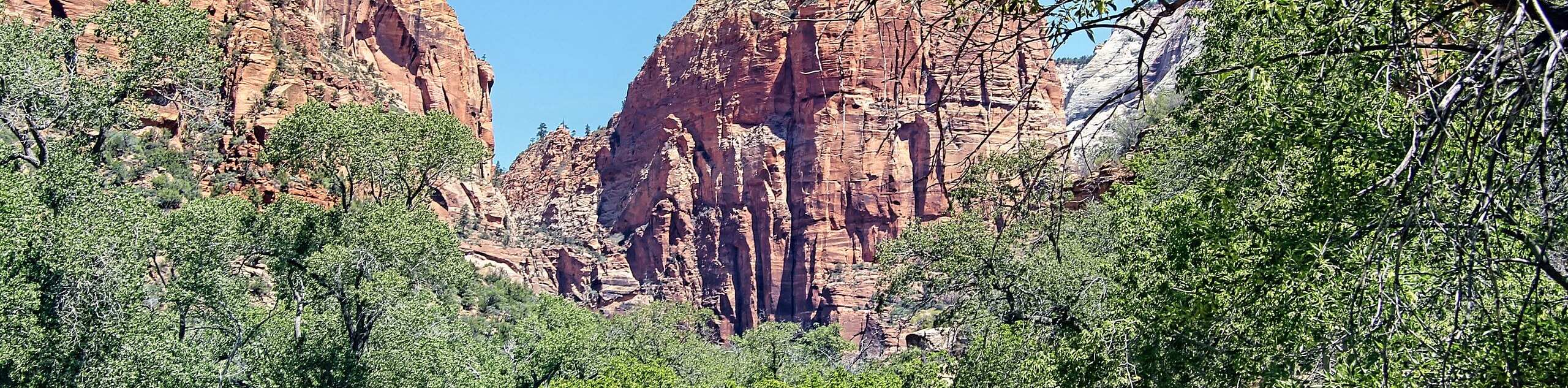
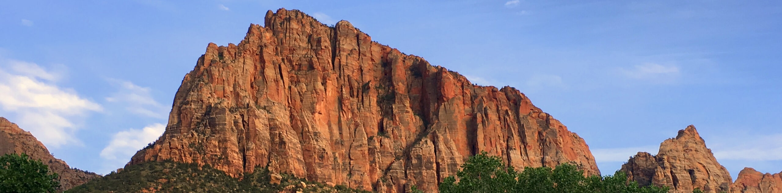
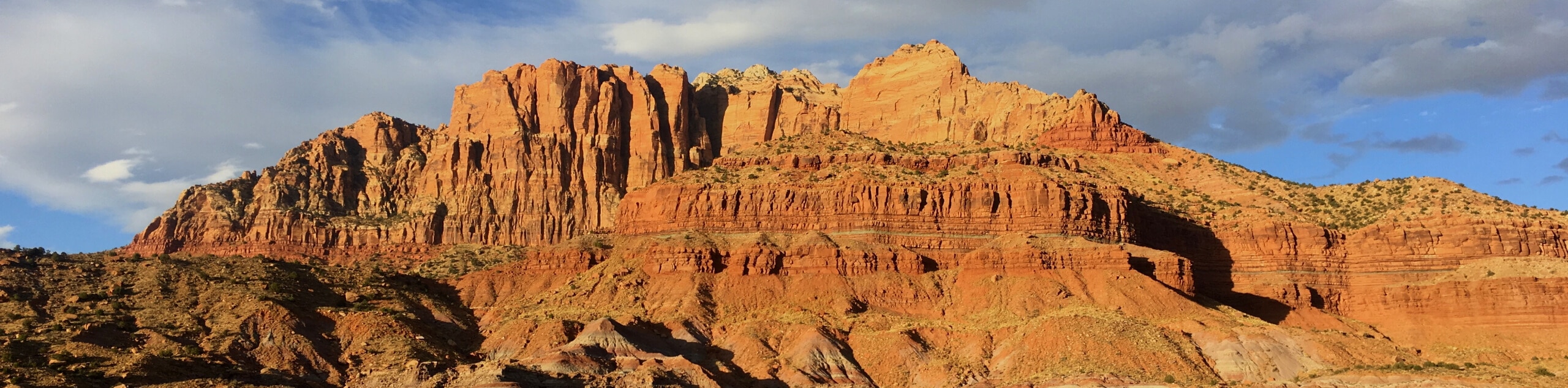
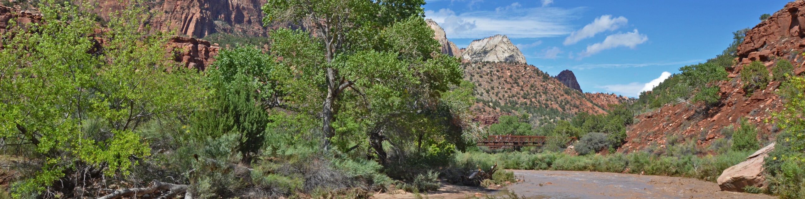
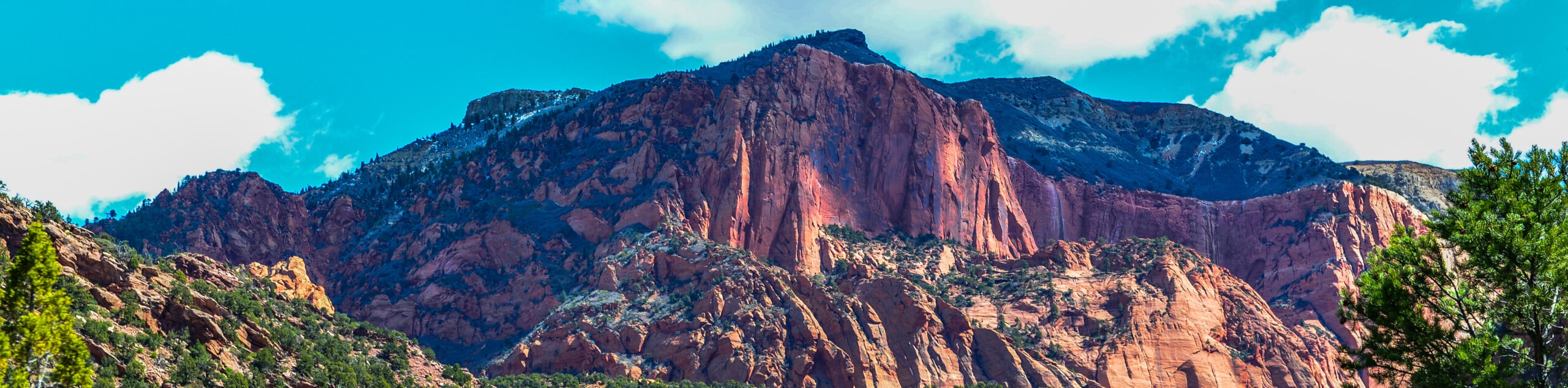
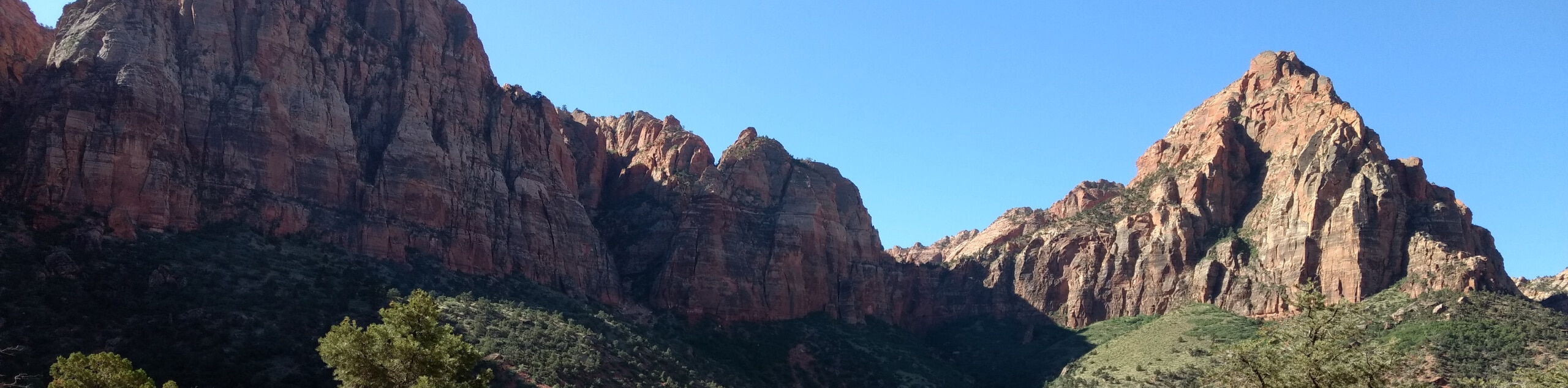
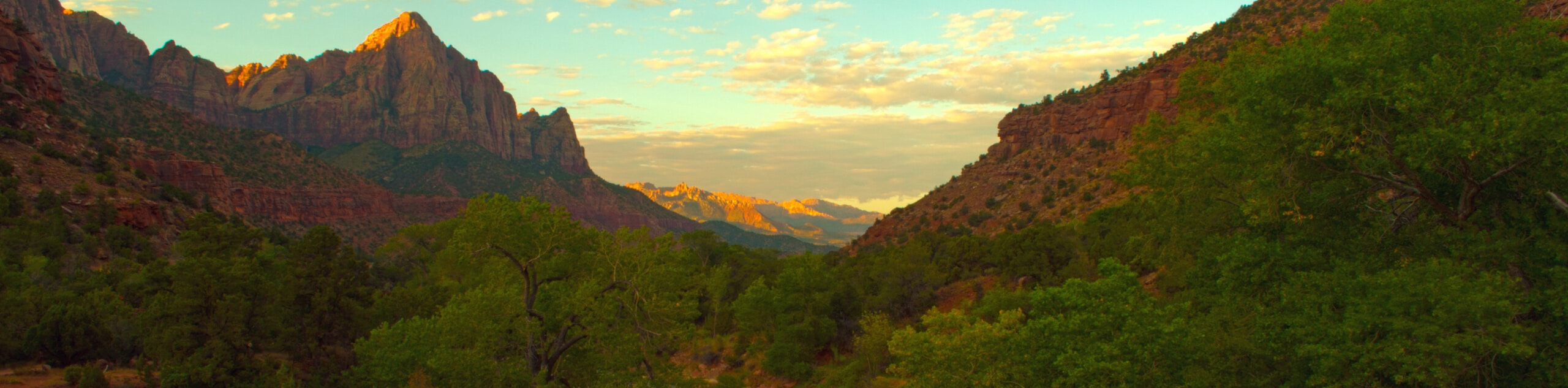
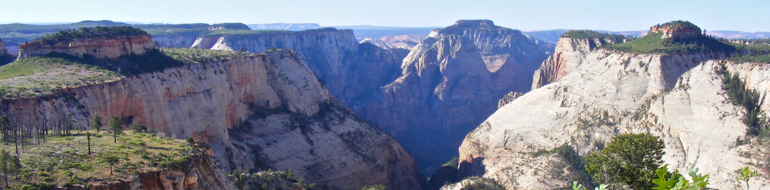
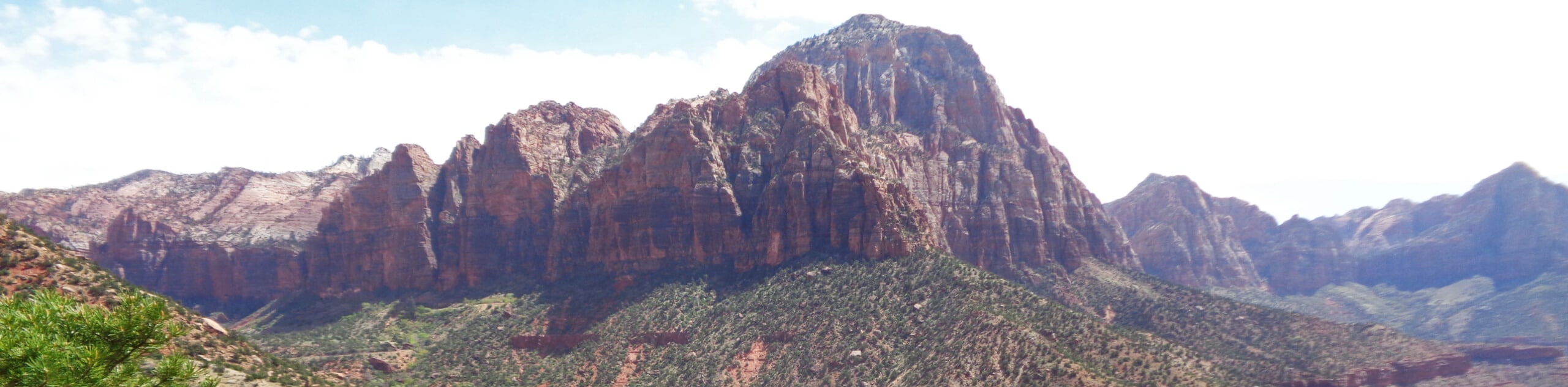
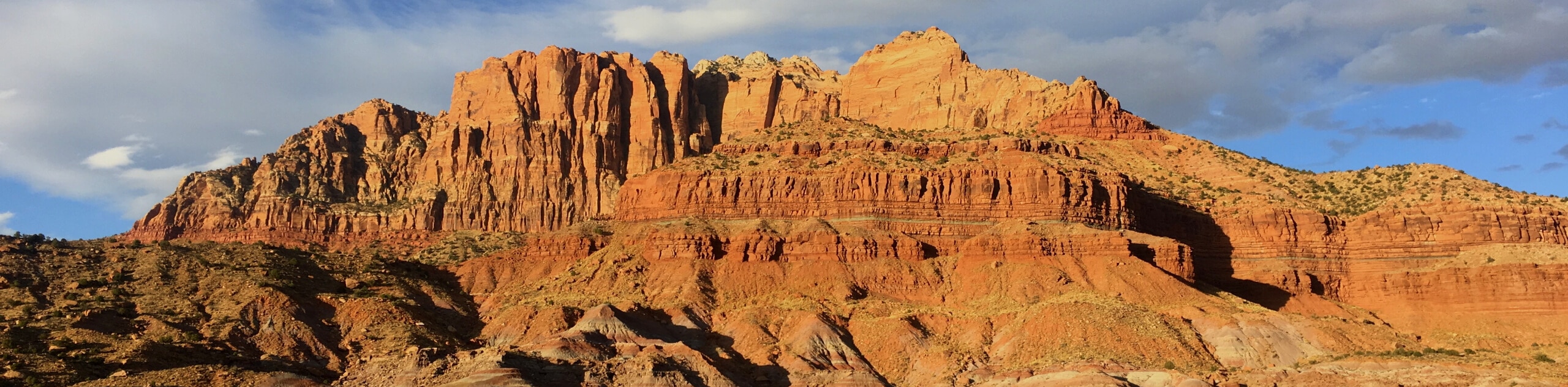
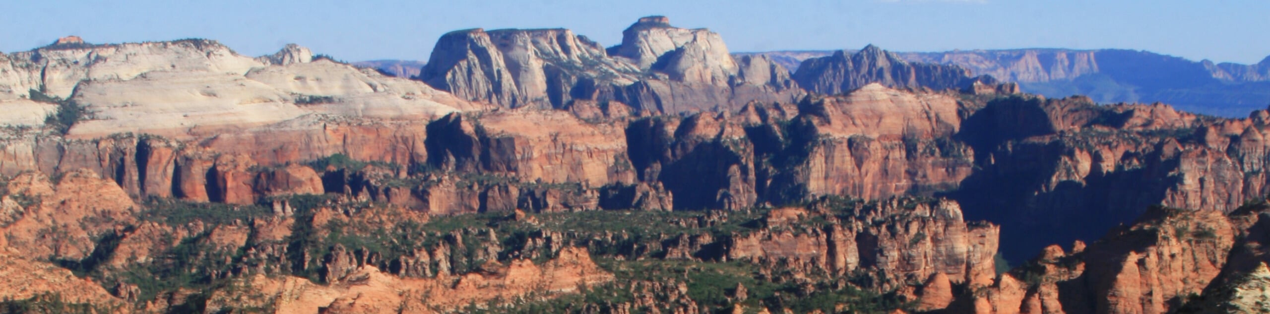
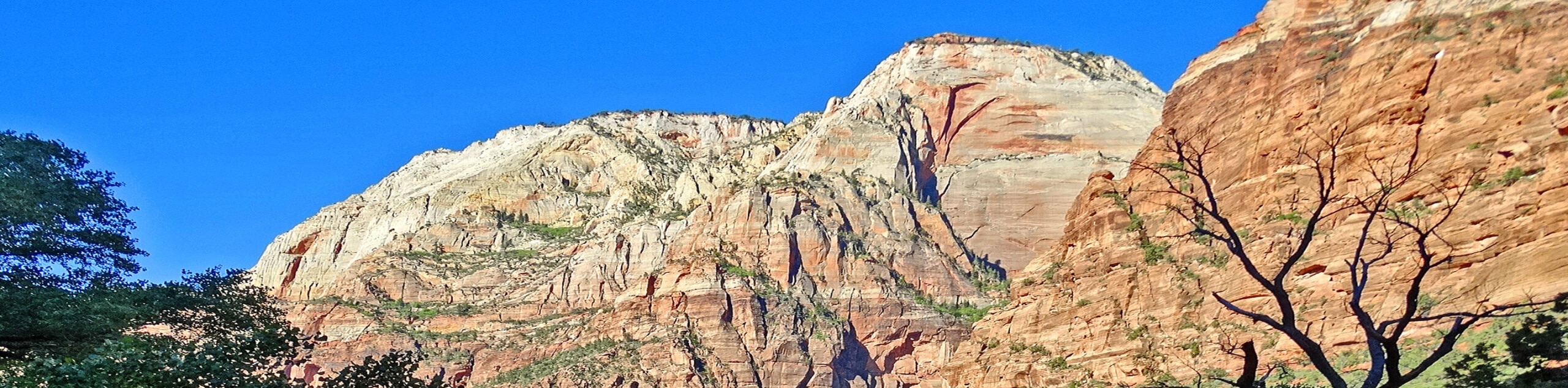
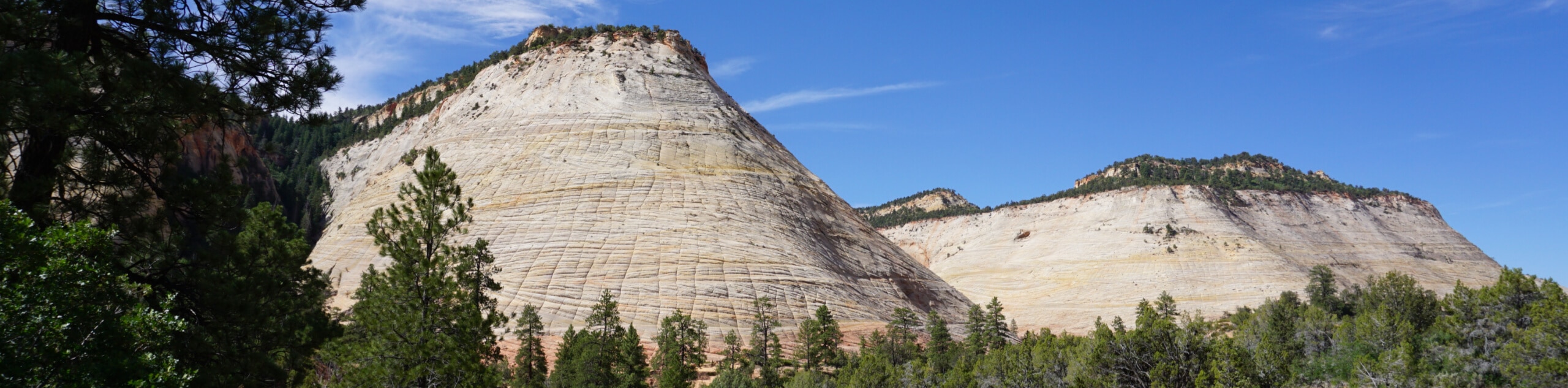
Shaped by the course of the Virgin River, the sandstone rocks of Zion National Park glow red in the bright sunlight, carved over millennia to form strange and otherworldly shapes. This desert oasis, fed by the coursing river, provides a visual spectacle like no other, with deep red rocks, lush green plants, and cool blue waters. Hiking in Zion National Park is an experience you’ll never forget.
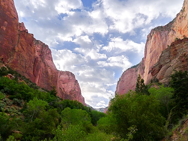
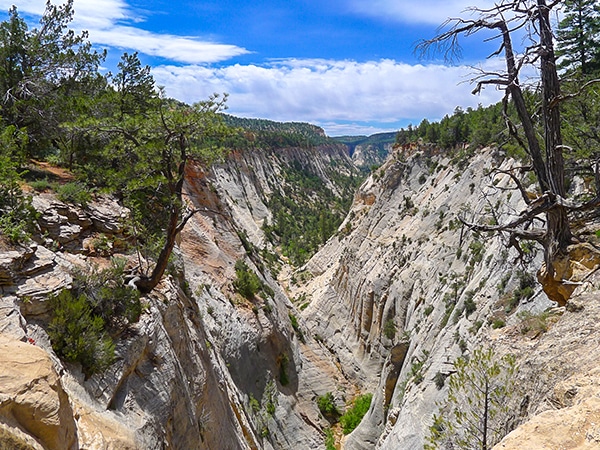
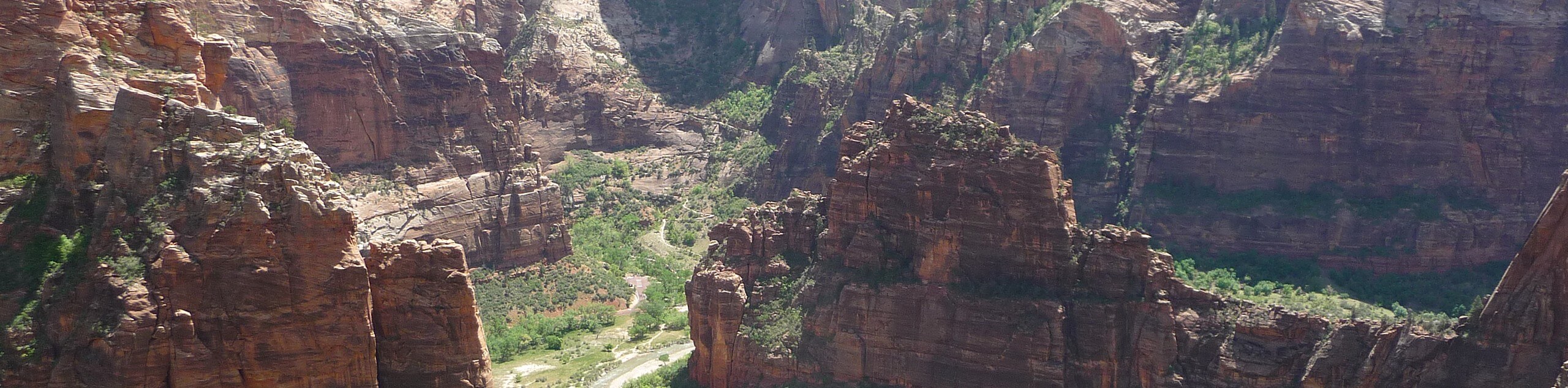
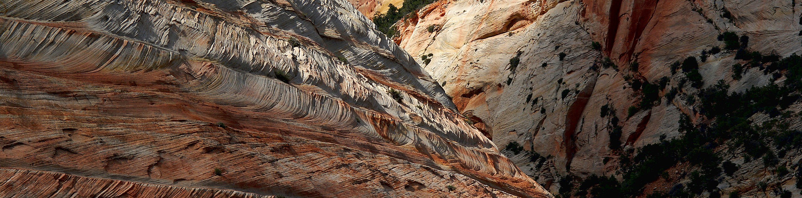
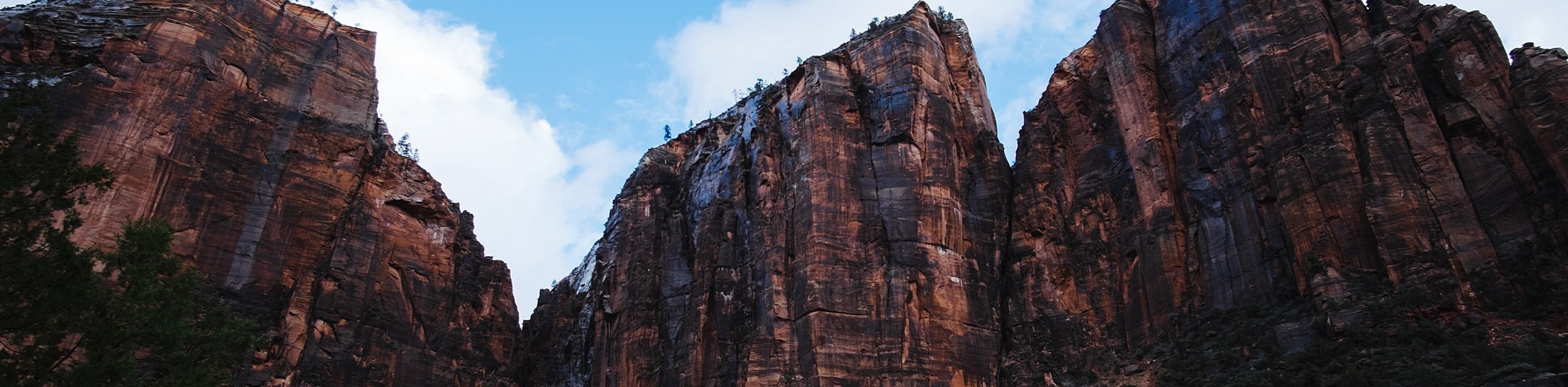
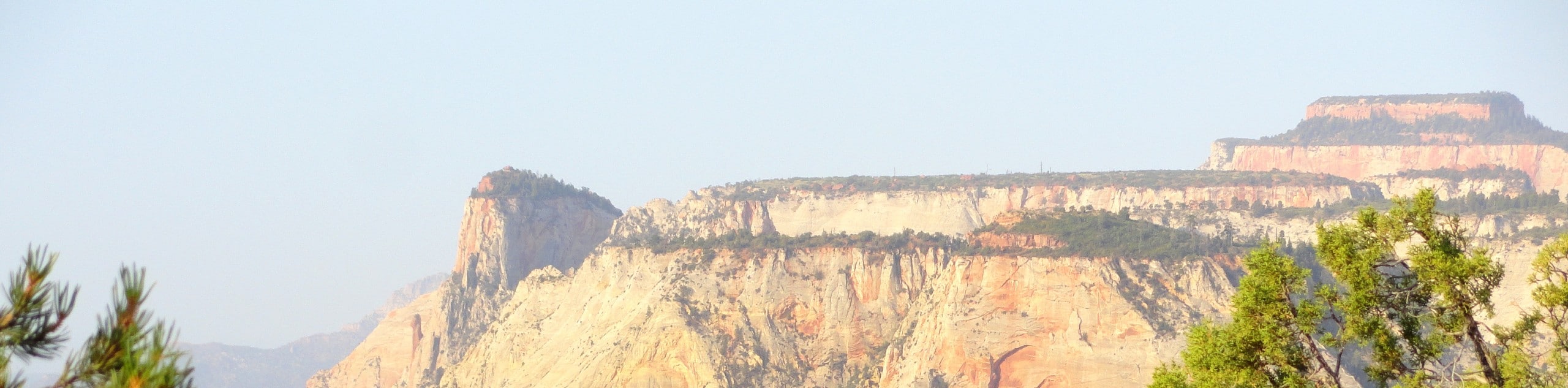
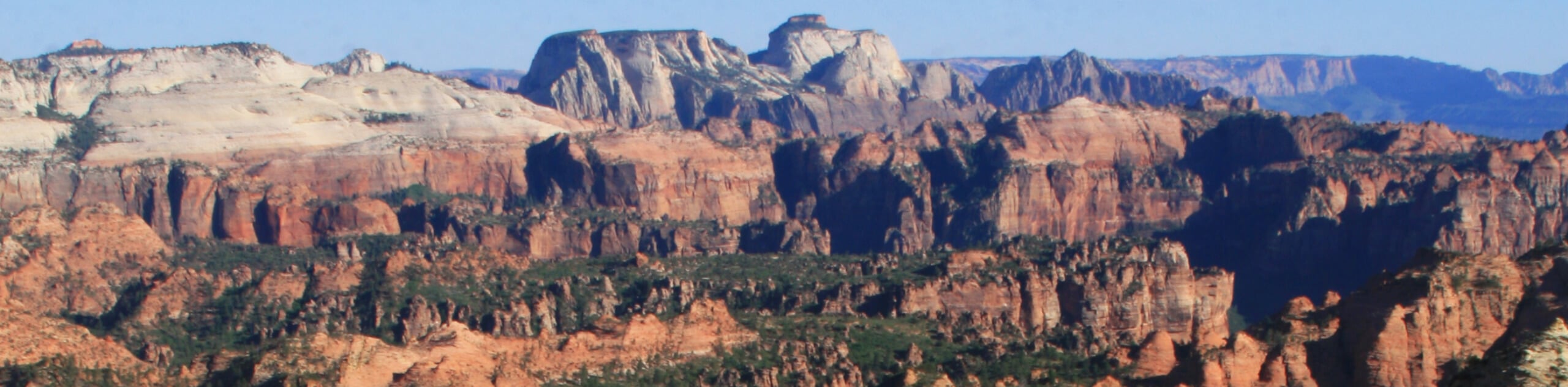
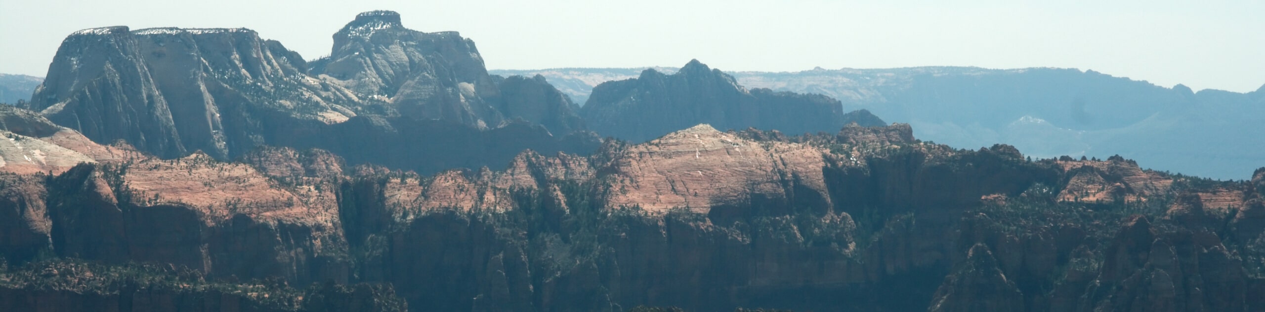
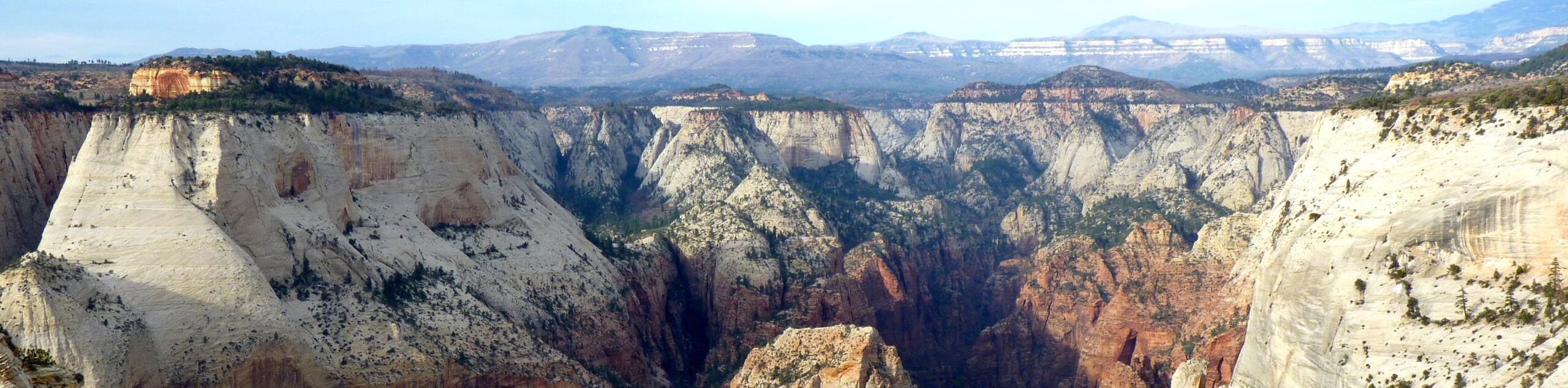
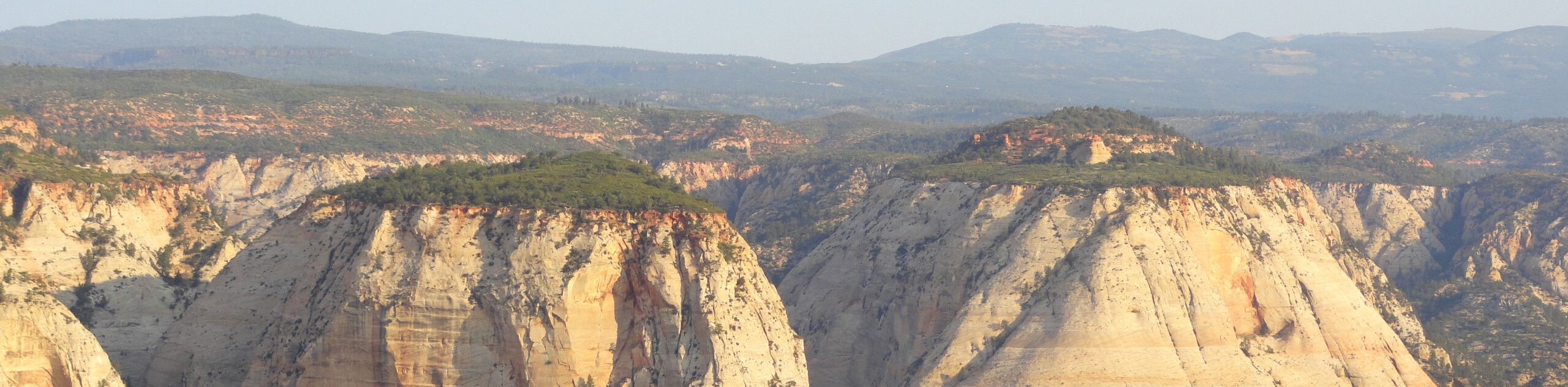
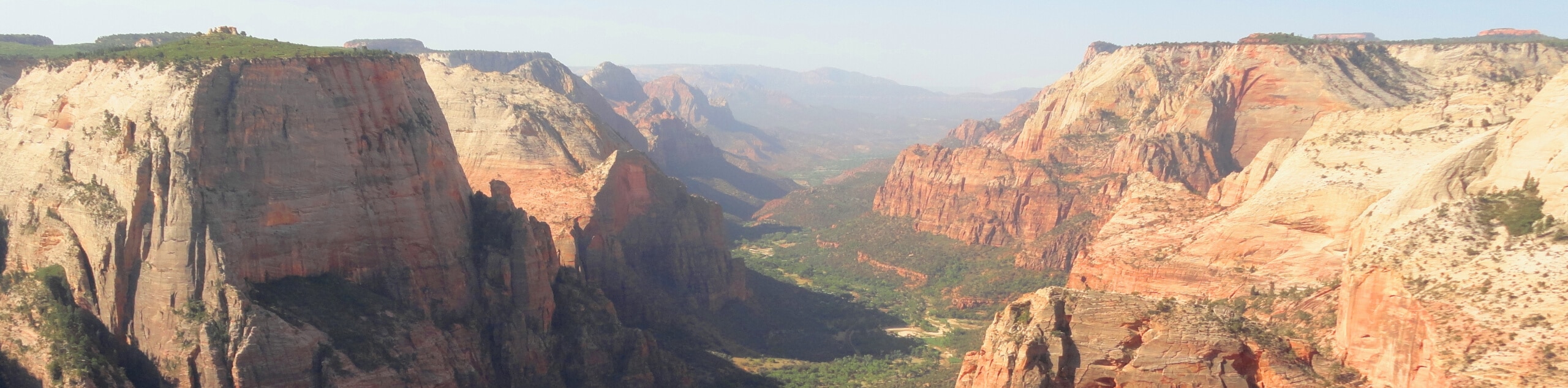
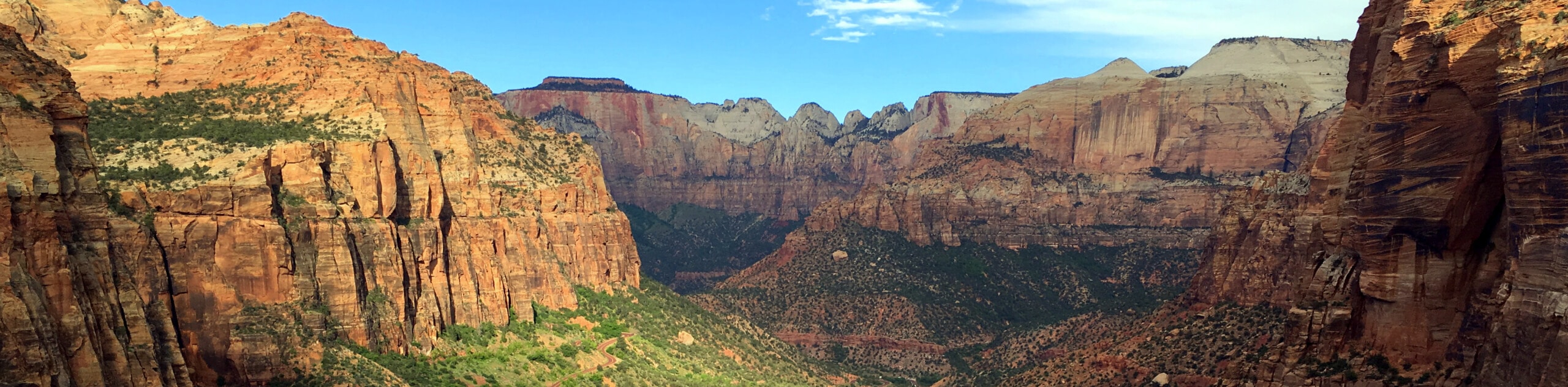
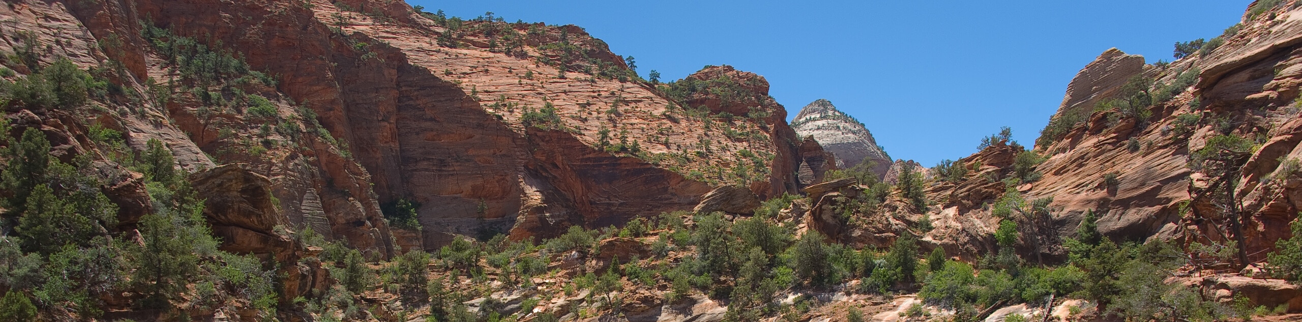
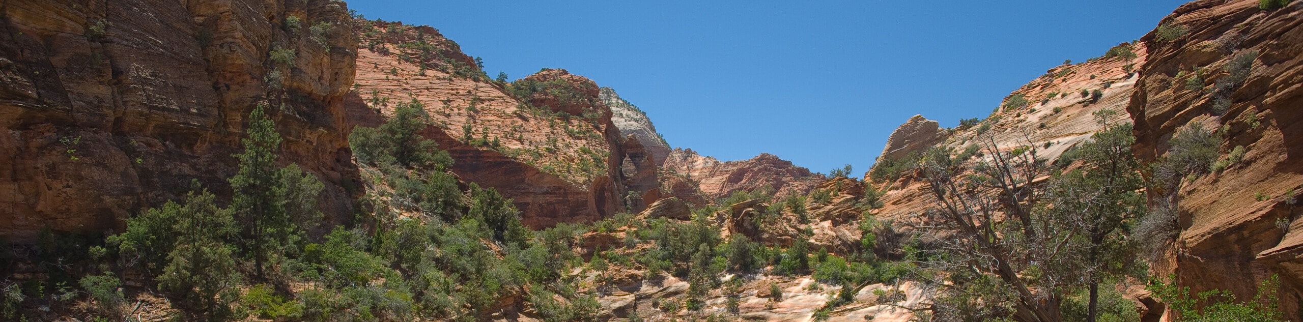
Zion National Park is packed with spectacular, accessible trails through some of Utah’s most dramatic landscapes. At the center of the park, the Zion Canyon is the focal point of most hikes, with cliff walls that rise 6562ft high in places, and narrow to a width of 66ft in others. Hiking here will take you to high overlooks, with a stunning panorama of the park, or deep into the depths of the canyon where you’ll walk through the lush valley bottom or wade through the chilly waters of the river.
Zion’s epic rocks are a major draw for most visitors, and you’ll find some spectacular, gravity-defying rock arches that provide ample photo opportunities. In addition, this part of Utah has a long history of human habitation, with traces of settlement stretching back around 8,000 years. It’s easy to imagine our human ancestors walking through this timeless landscape, admiring the beautiful rocks and lush vegetation.
Zion National Park is Utah’s finest gem, and a spectacular place for a hiking trip. If you’re planning a trip to this remarkable region, we’ve got some tips and trail suggestions that will give you plenty of inspiration. Happy hiking!
Types Of Hiking In Zion National Park
Hiking in Zion National Park is like passing into another world. With deep red rocks, jaw-dropping canyons, and pristine rivers passing through picturesque valleys, this stunning place has hiking trails for just about everyone. To prevent further erosion of the delicate sandstone rocks, many of the trails in Zion National Park are paved, making them particularly accessible if you’re travelling with a buggy or a visitor with mobility issues. Kids will love the strange, alien terrain, and there is an abundance of short, easy trails with lots of things to see along the way.
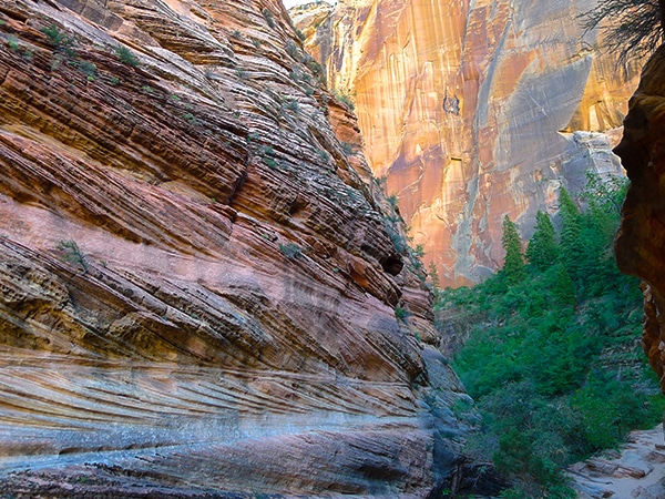
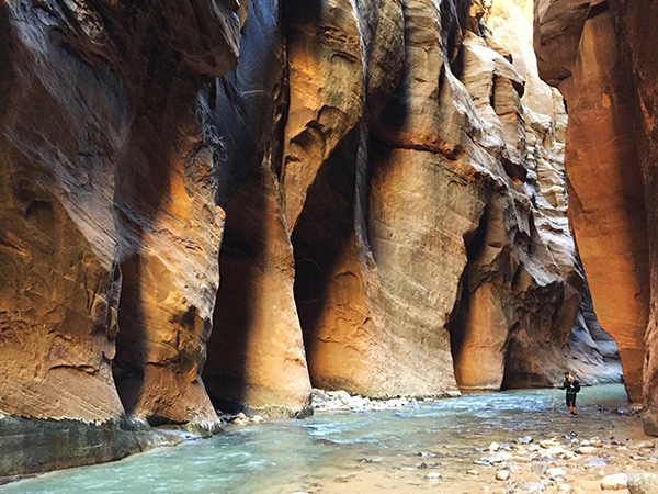
If, on the other hand, you’re looking for a more challenging adventure, Zion National Park has plenty of thrills in store. Ascending the cables at Angel’s Landing is sure to get your heart thumping (and not only from exertion), with jaw-dropping views and a climb that will pose a good challenge for most hikers. If you need to cool off, wade straight into the narrows, where you’ll hike, waist deep in water, through a tall canyon that looks like it’s come straight out of a movie. The sheer variety of trails here will keep even the most adventurous hikers happy.
Easy Hikes In Zion National Park
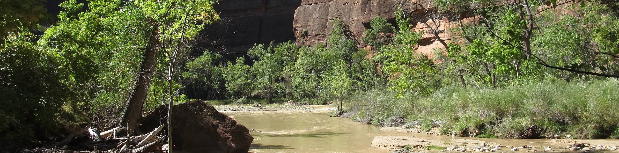
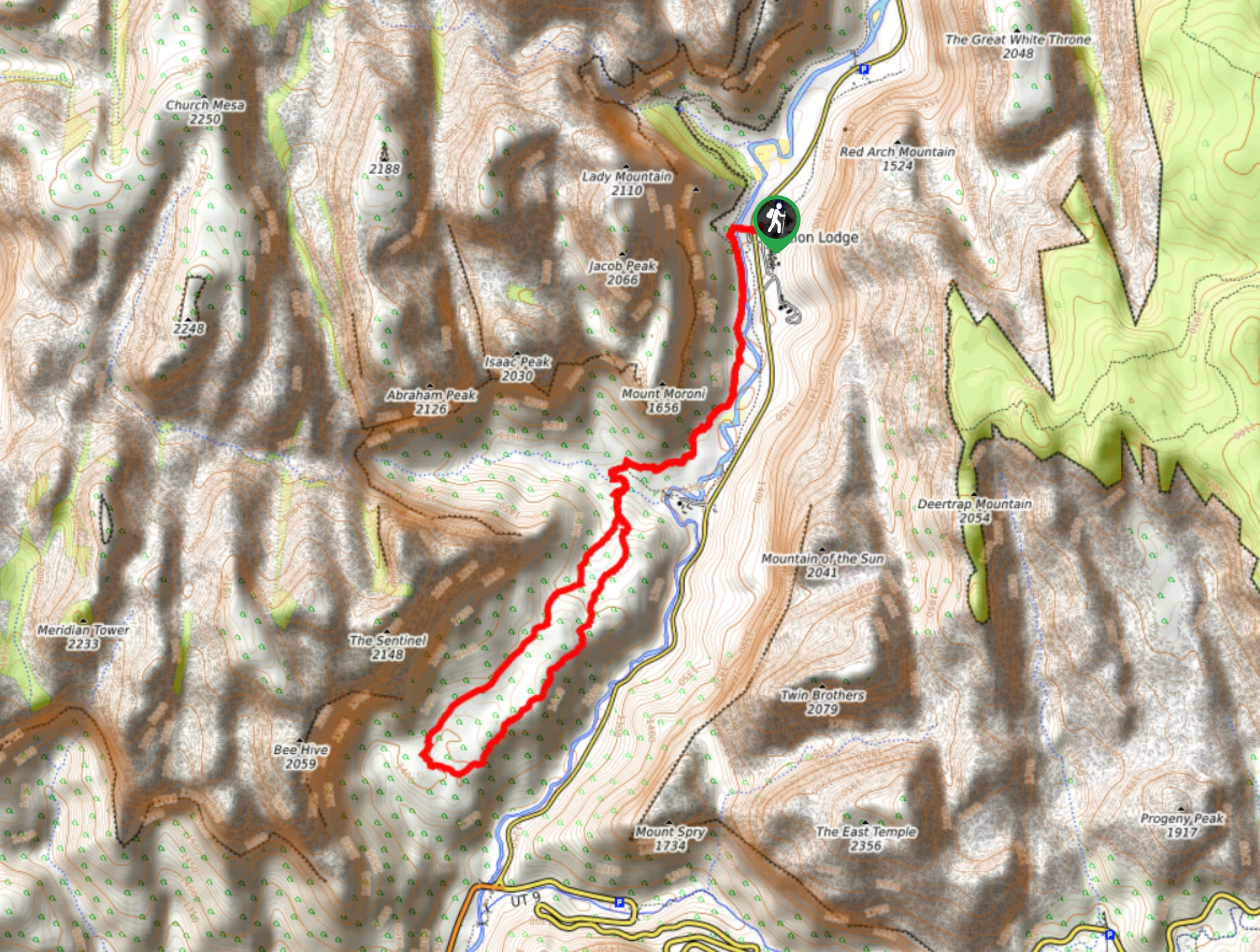
Pa’rus River Trail: This short hike over flat terrain is an ideal option for families and one of our favorite easy hikes in Zion National Park! ‘Pa’rus’ comes from the Palute word meaning “bubbling, tumbling water”, and this paved trail along the Virgin River certainly does justice to the name. As you hike through the bottom of the canyon, alongside the gurgling waters of the river, you’ll have a fantastic view of Bridge Mountain and the Beehive.
Family Hikes In Zion National Park
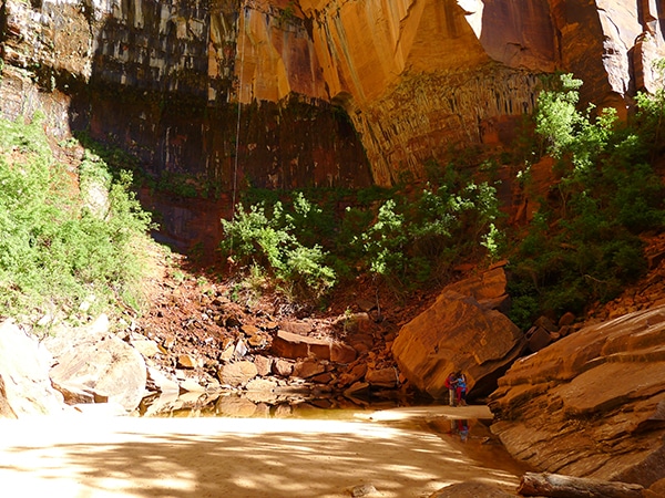
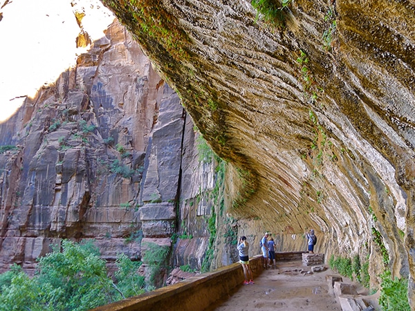
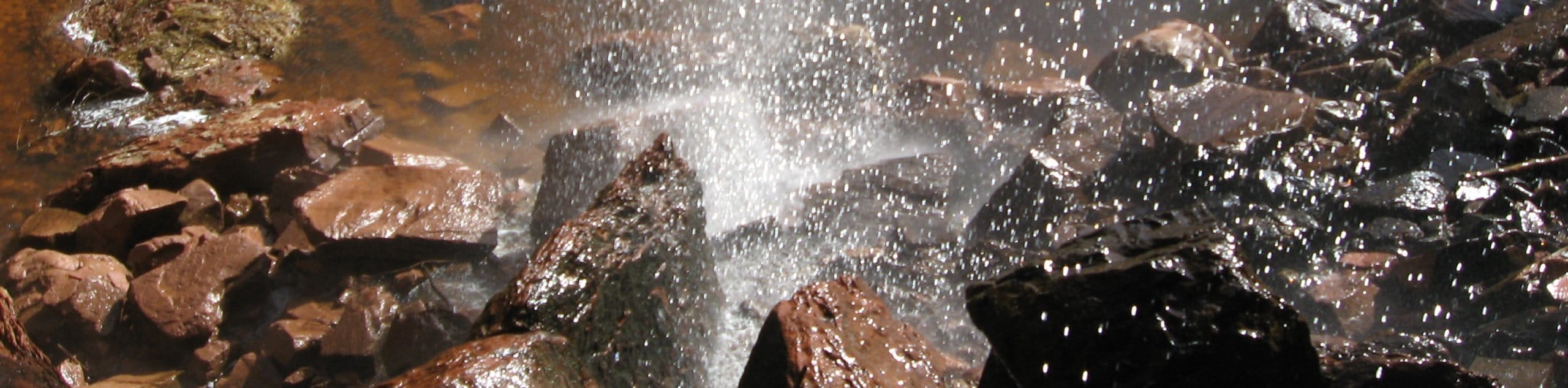
Weeping Wall Hike: This short steep trail will bring you to the secluded Weeping Wall, so named for the trickling waters that drip steadily from the sloping rock face. This is an ideal family hike for warm days, despite the steep ascent, as the entire trail is shaded from the hot sun. The cliffs are clothed in lush vegetation, making this a lovely spot to stay a while and take advantage of the dripping waters.
Day Hikes In Zion National Park
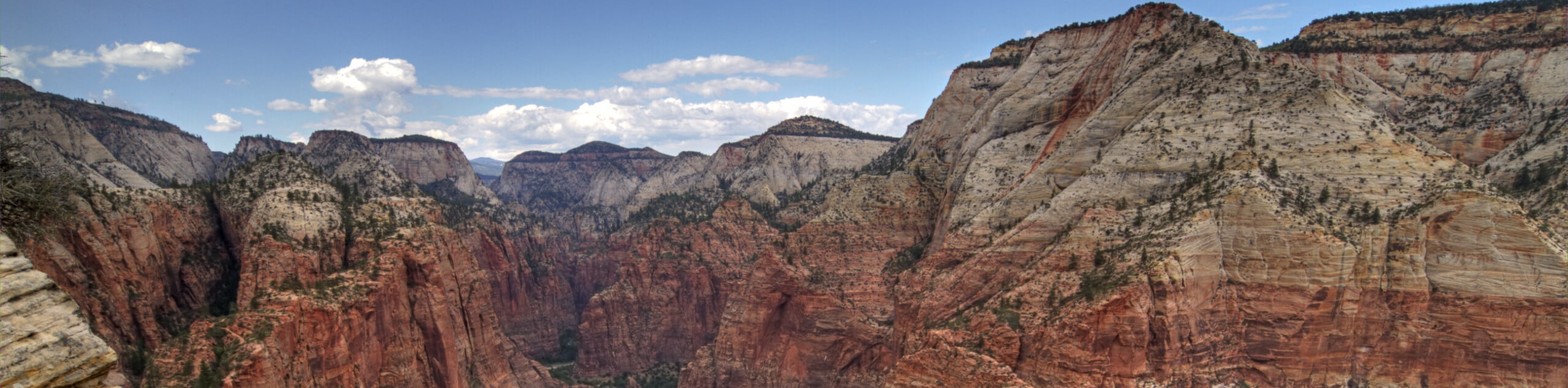
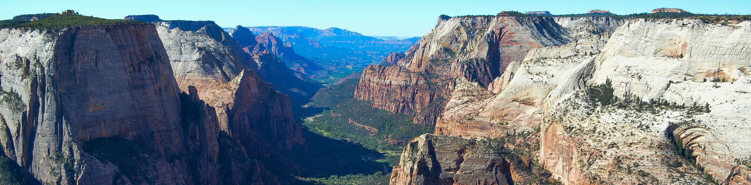
Observation Point Hike: Observation Point is one of the most scenic viewpoints in Zion National Park, towering over the Zion Canyon. The ascent is challenging, passing through a series of switchbacks up onto a small, cool ridge. The views from the summit are remarkable, especially early in the morning when the first rays of sun hit the canyon.
Challenging Hikes In Zion National Park
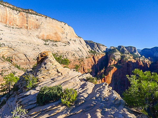
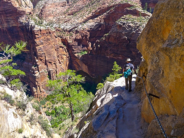
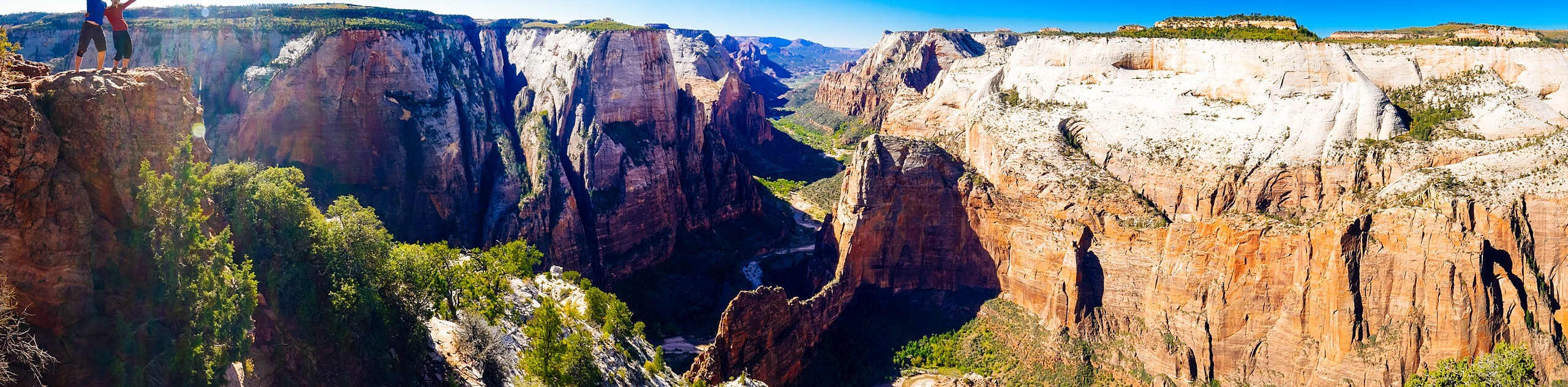
Angel’s Landing Hike: The hike up to Angel’s Landing is, without doubt, one of the best challenging hikes in Zion National Park. You’ll pass up a series of short, steep switchbacks known as Walter’s Wiggles, before arriving at the ridge of Scout’s Lookout. To get to Angel’s Landing itself you’ll need to negotiate the infamous run of chains before emerging at the summit, where you’ll enjoy a remarkable panorama of the park.
Best Hikes In Zion National Park
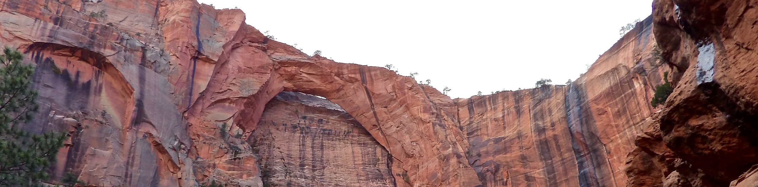
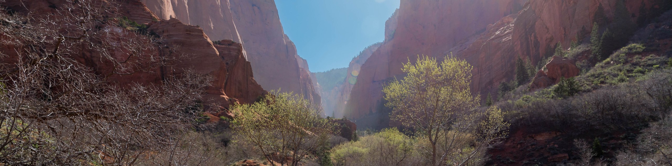
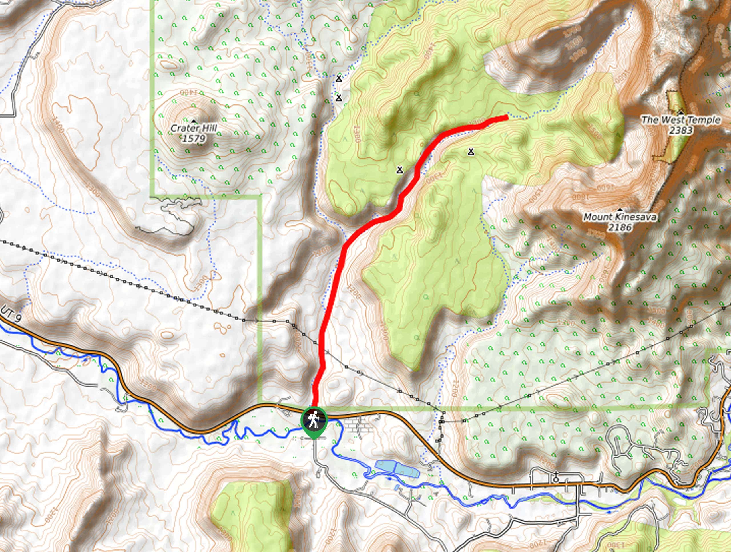
Taylor Creek Trail Hike: The Taylor Creek Trail passes through some of the most remarkable scenery in Zion National Park, passing through the red cliff walls of the Kolob Canyon. The striking sandstone features of the gorge can be easily appreciated all the length of this wonderful hike, passing back and forth over the creek on an undulating path. At the end of the route, you’ll reach the impressive Double Arch Alcove, a sandstone amphitheater that is sure to take your breath away.
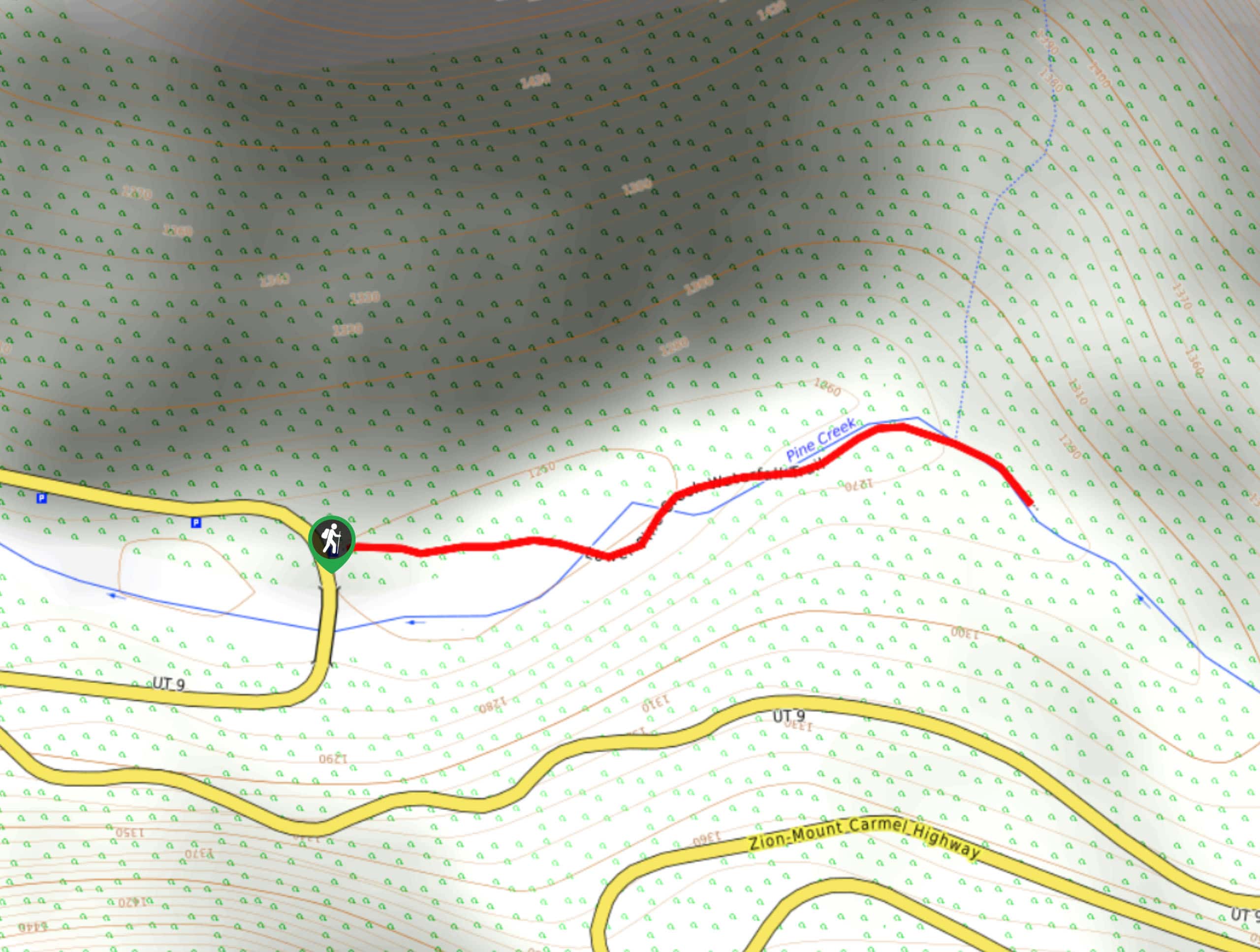
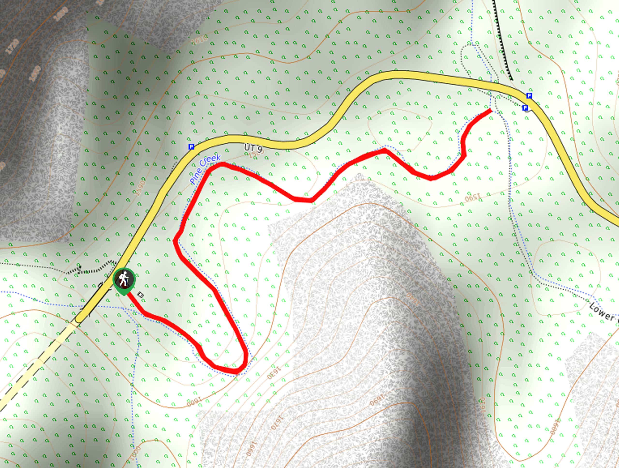
Canyon Overlook Hike: The short walk to Canyon Overlook is one of our favorites, and arguably one of the best hikes in Zion National Park. This trail will give you jaw-dropping views over both the Zion and Pine Creek Canyons, and is accessed via a rock staircase with a helpful handrail, so all hikers should be happy here. This trail is one of the best ways to experience the majesty of Zion National Park.
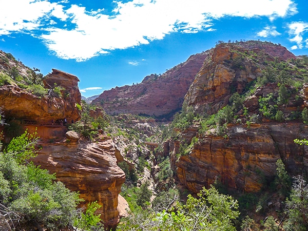
Hidden Canyon Hike: The Hidden Canyon hike offers a fantastic alternative for hikers looking for the thrills associated with Angel’s Landing, but who aren’t yet prepared to tackle the vertiginous cables. The latter part of this route is lined with cables to help you ascend the sandstone cliffs, but they are easy to tackle and you’ll be rewarded with a wonderful view of the valley, red cliffs, and Cable Mountain.
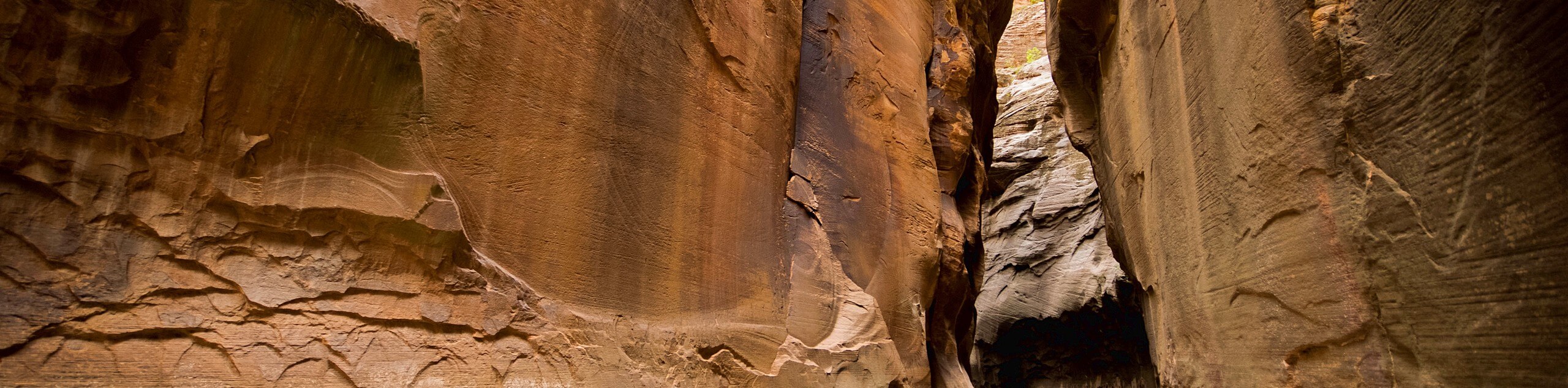
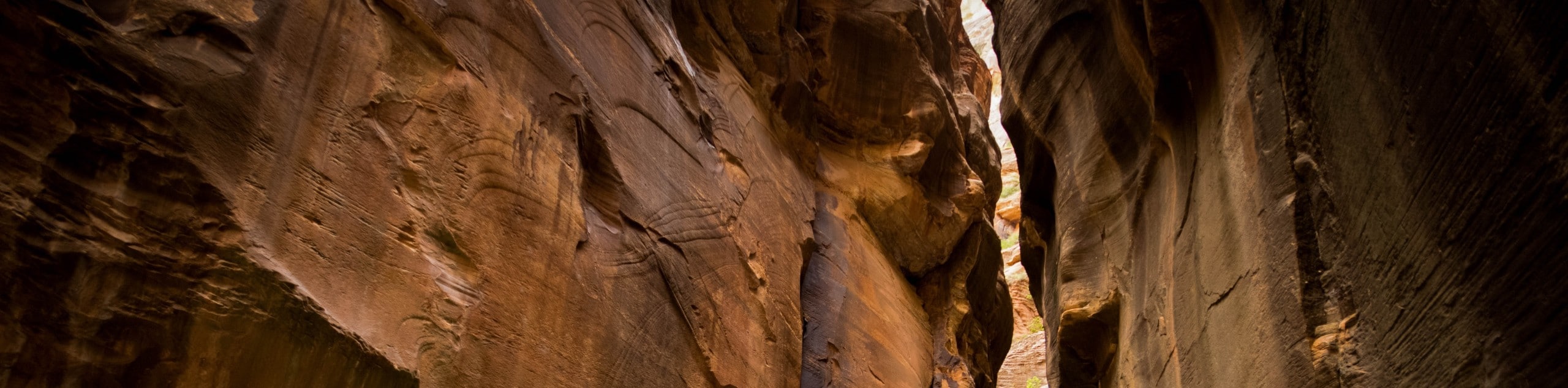
The Narrows Hike: Be prepared to get wet feet on this fun hike along the Virgin River! The trail follows the gurgling river as it passes through a picturesque slot canyon. You’ll follow the path for 1.6km before entering the river and wading through the canyon in the water. It’s possible to hire equipment for this popular and iconic hike in nearby Springdale, where you can pick up waders, water boots and hiking poles.
East Rim Trail Hike: This pleasant hike is an easy trail with some killer views, passing through Echo Canyon all the way to Weeping Rock. This is an adaptable and fun hike, as you can customize the length depending on your available time and energy levels. We suggest following the trail all the way to Jolly Gulch Creek, where you’ll find a picturesque waterfall.
Emerald Pools Hike: The hike to Emerald Pools offers spectacular views of the sandstone cliffs that line the Virgin River valley. You’ll ascend up a series of switchbacks with lovely views of the lush oasis, before arriving at the Upper Pools where you can relax in peace as you gaze at the tranquil waters. The Middle and Lower Pools can be accessed on the way back down, by taking one of the many paths that branch off the main trail.
When Is The Best Time To Hike In Zion National Park?
Temperatures in Zion National Park can be somewhat extreme, meaning that you’ll want to time your visit carefully to make sure you have the perfect hiking conditions. The winter months can be very cold, with temperatures dropping below freezing in December and January, whereas summer temperatures can reach the high 30s. The best time to hike in Zion National Park is in autumn, when the weather is clear and cool, there are fewer crowds on the trails, and most routes will be clear. Although spring offers pleasant temperatures, some trails are closed due to the flooding of the Virgin River. Summer is a very popular time for hiking in Zion National Park, but this means that the trails can be very crowded, as millions of people flock to see the fantastic natural treasures of this unique region.
Other Outdoor Activities In Zion National Park
Once you’ve exhausted the hiking trails, there are plenty of other outdoor activities in Zion National Park that will keep you busy! In addition to hiking and backpacking, this unique and beautiful park is the perfect place to go horseback riding. You can relax by the Virgin River and enjoy a little fishing, or even take the opportunity to try your hand at canyoning! If you’re a budding photographer, this is a wonderful destination, with plenty of scope to experiment with the play of the light on the colorful rocks.
How To Plan A Trip To Zion National Park
If the thought of these hikes has given you itchy feet, use our guide to help you plan your trip to Zion National Park! There’s never been a better time to visit this majestic, beautiful place, and to help you make the most of your trip we’ve put together all the information you’ll need to get started. From insider tips on where to stay and where to eat, to all our favorites hikes, we’ve got everything required to plan your bucket list adventures. Some of these trails in Zion National Park are considered to be the best hikes in Utah, and we think you’ll love them just as much as we do!
Frequently-Asked-Questions About Zion National Park
What is the most dangerous hike in Zion?
The hike up Angel’s Landing is one of the most iconic hikes in Zion National Park, involving a steep climb up a series of switchbacks and a thrilling ascent via cables. This is a challenging route, and it’s important to take great care on the cables, as there is a sheer drop, which has given it a reputation as the most dangerous hike in the park. There have been 8 fatalities on the route since 2004, but the overwhelming majority of people make the ascent without any problems.
How many hiking trails are in Zion National Park?
There are 46 hiking trails in Zion National Park, ranging from short, easy treks, to challenging ascents and long canyon hikes.
Can you go mountain biking in Zion National Park?
Mountain biking is not permitted in Zion National Park. The only trail that is suitable for bikes is the Pa’rus Trail.
How much time will you need in Zion?
Many of the trails in Zion National Park are short and accessible, meaning that if you’re short on time, you can still explore many of the riches that this wonderful park has to offer. We’d recommend spending at least 2-3 days here, so you can make the most of the glorious sunsets and sunrises, and fit in a couple of good hikes. If you have more time, there is plenty to explore, and you can easily fill 5-7 days will epic hikes and adventures across the park.
The best hikes in Zion National Park
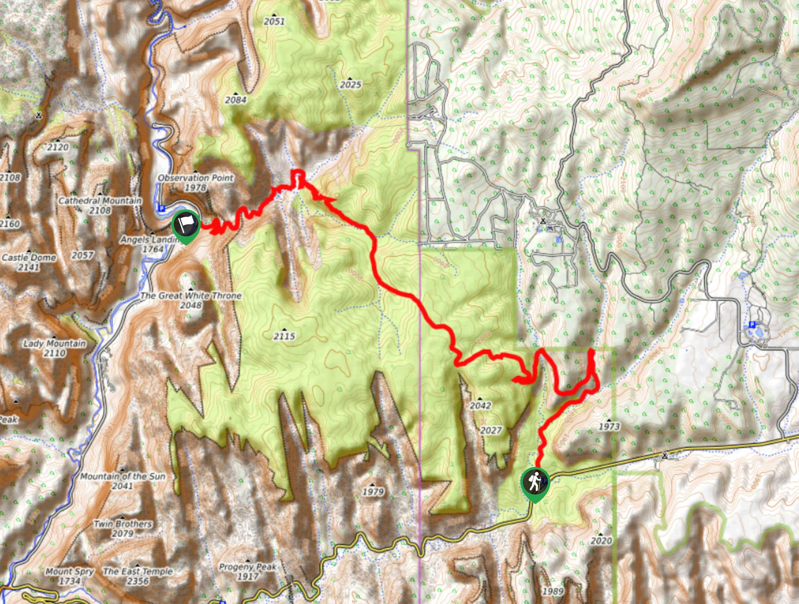
01. Observation Point Trail
Difficulty
This stunning hike brings trekkers to the most scenic viewpoint that can be found in… Read More
02. Angel's Landing
Difficulty
Easily the most popular hike in the park, the trail up to Angel’s Landing is… Read More
03. Taylor Creek Trail
Difficulty
Inside the quiet Kolob Canyon area of Zion National Park, the Taylor Creek Trail runs… Read More
04. Pa'rus River Trail
Difficulty
This wonderfully peaceful and exquisitely beautiful trail leads along the Virgin River from the campground… Read More
05. Canyon Overlook
Difficulty
Contouring the famous Zion – Mount Carmel Tunnel, the Canyon Overlook trail yields spectacular views… Read More
06. Hidden Canyon Trail
Difficulty
Accessed by part of the trail for Observation Point, the Hidden Canyon hike leads up… Read More
07. The Narrows Hike
Difficulty
The Narrows Hike is an amazing journey through Zion Canyon that eschews following a normal… Read More
08. East Rim Trail
Difficulty
Exploring the rolling hills east of the main canyon, the East Rim Trail yields stunning… Read More
09. Emerald Pools
Difficulty
This gentle hike brings trekkers up to the stunning spring-fed three-tiered Emerald Pools, with fantastic… Read More
10. Weeping Rock Hike
Difficulty
This short, steep trail leads to the scenic and secluded Weeping Rock. A natural spring… Read More
Yes, there are more than 10
Zion National Park is so beautiful that we can not give you only 10 hikes. So here is a list of bonus hikes in Zion National Park that you should take a look at as well
11. Zion Narrows: Bottom up to Big Springs
Difficulty
The Narrows Hike is one of the most popular destinations in Zion National Park. The… Read More
12. The Narrows: Top-Down
Difficulty
The Top-Down Trail through the Narrows is an epic adventure through a stunning section of… Read More
13. The Zion Narrows Riverside Walk
Difficulty
The Zion Narrows Riverside Trail is a scenic stroll along the Virgin river to the… Read More
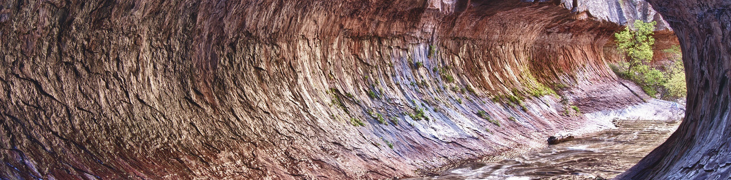
14. The Subway Trail
Difficulty
The Subway Trail is an iconic hike in Zion National Park that features paleontological wonders,… Read More
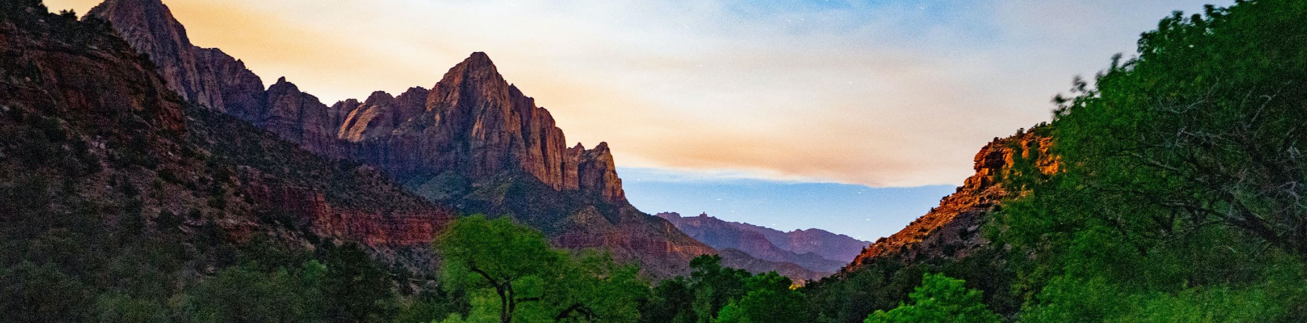
15. The Watchman Trail
Difficulty
The Watchman trail is a popular out-and-back trail just north of Springdale, UT. This hike… Read More
16. La Verkin Creek Trail to Kolob Arch
Difficulty
The La Verkin Creek Trail is a challenging, moderately trafficked trail that leads to the… Read More
17. Observation Point via The East Mesa Trail
Difficulty
Observation Point via the East Mesa Trail is a popular out-and-back day hike tucked in… Read More
18. The West Rim Trail (Top Down)
Difficulty
Do it all in one big day! The West Rim Trail Top-Down route from Lava… Read More
19. Lower Emerald Pool Trail
Difficulty
The Lower Emerald Pool Trail is a paved walkway up to the Emerald Pools near… Read More
20. Middle Fork of Taylor Creek Trail
Difficulty
The Middle Fork of Taylor Creek is an easy-to-moderate, out-and-back trail that criss-crosses back and… Read More
21. Scout Lookout via West Rim Trail
Difficulty
The West Rim Trail to Scout Lookout is the less popular neighbor of the Angel’s… Read More
22. Hop Valley and Kolob Arch Trail
Difficulty
The Hop Valley Trail passes through private ranch land and leads travellers to the iconic… Read More
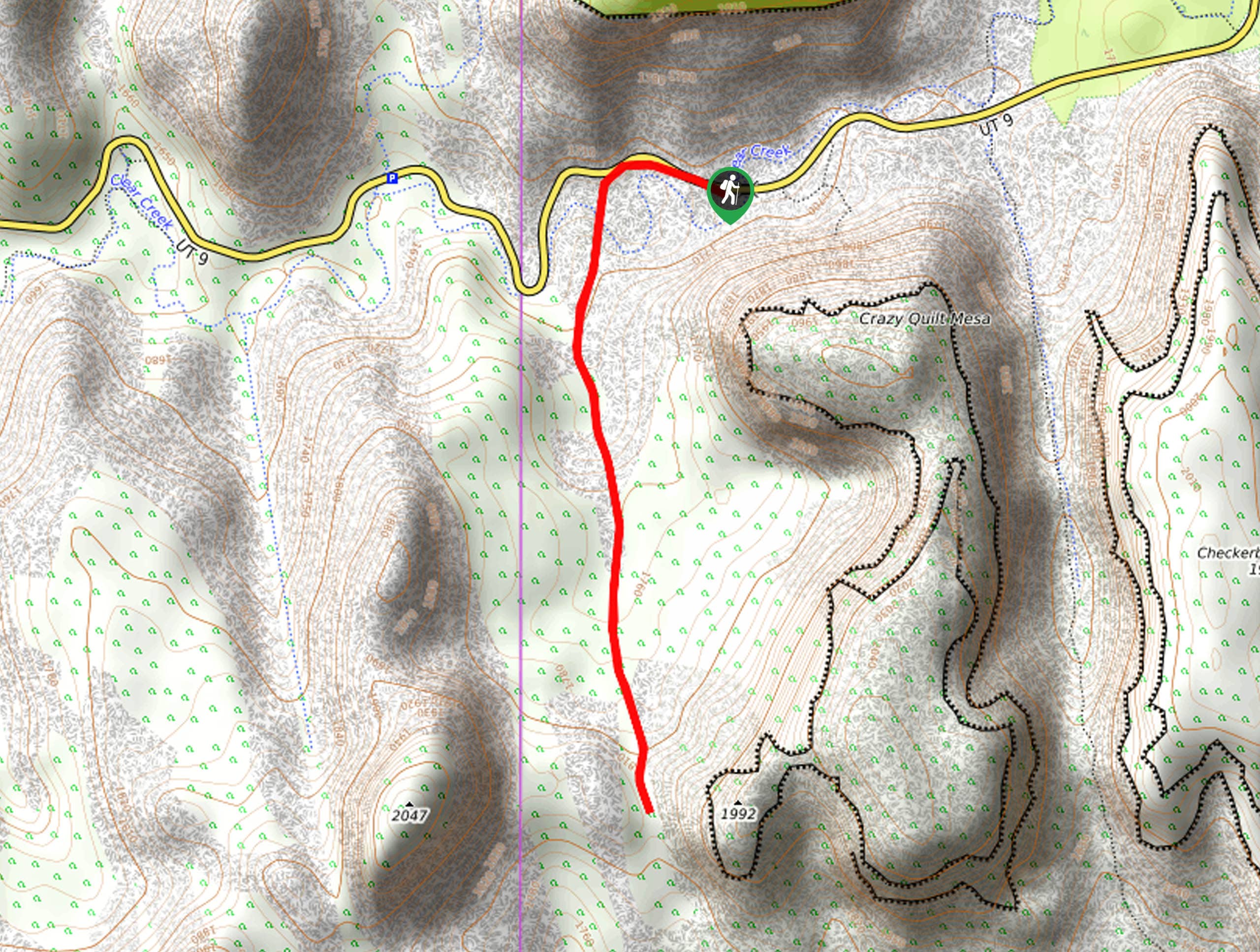
23. Checkerboard Mesa Canyon Trail
Difficulty
The Checkerboard Mesa Canyon Trail follows a drainage nestled between the Checkerboard and Crazy-Quilt Mesas… Read More
24. Lava Point Overlook Trail
Difficulty
The Lava Point Overlook Trail is a quick, 0.3mi jaunt off of Kolob… Read More
25. Kayenta Trail to the Emerald Pools
Difficulty
The Kayenta Trail is a popular access route to the Emerald Pools. This trail is… Read More
26. Zion Grotto Trail
Difficulty
The Zion Grotto Trail is a well-trafficked, easy hike between Zion Lodge and The Grotto… Read More
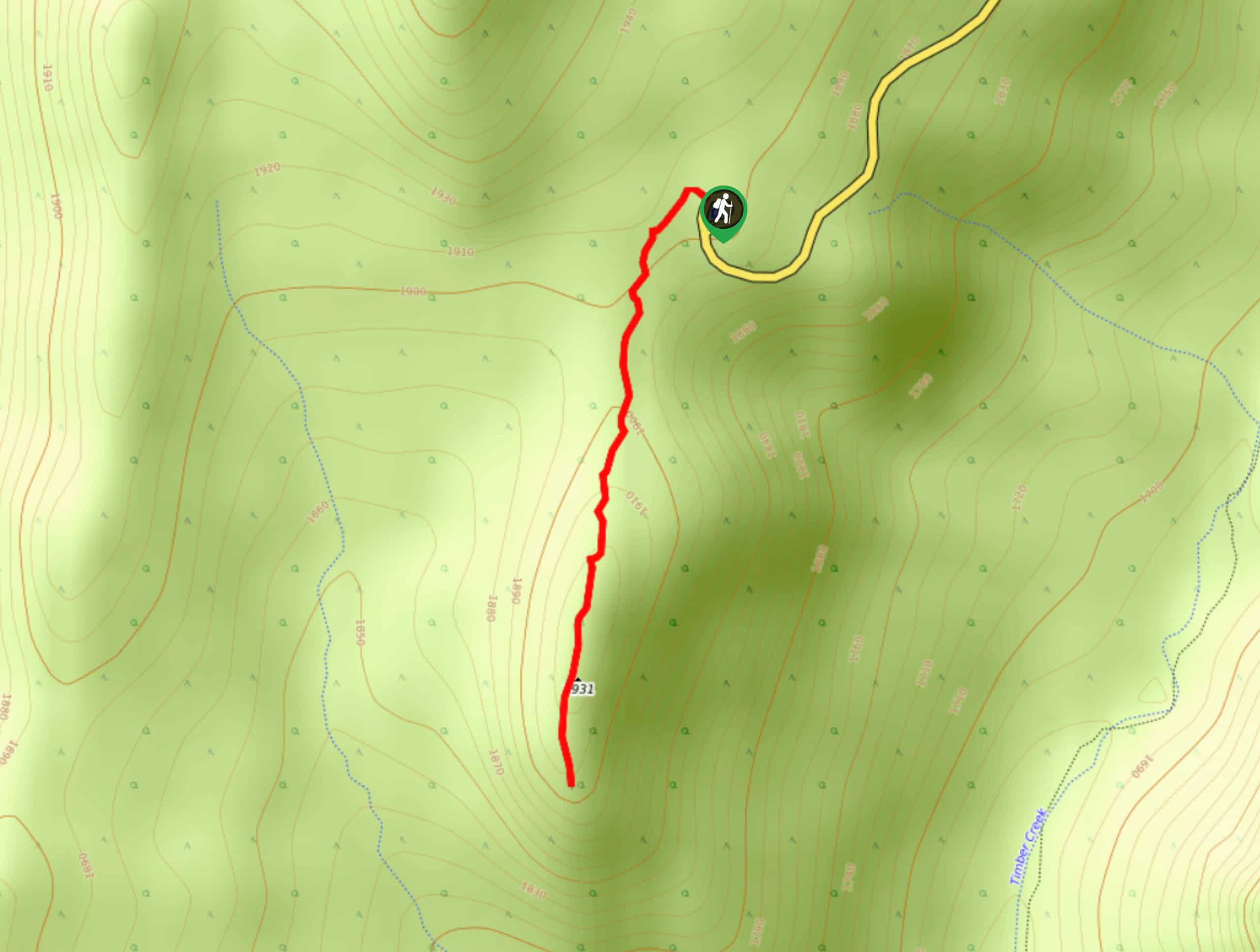
27. Timber Creek Overlook Trail
Difficulty
The Timber Creek Overlook Trail is a short, one-mile, out-and-back trail in the Kolob Canyons… Read More
28. East Rim Trail
Difficulty
The East Rim Trail to Weeping Rock is famous for its sandstone cliffs and canyon… Read More
29. The East Mesa Trail
Difficulty
The East Mesa Trail is a fantastic route that winds down to Weeping Rock past… Read More
30. Sand Bench Loop via Zion Lodge
Difficulty
The Sand Bench Loop is a low traffic sandy trail in the heart of Zion… Read More
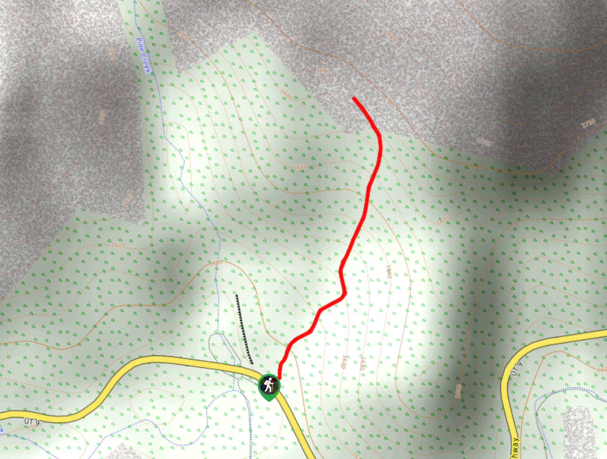
31. Lower Pine Creek Waterfall Trail
Difficulty
The Lower Pine Creek Waterfall trail is a short, unmaintained trail that leads to a… Read More
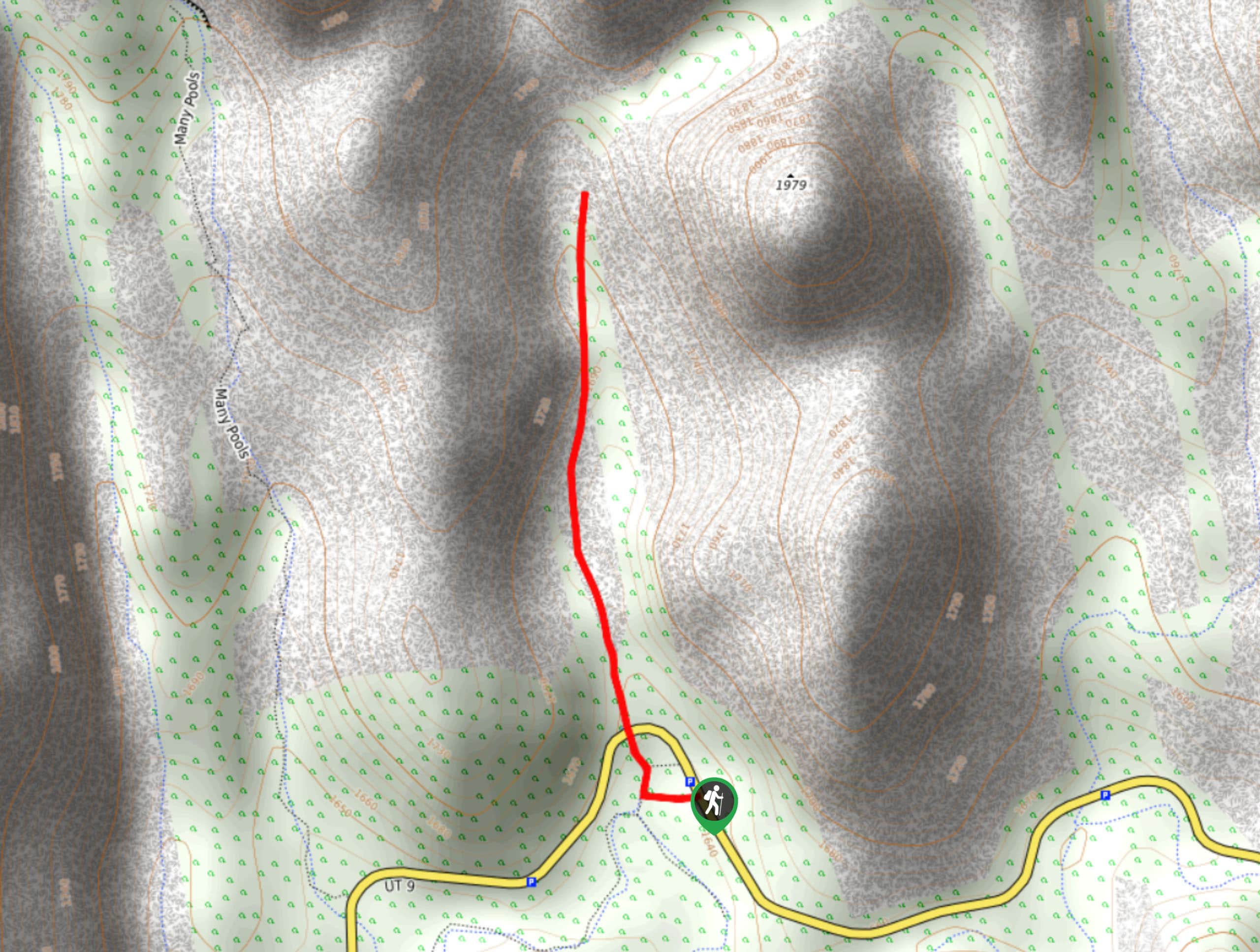
32. The Many Pools Trail
Difficulty
The Many Pools Trail is an unmaintained hike along the Many Pools drainage featuring—you guessed… Read More
33. Angels Landing, West Rim, Telephone Loop
Difficulty
The Angels Landing, West Rim Telephone loop is a good challenge for experienced hikers who… Read More
34. Cable Mountain vis Stave Spring
Difficulty
Hiking the Cable Mountain Trail starting at Stave Spring is a less-travelled trail up to… Read More
35. Wildcat Canyon Trail
Difficulty
The Wildcat Canyon Trail is a peaceful walk through meadows, forest, and grassland in the… Read More
36. Cockeye Falls Trail
Difficulty
The Cockeye Falls Trail is a moderately challenging hike over unmaintained trails in the remote… Read More
37. Northgate Peaks Trail
Difficulty
The Northgate Peaks Trail is a low-traffic hike with beautiful views of the Northgate Peaks… Read More
38. Chinle Trail
Difficulty
The Chinle trail is a low-traffic hike that features the petrified remains of an ancient… Read More
39. West Bank of the Virgin River Hike
Difficulty
The trail along the West Bank of the Virgin River is a family-friendly hike with… Read More
40. Petroglyph Pools Trail
Difficulty
Visit a little-known ancient archive in Zion National Park. The petroglyphs along the Petroglyph Pools… Read More
41. Two Pine Arch Trail
Difficulty
The Two Pine Arch Trail is an unmarked, unmaintained hike without a defined trail. This… Read More
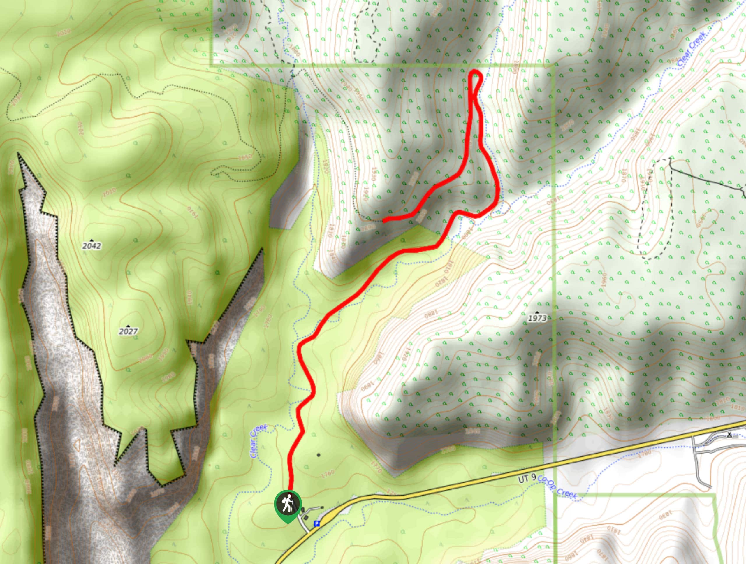
42. The Lower Clear Creek Trail
Difficulty
The Lower Clear Creek Trail, also known as the Hobbit Hole Trail, is a family-friendly… Read More
43. The South Fork of Taylor Creek Trail
Difficulty
The South Fork of Taylor Creek Trail is an unofficial trail that is used as… Read More
44. Shelf Canyon Trail
Difficulty
The Shelf Canyon hike is a low-traffic, out-and-back route that can be a fun challenge… Read More
45. Deertrap Mountain Trail
Difficulty
The Deertrap Mountain trail via the Stave Spring Trailhead is a low-traffic hike with high-quality… Read More
46. Separation Canyon
Difficulty
The Separation Canyon Trail is a great place to go if you want to separate… Read More
47. East Rim Overlook Trail
Difficulty
The East Rim Overlook Trail is a low-traffic subsection of the long and winding East… Read More
48. Wildcat Valley Trail
Difficulty
Not to be confused with the Wildcat Canyon Trail, the Wildcat Valley Trail is a… Read More
49. Coalpits Wash
Difficulty
The Coalpits Wash Trail features both human-made and natural points of interest. The trail features… Read More
50. North Fork of Taylor Creek Trail
Difficulty
The North Fork of Taylor Creek is the least-hiked trail along Taylor Creek. Solitude and… Read More
51. East Mesa Trail to Blew By Peak
Difficulty
The Blew By Peak trail is a subsection of the East Mesa Trail that leads… Read More
52. Observation Point via Stave Spring Trailhead
Difficulty
The hike to Observation Point via the Stave Spring Trailhead is a challenging, out-and-back trail… Read More
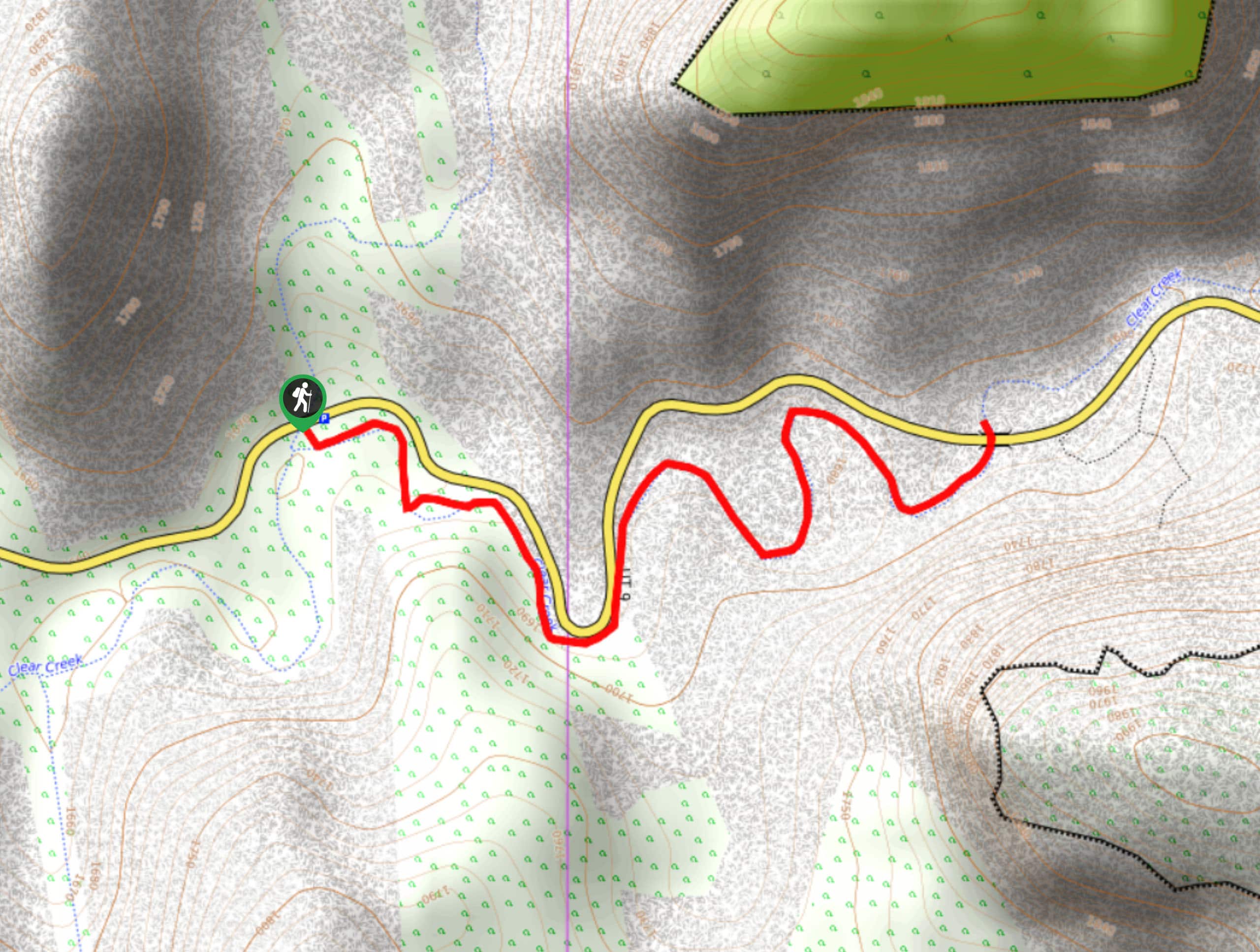
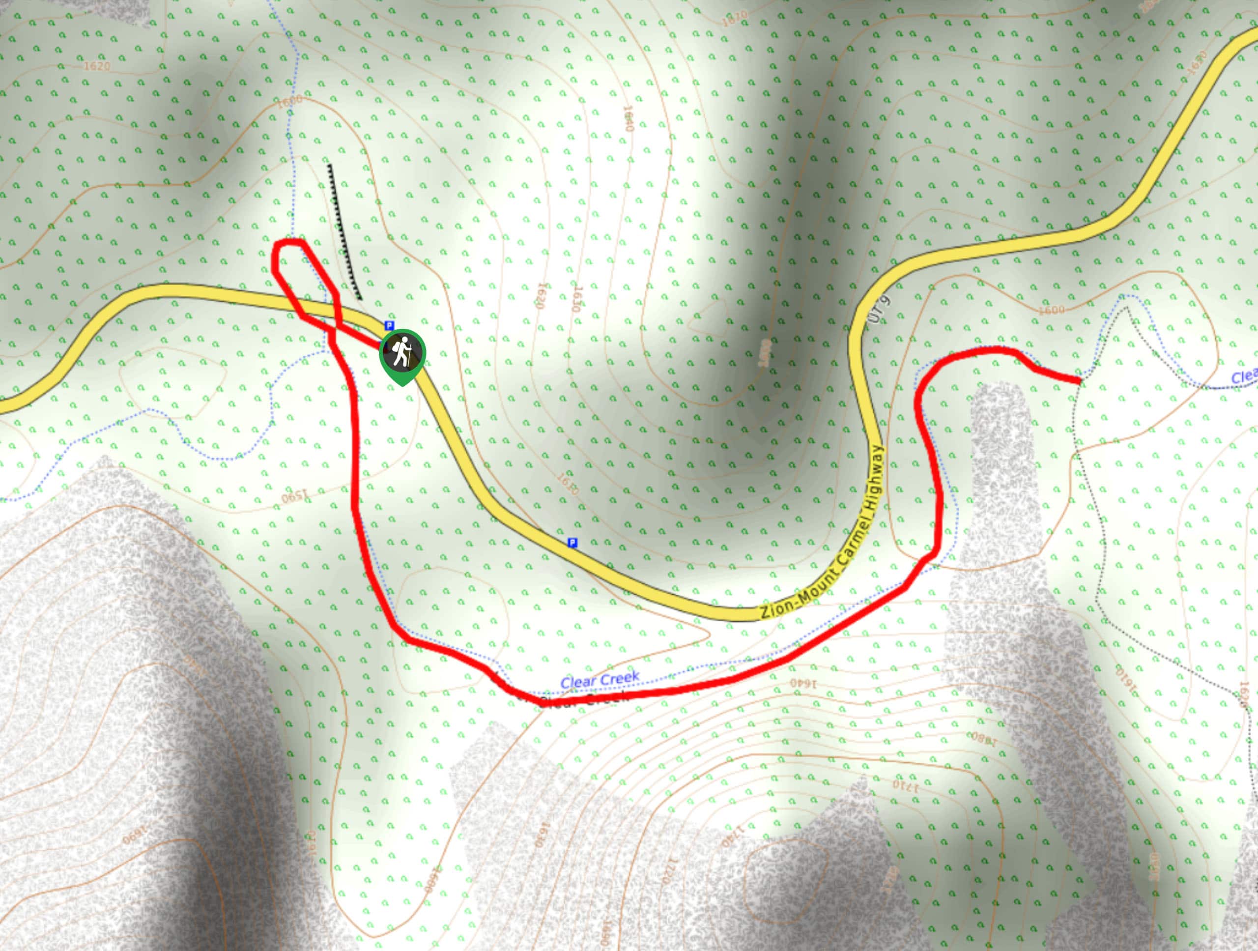
53. Clear Creek Wash
Difficulty
The Clear Creek Wash Trail is an unmarked little hike along route 9 that can… Read More
54. The West Rim Trail (Bottom-up)
Difficulty
The West Rim Trail starting at the southern trailhead is a moderately challenging day hike… Read More
55. East Mesa Trail to East Rim Trail and Observation Point
Difficulty
The East Mesa Trail to Observation Point and The East Rim Trail is a must-do… Read More
56. Gifford Canyon Wash Hike
Difficulty
The Gifford Canyon Wash is a great hike through rugged terrain. This hike can be… Read More

57. Wildcat Canyon Connector Trail
Difficulty
The Wildcat Canyon Connector Trail is a great hike away from the crowds of Zion… Read More
58. Cascade Falls Trail
Difficulty
The Cascade Falls trail is a little-hiked trail just off of route 9 near Springdale,… Read More
59. Sand Bench Loop
Difficulty
The Sand Bench Loop is a low-traffic lollipop trail through the site of an old… Read More
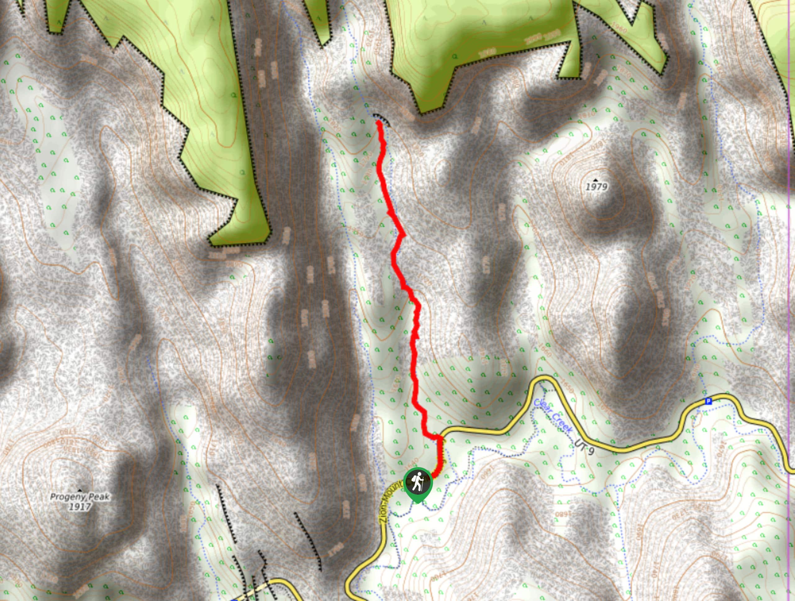
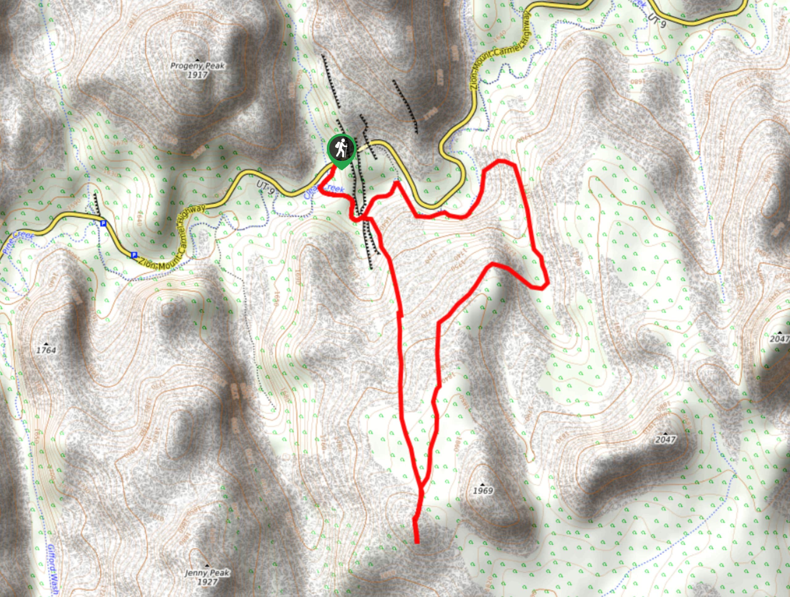
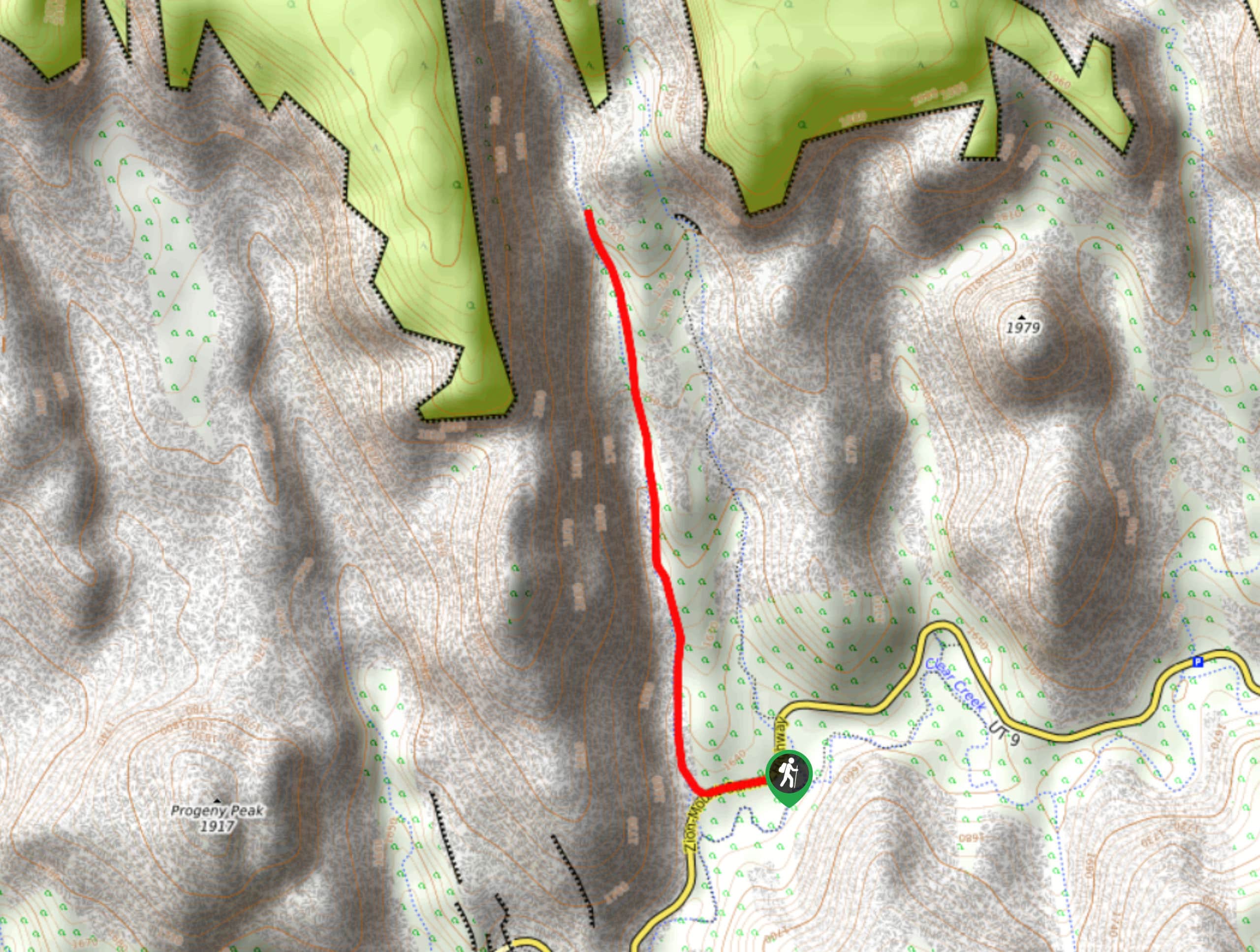
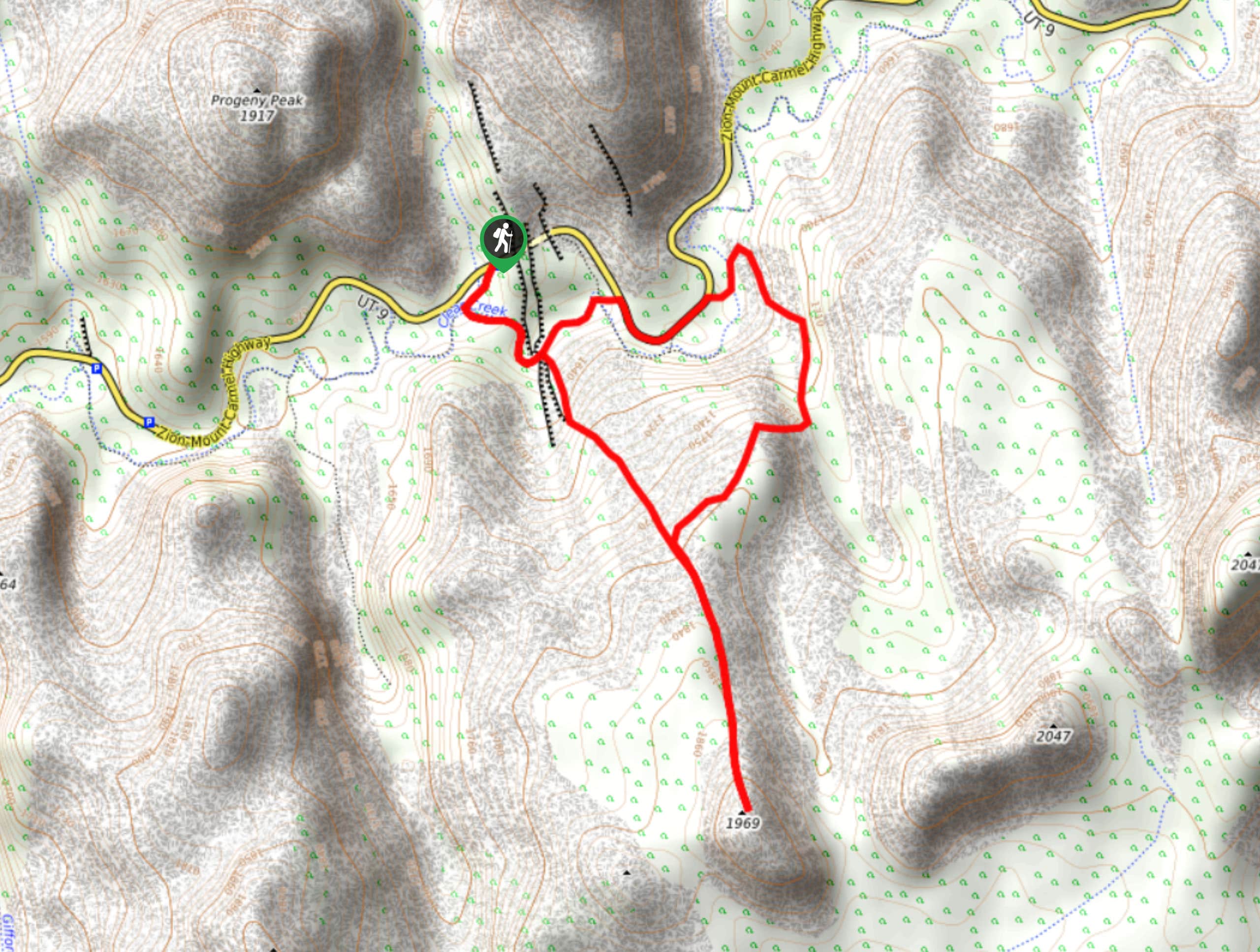
60. Progeny Peak
Difficulty
The Progeny Peak Trail is a low-traffic, unmarked and unmaintained trail in the East Canyon.… Read More
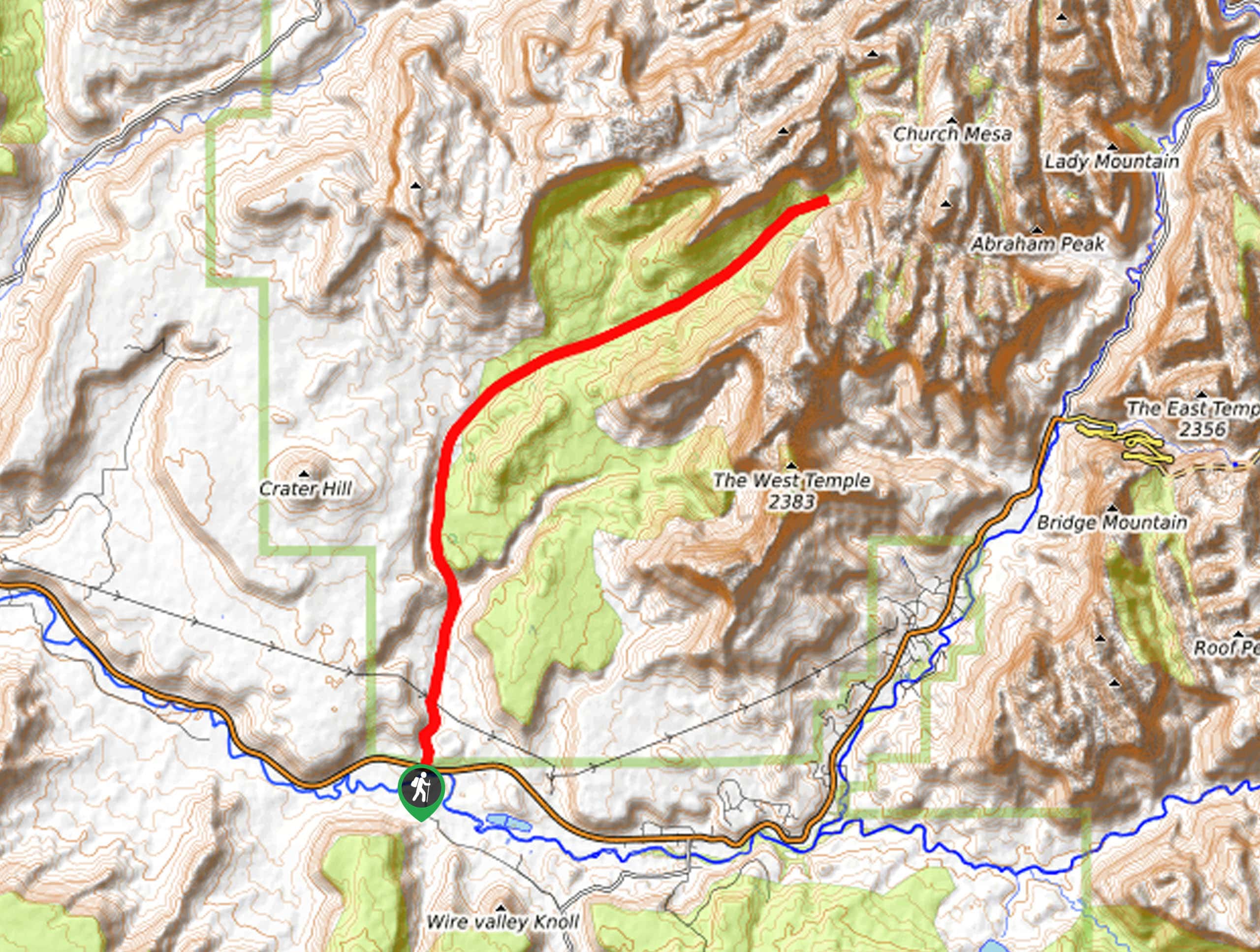
61. Hepworth and Roof Peaks Trail
Difficulty
The trail up to Hepworth and Roof Peaks is a rugged path up and off… Read More
62. West Route Canal Trail
Difficulty
The West Route Canal Trail is a low-traffic route down a little-explored canyon. This path… Read More
63. 6460 Lost Peak Trail
Difficulty
The trail to Peak 6460 (known locally as “Lost Peak”) is a fantastic scramble for… Read More
64. Huber Wash Trail
Difficulty
The Huber Wash trail is a nice hike that runs parallel to the more popular… Read More
65. West Rim to Wildcat Canyon Trail
Difficulty
The West Rim to Wildcat Canyon trail is a low-traffic hike through a beautiful area… Read More
66. Elephant Temple via The Riverside Walk
Difficulty
The hike through the Narrows to the base of Elephant Temple is a challenging day… Read More
67. Pine Creek Narrows Trail
Difficulty
The Pine Creek Narrows Trail is a great little hike exploring beautiful slot canyons just… Read More
68. Camp Creek Trail
Difficulty
The Camp Creek Trail is a rarely visited path down a beautiful box canyon in… Read More
69. Scoggin’s Wash
Difficulty
The Scoggin’s Wash Trail is a true desert hike that links the more popular Coalpits… Read More
70. Zion Ponderosa Checkerboard Trail
Difficulty
The Zion Ponderosa Checkerboard Trail is an easy walk that the whole family can enjoy.… Read More
Are we missing your favourite hike?
Tell us! If you've got photos, a GPS track and know the hike, we'd love to share your favourite hike with the rest of the 10Adventures community.