Observation Point via Stave Spring Trailhead
View Photos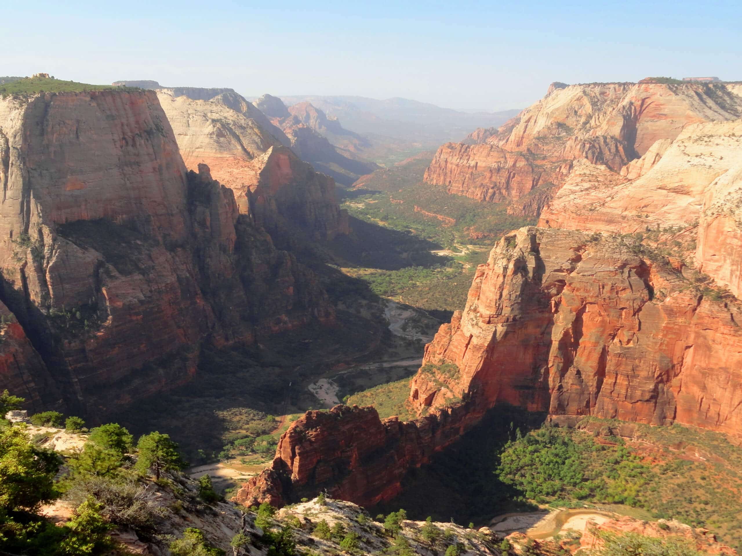
Observation Point via Stave Spring Trailhead
Difficulty Rating:
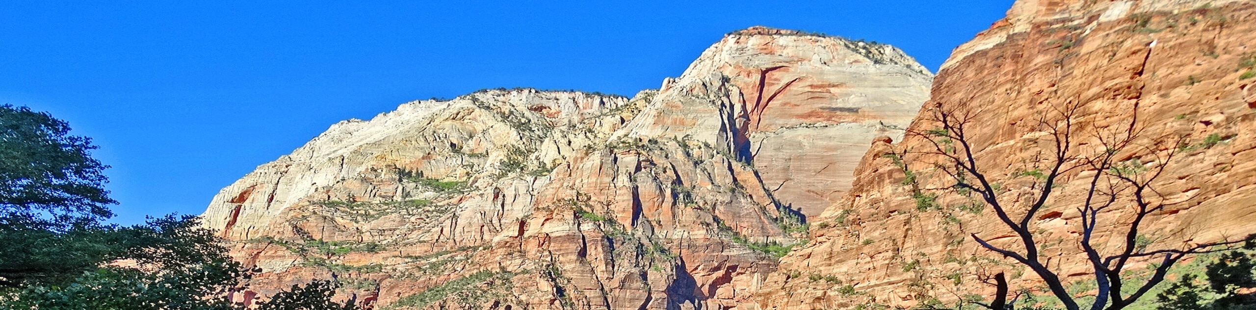
The hike to Observation Point via the Stave Spring Trailhead is a challenging, out-and-back trail with phenomenal views of Zion. This hike has a considerable uphill climb, so wear good hiking shoes and bring more water than you think you need. Don’t forget to bring the camera—the views from the overlook are absolutely jaw-dropping.
Getting there
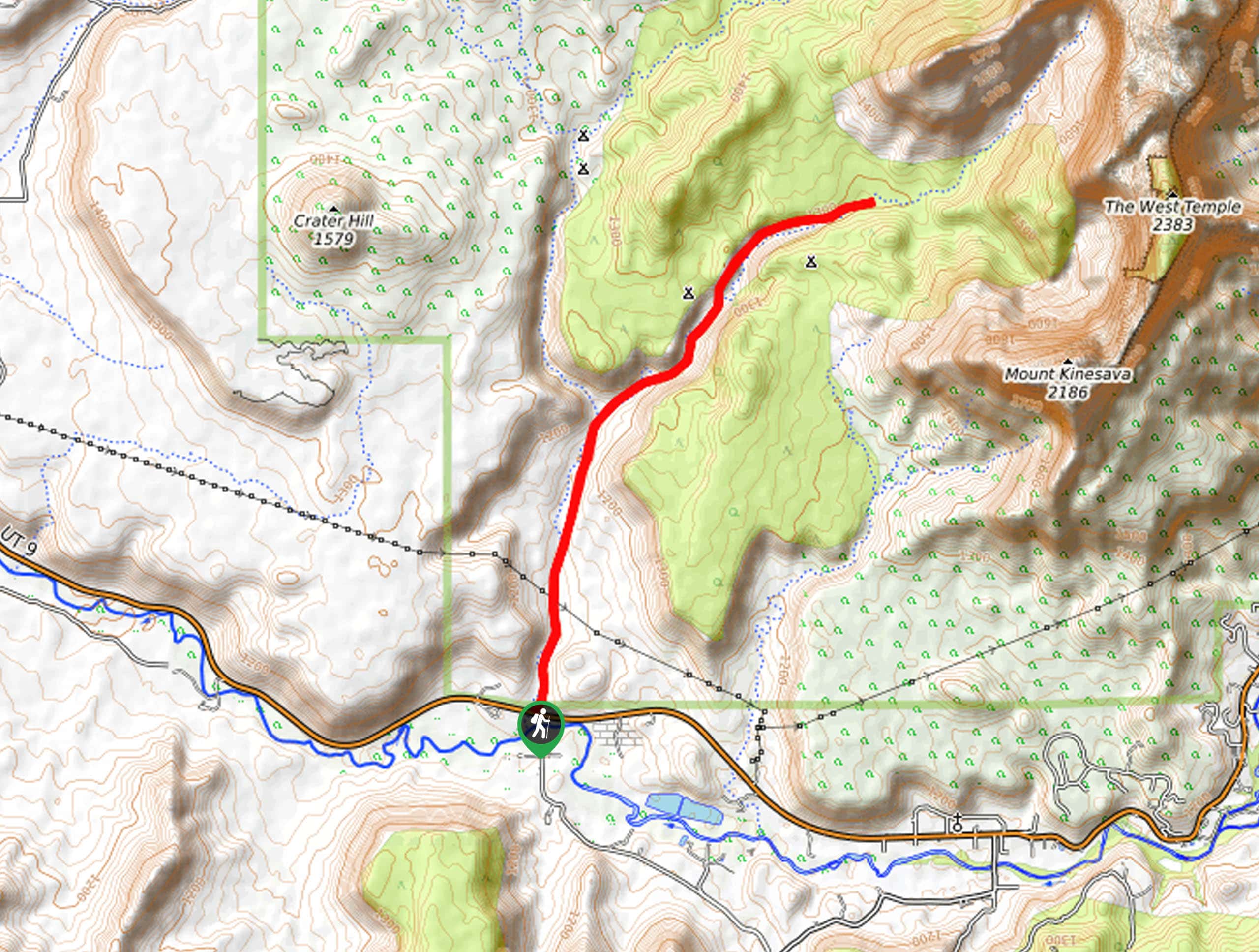
Turn up North Fork County Road off of Highway 9.1mi east of Springdale. Approximately 5.0mi down the road turn left onto Twin Knolls road and follow it westward past the Zion Ponderosa Ranch Resort. Take your second left past the resort onto Buck Road and follow this south to East Pine Street. turn right onto East Pine Street and follow it as it turns into West Pine Street and ends at the Stave Spring Trailhead.

About
| Backcountry Campground | No |
| When to do | year-round |
| Pets allowed | No |
| Family friendly | No |
| Route Signage | Average |
| Crowd Levels | Low |
| Route Type | Out and back |
Observation Point via Stave Spring Trailhead
Elevation Graph
Weather
Observation Point via Stave Spring Trailhead Description
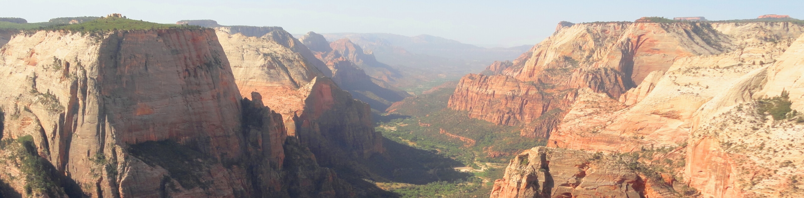
The hike to Observation Point via the Stave Spring Trailhead is a worthy challenge for experienced hikers. This trail has a serious incline and hikers should bring lots of water, electrolytes, and snacks. All the hard work is totally worth the effort—this trail is absolutely phenomenal and the view from Observation Point gives Angels Landing a run for its money.
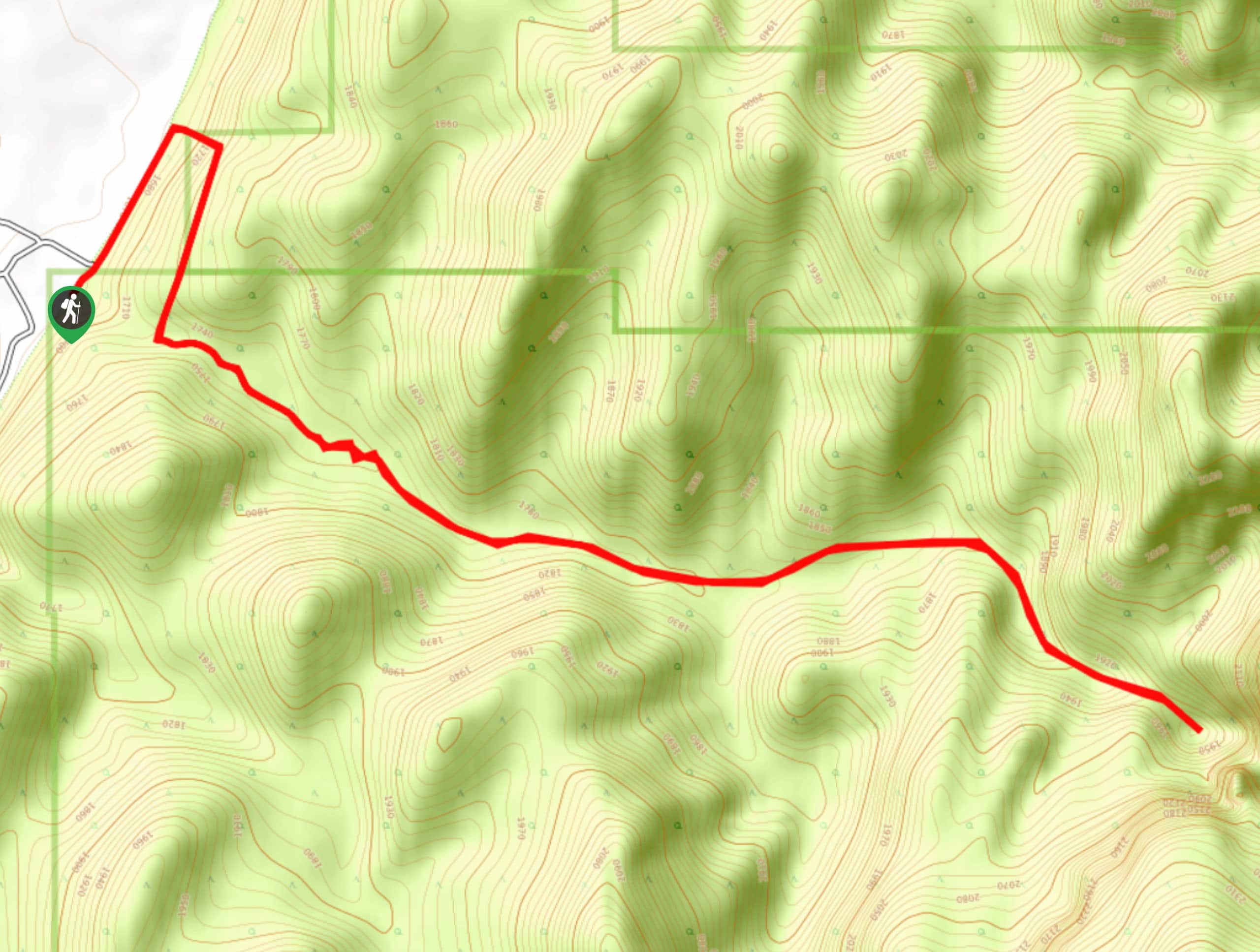
From the Stave Spring Trailhead, follow the path west for about 0.5mi to where the path splits in two. Take a right, and head north; you are now on the East Rim Trail. The East Rim Trail tracks northwest for another 3.7mi before dividing once again. As you follow this section of trail you’ll find yourself hiking through spectacular scenery and up gruelling switchbacks. At the divide, take a left and follow the trail just 0.3mi to Observation Point.
From the overlook, gaze westward over the Virgin River to Angels Landing and Cathedral Mountain. The views from this vantage point are absolutely phenomenal, so be sure to soak in the moment and snap a photo or two before turning back and following the same trail back home.
Similar hikes to the Observation Point via Stave Spring Trailhead hike
Scoggin’s Wash
The Scoggin’s Wash Trail is a true desert hike that links the more popular Coalpits Wash Trail with the iconic…
Camp Creek Trail
The Camp Creek Trail is a rarely visited path down a beautiful box canyon in the Kolob section of Zion.…
Elephant Temple via The Riverside Walk
The hike through the Narrows to the base of Elephant Temple is a challenging day hike through one of the…
Comments