The West Rim Trail (Top Down)
View Photos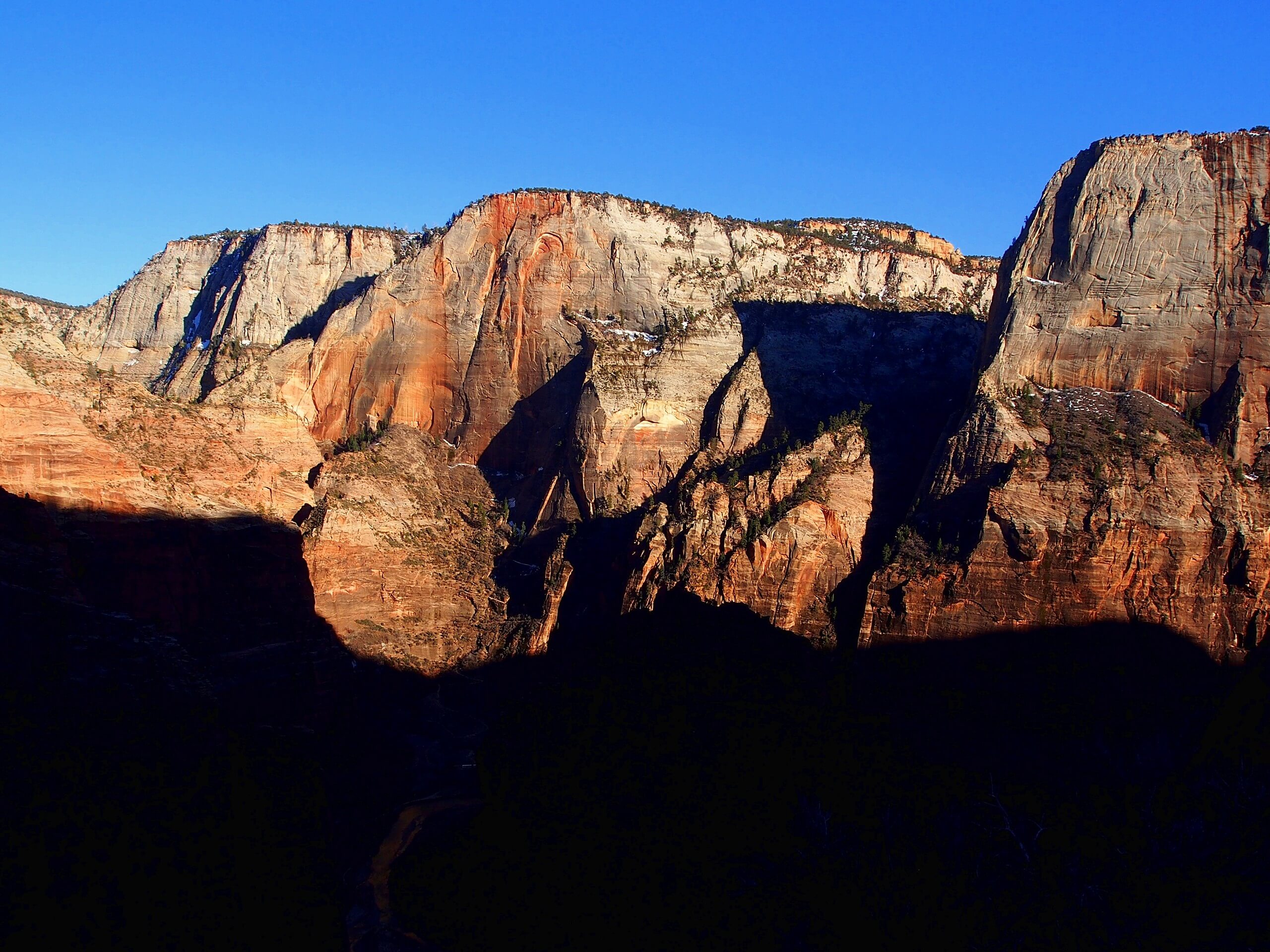
The West Rim Trail (Top Down)
Difficulty Rating:
Do it all in one big day! The West Rim Trail Top-Down route from Lava Point is an ambitious day hike that takes you past some of the most popular and scenic sections of Zion National Park. This hike can be done as a big day hike or broken up into a multi-day backpacking trip. Campsites are available for use along the West Rim trail with a Zion Wilderness Permit.
Getting there
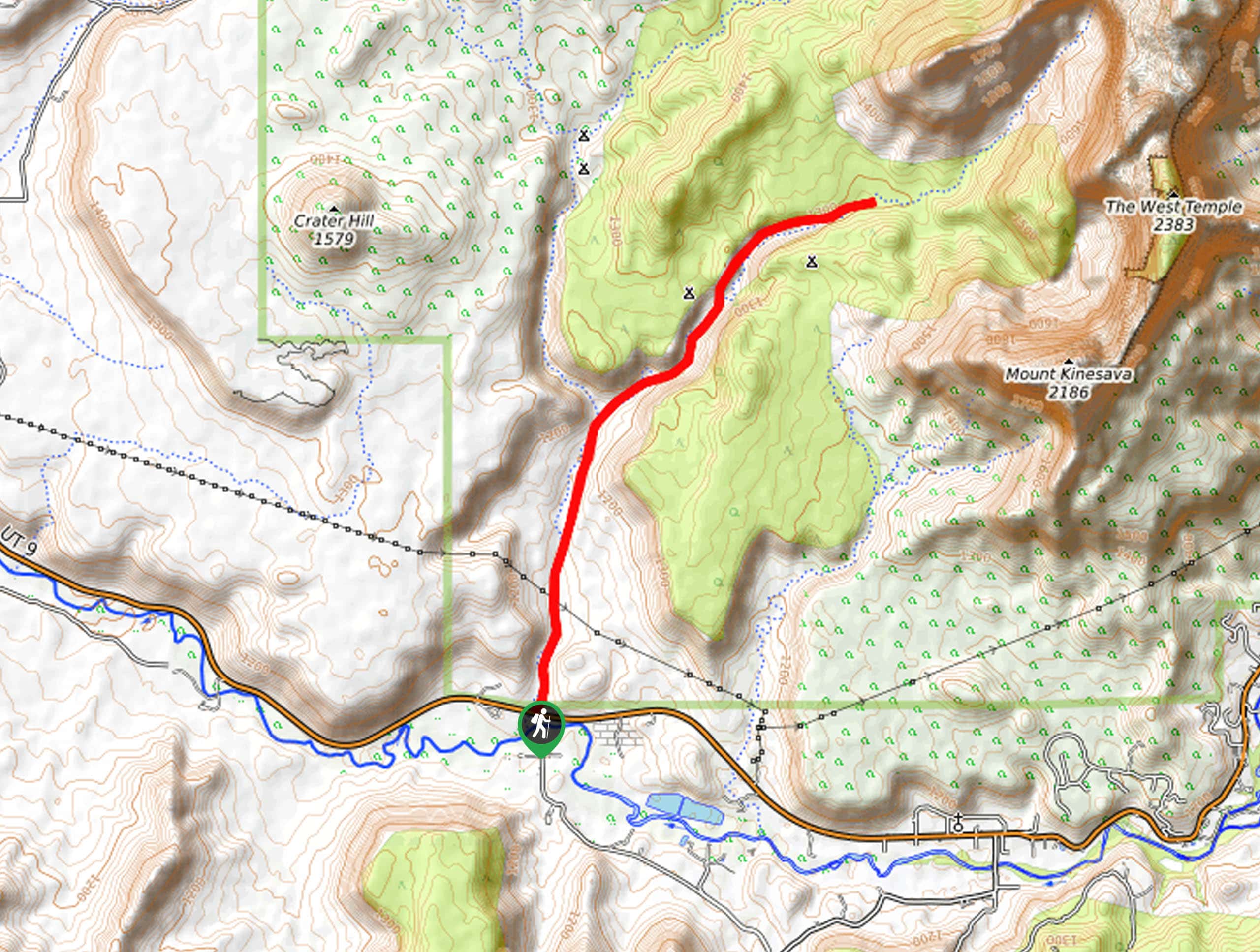
Follow Kolob Reservoir Road northwest for approximately 20.0mi from Route 9 as it passes through Virgin, UT. Look for the turn off to Lava Point on the east side of the road. Turn right onto Lava Point road and then take your first left, branching off before you reach Lava Point Campground. After you take the left, the road will split right away, just stay right and follow the road a short 1.4mi to the West Rim Trailhead.

About
| Backcountry Campground | Campsites 1-9 for use with Zion Wilderness Permit |
| When to do | March to November |
| Pets allowed | No |
| Family friendly | No |
| Route Signage | Average |
| Crowd Levels | Moderate |
| Route Type | One Way |
The West Rim Trail (Top Down)
Elevation Graph
Weather
The West Rim Trail (Top Down) Description
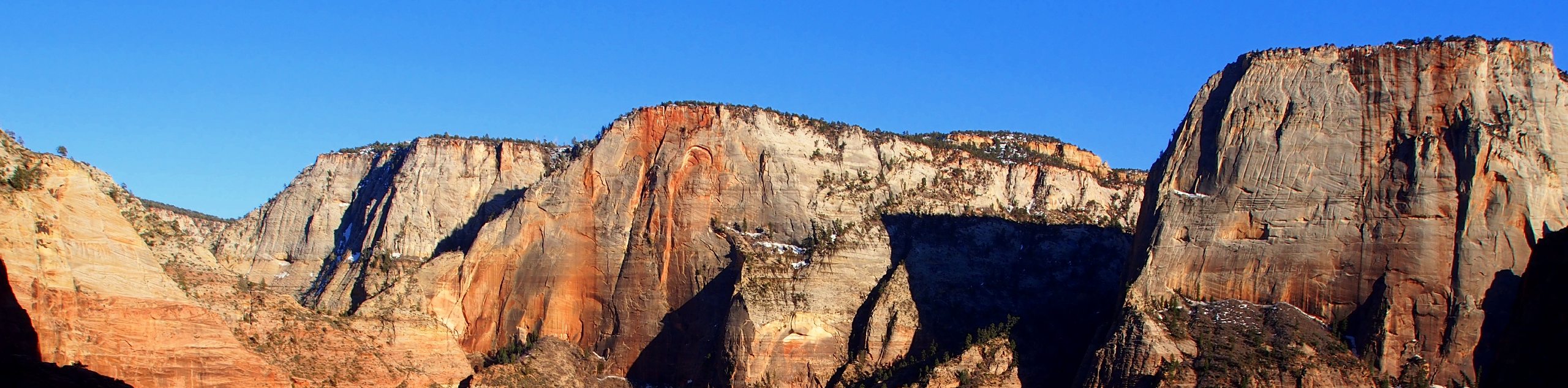
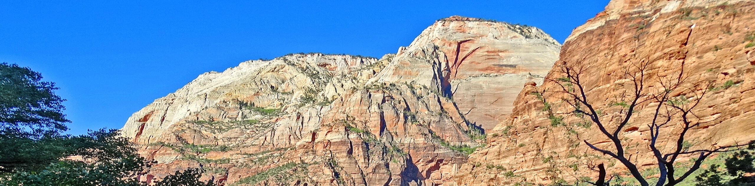
The West Rim Trail Top-Down route takes hikers through some of the most picturesque scenery in Zion National Park. This hike is long and strenuous and not recommended for young children. Proper footwear, lots of water and snacks, and an early start are all musts for this hike. This hike can be broken up into a multi-day backpacking trip to make the distance and elevation more manageable. This hike also has such spectacular scenery, you won’t want to rush your way through. The West Rim Trail from the top down is usually quiet until you reach Scout Lookout and Angels Landing towards the end of the hike. Be prepared for lots of hikers and photographers crowding this last part of the trail.
The West Rim Trail will take you past iconic viewpoints in Zion including Scout Lookout and Angels Landing that overlook the main canyon. The views you earn on this hike are absolutely worth the effort. Be sure to bring along a camera to capture the beauty of this trail.
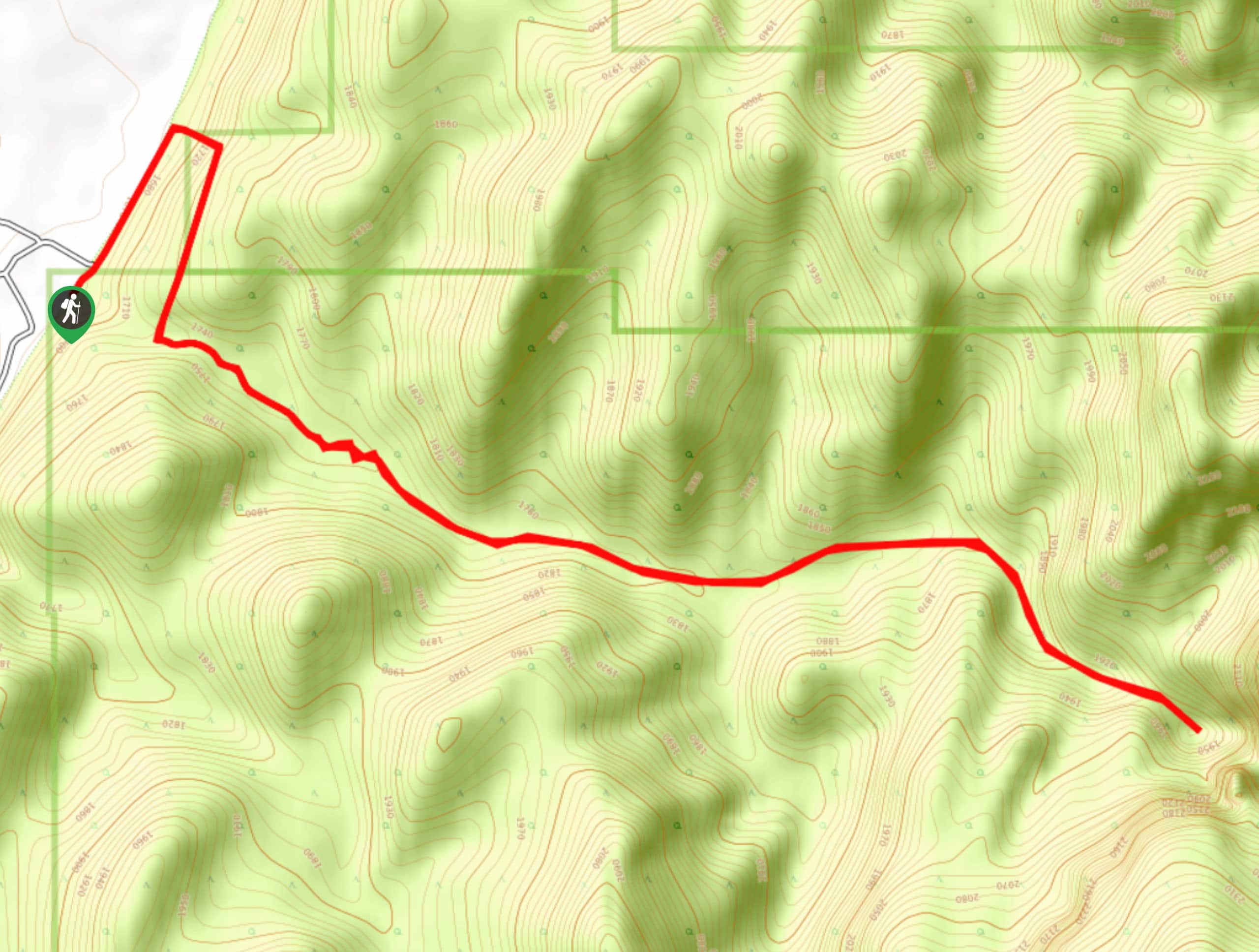
Starting from the Trailhead near Lava Point, follow the West Rim Trail southeast. The Wildcat Canyon trail will branch off on your right just 0.2mi in—stay left at this junction. 1.3mi later, you’ll see a spur trail on the right hand side of this trail. This trail goes down to Sawmill Springs and to campsite 9.
This spring flows seasonally and is a good place to fill up water if you need it. Remember that water from these natural springs is only safe to drink once treated. 4.3mi later there is another spring just off the trail to your left. This is Potato Hollow Spring- it also flows seasonally and is also a good place to fill up. Just a mile and a half past Potato Hollow Spring, the trail divides in two. Stick to your right to stay on the West Rim Trail. The other (left-hand) path takes you along Telephone Canyon before rejoining with the main trail. Both paths are good choices with great views and both will connect again about a mile and a half later at Cabin Spring. Cabin Spring is your last chance to fill up water along the trail, so take advantage of this source if you need to. From Cabin Spring, the trail will begin to get busier as you hike another 2.8 miles to the Angels Landing Trailhead. A side trip up to Angels Landing is an exciting addition to this hike, but if you are not into exposure, enjoy the views from Scout Lookout instead before heading down Walter’s Wiggles into Refrigerator Canyon. A mile and a half down the trail from the 21 switchbacks, you will arrive at the West Rim Southern Trailhead.
Congratulations! You made it! From the Southern Trailhead, cross the footbridge over the Virgin River to the Grotto Picnic site and catch a shuttle back home.
Trail Highlights
Angel’s Landing
Angels Landing is a 1488ft tall formation of Navajo Sandstone that overlooks Zion’s main canyon. The trail up to the overlook is highly exposed and vertiginous. Despite the dangerous approach, Angels Landing is one of the most iconic hikes in Zion National Park.
Walter’s Wiggles
Walter’s Wiggles is a series of 21 switchbacks up a steep section of the West Rim Trail. These switchbacks are located just before the trail branches off to Angel’s Landing in one direction and continues on to Scout’s lookout in the other. The Wiggles are named after the first Park Superintendent: Walter Ruesch, who designed the switchbacks back in 1926.
Insider Hints
This hike is point-to-point- make sure you have a way to get back to your vehicle at the trailhead at the end of the day. Alternatively a private shuttle can be hired in Springdale to drop you off at the trailhead and save you a logistical headache.
This hike is long and exposed: bring good sun protection, and lots of water and electrolytes.
Hiking poles can be a huge help on this trail.
Similar hikes to the The West Rim Trail (Top Down) hike
Scoggin’s Wash
The Scoggin’s Wash Trail is a true desert hike that links the more popular Coalpits Wash Trail with the iconic…
Camp Creek Trail
The Camp Creek Trail is a rarely visited path down a beautiful box canyon in the Kolob section of Zion.…
Elephant Temple via The Riverside Walk
The hike through the Narrows to the base of Elephant Temple is a challenging day hike through one of the…
Comments