Progeny Peak
View Photos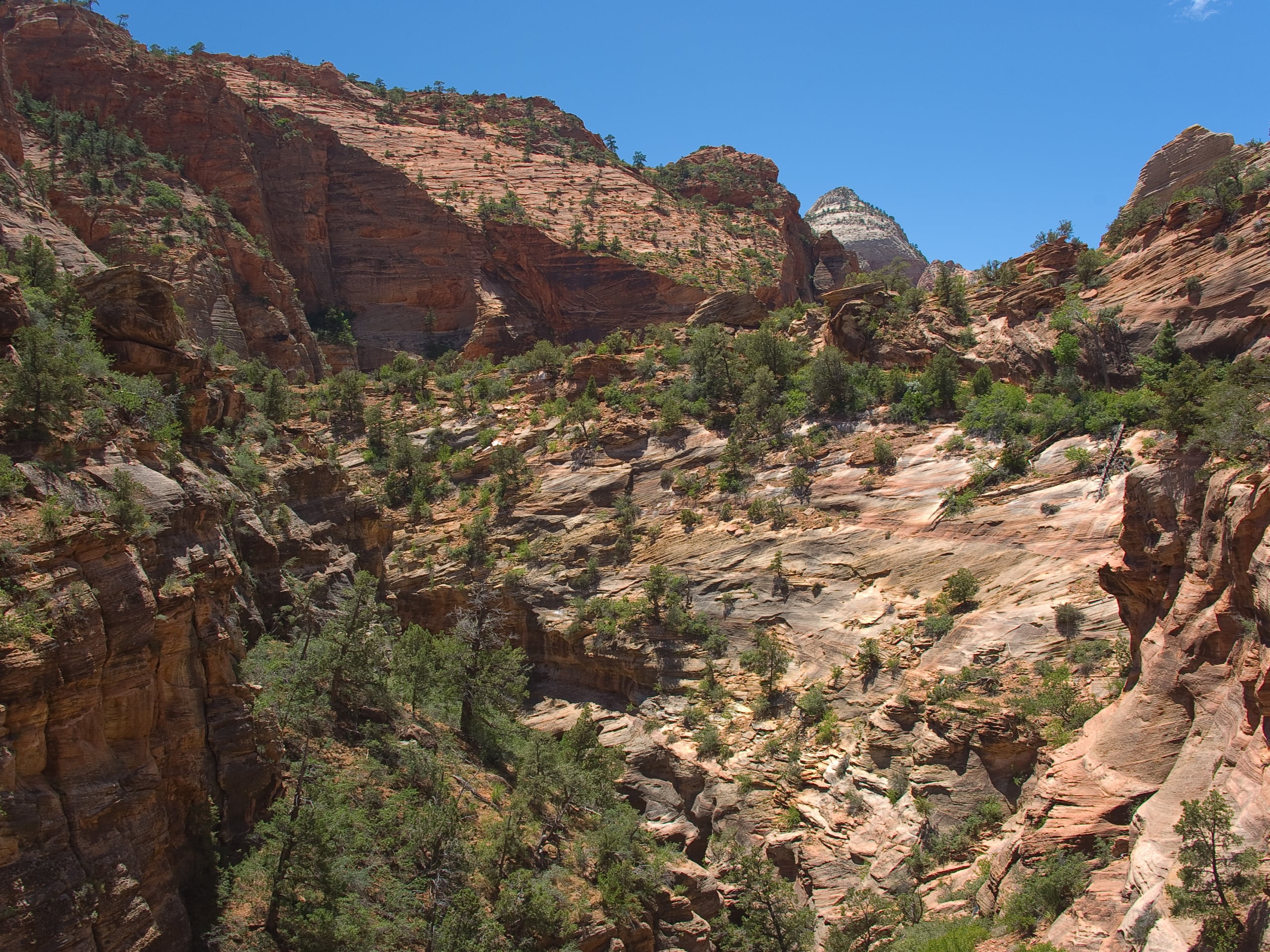
Progeny Peak
Difficulty Rating:
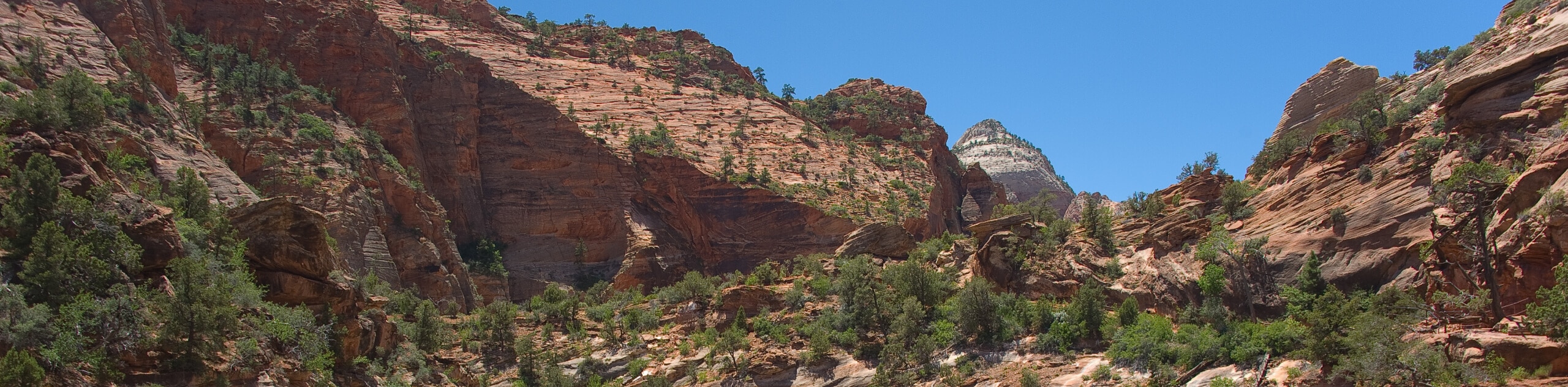
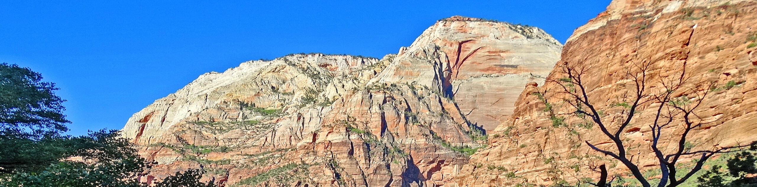
The Progeny Peak Trail is a low-traffic, unmarked and unmaintained trail in the East Canyon. This out-and-back trail passes by the Two-Pines Arch formation and up to the top of Progeny Peak itself. This hike has incredible sandstone features, including hoodoo-like formations that are totally picture-worthy, so don’t forget the camera!
Getting there
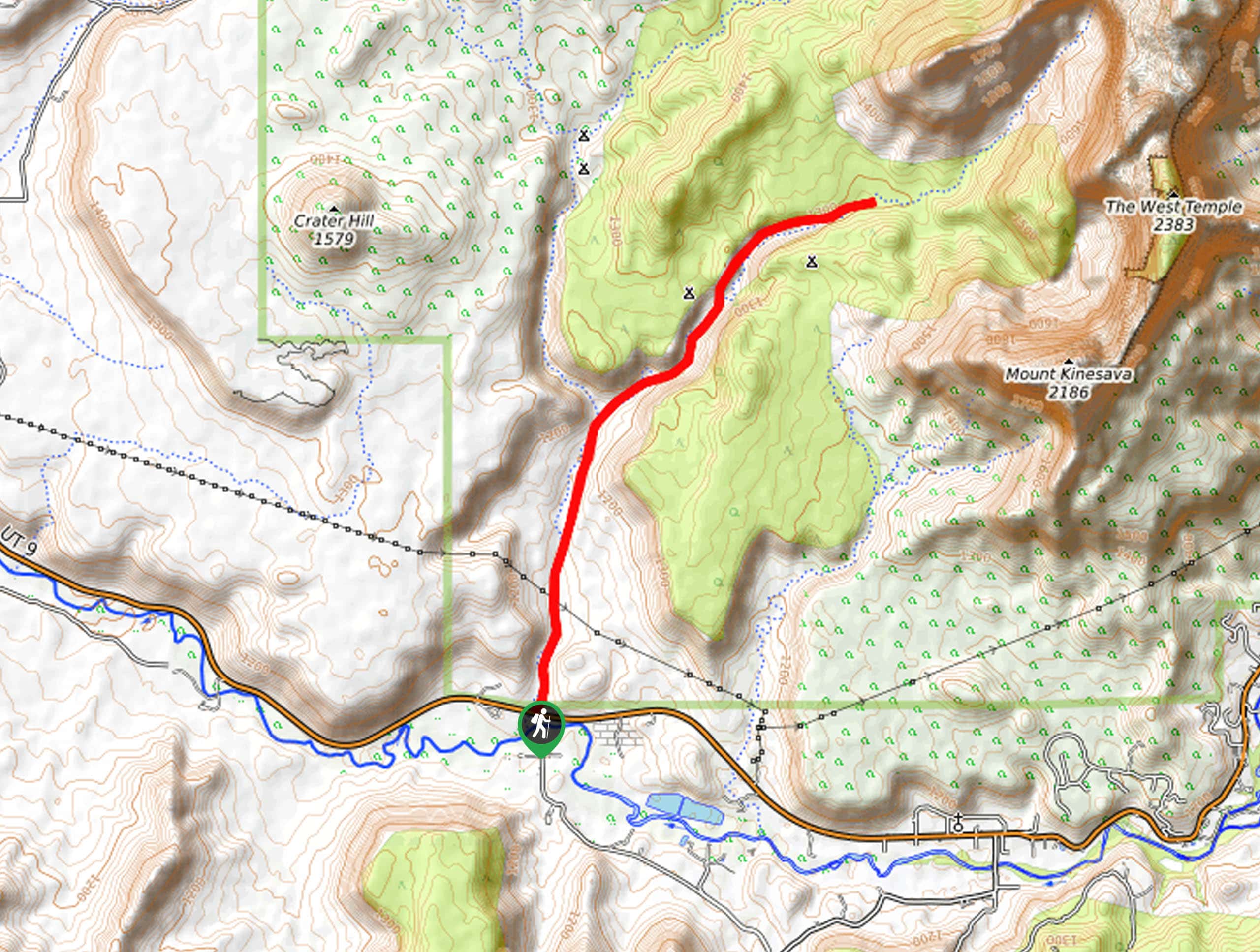
Park at the Canyon Overlook parking area on the east side of the Zion-Mount Carmel Tunnel along route 9 near Springdale, UT.

About
| Backcountry Campground | No |
| When to do | March to October |
| Pets allowed | No |
| Family friendly | No |
| Route Signage | None |
| Crowd Levels | Low |
| Route Type | Out and back |
Progeny Peak
Elevation Graph
Weather
Progeny Peak Description
The Progeny Peak trail is a beautiful, low-traffic hike in Zion National Park. This trail is not well marked, so we highly recommend downloading the map for this hike and bringing a GPS along with you. This trail does require some scrambling towards the end to reach the top of Progeny Peak. If you are not comfortable with scrambling or with exposure, this may not be the best trail for you. However, the views from the top of the trail are absolutely beautiful, and if you’re up for an adventure, this hike is well worth the effort.
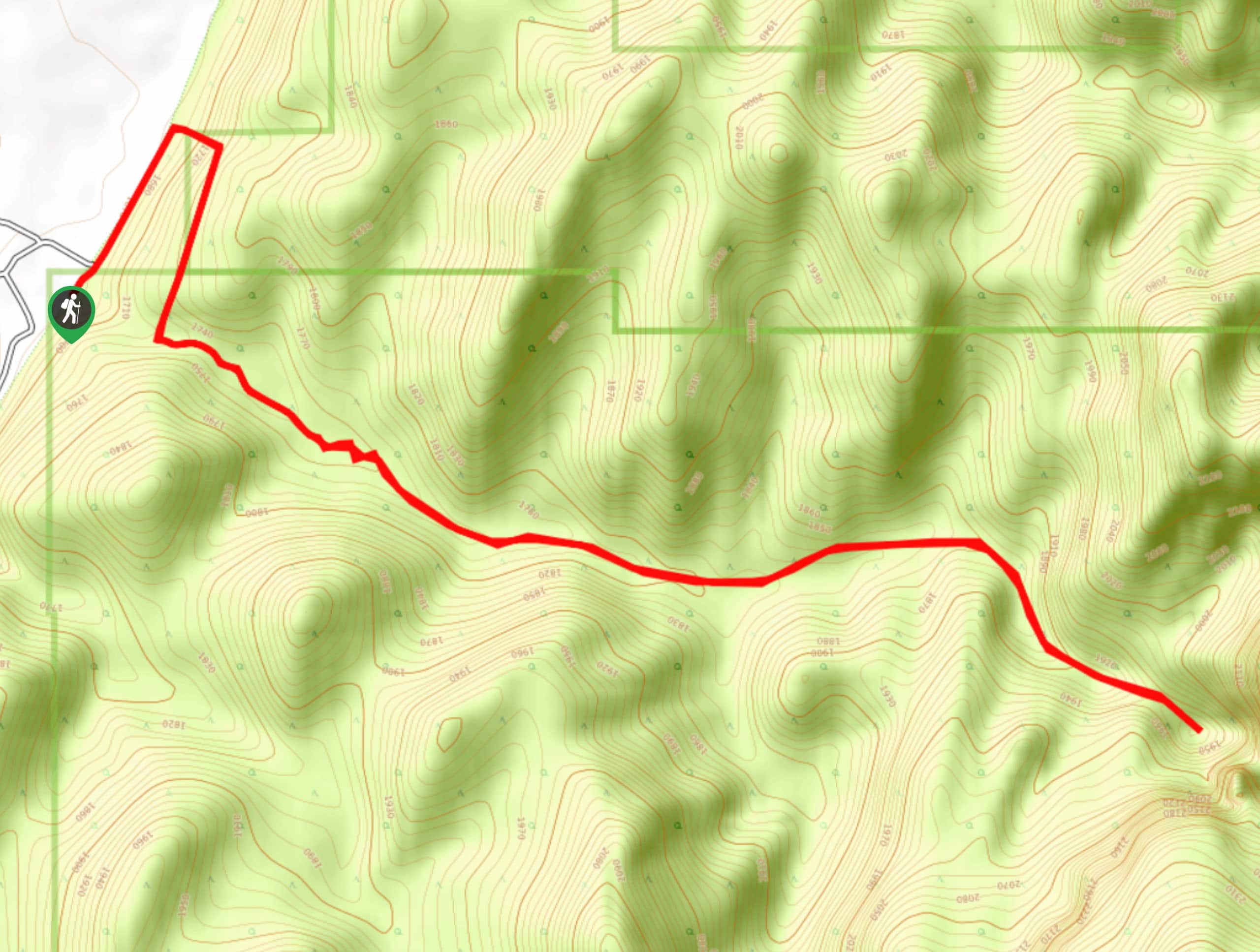
Starting at the Canyon Overlook Parking area, follow route 9 eastward before dipping down on the north side of the road into the wash. It is very common for hikers to accidentally enter the wrong wash. If you find yourself in an open, sandy area with a well-constructed culvert leading under the highway behind you, you are in the wrong place. The Progeny Peak Trailhead is one wash east. Follow the gully as it tracks northeast once you’ve found the smaller wash. Approximately 0.8mi down the trail you will pass the Two Pine Arch. Take a photo and a rest here before continuing on northward. From the arch, it is just 0.2mi to the first saddle- stick to the right of the hoodoos here and follow the ponderosa pines up to the series of ledges. Make your way up the ledges and turn east to follow the large sandstone slabs and smaller ledges all the way to the summit.
At the top, mark your name in the summit logbook and enjoy the view. When it’s time to go, follow the same path back to the car.
Similar hikes to the Progeny Peak hike
Scoggin’s Wash
The Scoggin’s Wash Trail is a true desert hike that links the more popular Coalpits Wash Trail with the iconic…
Camp Creek Trail
The Camp Creek Trail is a rarely visited path down a beautiful box canyon in the Kolob section of Zion.…
Elephant Temple via The Riverside Walk
The hike through the Narrows to the base of Elephant Temple is a challenging day hike through one of the…
Comments