East Rim Trail
View Photos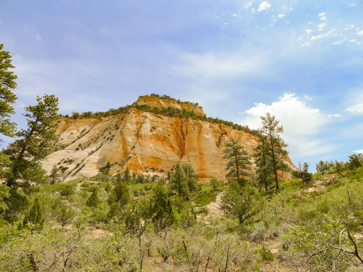
East Rim Trail
Difficulty Rating:
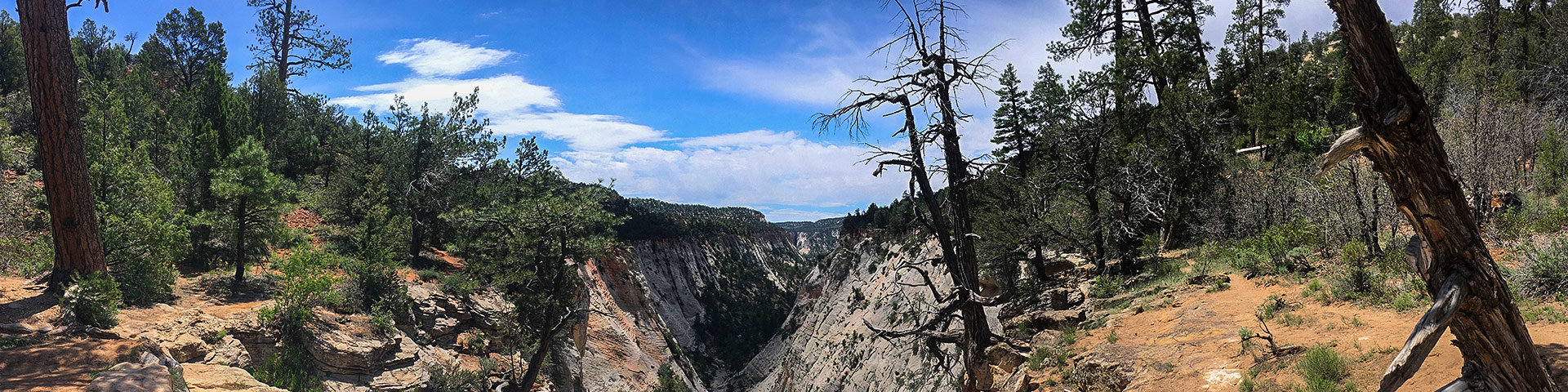
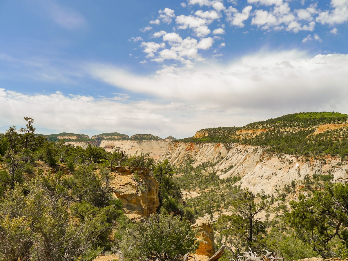
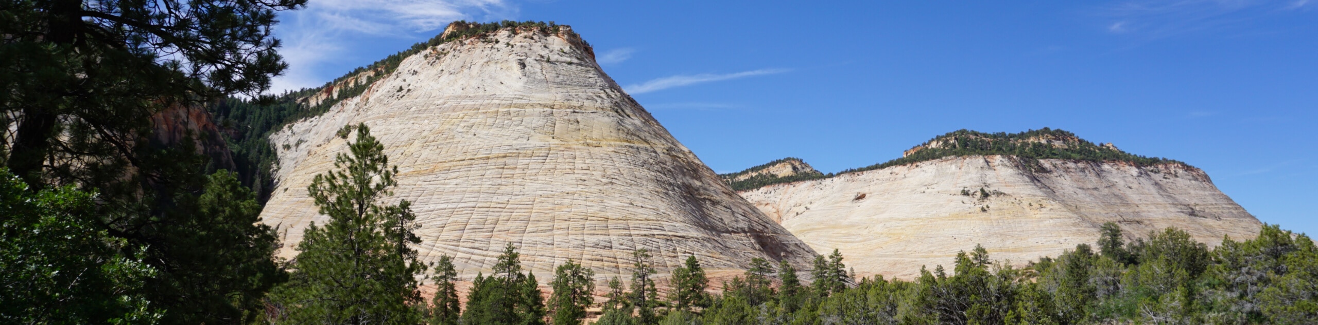
Exploring the rolling hills east of the main canyon, the East Rim Trail yields stunning views at a low physical cost. Continue along the trail as long as you like and bask in the sandstones domes, cliffs, and canyons.
Getting there
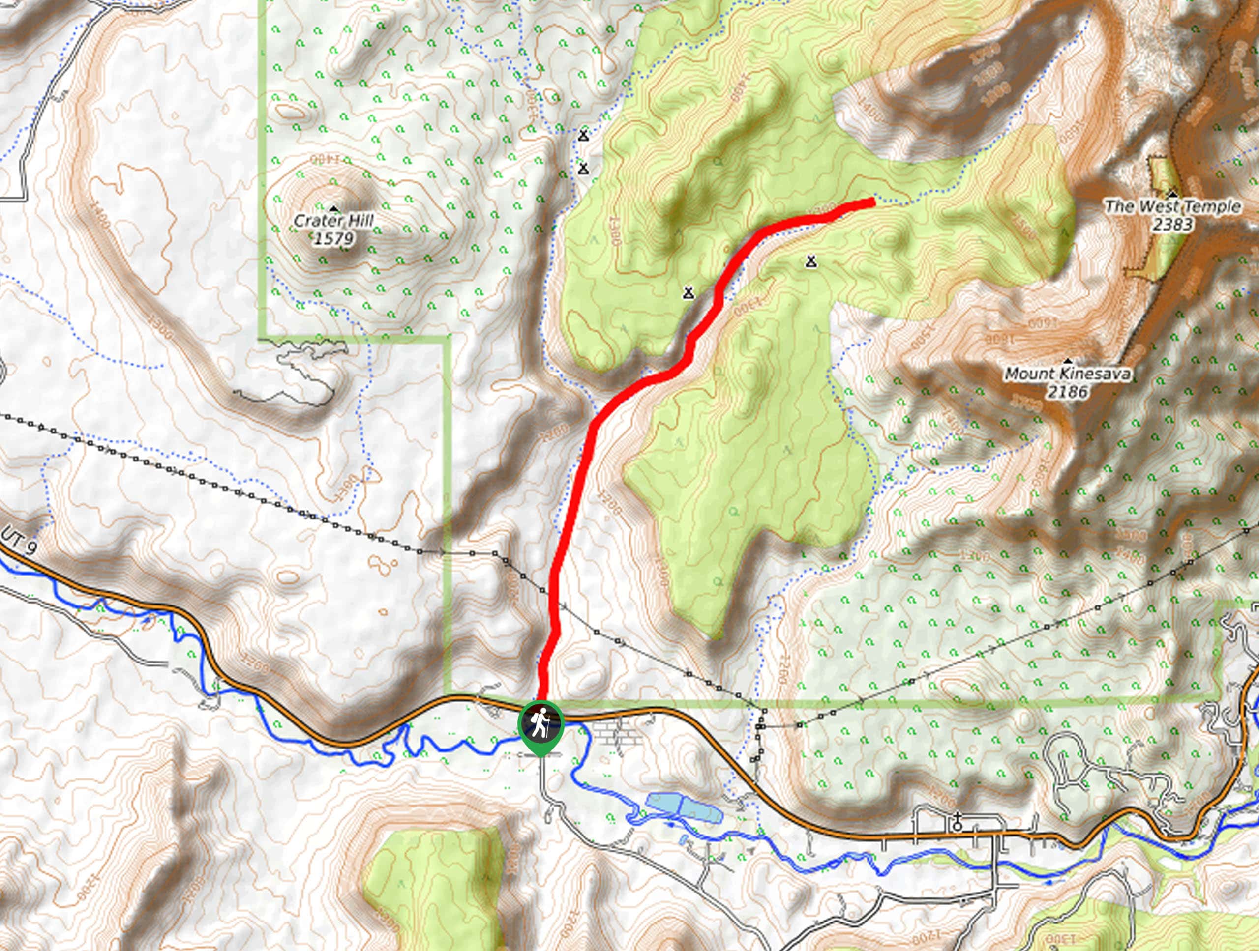
From Springdale enter the park and continue along Utah 9 East. Do not turn left into Zion Canyon. You will go through the famous Zion - Mount Carmel Tunnel, the longest vehicle tunnel in the park system. Follow this road until just before you reach the East Entrance, turning left towards the ambiguous “trailhead” sign. If you coming from the East Entrance, enter the park and almost immediately turn right towards the ambiguous “trailhead” sign. Follow this road past “Private Residence” signs and find the small dirt parking lot at its end.

About
| When to do | Spring and Fall, avoid summer heat |
| Backcountry Campsites | Yes, see visitors centre |
| Toilets | At East Entrance near trailhead |
| Family friendly | Yes |
| Route Signage | Average |
| Crowd Levels | Low to Moderate |
| Route Type | Out and back |
East Rim Trail
Elevation Graph
Weather
Route Description for East Rim Trail
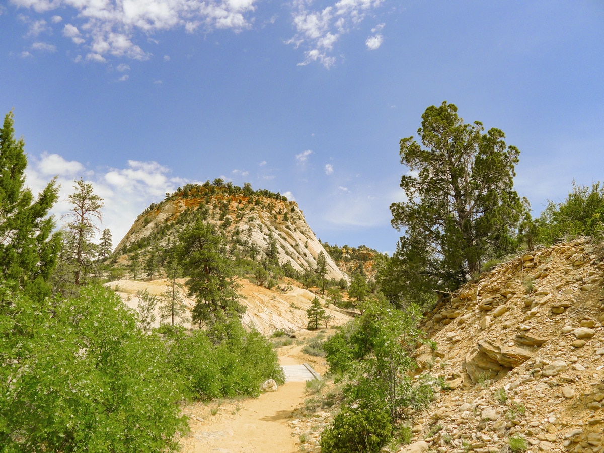
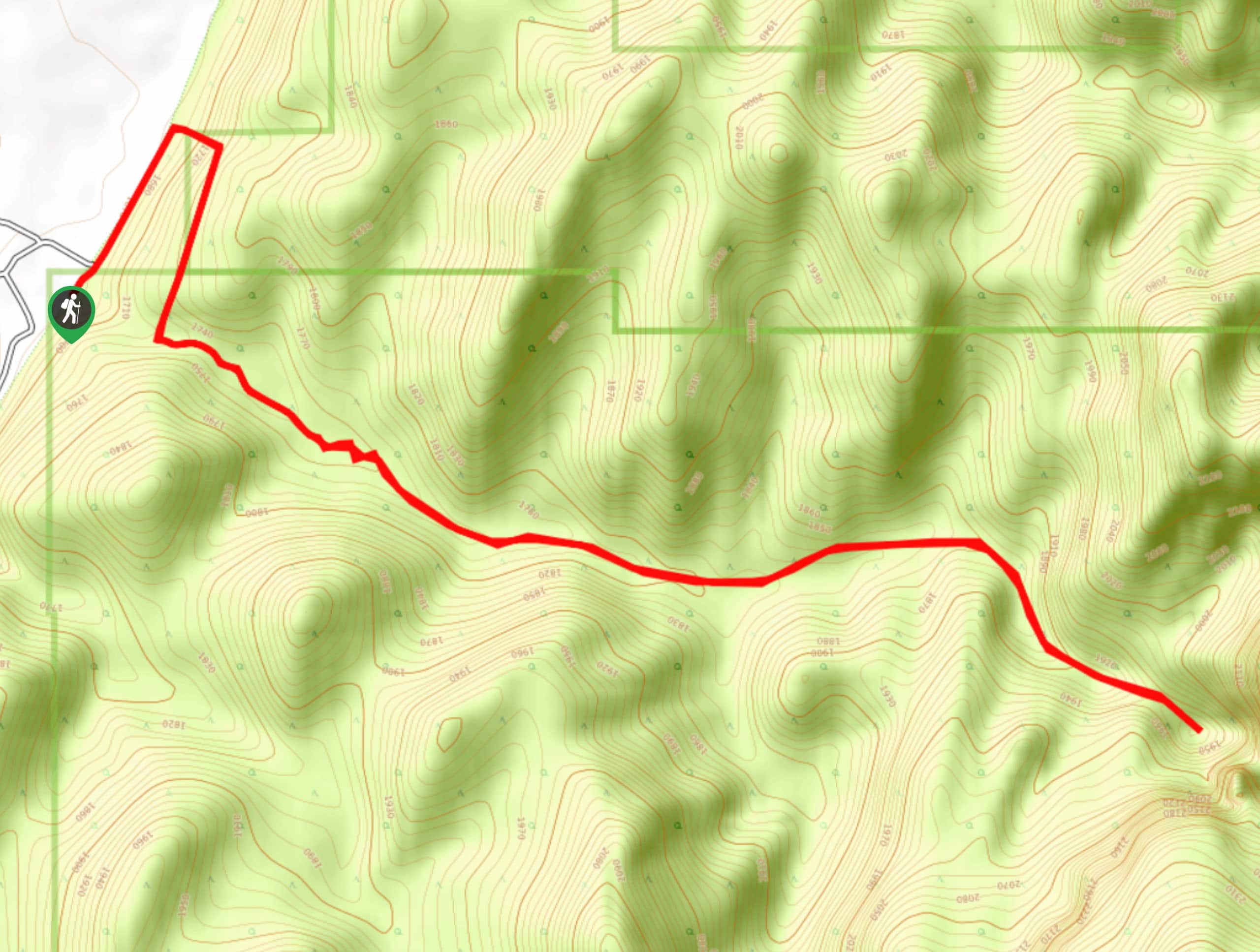
Start along the wide, mostly flat trail as it begins from the far side of the parking lot. You will start to slowly gain elevation as the trail winds along the width of the wide canyon. Soon the trail will start to veer right slightly and the grade will increase.
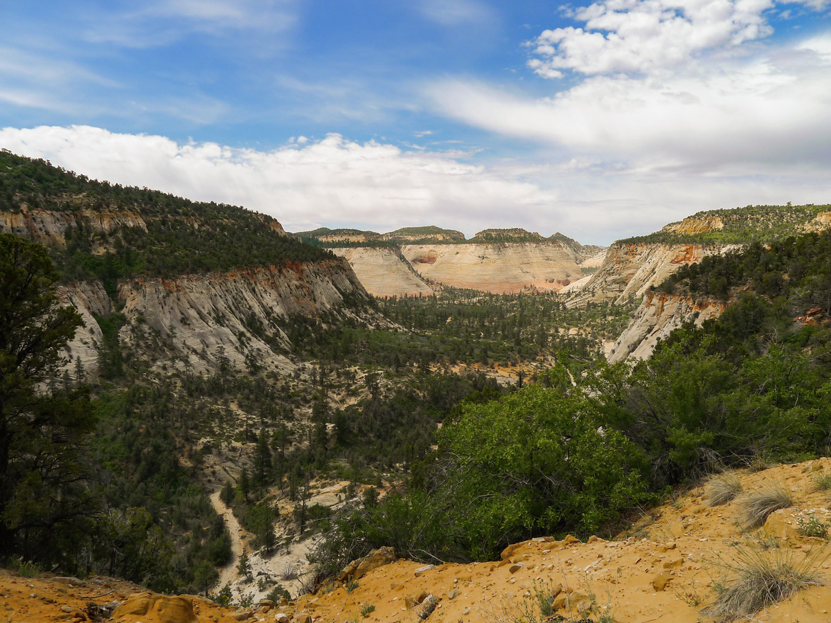
As you enter the canyon you will distance yourself from Clear Creek running bellow you. Ponderosa Pine’s litter most of your surroundings you continue along the trail. Just over halfway through the hike you will switchback to the left and continue to climb. Next you will crest a small ridge, contour around and start to descend slightly.
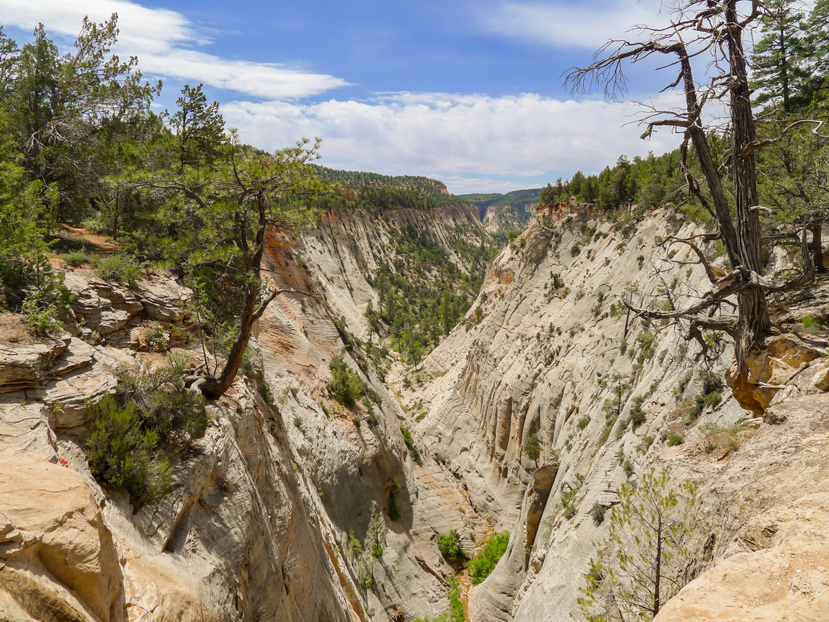
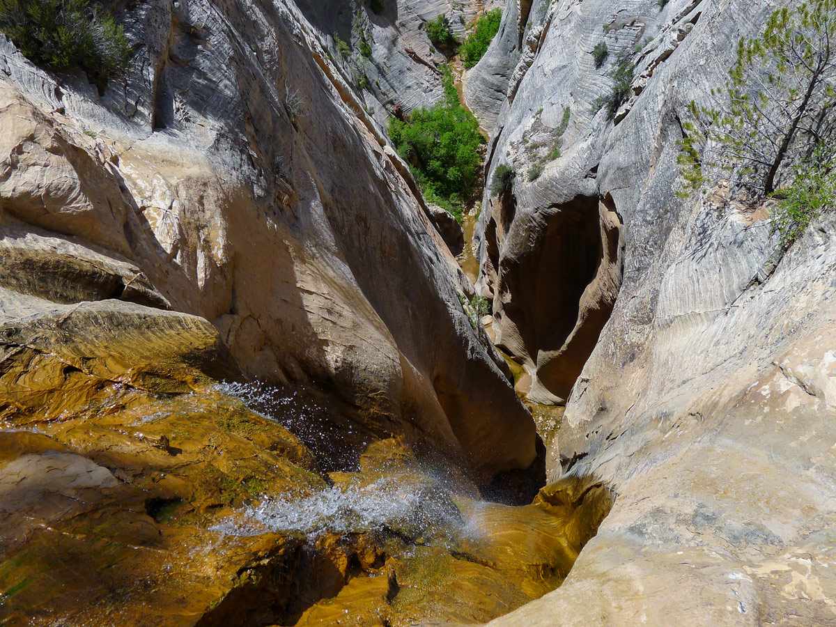
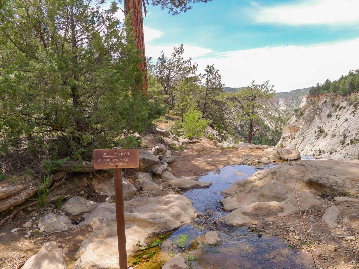
Seemingly out of nowhere you will find yourself beside a gurgling creek. If you proceed to the edge of the cliff you will see the impressive Jolly Gulch. This extremely steep, deep and narrow canyon drops away from your feet and there is no handrail guarding you from going right up to the edge. The Jolly Gulch Creek runs right off the edge, creating a seasonal waterfall!
For most, the Gulch is a fantastic turnaround point, however you can continue along the trail for as long as you wish. From the vantage point at the end of the hike you’ll be able to see all the way across the valley towards Chalkboard Mesa, as well as the plethora of other unnamed mountains and domes. The grey and red slick rock is truly stunning, and the ambiance of the large trees is calming and secluded.
Find other spectacular hikes in Zion:
Insider Hints
Another great turnaround point is Stave Springs, 5.0mi from the beginning of the trail. This would be a grade 3 hike.

Similar hikes to the East Rim Trail hike
Zion Ponderosa Checkerboard Trail
The Zion Ponderosa Checkerboard Trail is an easy walk that the whole family can enjoy. This trail is shared by…
Scoggin’s Wash
The Scoggin’s Wash Trail is a true desert hike that links the more popular Coalpits Wash Trail with the iconic…
Camp Creek Trail
The Camp Creek Trail is a rarely visited path down a beautiful box canyon in the Kolob section of Zion.…
Barbara Clarkson 4 years ago
Beautiful and not too difficult a hike. Absolutely stunning and a must do.
Frank M. 4 years ago
Fairly easy hike with amazing views. fresh air and nature is what you find here, we love it.
Joe Bart 5 years ago
Great hike to do if you want to avoid the crowd. It's not as magical as Canyon Overlook, but it's still worth doing.
Yuli H. 5 years ago
Nice family-friendly hike. Overall it was short and easy. I highly recommend it.
Washington H. 5 years ago
Easy trail. East Rim is a fantastic hike. However, it would be better to be more cautious while passing the edge of the cliff.
Jane L. 5 years ago
Great hike to explore. There were some mild inclines, but they are manageable. Bring lots of water, especially if you plan to start during the late afternoon.
Walter Blu 5 years ago
East Rim Hike was nice, good views, I did not have many people around me and the weather was great.
Zuzu T. 5 years ago
Wow this is fun! It felt great to hike here.
SteffWilk 5 years ago
East rim trail was good to finish the day with. Good views and you don't spend too much effort on it.
Jane 5 years ago
Nice views, fewer people, really enjoyed it.