The South Fork of Taylor Creek Trail
View Photos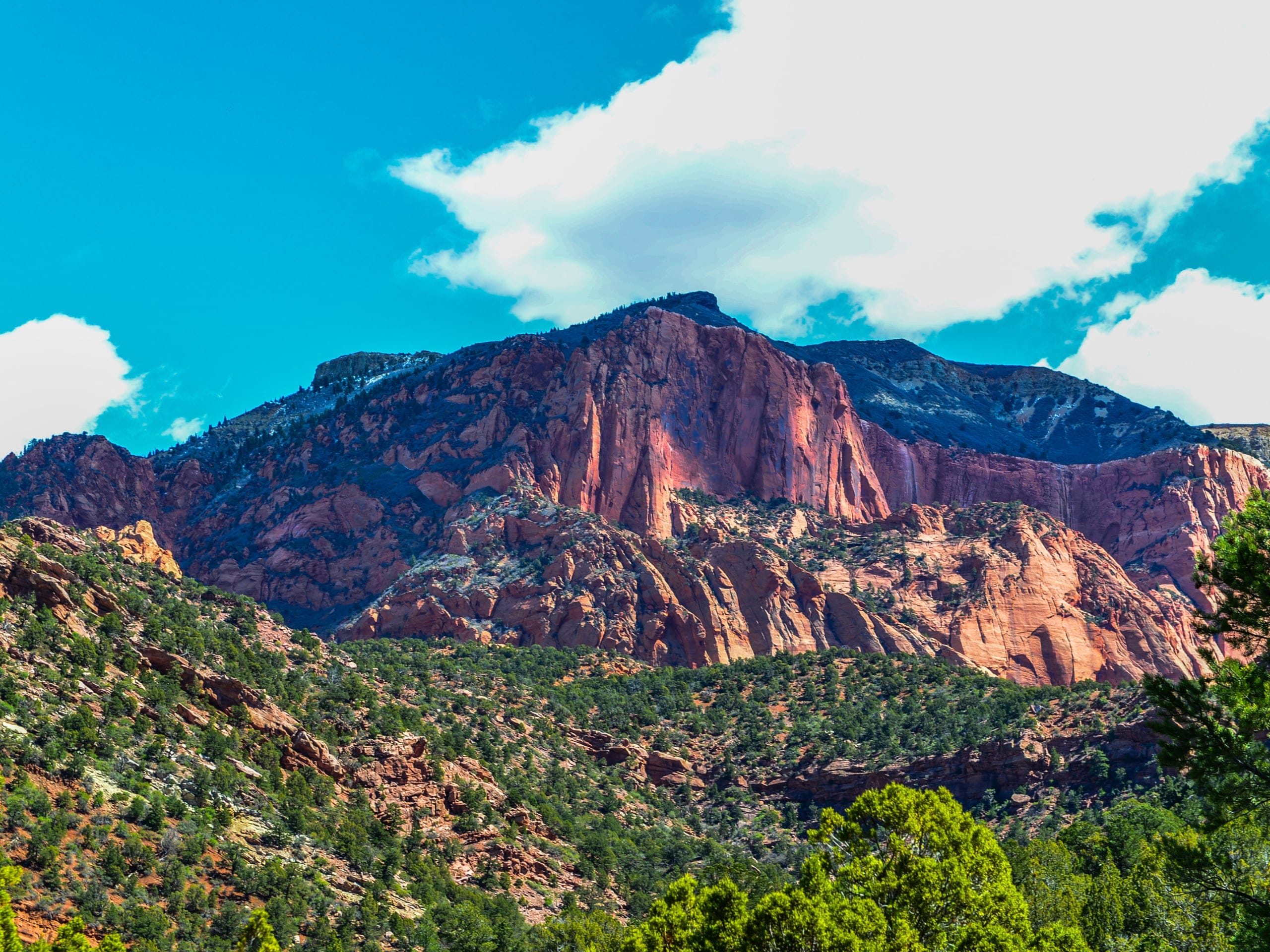
The South Fork of Taylor Creek Trail
Difficulty Rating:
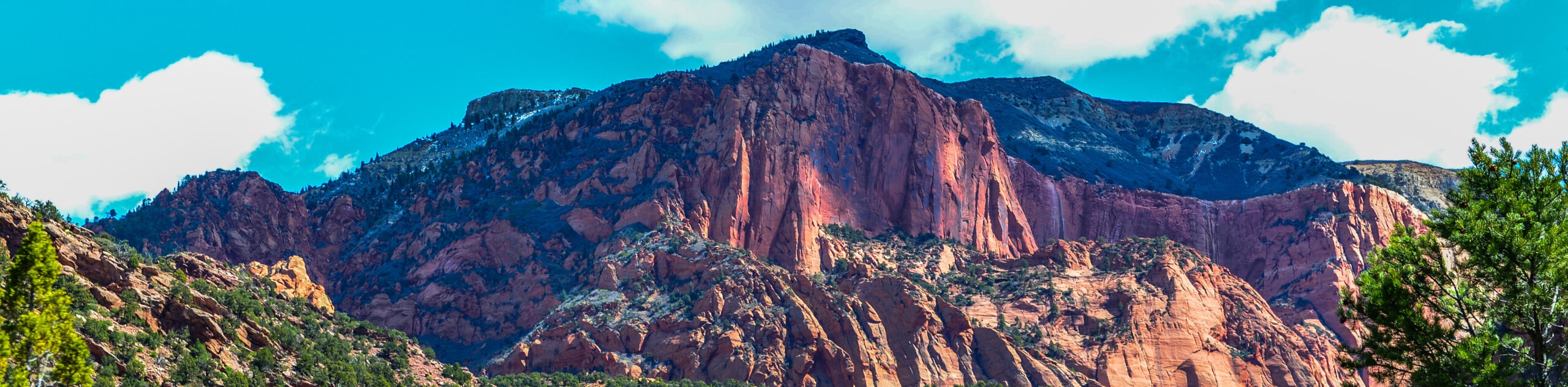
The South Fork of Taylor Creek Trail is an unofficial trail that is used as an access point for rock climbers. This trail is beautiful and shady and is a great alternative to the more popular Middle Fork Trail. This out-and back trail is family-friendly and a great hike to do on a hot summer day.
Getting there
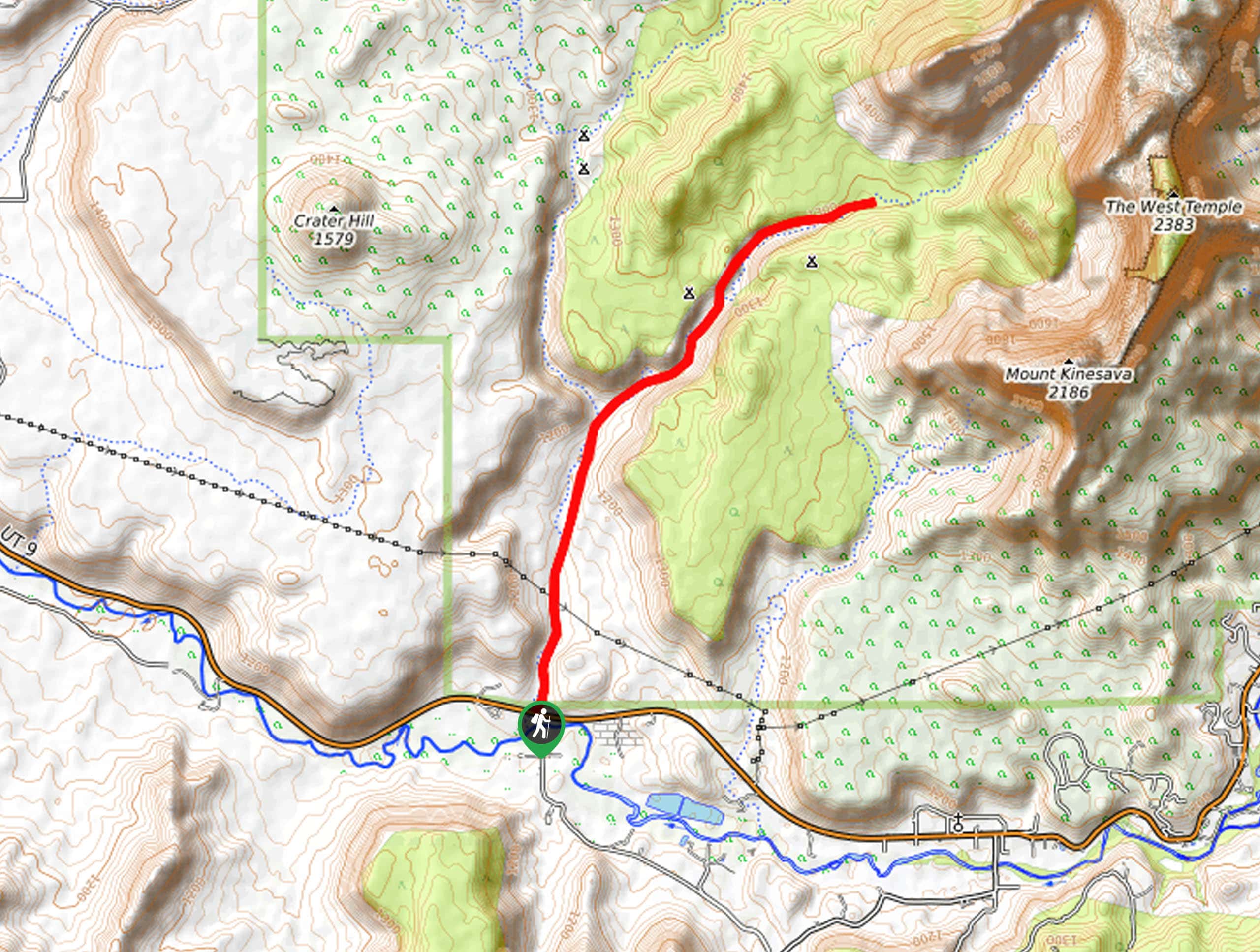
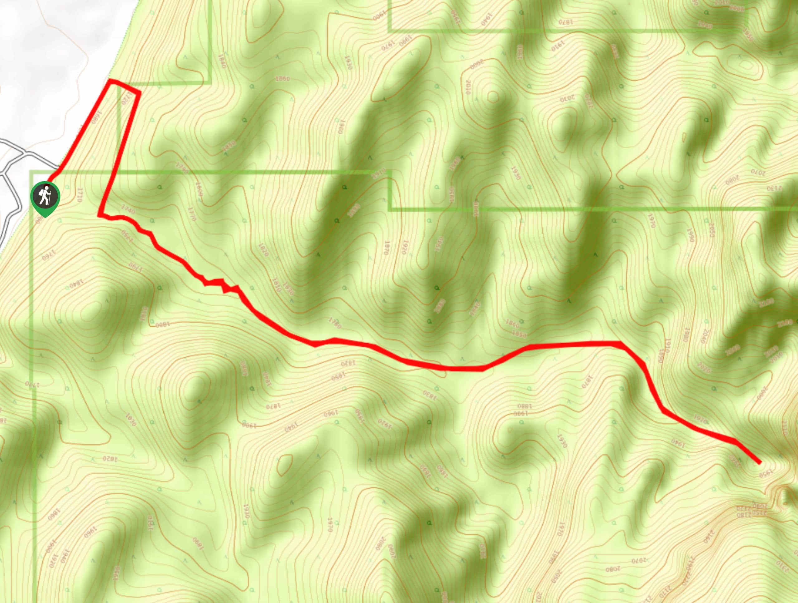
The parking area for this trail is approximately 3.3mi down Kolob Canyons Road from the Visitor Center along Highway 15. The parking lot is located between the Middle Fork Taylor Creek Trailhead and the Lee Pass Trailhead.

About
| Backcountry Campground | No |
| When to do | year-round |
| Pets allowed | No |
| Family friendly | Older Children only |
| Route Signage | Poor |
| Crowd Levels | Low |
| Route Type | Out and back |
The South Fork of Taylor Creek Trail
Elevation Graph
Weather
The South Fork of Taylor Creek Trail Description
The South Fork of Taylor Creek Trail is a shaded, quiet trail through one of the Kolob Finger Canyons. This trail is unofficial but well defined. Wear good shoes and be prepared to hike upwards through sand. The shade thrown by the canyon walls can make it feel a bit chilly along this trail, so bring a layer along with you, especially if you are hiking outside of the summer season.
From the parking area, cross over to the north side of the road where you will find the trailhead. This trail is a straightforward path heading eastward up the canyon. The path will ascend for the first 0.5 miles as it goes up the remains of an ancient landslide before levelling out into a cool forest. The trail is well above the stream bed, so you don’t have to worry about getting wet feet. Keep an eye out for rock climbers scaling the striped sandstone walls.
You’ll know you’ve reached the end of the trail when the canyon becomes impassable. At this point, turn back and follow the trail back home.
Similar hikes to the The South Fork of Taylor Creek Trail hike
Zion Ponderosa Checkerboard Trail
The Zion Ponderosa Checkerboard Trail is an easy walk that the whole family can enjoy. This trail is shared by…
Scoggin’s Wash
The Scoggin’s Wash Trail is a true desert hike that links the more popular Coalpits Wash Trail with the iconic…
Camp Creek Trail
The Camp Creek Trail is a rarely visited path down a beautiful box canyon in the Kolob section of Zion.…
Comments