La Verkin Creek Trail to Kolob Arch
View Photos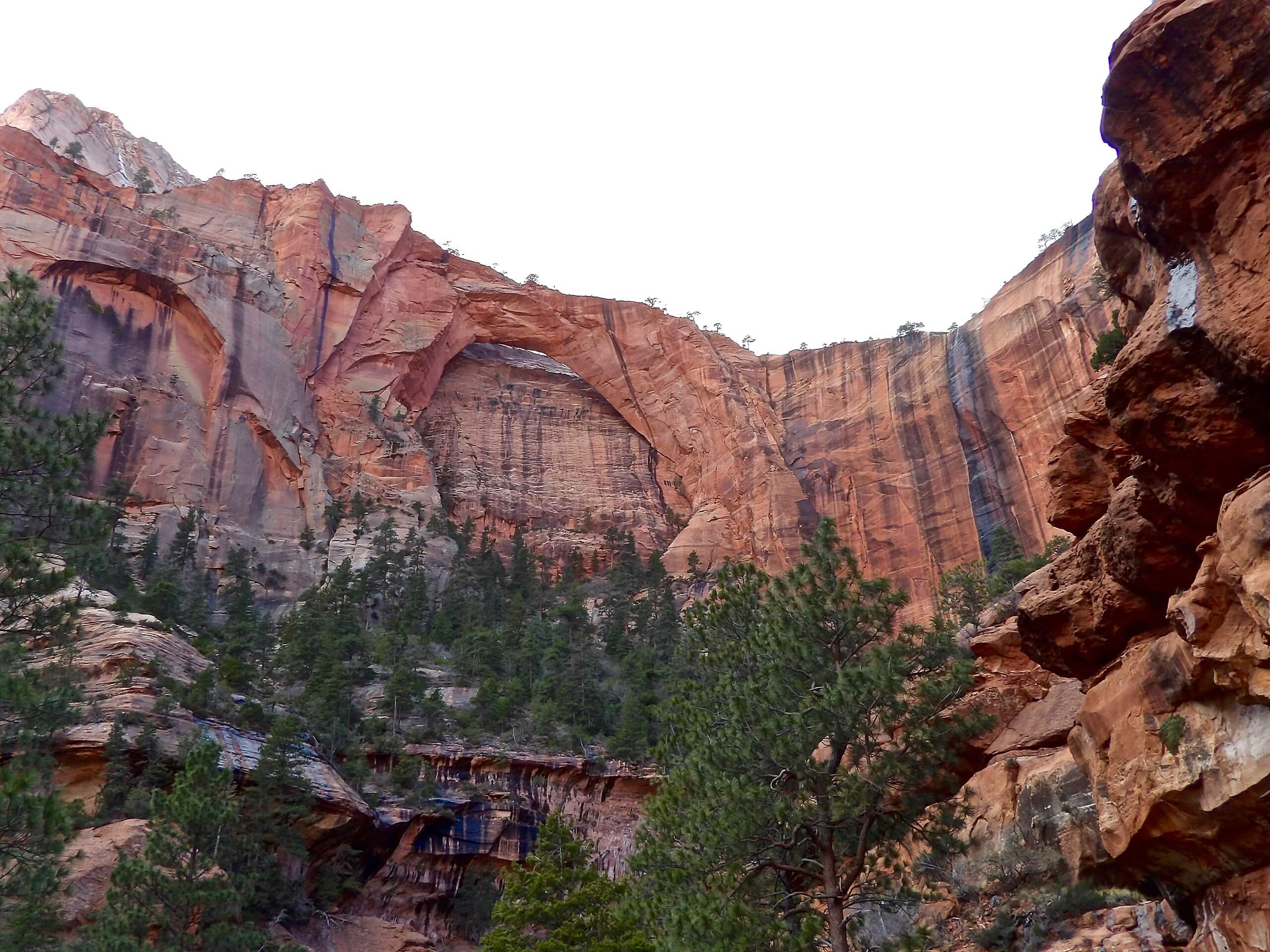
La Verkin Creek Trail to Kolob Arch
Difficulty Rating:
The La Verkin Creek Trail is a challenging, moderately trafficked trail that leads to the Kolob Arch formation in Zion National Park. This hike can be done in one, long day, or can be broken up into a multi-day backpacking trip. This trail hosts 13 campsites for those who wish to extend their stay along the La Verkin Creek Trail.
Cyanobacteria and cyanotoxins detected in La Verkin Creek. Do not drink creek water even if filtered. Do not swim or submerge your head or face in the creek.
Getting there
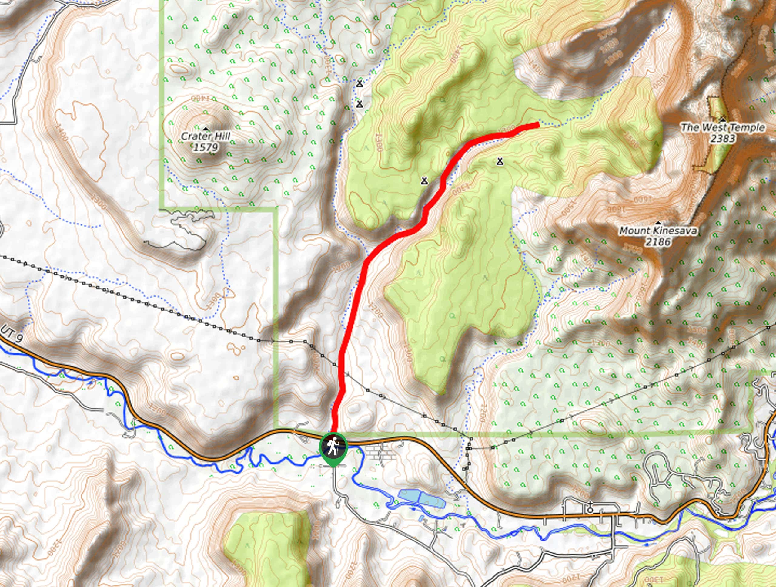
The La Verkin Creek trail begins at the Lee Pass Trailhead, approximately 3.8mi down the Kolob Canyons road from the Kolob Visitor Center off of Highway 15.

About
| Backcountry Campground | Campsite 1: Deer Camp (Group size: 4) |
| When to do | Year-round |
| Pets allowed | No |
| Family friendly | No |
| Route Signage | Poor |
| Crowd Levels | Moderate |
| Route Type | Out and back |
La Verkin Creek Trail to Kolob Arch
Elevation Graph
Weather
La Verkin Creek Trail to Kolob Arch Description
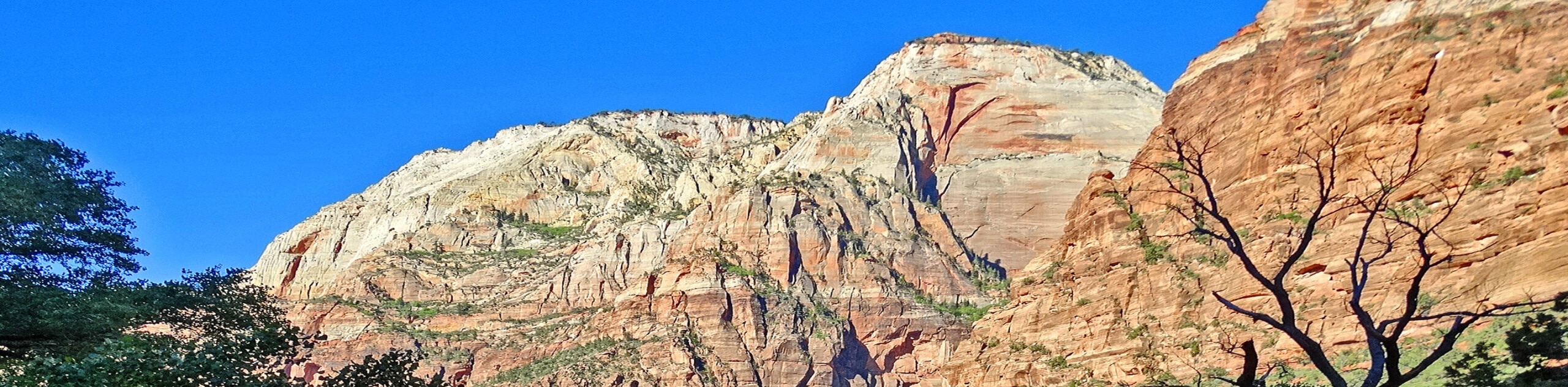
The La Verkin Creek Trail is a beautiful, long hike that is a popular access route to the iconic Kolob Arch formation in Zion National Park. The length and sun exposure of this hike make it a challenging trek for experienced hikers. Bringing lots and lots of water with you on the La Verkin Creek Trail is key as dehydration and heat exhaustion are real risks on this hike. Check with the Parks office about water advisories before you begin your hike, as of 2021 the water in the La Verkin Creek is not safe to drink, even if filtered, due to toxic cyanobacteria. There are two natural springs along the La Verkin Creek trail where freshwater can be collected and drunk once treated but these springs can be difficult to find and their flow is unpredictable. Do not rely on these springs for drinking water. The round trip route to the Kolob Arch is approximately 15.0mi, so it is recommended that you start this route early in the day and give yourself lots of time to make the return before dark. If you are so inclined, you can also split this hike up over a few days and spend time camping and stargazing at one of the thirteen campsites along the La Verkin Creek Trail.
The La Verkin Creek trail itself is beautiful and offers the opportunity to see desert wildlife, such as lizards, rattlesnakes, and mule deer. If you choose to spend the night at one of the campsites, the stargazing is out of this world (pun intended) and the moonlight illuminates the red rocks of the Kolob canyon in an arresting contrast to the deep blue of the night sky.
The hike to Kolob Arch via the La Verkin Creek Trail begins at the Lee Pass Trailhead just off of Kolob Canyons road. The trail begins with a steep descent into the valley. The descent will ease up about a mile in as you reach Timber Creek which is often just a dry creek bed. As you continue southward, you will get excellent views of the Kolob finger canyons on the east side of the trail. After approximately 3.5 miles, the trail will turn eastward as it meets up with its namesake: La Verkin Creek.
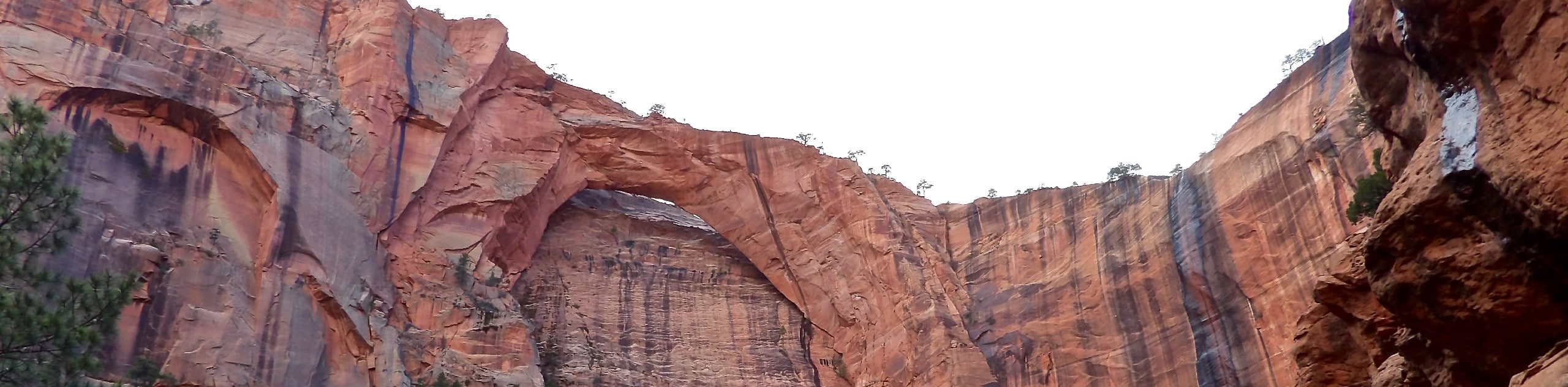
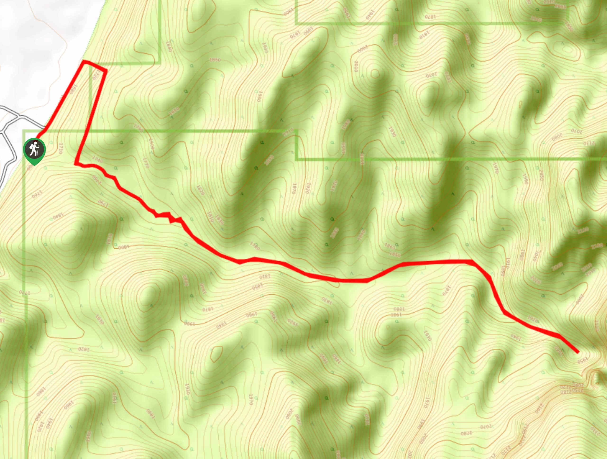
Three miles of following the creek will take you to a junction where there is a small trail splitting off to your left. This is the trail up to the Kolob Arch. The other branch is a continuation of La Verkin Creek trail. If you are low on water, Beatty Spring is just ahead along the La Verkin Creek branch, about 300 yards down the trail between campsites 10 and 11, where the trail crosses over La Verkin Creek. The spring water is safe to drink only if filtered. If you are fully hydrated and ready to roll, take a left at the junction and follow the trail a short 0.5 miles up to the Kolob Arch. This arch is a whopping 287ft long, making it the second largest natural arch in the World.
Kolob Arch is a great place to stop for lunch before beginning the trek back to the parking lot. If you are camping or want to extend your hike, the La Verkin Creek Trail does continue on eastward for another 2.4 miles and passes through the beautiful Beartrap Canyon Falls. If you are ready to head home, retrace your steps back to the La Verkin Creek Trail and follow your footprints back to the parking lot. Remember that you descended about 1000ft on your way to the arch, so save some energy, and some water for the hike back up.
Frequently Asked Questions
How Long is La Verkin Creek Trail?
La Verkin Creek Trail is a total of 9.4mi long. It is 7.0mi from the Lee Pass trailhead to Kolob Arch.
Can you walk on Kolob Arch?
No, you cannot walk on Kolob Arch.
How can I book a campsite along La Verkin Creek Trail?
Zion wilderness permits are required to camp along La Verkin Creek Trail. Permits can be reserved online here and picked up at the Zion Canyon Visitor Center either the day before, or the day of your hike. Camping is permitted at designated campgrounds only.
Insider Hints
The flies on this trail can be quite irritating: we recommend layering on bug spray and bringing some spray or bug lotion with you.
This trail gets a lot of sun exposure: wear a sun hat, sunscreen, and long, light-colored layers.
Bring more water than you think you need. We recommend bringing at least 4L per person.
As of 2021 the water in La Verkin Creek is not safe to drink, even when filtered, due to high levels of toxic cyanobacteria. Check in with the Parks office to learn about current water advisories before heading out on the trail.
Similar hikes to the La Verkin Creek Trail to Kolob Arch hike
Scoggin’s Wash
The Scoggin’s Wash Trail is a true desert hike that links the more popular Coalpits Wash Trail with the iconic…
Camp Creek Trail
The Camp Creek Trail is a rarely visited path down a beautiful box canyon in the Kolob section of Zion.…
Elephant Temple via The Riverside Walk
The hike through the Narrows to the base of Elephant Temple is a challenging day hike through one of the…
Comments