The East Mesa Trail
View Photos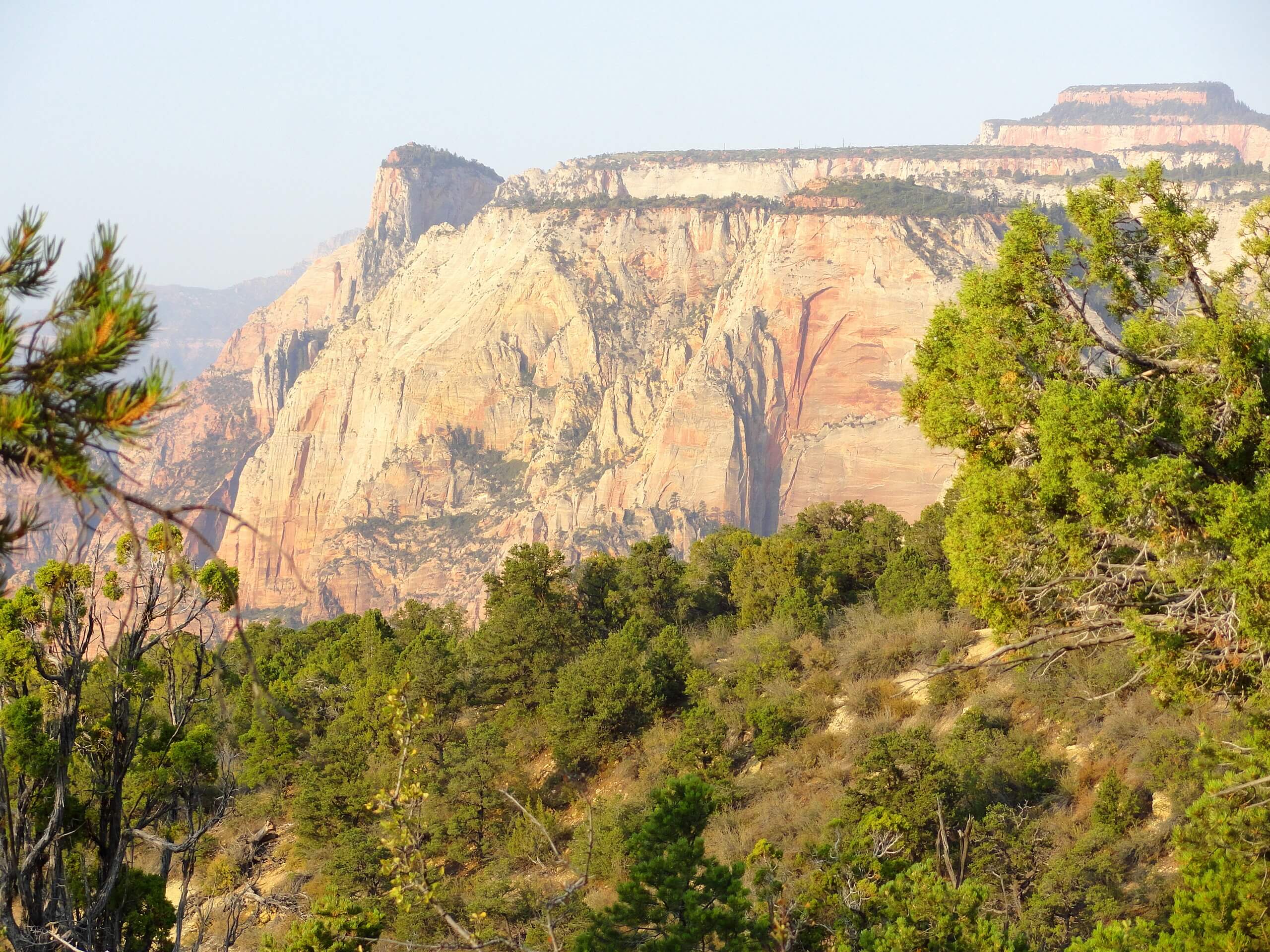
The East Mesa Trail
Difficulty Rating:
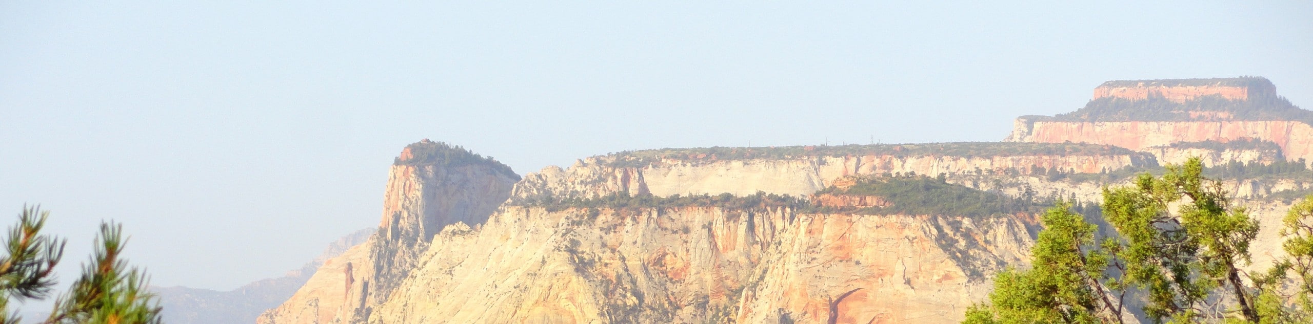
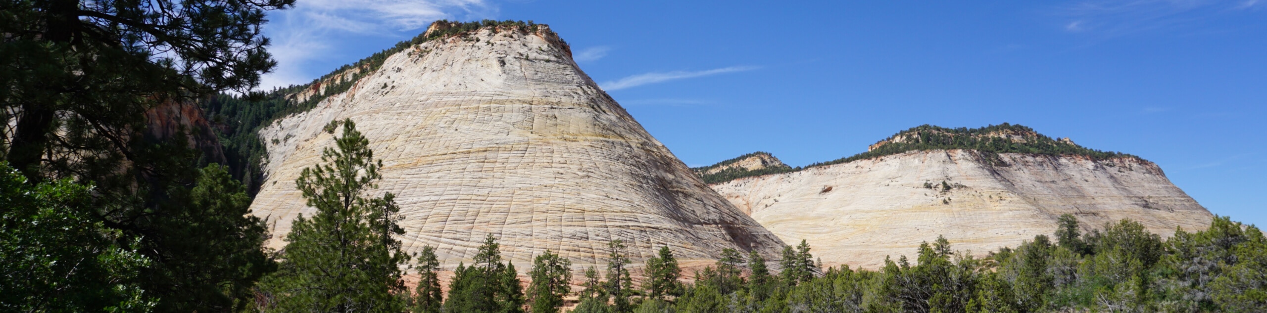
The East Mesa Trail is a fantastic route that winds down to Weeping Rock past Observation Point. This trail is relatively easy until the descent down to Weeping Rock (and the ascent back up). The views on this trail are absolutely breathtaking, bring lots of water and don’t forget to pack the camera!
Getting there
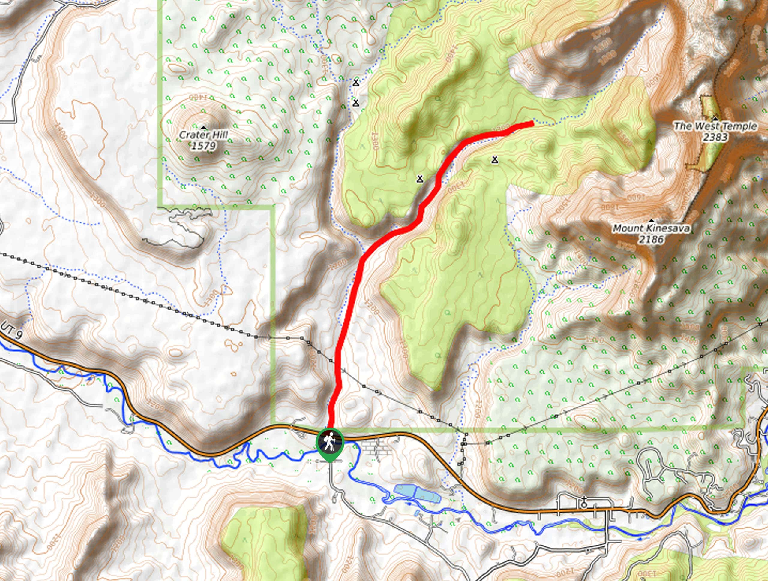
This trail begins at the East Mesa Trailhead. The East Mesa Trailhead can be accessed via Pine Angle access road off of North Fork Road or via a $5 shuttle service. This access road is unmaintained and only recommended for high clearance vehicles. Additionally, parking is very limited at the trailhead, so we highly recommend the shuttle service.

About
| Backcountry Campground | No |
| When to do | March to October |
| Pets allowed | No |
| Family friendly | No |
| Route Signage | Average |
| Crowd Levels | Moderate |
| Route Type | Out and back |
The East Mesa Trail
Elevation Graph
Weather
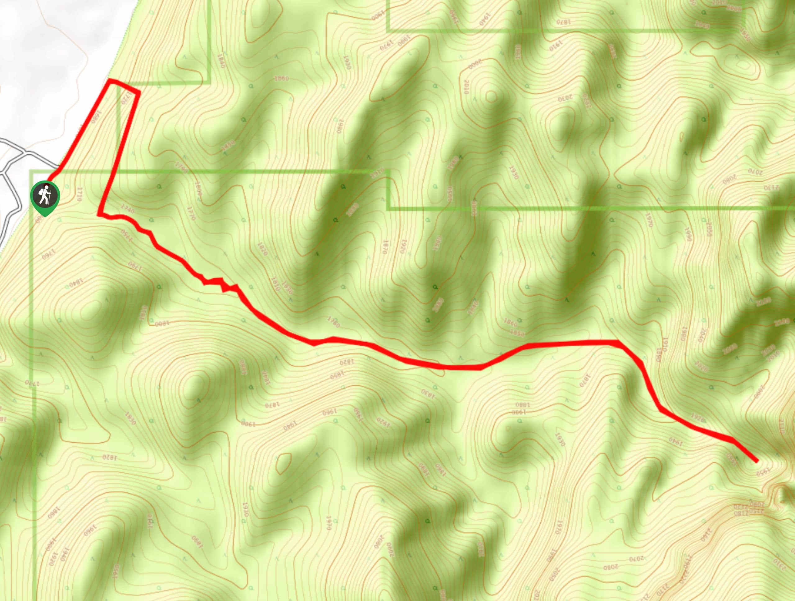
The East Mesa Trail Description
The East Mesa Trail is a great access route to the Observation Point overlook and to Weeping Rock beyond. The trail is relatively flat and easy from the trailhead to Observation Point, but the descent to Weeping Rock is very steep. If you have bad knees, consider bringing hiking poles for that section, or access Weeping Rock from the Weeping Rock Trailhead below. The views along the East Mesa Trail, especially those from Observation Point, are second to none. Bring along a camera to capture the incredible views of the Virgin River and Angels Landing in the main canyon below.
From the East Mesa Trailhead, follow the off-road trail westward into the forest. After approximately 2.0mi, you will see a trail branching off to the north; stay left. 1.0mi later, the trail will divide—stay right at this junction to continue a short 0.3mi to the Observation Point overlook. At the overlook, take a rest and enjoy the panoramic views of the main canyon below. To continue on to Weeping Rock, head back to the main trail and continue southeast to the next junction. Take a right here, and make your way down the canyon to Weeping Rock.
If you are exhausted by the time you reach Weeping Rock, you can take a free shuttle service back to the Zion Visitor’s Center – just make sure you have a way to get back to your car. If you are ready to keep going, turn around and begin the ascent back up the East Mesa Trail and follow the same route back to the trailhead.
Similar hikes to the The East Mesa Trail hike
Zion Ponderosa Checkerboard Trail
The Zion Ponderosa Checkerboard Trail is an easy walk that the whole family can enjoy. This trail is shared by…
Scoggin’s Wash
The Scoggin’s Wash Trail is a true desert hike that links the more popular Coalpits Wash Trail with the iconic…
Camp Creek Trail
The Camp Creek Trail is a rarely visited path down a beautiful box canyon in the Kolob section of Zion.…
Comments