East Rim Trail
View Photos
East Rim Trail
Difficulty Rating:
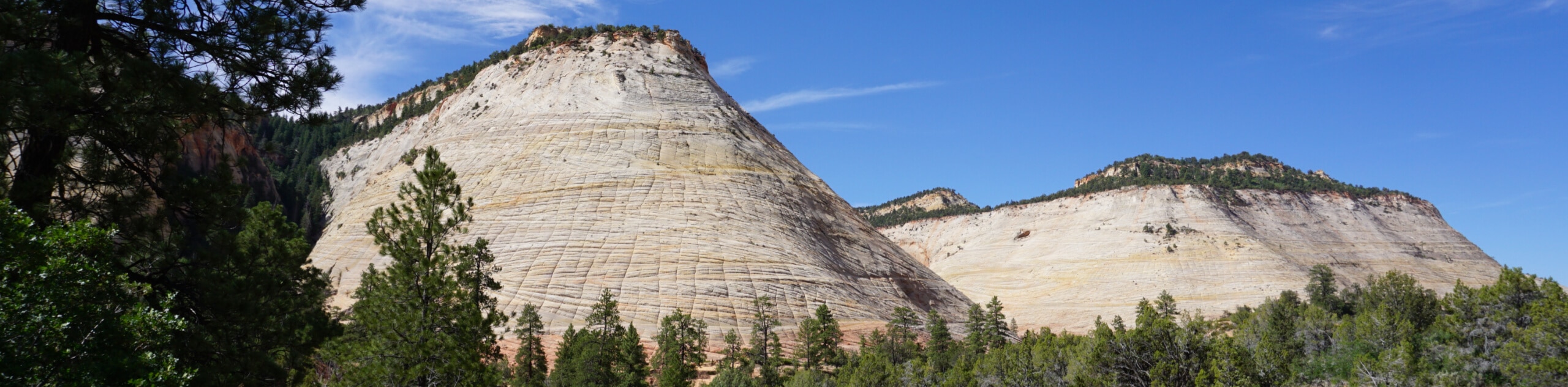
The East Rim Trail to Weeping Rock is famous for its sandstone cliffs and canyon views. This hike takes you over sand and slickrock past Jolley Gulch, Echo Canyon, and Weeping Rock. This point-to-point hike is a big day in the sun, so start early and bring lots of water.
Getting there
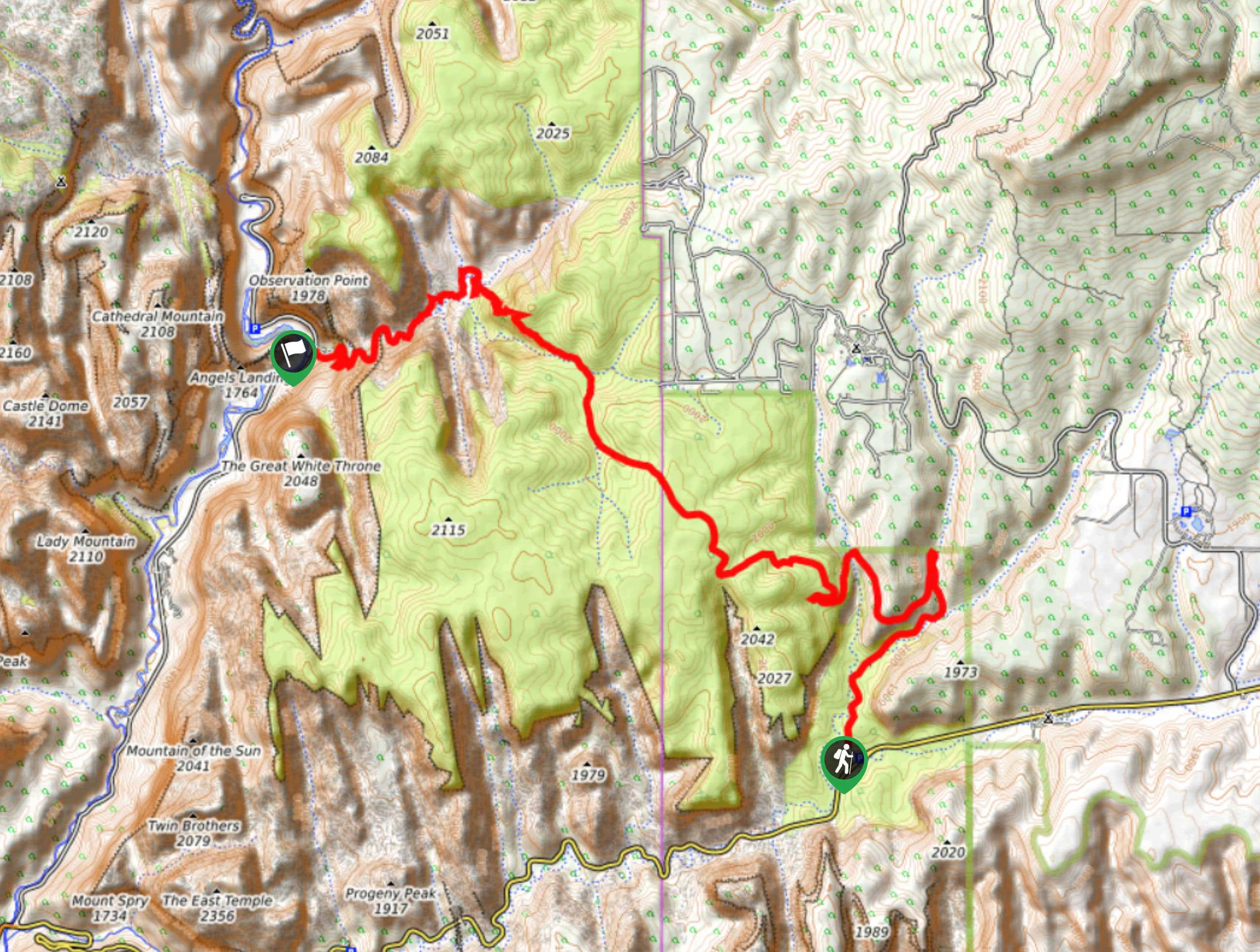
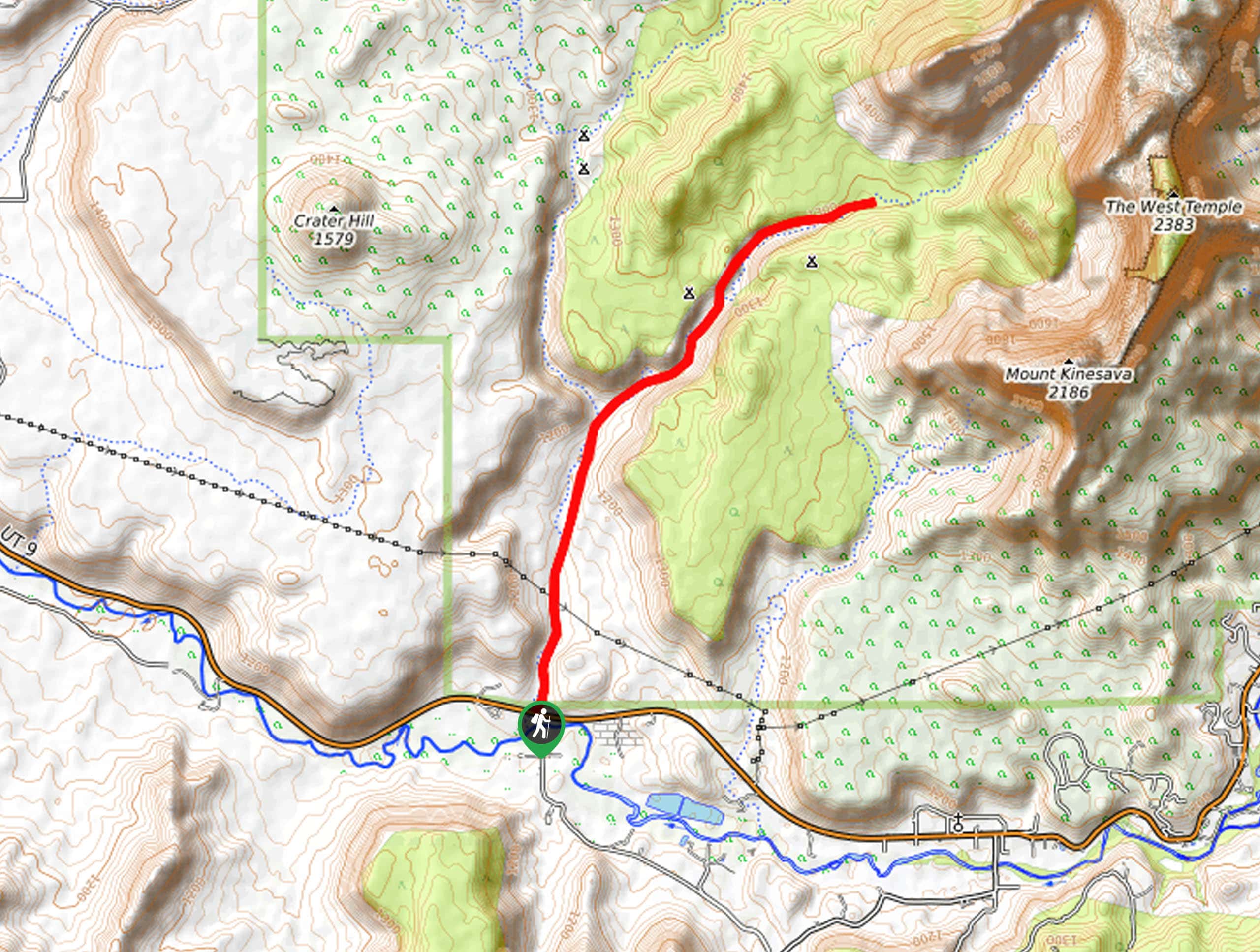
This trail begins at the East Rim Trailhead, just off of route 9, 12.0mi east of Springdale, UT.

About
| Backcountry Campground | No |
| When to do | year-round |
| Pets allowed | No |
| Family friendly | No |
| Route Signage | Average |
| Crowd Levels | Low |
| Route Type | One Way |
East Rim Trail
Elevation Graph
Weather
East Rim Trail Description
The East Rim Trail to Weeping Rock is a fantastic hike with awesome views of Zion National Park. This hike is long and exposed to the sun. Stave Spring is the only source of water on this trail and its flow is unreliable, so hikers should be prepared with lots and lots of water; dehydration and heat exhaustion are real risks on this route. This trail sees little foot traffic for the first half, so it is an excellent spot to enjoy some peace and quiet in one of the most beautiful areas of Zion National Park.
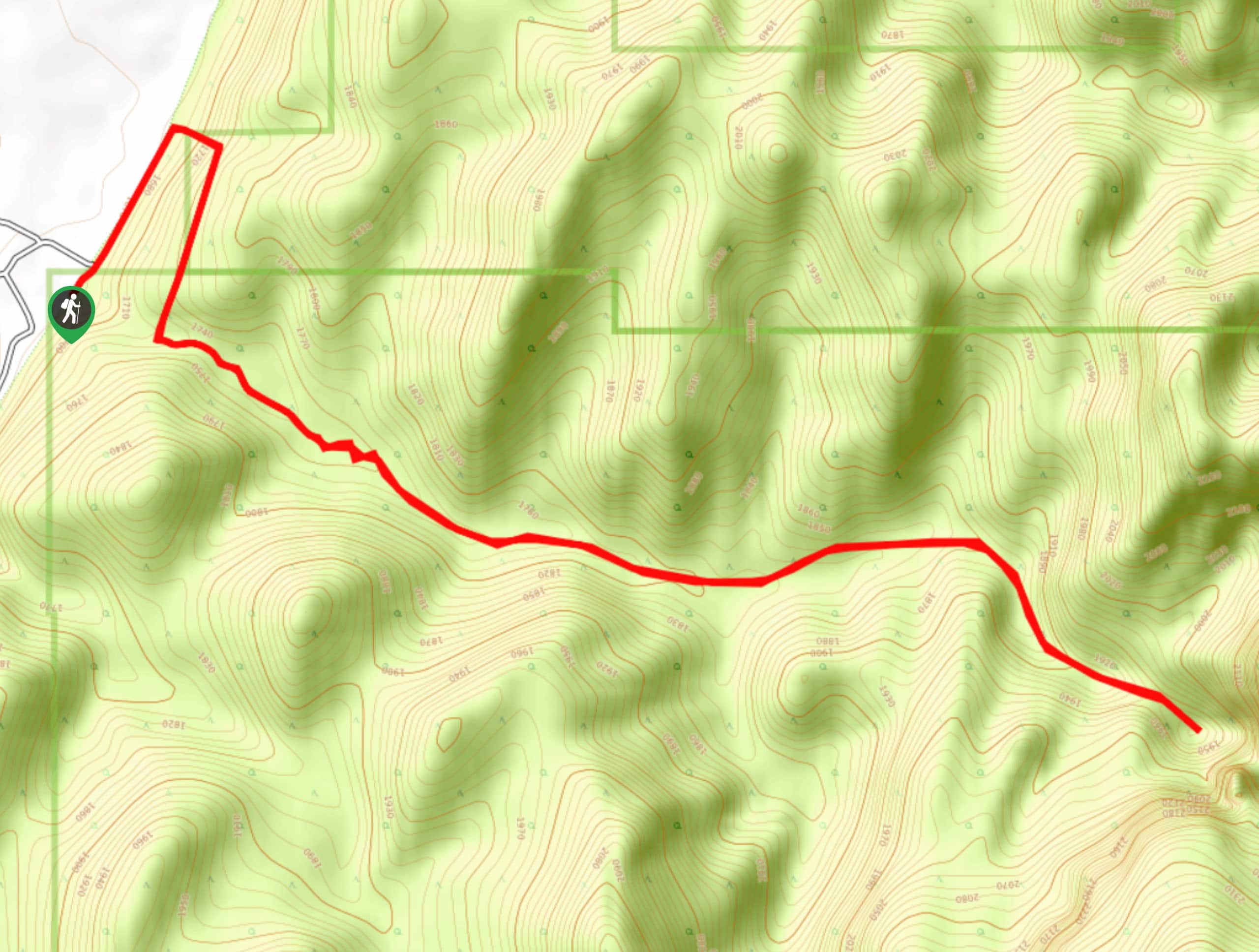
From the East Rim Trailhead off of route 9, follow the path north through Jolley Gulch and Cave Canyon. After about 1.6mi, the trail will switch back on itself and head south/southwest as you begin to gain more elevation. There is a lovely viewpoint that is only 0.5mi past this switchback that overlooks Jolley Gulch below. 2.9mi in, the trail will divide at Stave Spring. This is the only source of water along the East Rim Trail, remember that this water is only safe to drink once treated. Follow the path to your right until the trail divides again then take a left. Keep left at the following junctions as the trail meets up with the more heavily trafficked East Mesa Observation Point trail and descends down the canyon to Weeping Rock.
This trail ends at the Weeping Rock Trailhead, where you can catch a free shuttle to the Zion Visitors Center. If you plan on leaving your car at the East Rim Trailhead, ensure that you have a way to get back there before you begin your hike.
Similar hikes to the East Rim Trail hike
Zion Ponderosa Checkerboard Trail
The Zion Ponderosa Checkerboard Trail is an easy walk that the whole family can enjoy. This trail is shared by…
Scoggin’s Wash
The Scoggin’s Wash Trail is a true desert hike that links the more popular Coalpits Wash Trail with the iconic…
Camp Creek Trail
The Camp Creek Trail is a rarely visited path down a beautiful box canyon in the Kolob section of Zion.…
Comments