
Canyon Overlook hike
View Photos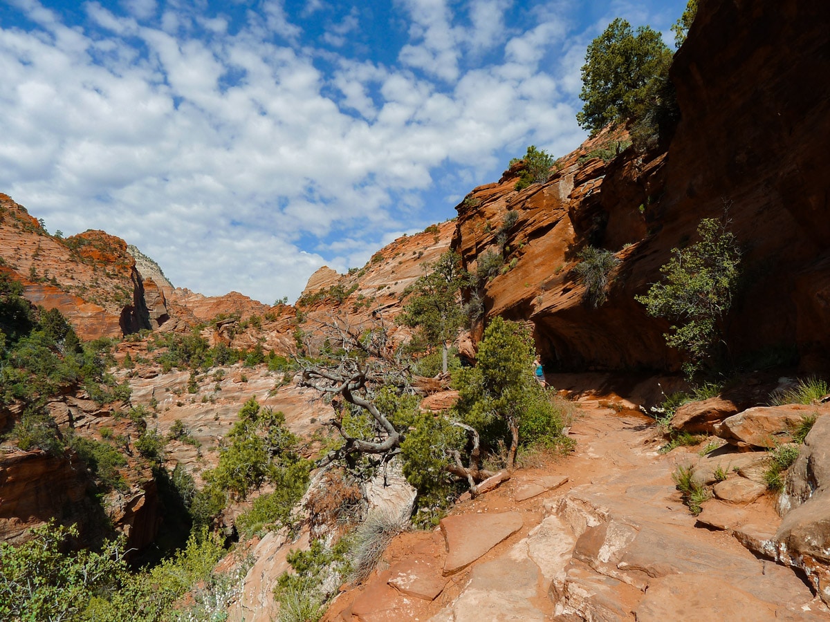
Canyon Overlook hike
Difficulty Rating:
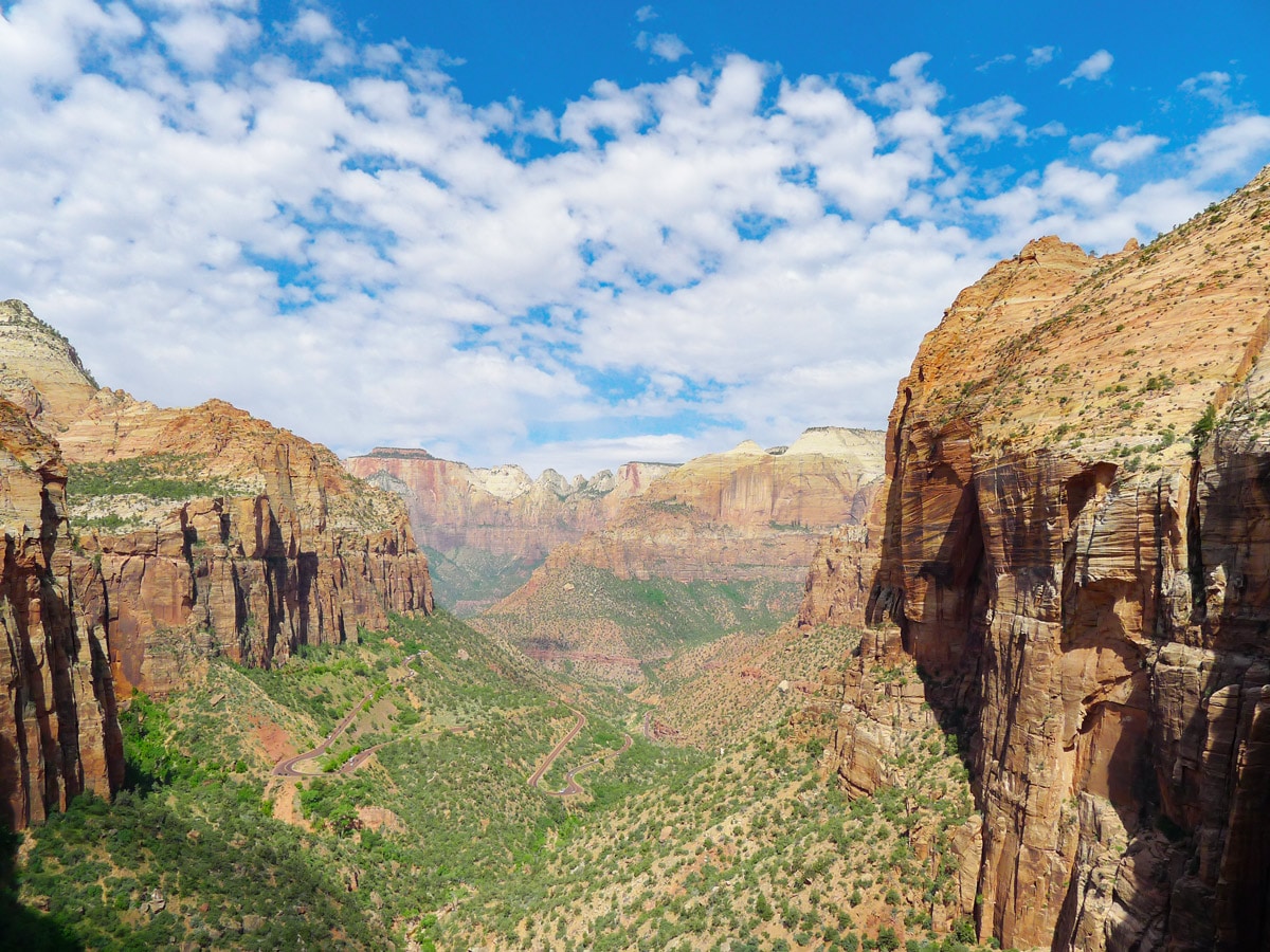
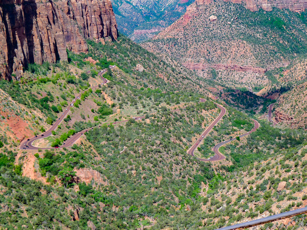
Contouring the famous Zion – Mount Carmel Tunnel, the Canyon Overlook trail yields spectacular views of both the Zion and Pine Creek Canyons. It's so impressive that we added this hike to our list of the best hikes in the USA. A few stunning feats of engineering have also reduced the amount of climbing that would normally be required and makes this path very accessible for almost all skill levels.
Getting there
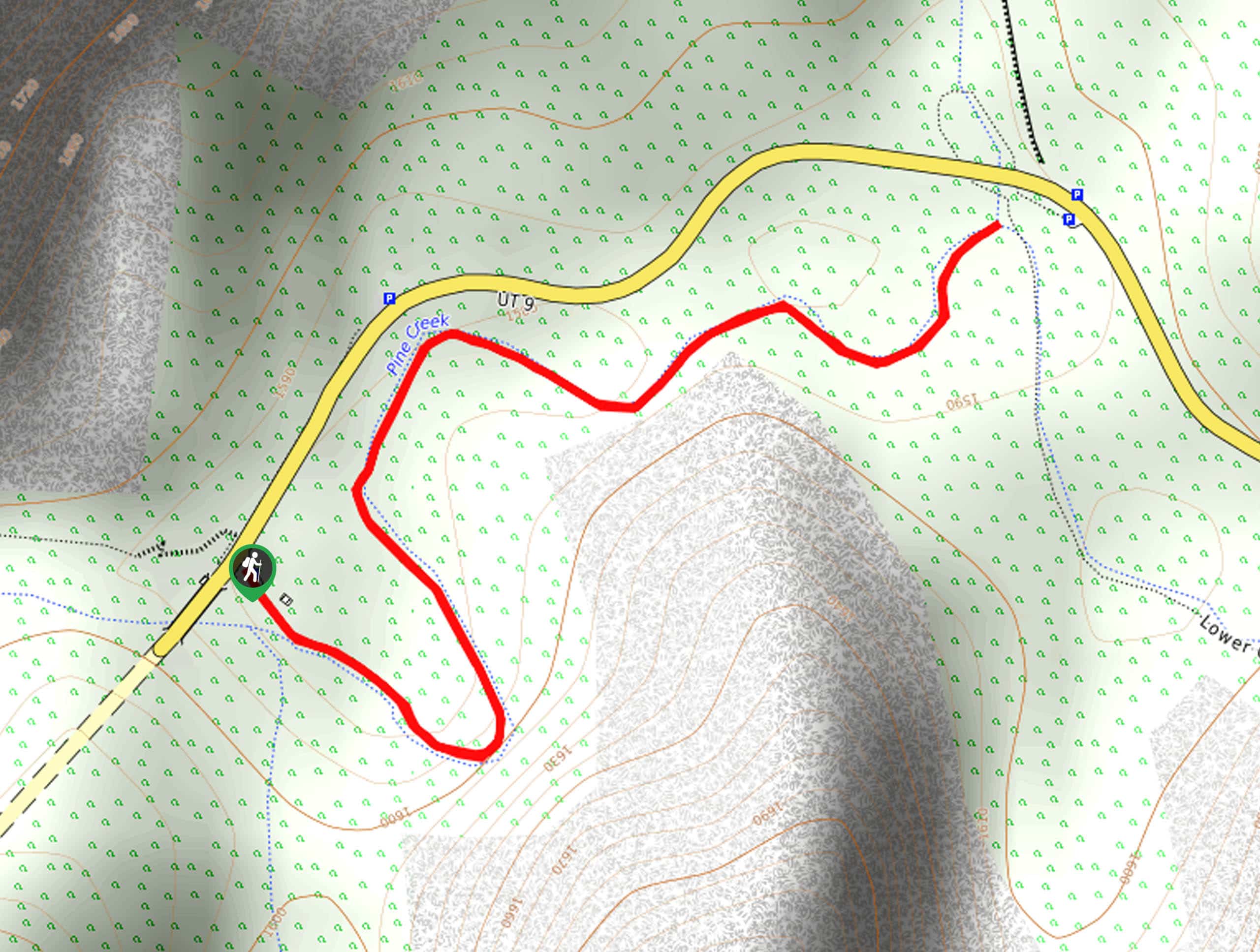
From Springdale, enter the park and continue along Utah 9 East for 7.0mi. Do not turn left into Zion Canyon. You will go through the famous Zion - Mount Carmel Tunnel, the longest vehicle tunnel in the park system. Just after you pass the tunnel the trailhead parking lot will be on your right, so keep your eyes up! Otherwise you can park in one of the few pullouts along the road and walk back to the trailhead. If you are coming from the East Entrance, head along the windy Utah 9 West for 6.0mi and find the trailhead parking lot on your left, just before the tunnel.

About
| When to do | Spring and Fall, avoid summer heat |
| Backcountry Campsites | None |
| Toilets | At Visitors Centre, museum and Canyon Junction |
| Family friendly | Yes |
| Route Signage | Average |
| Crowd Levels | Moderate |
| Route Type | Out and back |
Canyon Overlook
Elevation Graph
Weather
Route Description for Canyon Overlook
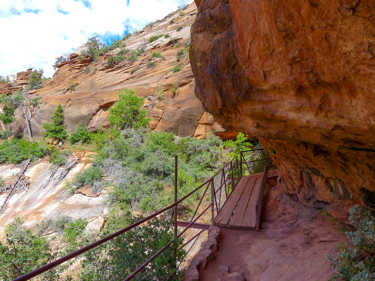
The trailhead is directly opposite the small parking lot. Right from the start, you will gain all the elevation this hike requires in the form of two narrow switchbacks. Here you will also see how meticulously man-made this trail is. The park service has blasted out steps in the rock, as well as installed a sturdy metal railing. Unlike Angel’s Landing, everyone should be comfortable on this hike!
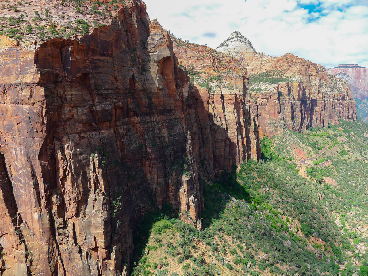
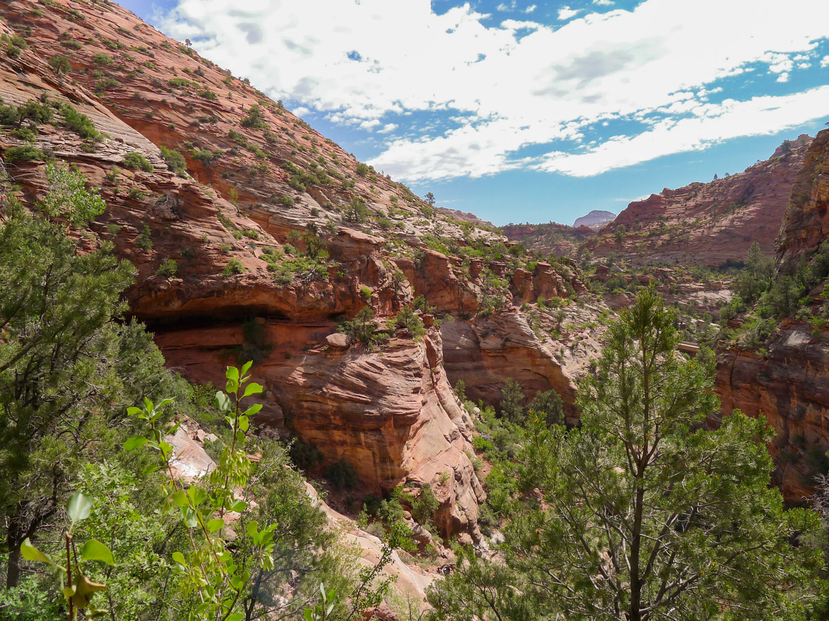
Continuing along the path you will start veering right and away from the roadway. Again, blasting has been done to create a path along a nearly sheer vertical slick rock section! There is, yet again, a railing here to please everyone.
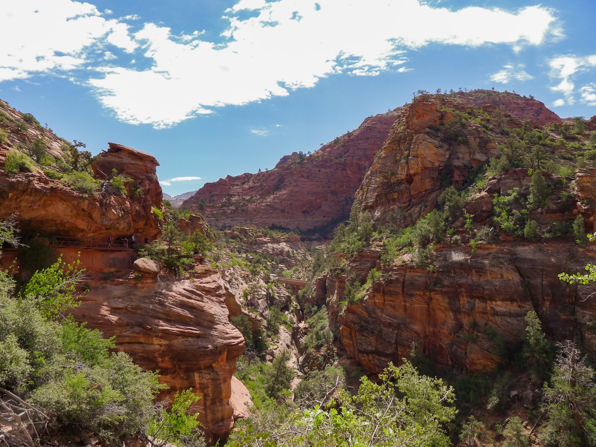
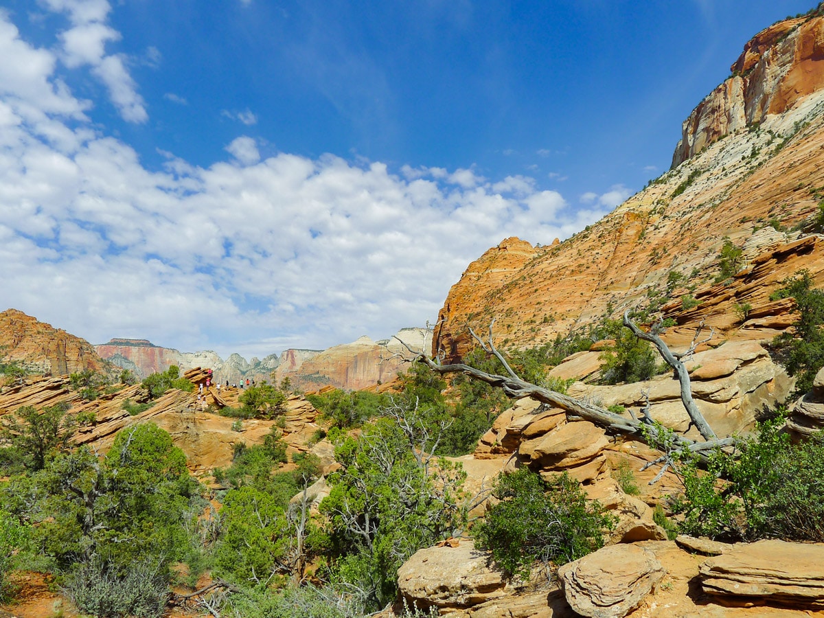
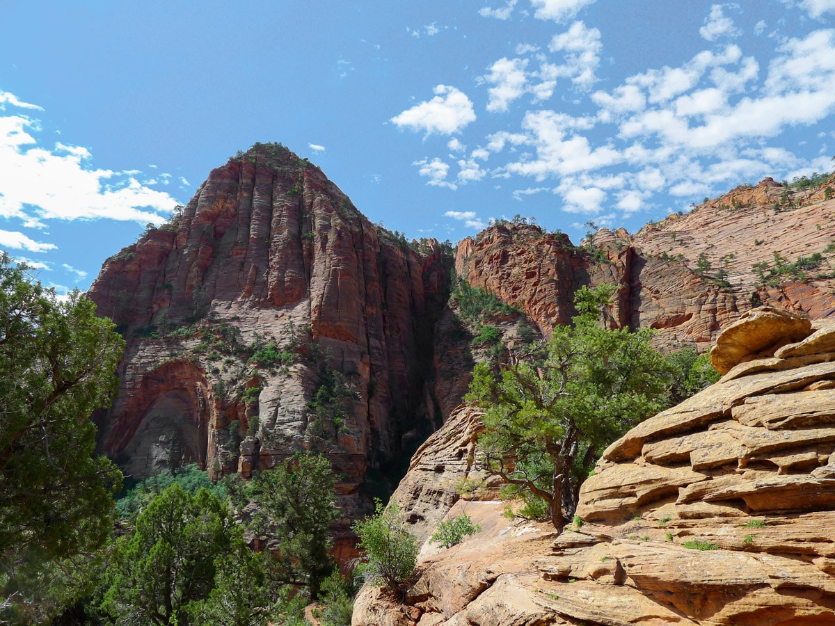
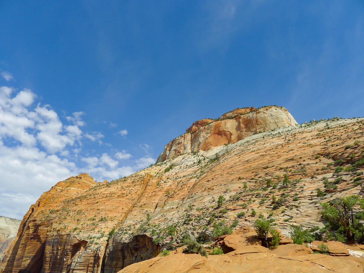
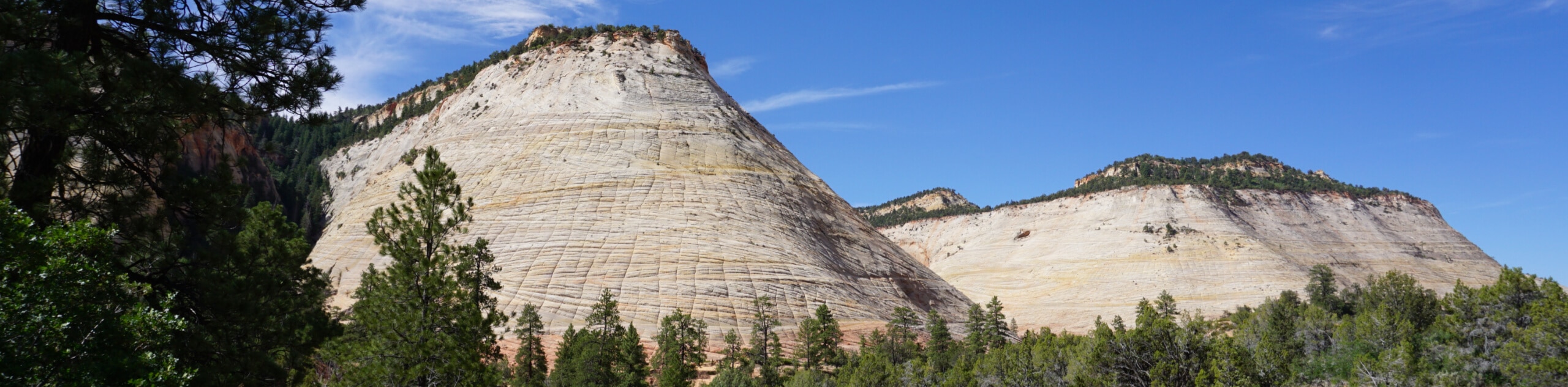
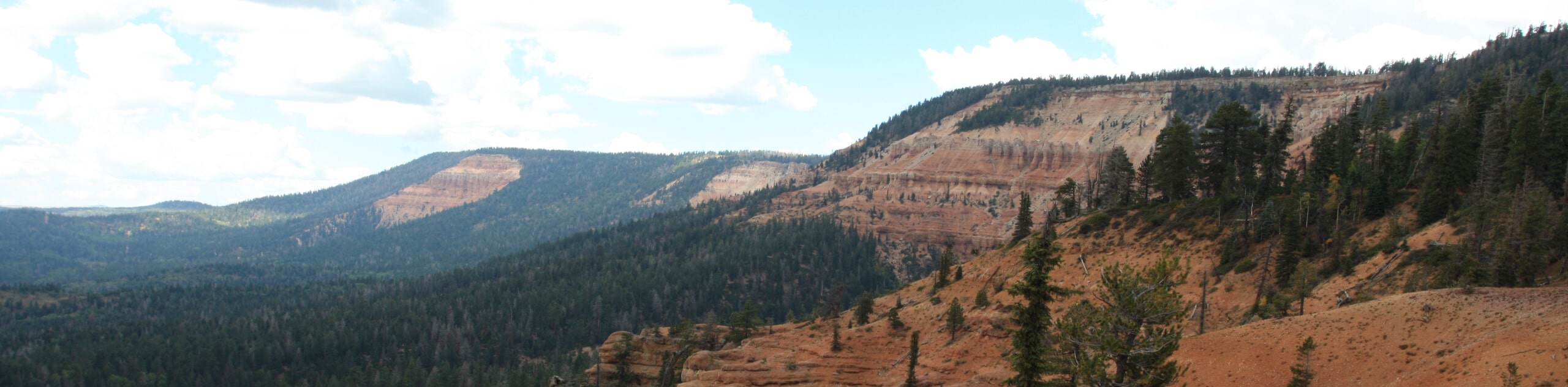
You will contour around this cliff band for just over 0.5mi before reaching your destination. Along the way you will get fantastic views of the East Temple up above you. Finally, though, you will crest a final ridge and be given stunning panoramic views of the canyons in front of you.
Bridge Mountain and Mount Spry occupy the closer scenery (on the left and right respectively). However looking directly across the valley you will be able to make out the Court of the Patriarchs, as well as the looming West Temple! A small sign at the end of the trail identifies peak names for you.
Find other spectacular hikes in Zion:
Insider Hints
here is usually tons of congestion along Utah 9, especially at the tunnel since they only allow one-way traffic. Try and do this hike on the day you are leaving Springdale, if you are heading east or north!

Similar hikes to the Canyon Overlook hike
Zion Ponderosa Checkerboard Trail
The Zion Ponderosa Checkerboard Trail is an easy walk that the whole family can enjoy. This trail is shared by…
Pine Creek Narrows Trail
The Pine Creek Narrows Trail is a great little hike exploring beautiful slot canyons just off of route 9. This…
Cascade Falls Trail
The Cascade Falls trail is a little-hiked trail just off of route 9 near Springdale, UT. The waterfalls themselves flow…
ShantiLewis 4 years ago
Unbelievable views! Words cannot describe everything you see.
leo_Martini 4 years ago
It's clean, accessible, gorgeous, and filled with nooks and crannies to explore.
April O. 4 years ago
The Skies are blue, and the sun was shining so bright. It boosts the vibrant tone of the rock faces.
benhilton 4 years ago
Excellent! Words are not enough to describe how lovely this place is!
HIllaryPNW 4 years ago
Bit challenging trail but it's really worth it. The views are just amazing.
Jin Ri 4 years ago
Stunning! One of the most uniqe hikes I've done so far!
Adriana K. 4 years ago
Awesome!! Such a fun trail! Beautiful scenery.
brandonlong 4 years ago
The landscapes, the mountains ...everything is truly unbelievable.
Gabriel10 4 years ago
Awesome place! You should see this at least once in your lifetime!
Carlos Gómez Sánchez-Lafuente 5 years ago
Great walk with amazing views of the valley. The trail was crowded in a weekday in october.