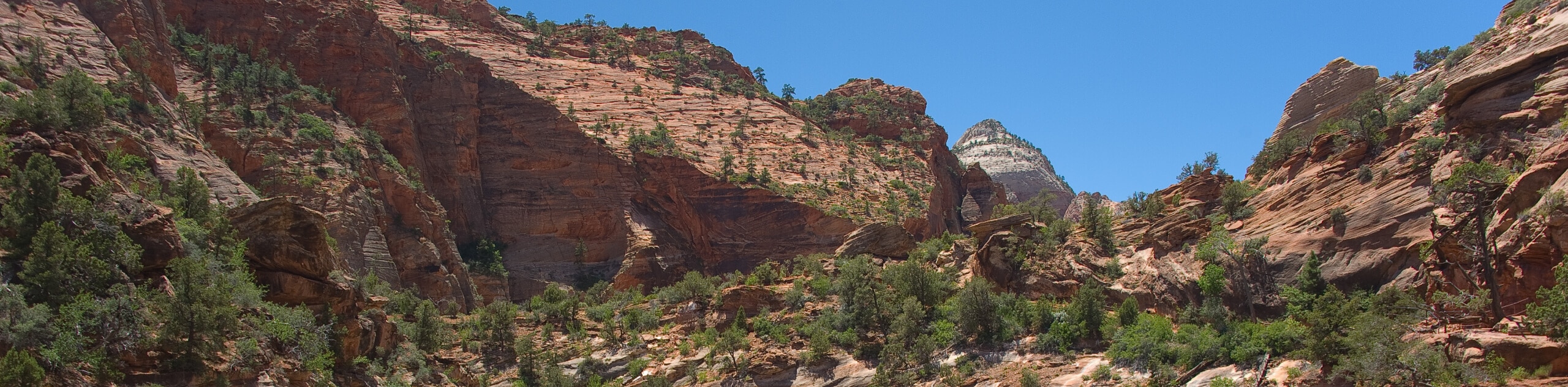
The Narrows: Top-Down
View Photos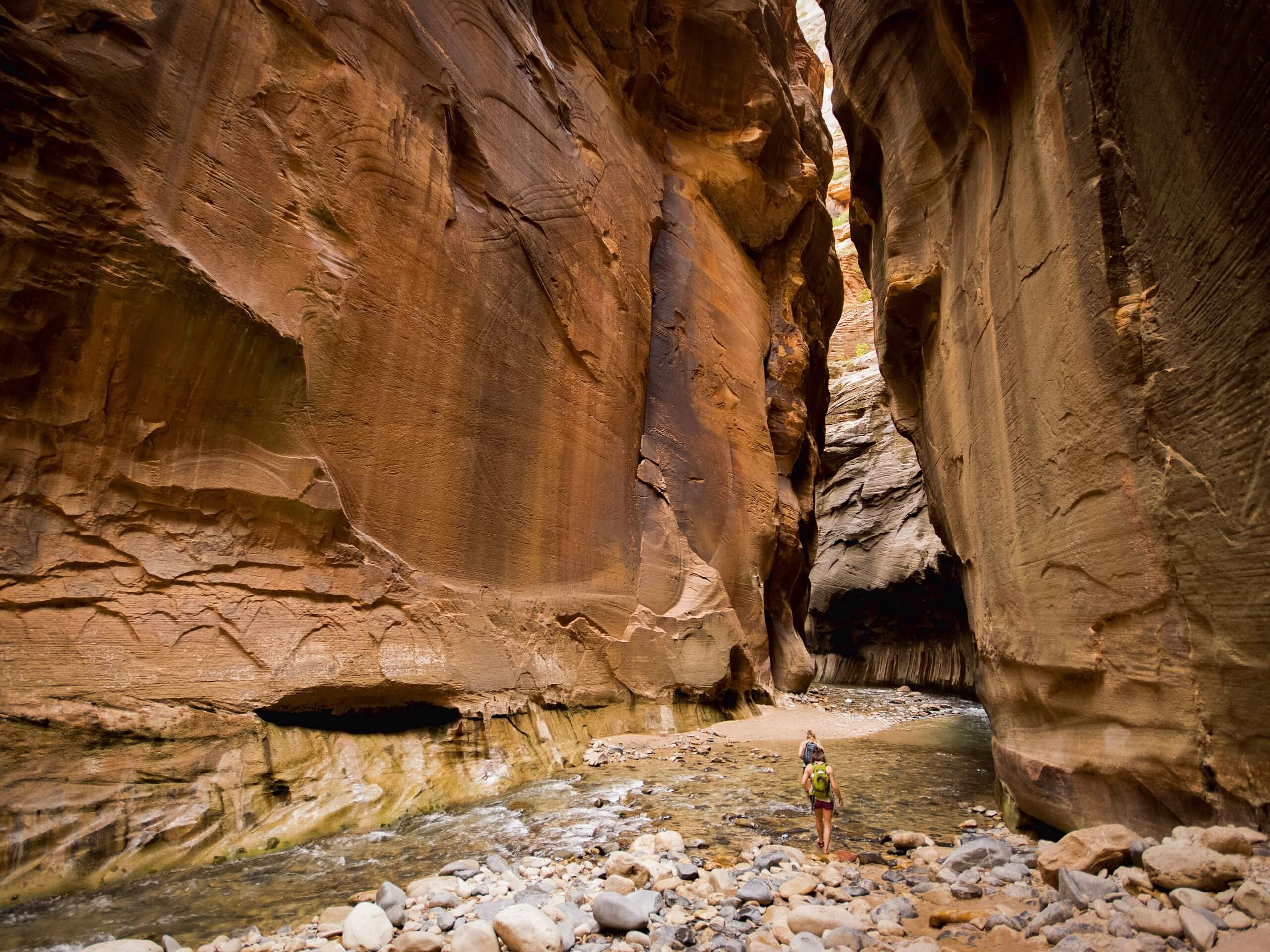
The Narrows: Top-Down
Difficulty Rating:
The Top-Down Trail through the Narrows is an epic adventure through a stunning section of the main canyon. This hike, which features waterfalls and towering canyon walls, can be done in one big day or as an overnighter. A Zion Wilderness Permit is required to hike this trail and can be obtained either online or through the Zion Wilderness Desk.
Getting there
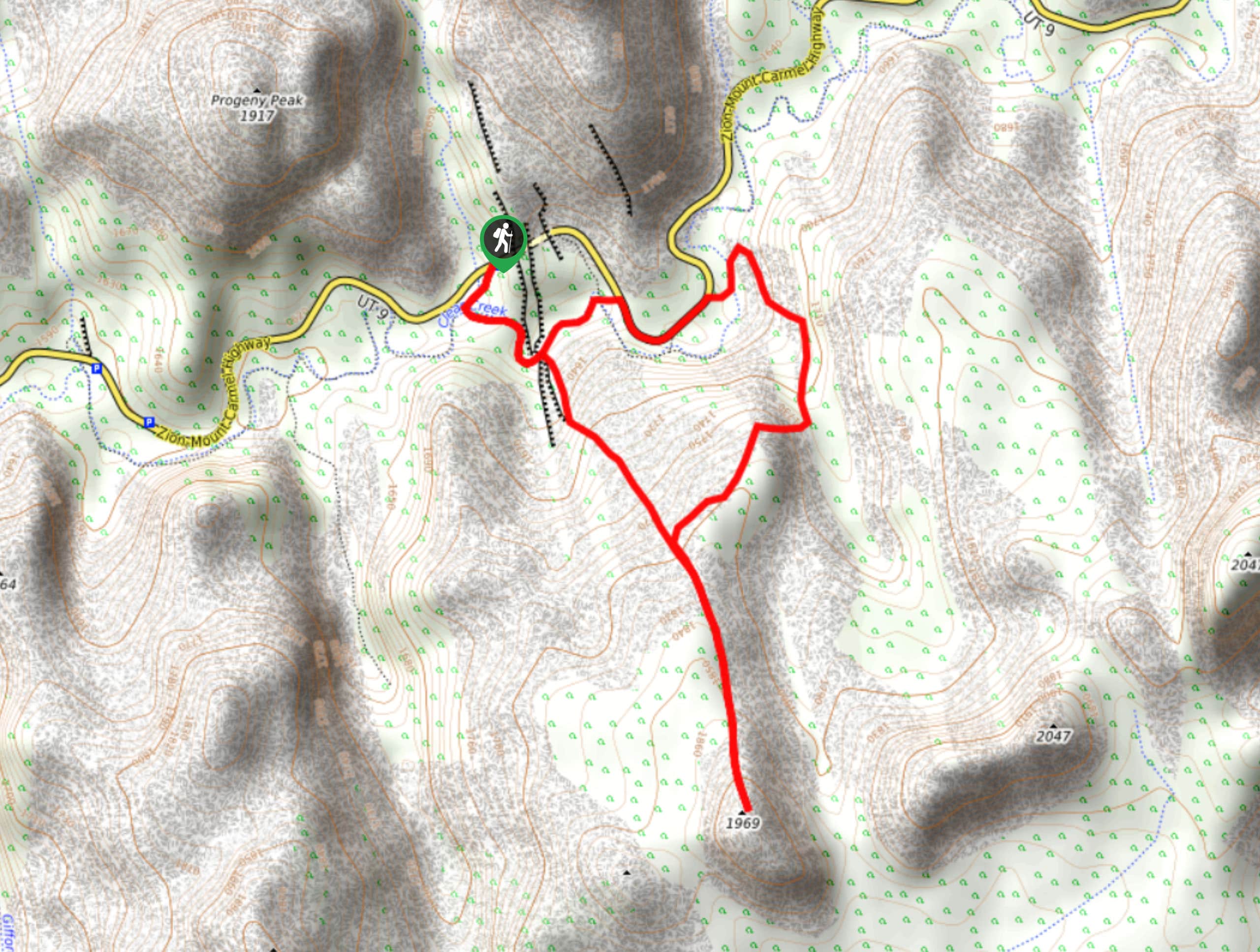
The Top-Down hike through the Narrows begins at the Chamberlain Ranch Trailhead (also known as the Zion Narrows Upper Trailhead) just off of North Fork Country Road. This hike is a one-way, point-to-point trail, so hikers should arrange for a shuttle. If you do not have two cars, a private shuttle service can be hired to drop you off at the trailhead.

About
| Backcountry Campground | Campsites 1-12 |
| When to do | May to October |
| Pets allowed | No |
| Family friendly | No |
| Route Signage | Good |
| Crowd Levels | High |
| Route Type | One Way |
The Narrows: Top-Down
Elevation Graph
Weather
The Narrows: Top-Down Description
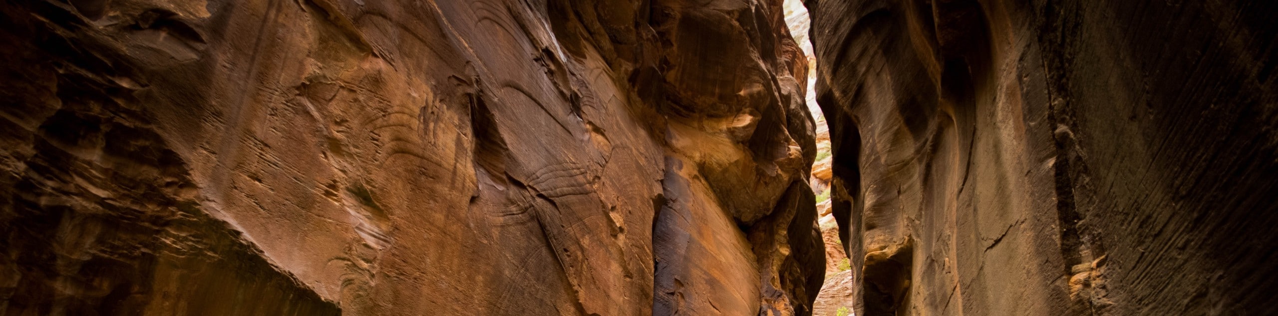
The Zion Narrows Top-Down Hike is an epic adventure through the narrowest section of Zion Canyon. This trail requires hikers to get in the water and wade through the Virgin River as it flows down through the canyon. The Top-Down route is for experienced hikers only, and hikers should come prepared with proper footwear, a wetsuit or drysuit if the temperatures are low, and more water than you think you’ll need. Remember that the water in the Virgin River is not safe to drink, even when filtered. In addition, this hike passes through a section of canyon that is susceptible to flash floods. Check-in with the rangers before starting down the trail and do not attempt this hike if there is rain in the forecast. A Zion wilderness permit is required to hike this trail and to use any of the campsites along the Narrows route. A permit can be purchased either online or through the Zion Wilderness Desk.
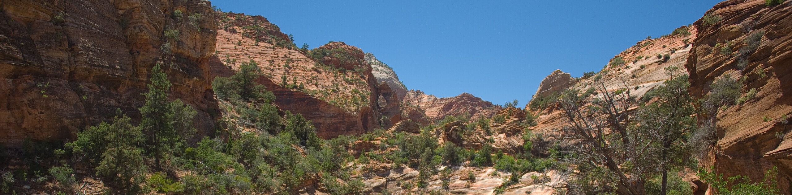
The jaw-dropping beauty and adventurous terrain make The Narrows Top-Down trail a must-do for avid adventurers. You will pass numerous waterfalls and secret side canyons as you hike down in and along the river. Don’t forget your camera; this hike becomes more photo-worthy at every turn.
Starting at the trailhead, follow the dirt path westward. This section of trail passes through private ranch land, so be respectful and close any gates securely behind you. Three miles in, you will pass the remains of an old homestead known as Bulloch’s Cabin. Just past here, the trail officially enters the water. The water here is normally quite shallow, but it will get deeper and deeper as you go.
Approximately 8.5 miles in, you will come to the 15-foot North Fork Falls. Don’t panic—these can be passed via a small trail on the south side of the waterfall. 0.5mi past North Fork Falls, Deep Creek converges with the Virgin River to double the water volume, and Kolob Creek and Goose Creek will enter soon after. 2.5mi past the Deep Creek convergence, hikers will arrive at Big Springs. This is the turnaround point for hikers who are doing a day trip up the bottom-up route, so expect this trail to get busier from here on out.
The next two miles can be a challenge as you pass over the “boulder field of broken hearts”: take your time here and tread carefully. Past this rocky section, you will enter what is known as “Wall Street”, a deep and cavernous section of canyon where the sandstone towers impressively overhead. Just past here, look for the Orderville Canyon on the east side; if you have the time and the energy, a short trip down this narrow canyon is worth your while. About a mile past Orderville Canyon, hikers will pass Mystery Falls cascading in from the east. Just a third of a mile past Mystery Falls, you will reach the end of the Narrows and find yourself on the paved riverside walkway that leads you just one more mile to the Temple of Sinawava Shuttle Stop.
The Top-Down route through the Narrows can be an ambitious day hike. There is so much to explore and so much beauty to absorb in this section of Zion, so splitting this trail up over two days can be a great way to do this hike. Doing this hike in two days also allows you to spend a night stargazing in the heart of the canyon.
Frequently Asked Questions
Do I need a permit to hike the Narrows?
Yes, you do need a permit to hike The Narrows via the top-down route. You do not need a permit if you are hiking The Narrows bottom-up to Big Springs.
How cold is the water in the Narrows?
Depending on the season, the water temperature in the Narrows can range from around 40-60 degrees.
Can I camp in the Narrows?
Yes, there are 12 campsites along the trail above Big Springs. Camping in The Narrows requires a Zion Wilderness Permit.
Insider Hints
Close-toed shoes with good grip are essential for this hike
Waders, wetsuits, or drysuits are handy on this hike- especially if you are going in the cooler months. These can be rented for a day-rate at Zion Outfitter in Springdale, UT.
Hiking poles or a good walking stick is helpful for balance and route finding on this hike
This hike is susceptible to flash flooding- check in with the Rangers before embarking
The mice in the area are total fiends. If you are camping, pack your food in a smell-proof bag or container and string it up at night to deter any four-legged friends from sharing your meals
If you are planning to do this hike in one day, start early and bring a headlamp in case you end up finishing in the dark.
Similar hikes to the The Narrows: Top-Down hike
6460 Lost Peak Trail
The trail to Peak 6460 (known locally as “Lost Peak”) is a fantastic scramble for experienced hikers. This trail follows…
Hepworth and Roof Peaks Trail
The trail up to Hepworth and Roof Peaks is a rugged path up and off Gifford Canyon Wash that requires…
Progeny Peak
The Progeny Peak Trail is a low-traffic, unmarked and unmaintained trail in the East Canyon. This out-and-back trail passes by…
Comments