Coalpits Wash
View Photos
Coalpits Wash
Difficulty Rating:
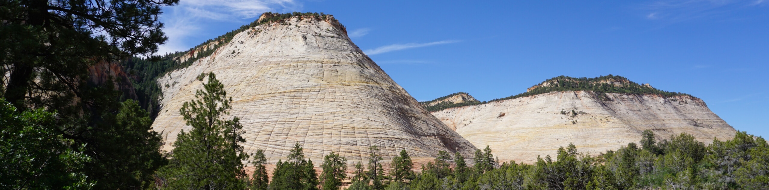
The Coalpits Wash Trail features both human-made and natural points of interest. The trail features large boulders of volcanic rock that give this hike its name. Hikers will also pass the remains of an oil well left in the desert to fossilize after a failed attempt to drill for oil in the early 1900s.
Getting there
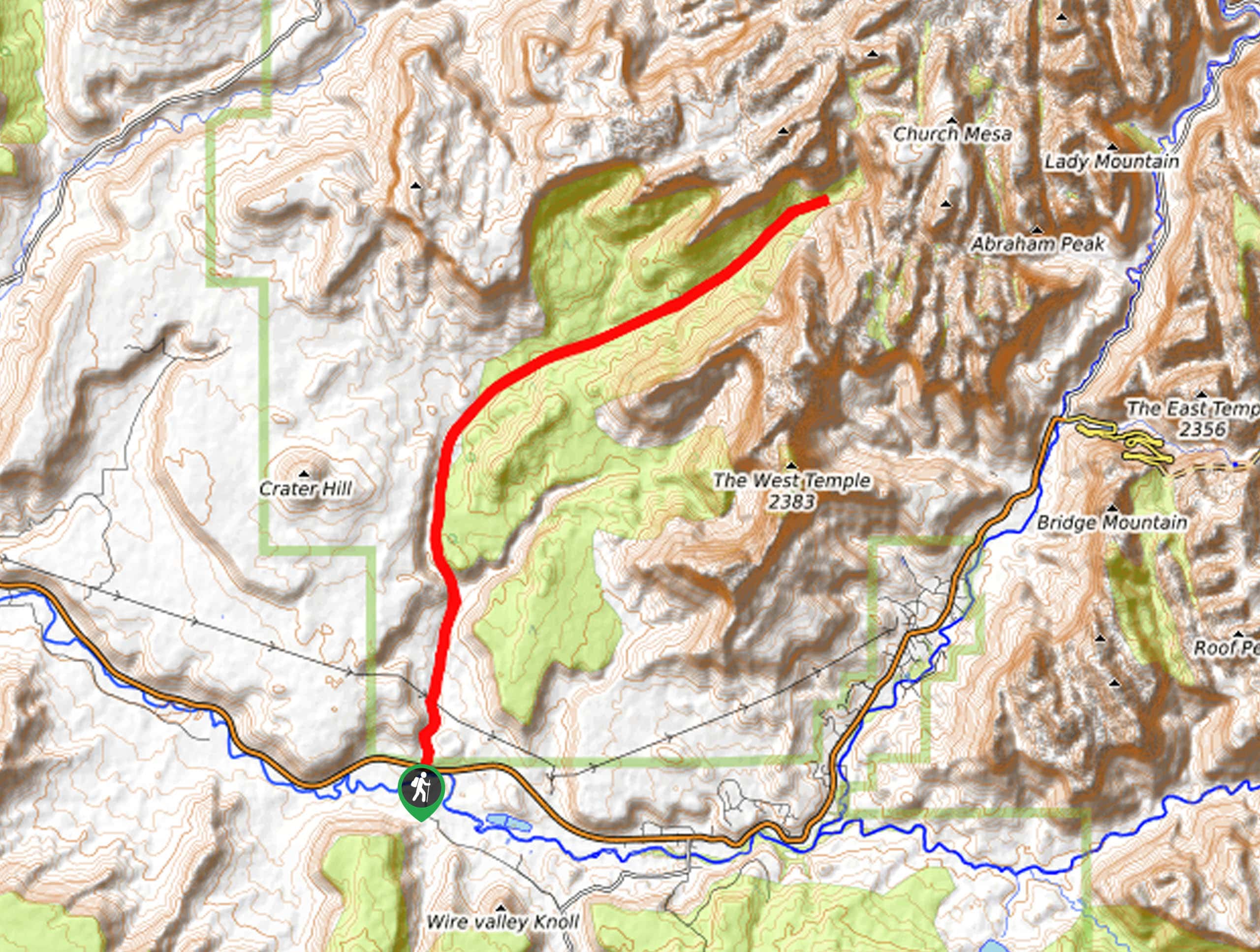
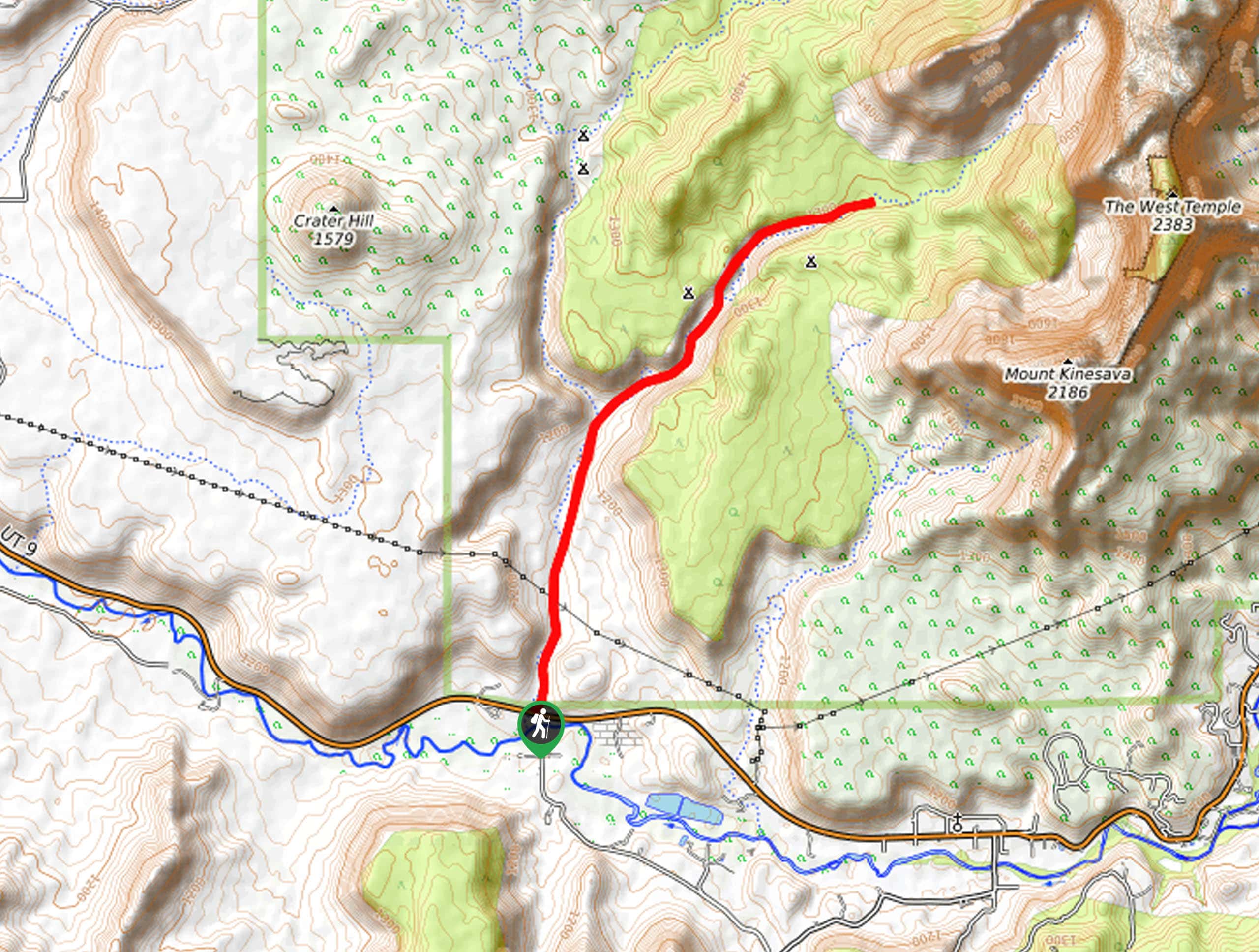
The trailhead for the Coalpits Wash hike is 2.7mi west of Rockville, UT along route 9. There is a pullout and parking area on the north side of the road, on the east end of the overpass that crosses Coalpits wash.

About
| Backcountry Campground | 6 campsites available with backcountry permit |
| When to do | March to October |
| Pets allowed | No |
| Family friendly | Older Children only |
| Route Signage | Poor |
| Crowd Levels | Low |
| Route Type | Out and back |
Coalpits Wash
Elevation Graph
Weather
Coalpits Wash Description
The Coalpits Wash is a rugged trail that intersects with the famous Chinle trail just outside of Rockville, UT. This is a true desert hike over uneven terrain, so bring lots of water with you and wear a sturdy pair of shoes. Depending on the season, you may get wet feet walking through some sections of the wash, so wear footwear that is either highly breathable or waterproof (because of the heat, we recommend breathable shoes), and if you’re not a fan of hiking with wet feet, bring along an extra pair of socks.
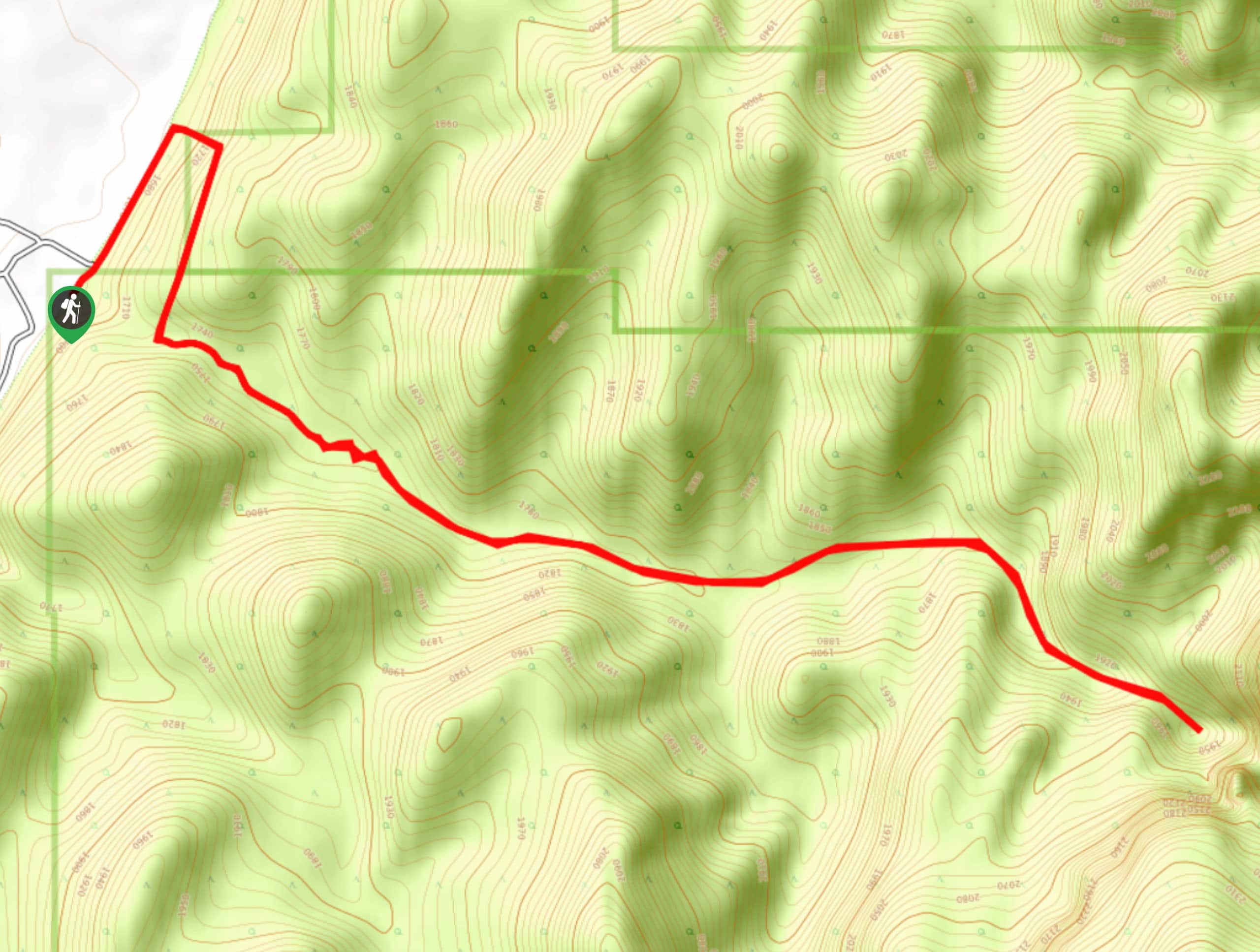
The Coalpits Wash trail heads north from the trailhead along route 9. The trail is not often maintained and the path can be overgrown and bouldery. As you follow the wash, look for the volcanic boulders on the hillside to your west. Approximately 3.3mi in, the Coalpits Wash intersects with the Chinle trail, keep left here to stay on the Coalpits Wash Trail. About 2.2mi past this junction, you will pass the old oil well ruins on the east side of the stream. Take a minute to check out these artifacts before continuing on northeast. Roughly 2.0mi later the wash will narrow into a canyon-like section that leads to three little waterfalls. These waterfalls can be ascended by scrambling up to the left but watch out for quicksand! The second waterfall generates a patch of quicksand along the trail that can make your hike reminiscent of an Indiana Jones movie, and not in a good way.
Once you’ve had your fill exploring this unique area of Zion, simply turn back and follow the same path back to your car at the Coalpits wash trailhead. If you want to extend your time exploring this area, there are 6 backcountry campsites located nearby. These campsites all require a Zion Wilderness permit for use and can be reserved either online or in person at the Zion Wilderness Desk.
Similar hikes to the Coalpits Wash hike
Zion Ponderosa Checkerboard Trail
The Zion Ponderosa Checkerboard Trail is an easy walk that the whole family can enjoy. This trail is shared by…
Scoggin’s Wash
The Scoggin’s Wash Trail is a true desert hike that links the more popular Coalpits Wash Trail with the iconic…
Camp Creek Trail
The Camp Creek Trail is a rarely visited path down a beautiful box canyon in the Kolob section of Zion.…
Comments