Gold Mountain Trail
View Photos
Gold Mountain Trail
Difficulty Rating:
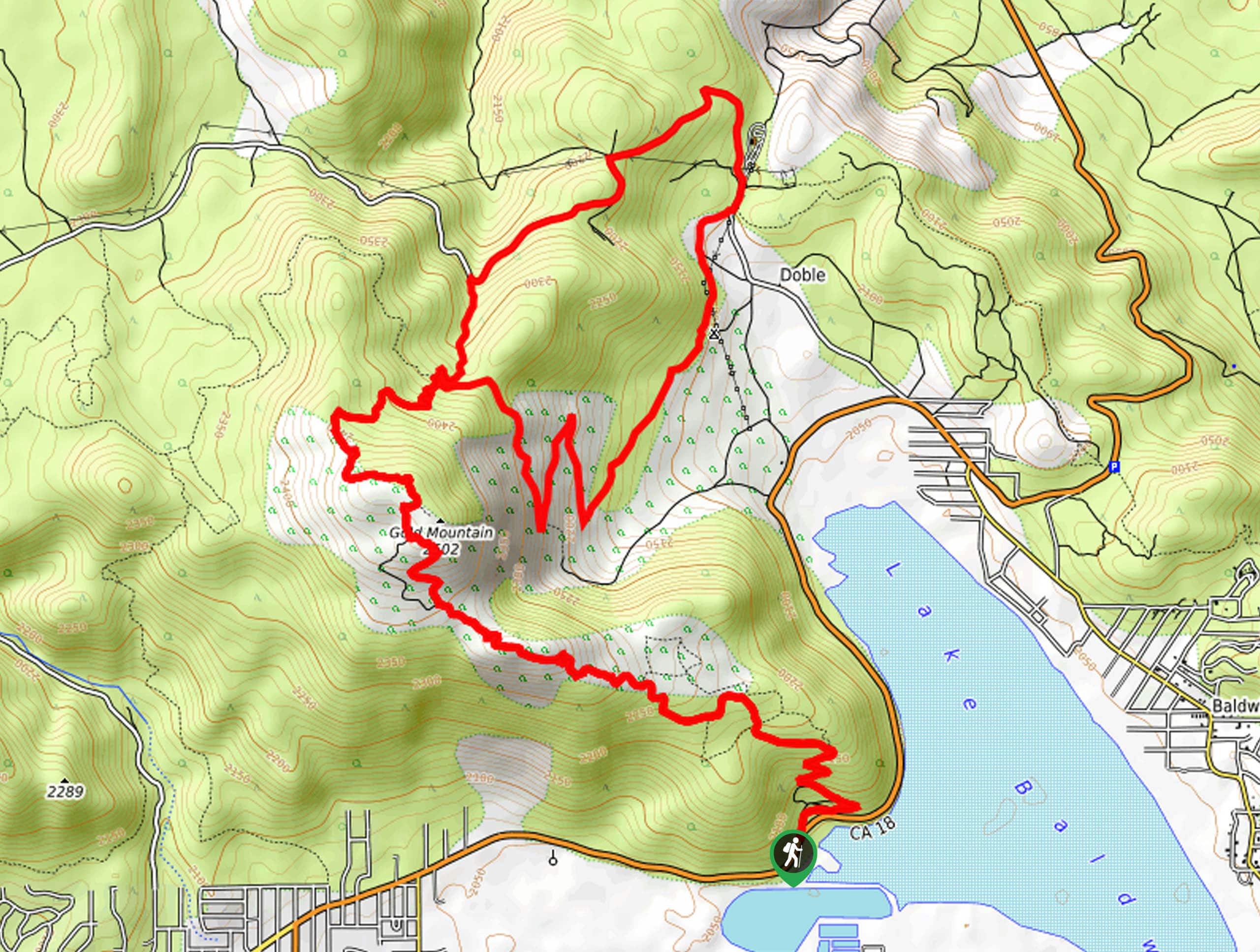
The Gold Mountain Trail is a long and rugged hiking route in the San Bernardino National Forest that will take you along an off-road vehicle trail in order to take in some scenic views. While out on the trail, you will climb up the rocky and forested slopes of Gold Mountain for incredible views overlooking Big Bear Lake, before looping around Holcomb Valley and back over Gold Mountain on the return. Hikers should take note that this route utilizes an off-road vehicle trail, so make sure to keep an eye out for passing vehicles and allow them enough room to safely pass.
Getting there
The Gold Mountain Trailhead can be found next to Baldwin Lake, at the junction between CA-18 and Forest Service Road 3N69.

About
| Backcountry Campground | Doble Trail Campground |
| When to do | March-October |
| Pets allowed | Yes |
| Family friendly | No |
| Route Signage | Average |
| Crowd Levels | High |
| Route Type | Lollipop |
Gold Mountain Trail
Elevation Graph
Weather
Gold Mountain Trail Description
While the Gold Mountain Trail does follow along an off-road vehicle route, the terrain underfoot is still quite rugged. Be sure to wear proper hiking boots with good ankle support and bring trekking poles in order to relieve some of the pressure off your knees. Additionally, you will need to pay attention to passing vehicles and allow them enough room to safely maneuver along the road.
If you are after a great long distance hiking route that isn’t overly technical but still provides a good challenge and spectacular views, then you will want to check out the Gold Mountain Trail. Rugged mountain slopes, scenic views overlooking Big Bear Lake, and a lengthy overall distance with several uphill climbs make this an exciting hike to be enjoyed by those looking to push themselves.
Setting out from the trailhead, you will make your way north along Forest Service Road 3N69 for roughly 315ft and head left at the junction. As you continue up the hillside, you will quickly encounter a series of other junctions along the road. Here, you will keep right at the first, left at the second, and left again at the third so that your direction turns to the northwest.
Follow the road as it switches back and forth up the mountain side for the next 1.1mi, where the terrain will start to become considerably more rocky and rugged. After another 1.0mi along the road, you will follow a path branching off to the right and make the push up to the summit of Gold Mountain, where you will experience stunning views overlooking the magnificent Big Bear Lake below to the southwest.
Once you have taken in the views, you will continue along the trail as it heads to the north and begins to descend the mountainside. After 1.1mi, you will come to a point where the road is intersected by the Pacific Crest Trail. Take the path on the right and follow it downhill through the tree cover for the next 2.6mi, passing by the Doble Trail Campground to arrive at the edge of Holcomb Valley Road.
Turning left onto the road, you will follow it north through the valley for 0.5mi, at which point it will turn back to the southwest and begin climbing uphill once again. In 0.4mi, keep left at the junction to pass by the Doble Mine, keeping on for 0.7mi to come to another junction.
Here, you will turn left once again and climb uphill along the off-road vehicle trail for 1.5mi in order to arrive back at the summit of Gold Mountain. After pausing for a moment for some final views over the spectacular landscape, you will follow the road down the mountainside along your initial route in order to arrive back at the trailhead where you began your day along the Gold Mountain Trail.
Trail Highlights
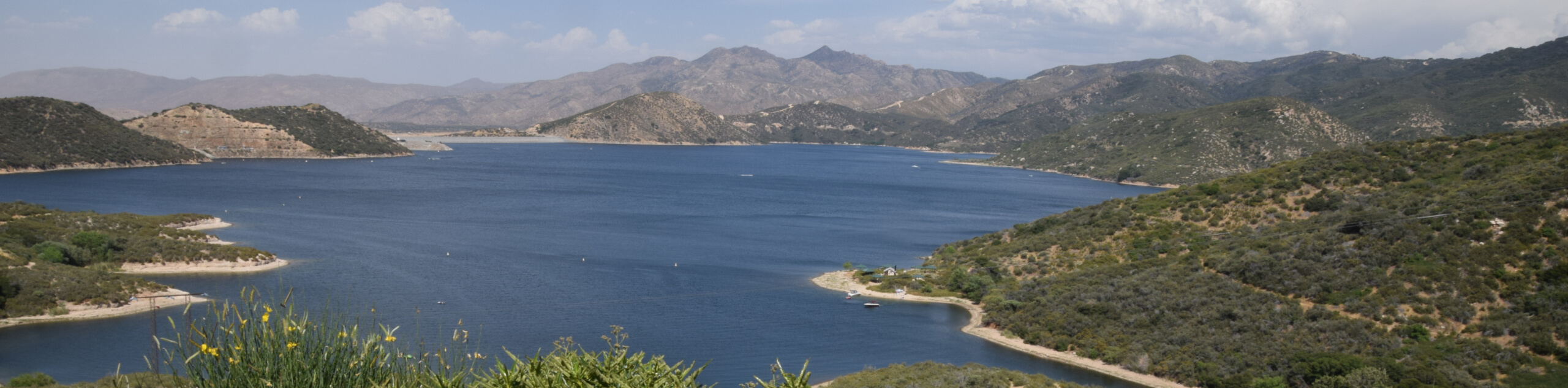
Big Bear Lake
Situated in the San Bernardino Mountains and featuring a total surface area of 2971 acres, Big Bear Lake is the largest recreational lake in Southern California. The lake is not fed by streams, rivers or tributaries; instead, its water levels are replenished by the melting snow from surrounding mountains.
Insider Hints
This trail is quite rugged, so proper hiking boots and trekking poles are recommended.
You will need to display a valid adventure Pass to access this route. Bring plenty of water and snacks.
Try camping in the area for a fun weekend outdoors.
Similar hikes to the Gold Mountain Trail hike

Palm View Peak Trail
The Palm View Peak Trail is a great hiking route in the San Bernardino National Forest that features a solid…

Cram Peak Ridge Trail
The Cram Peak Ridge Trail is a fantastic, albeit difficult, hiking route in the San Bernardino National Forest that will…
Highway 138 VOE Trail
The Highway 138 VOE Trail is a fantastic hiking route north of the Valley of Enchantment that will see you…
Comments