Arrowhead Pinnacles Trail
View Photos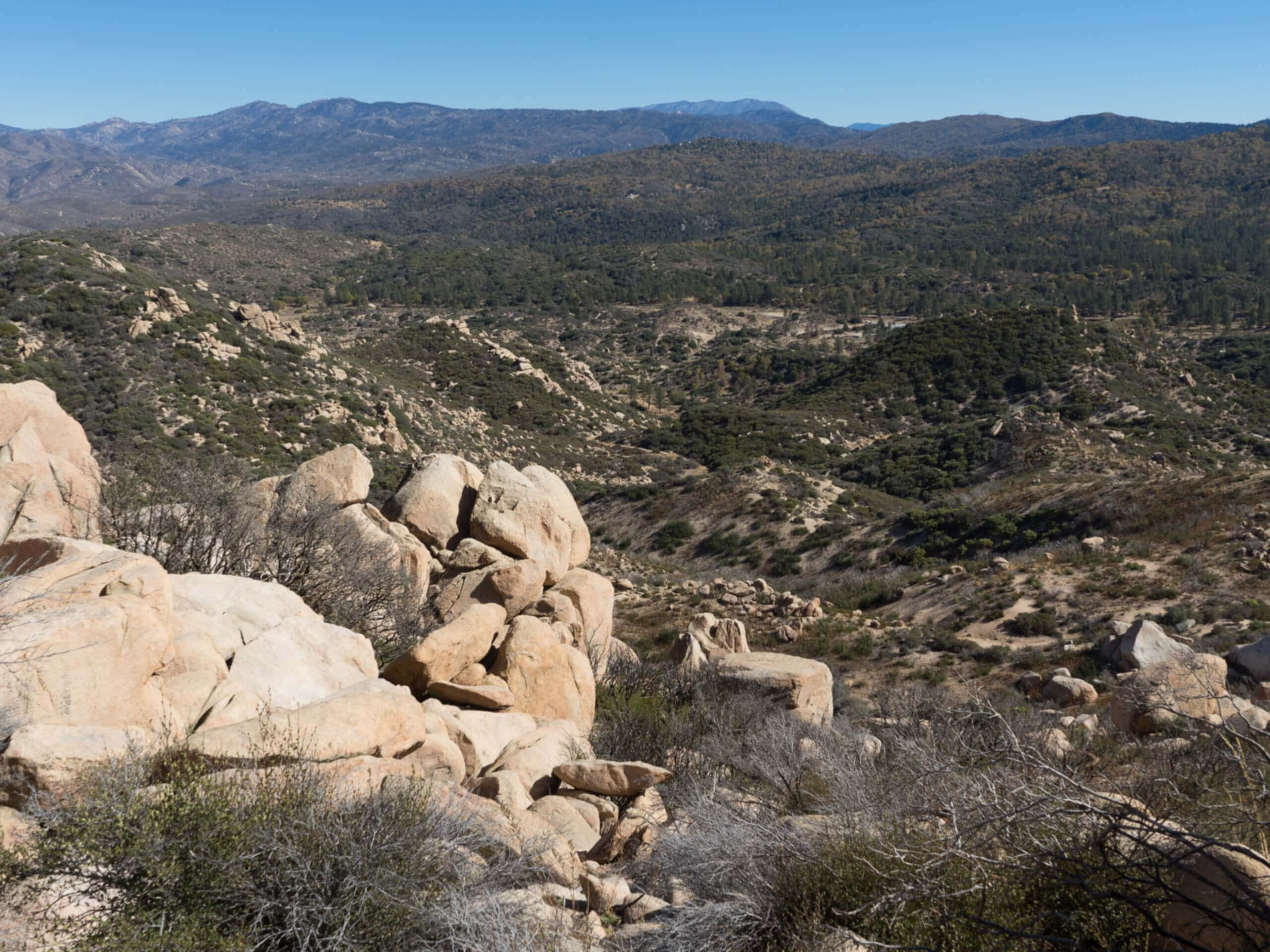
Arrowhead Pinnacles Trail
Difficulty Rating:
The Arrowhead Pinnacles Trail is a great adventure in the San Bernardino National Forest that will take you through a bit of desert terrain for views of the surrounding mountains. While out on the trail, you will traverse rock-strewn pathways and dried up creek beds, before pushing up to the top of a small granite peak for views of the nearby San Bernardino Mountains. Hikers should take note that this is a popular trail, so try to arrive early if you hope to secure parking at the trailhead.
Getting there
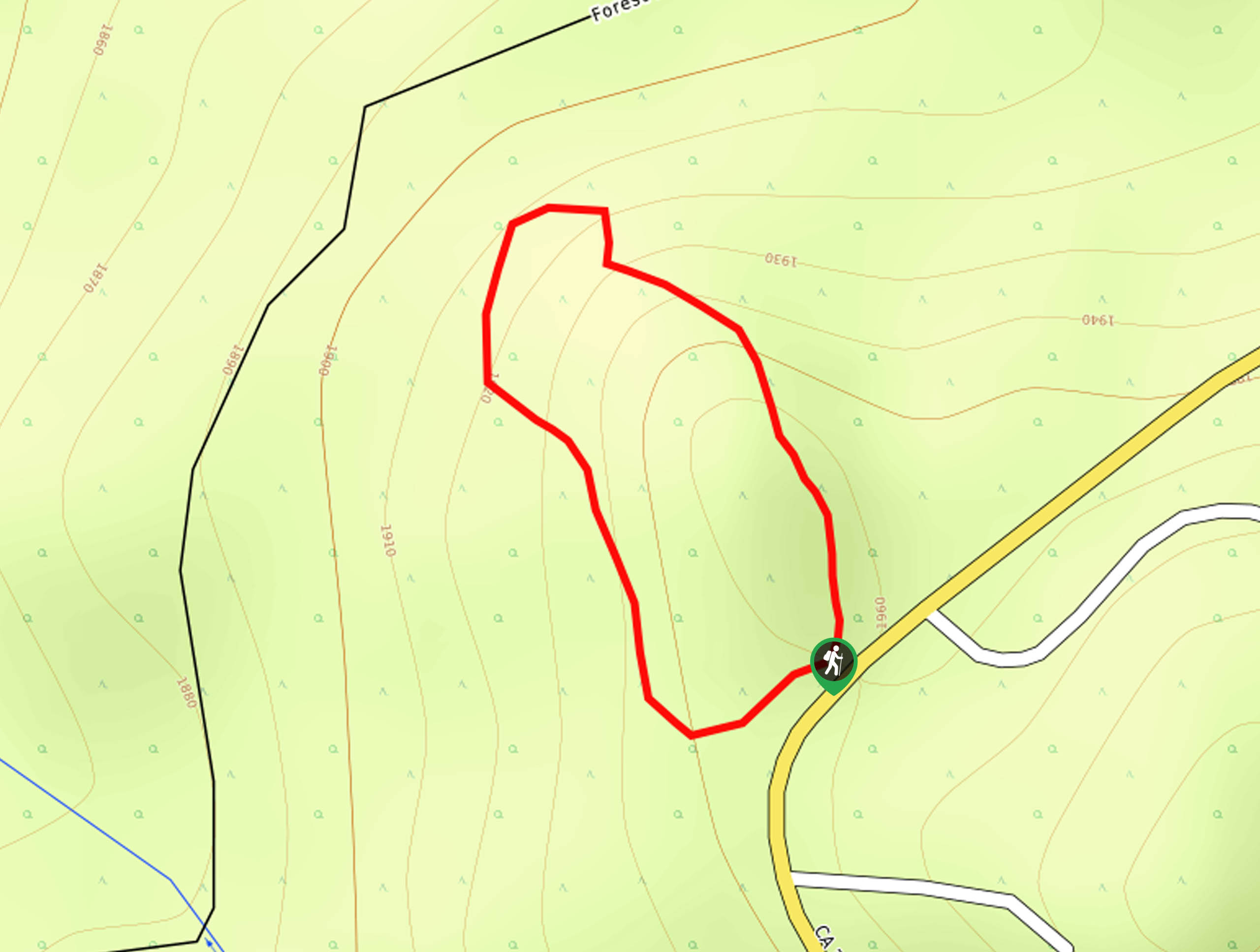
The parking area for the Arrowhead Pinnacles Trail can be found along CA-173, just 0.2mi southwest of the Arrowhead Fish & Game Conservation Club.

About
| Backcountry Campground | No |
| When to do | Year-Round |
| Pets allowed | Yes |
| Family friendly | Older Children only |
| Route Signage | Poor |
| Crowd Levels | High |
| Route Type | Out and back |
Arrowhead Pinnacles Trail
Elevation Graph
Weather
Arrowhead Pinnacles Trail Description
While it isn’t too physically demanding, the Arrowhead Pinnacles Trail is a bit of a challenging hike due to the rugged and rocky terrain that can be tricky to navigate. Be sure to wear proper hiking boots and bring a GPS in order to stay on the correct path. Additionally, trekking poles will come in handy for stability when traversing the rocky trail.
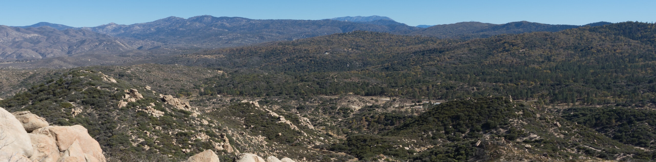
Although it is a bit on the rugged side, this route offers a great way to get out into the desert to enjoy some beautifully scenic landscape views. In addition to the desert landscape and rocky terrain, you will also have a great sightline of the nearby San Bernardino Mountains. For those who enjoy rock climbing, the Pinnacles offer some of the best routes in the region, so plan on sticking around for the afternoon if you are up for a bit of bouldering!
Setting out from the parking area, you will make your way through the tree cover to the north and cross over the banks of Kinley Creek. From here, you will traverse the open desert landscape to the northwest for roughly 0.2mi, where you will come to a junction with another trail.
Taking the path on the left, you will continue on to the northwest through the desert, gaining some elevation as you work your way across the rocky and scrub covered undulating landscape. After 0.5mi, you will cross over another creek bed, after which the trail will become quite a bit more rocky.
Take some time to appreciate the natural beauty of the desert landscape and be sure to watch your footing, as you work your way around some large boulders scattered alongside the trail. Here, the trail will turn back to the northwest for the final push up to the top of the Pinnacles.
After arriving at the rocky summit, you will enjoy sweeping views across the surrounding desert landscape and the nearby San Bernardino Mountains. Once you have taken in the views, you will carefully backtrack along the rocky trail in order to return to the trailhead where you began your adventure along the Arrowhead Pinnacles Trail.
Trail Highlights
The Pinnacles
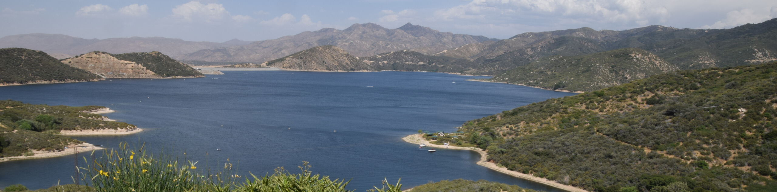
Located to the northwest of Lake Arrowhead in the San Bernardino Mountains, the Pinnacles are a series of small granite peaks that are popular with hikers and rock climbers. Climbers local to the area consider the rock and numerous routes to be comparable to those found at Joshua Tree.
Insider Hints
Proper hiking boots are required for this hike, as the terrain here is quite rocky.
You will need to purchase an Adventure Pass for this hike.
The trail can be tricky to navigate, especially in the upper portions. Bring a GPS if you are concerned about losing your way.
Similar hikes to the Arrowhead Pinnacles Trail hike

Bluff Mesa Hike
The Bluff Mesa Hike is a fantastic adventure in Southern California that features a lovely woodland setting and can be…
Highway 138 VOE Trail
The Highway 138 VOE Trail is a fantastic hiking route north of the Valley of Enchantment that will see you…
Ponderosa Nature Trail
The Ponderosa Nature Trail is a quick and easy hiking loop in the San Bernardino National Forest that features a…
Comments