Windtower hike
View Photos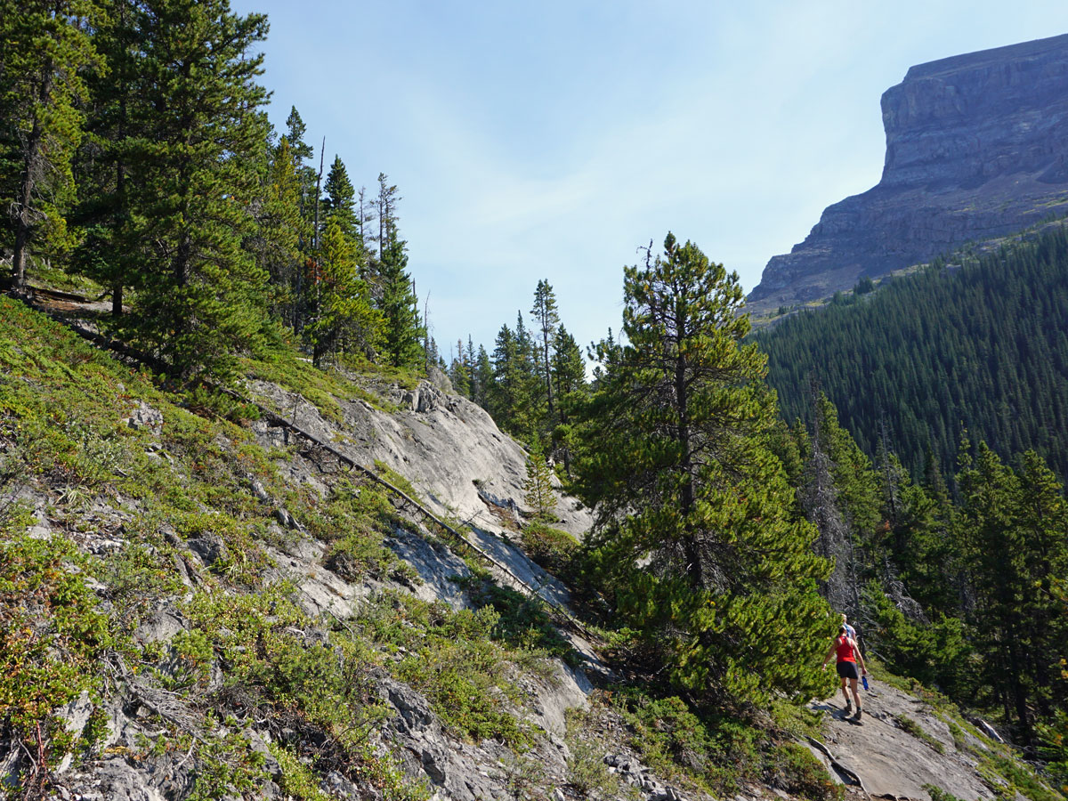

Windtower hike
Difficulty Rating:
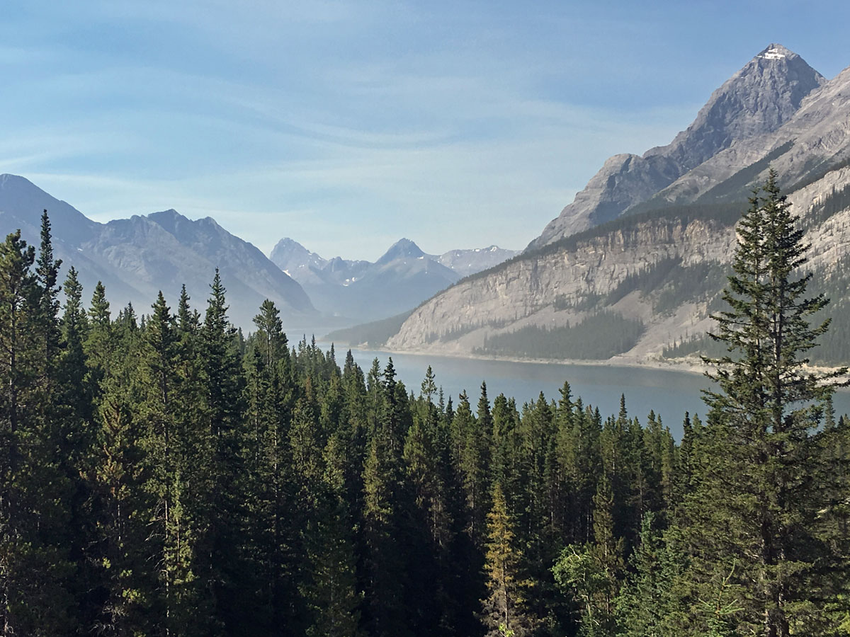
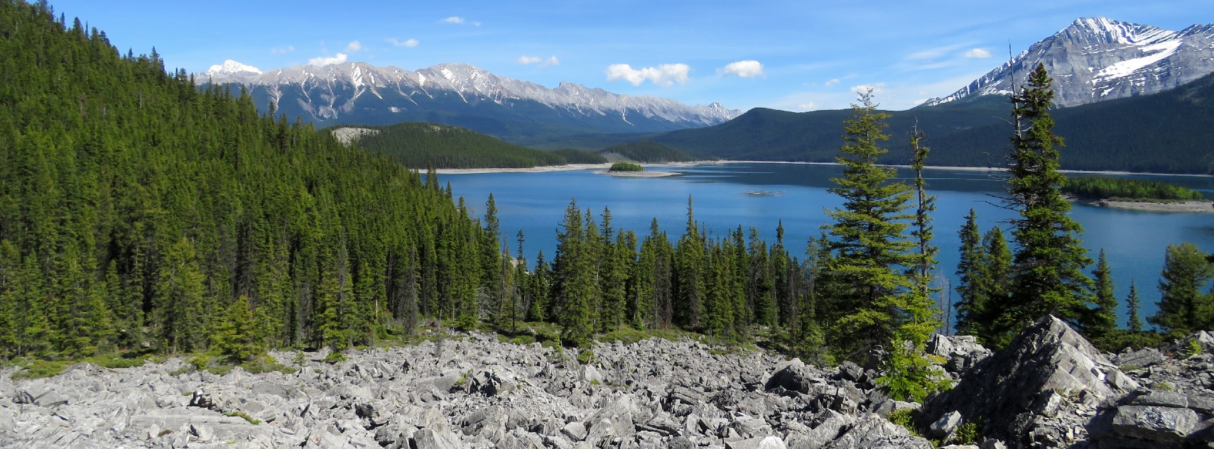
A hike up Windtower is an underappreciated gem of the Canadian Rockies. First take in West Wind pass and then find the path up Windtower for spectacular views in all directions, especially back towards the Spray Lakes Reservoir. Windtower is one of our favourite hikes in the Kananaskis.
Getting there
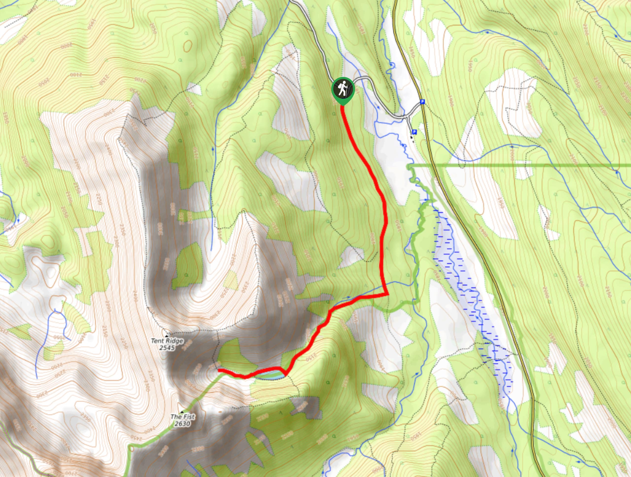
From the Canmore Nordic Centre, continue west on the Smith-Dorrien (Hwy 742) as it winds up into the Spray Valley for 11.5mi. You’ll notice cars parked on both sides of the highway, with a pull-out to your right, adjacent to Spray Lake. There is no signage for this parking.

About
| When to do | June 15 to early October |
| Backcountry Campsites | No |
| Toilets | None |
| Family friendly | No |
| Route Signage | None |
| Crowd Levels | Low |
| Route Type | Out and back |
Windtower
Elevation Graph
Weather
Route Description for Windtower
For first-timers, just finding the right parking lots can be a challenge. Luckily, on weekends there are usually a fair number of other cars that are mostly for hikers going to West Wind Pass. Windtower is a lightly-trafficked hike, and don’t be surprised if your group is the only one there during midweek.
The trail starts by going up the same route as the trail to West Wind Pass, so you’ll meet other people heading there as you hike.
The hike starts in the trees across the road from where you parked, and immediately comes to a sign stating that the West Wind Valley is closed from December 1st to June 15th.
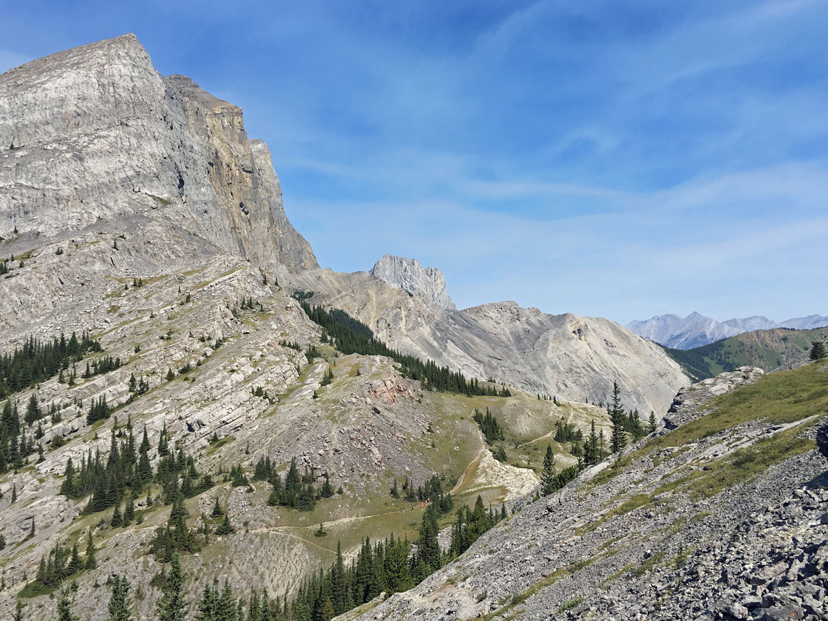
The path heads up through the trees, with Spurling Creek to your right, though often out of sight. Soon after you start your hike, you’ll come across the trail’s first deviation: take the right-hand route with signs west for Windy Pass.
After roughly 30 minutes you’ll come to some cliff bands with the route going over them. Go across this tricky area, taking care. The path splits 10 minutes later, and you can go either way, however we prefer to take the lower of the two paths.
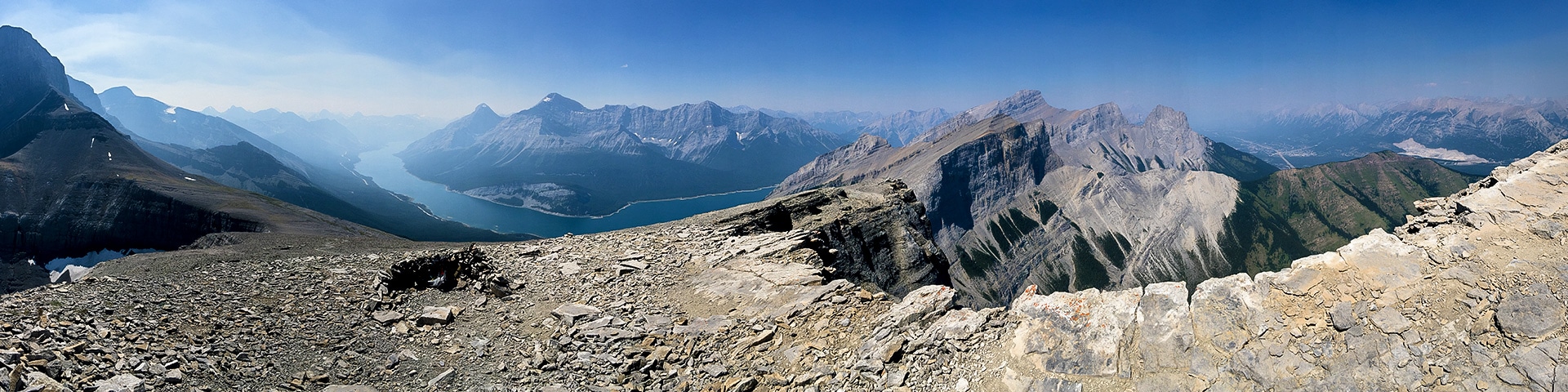
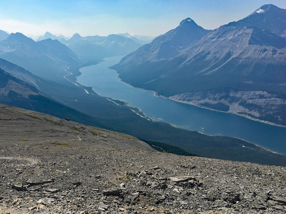
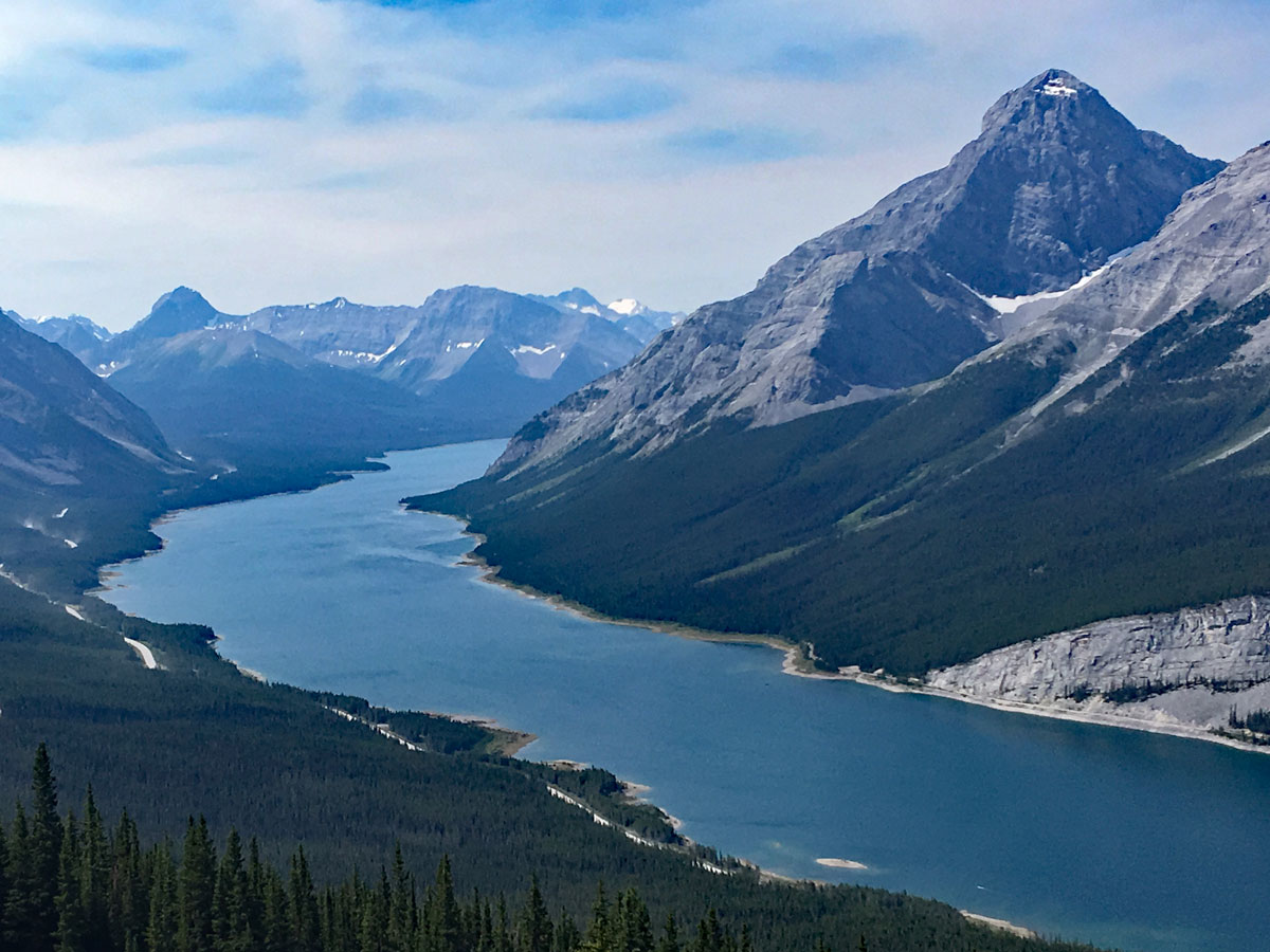
As you come to West Wind Pass (also known as Windy Pass), you’ll notice a large mountain on the right. This is Windtower. The path you see up the mountain on your left is the Rimwall Ridge Route. Continue to follow the well-defined path to the right as it comes to West Wind Pass.
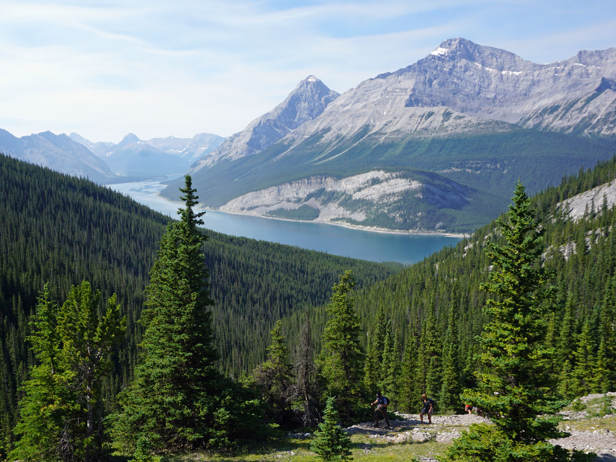
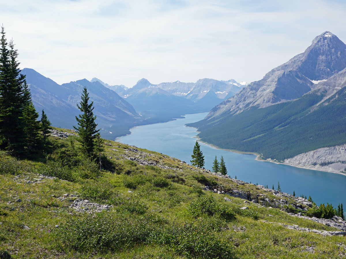
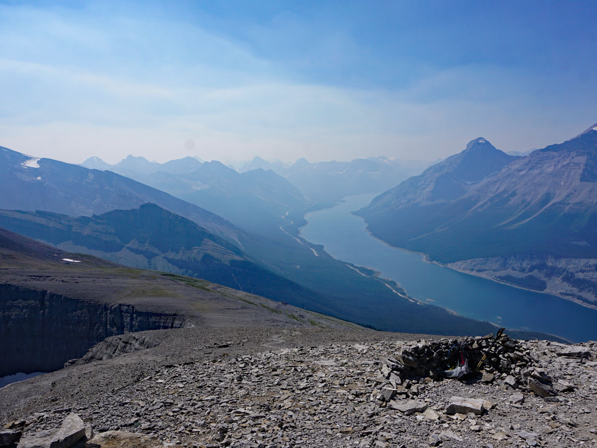
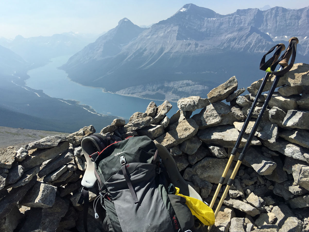
Once you get to West Wind Pass, you will appreciate the beauty. You can continue along the path for a short while to let the views expand in front of you! We love a break here.
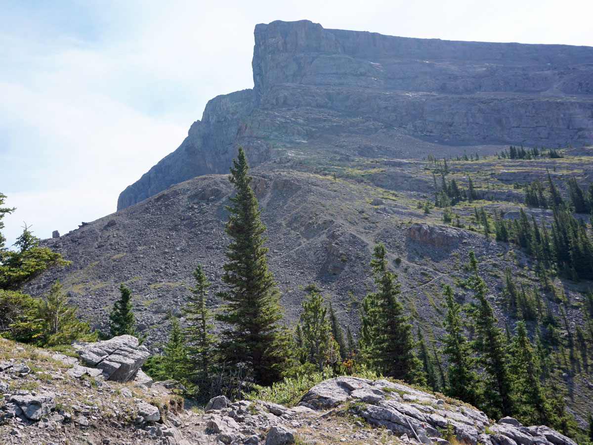
Now you must break away from the crowds and head up to Windtower. Return to the pass and looking down on where your car is (and Spray Lakes Reservoir), follow a path that goes to your left, in and out of the trees. You’ll only be on this path for a short while before you come across some cliff bands that may require use of hands. As far as scrambles go it isn’t formidable however be careful.
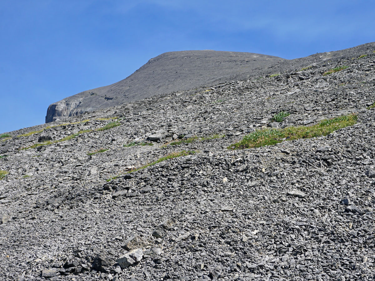
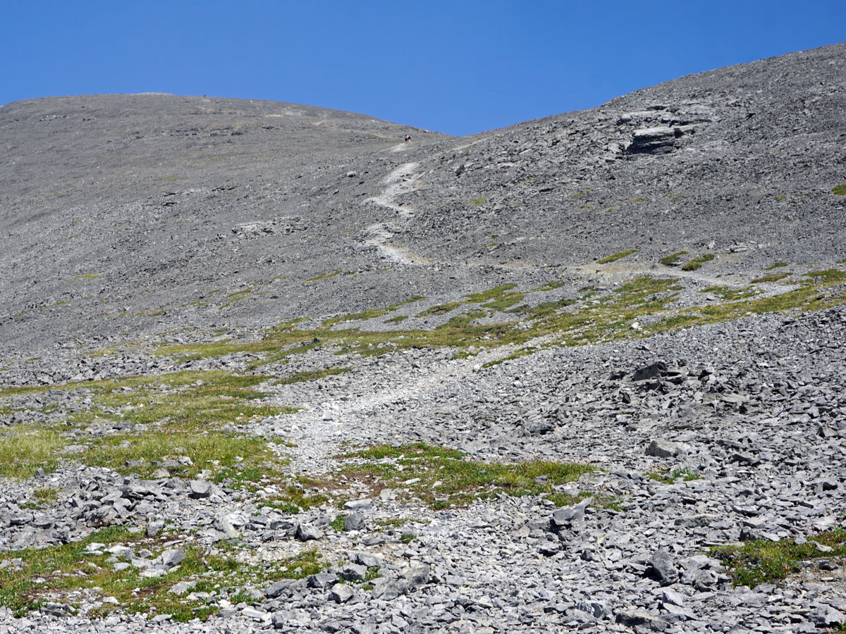
From here, the route goes from very clear to heavily braided and hard to follow as it goes across the slope below Windtower for roughly 45 minutes. Make sure to follow a path you are comfortable on and be prepared to go around any scrambling you don’t like the look of.
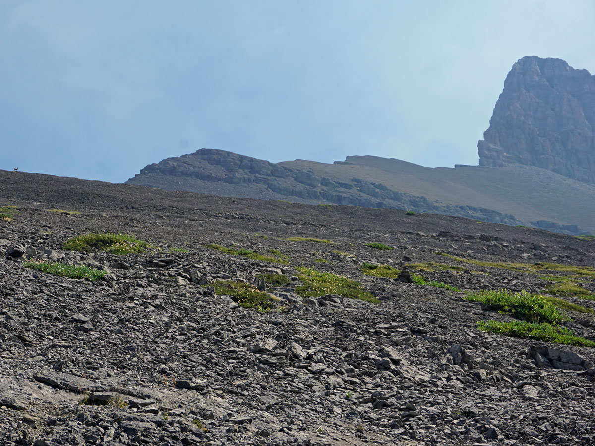
It’s very easy to miss the turn on your left that heads up the scree slope up to Windtower. This is because the turnoff comes when the view towards the Spray Lakes before you and to your right is spectacularly distracting! Look for a path going off to the left. If you look up and see a large cliff band, then you’ve turned too soon. On our map, we show how to get back on the path if you turn too soon on the way up and the regular route coming down.
Once on the correct path, the route up is clear. The path listed on most maps shows a large switchback, however the actual path is pretty much a direct line to the summit of Windtower.
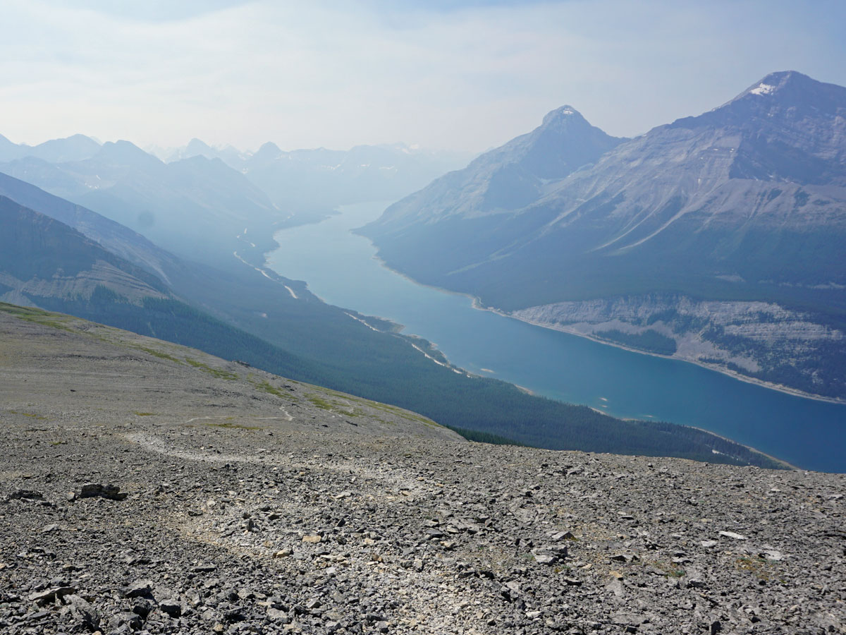
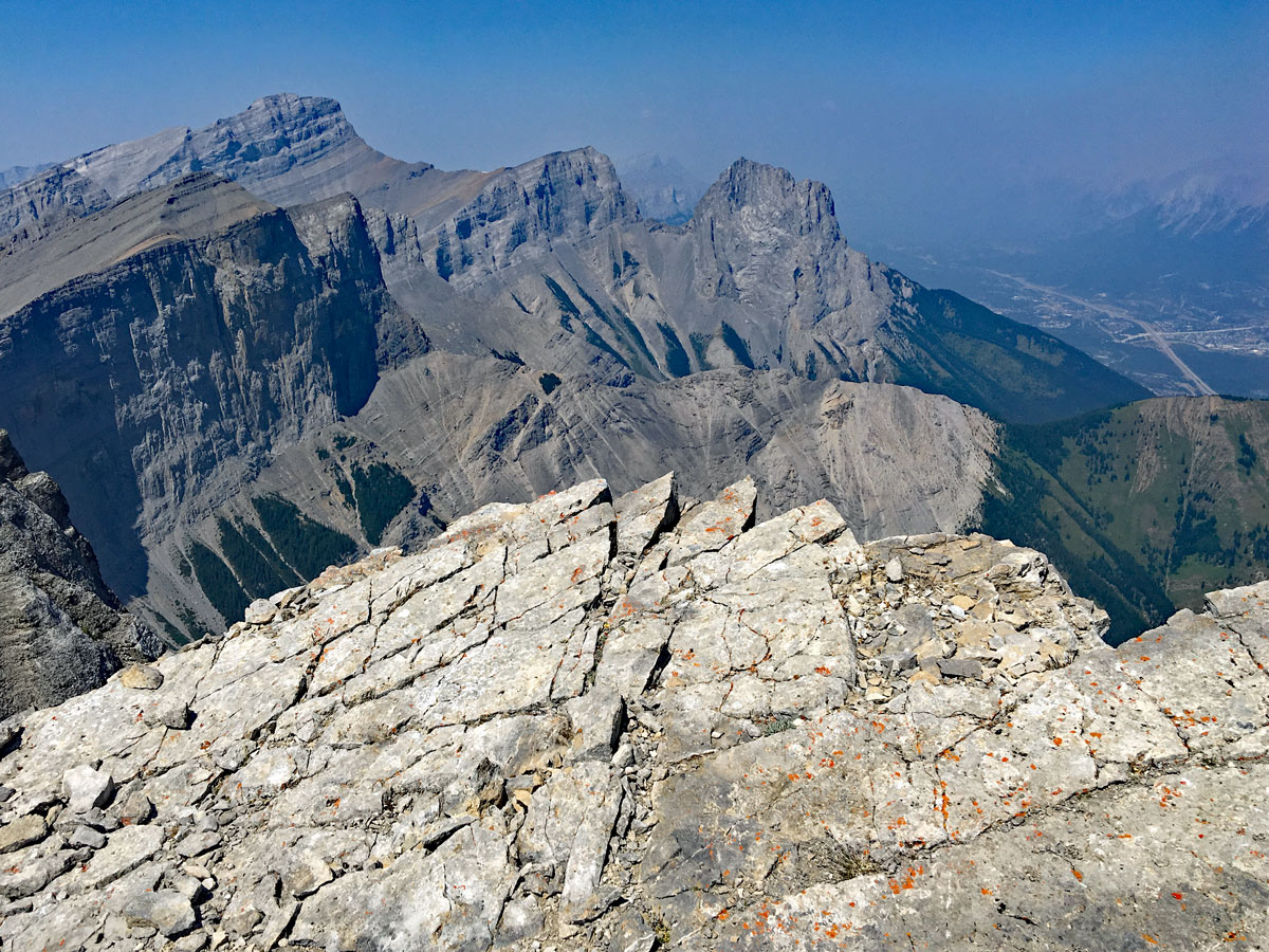
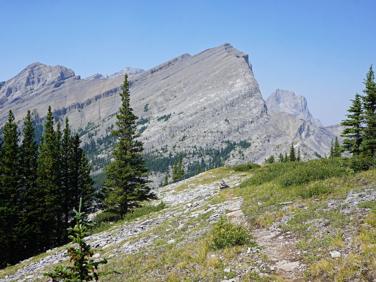
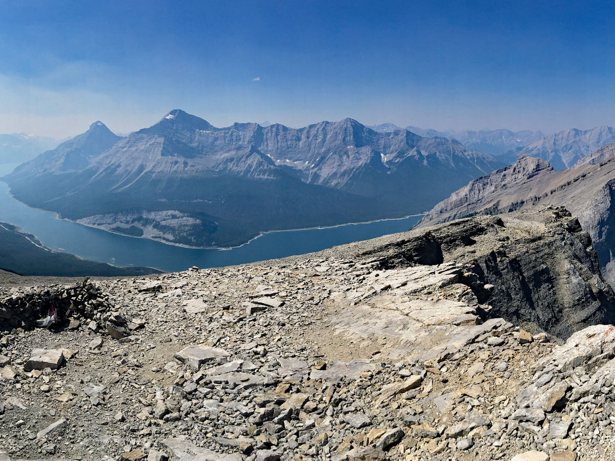
While walking up to Windtower, the stunning Mount Lougheed comes into view as you get higher, with the rugged serrated faces that are colourful and beautiful.
Once at the top, you’ll have amazing views into Canmore, over to Mount Lougheed, behind you to the Spray Lakes and Spray Valley, and down to the left the West Wind Pass and the Rimwall looming high above. There is a summit register here for you to leave your name.
From the top of Windtower, hike back down the way you came. You’ve just had one of the best days of hiking in the Kananaskis!
Check out other amazing hikes in Kananaskis – Smith Dorrien:
Insider Hints
Take poles as this hike is very steep at times.
It can get hot on this hike, as it’s west-facing and exposed. Consider bringing some swimming trunks and a lot of courage to swim in the chilly Spray Lake down by the car.
Fill-up on bagels in Canmore before the hike at the Rocky Mountain Bagel Co.
Really hot days may need slurpees, which can be found at the Mac’s store in Canmore on Bow Valley Trail, in a strip mall just off of Railway Ave.

Similar hikes to the Windtower hike
Pig’s Back Trail
The Pig’s Back is a route to a prominent feature along the Commonwealth Ridge Traverse. You will hike up Commonwealth…
Tryst Lake Trail
The trail to Tryst Lake is used year-round by many different types of adventurers. The summer trail is easy to…
Hidden Lake Trail
There’s an element of uncontained excitement when making your way to a destination with the name Hidden Lake. Just hearing…
Hector Carabez 3 years ago
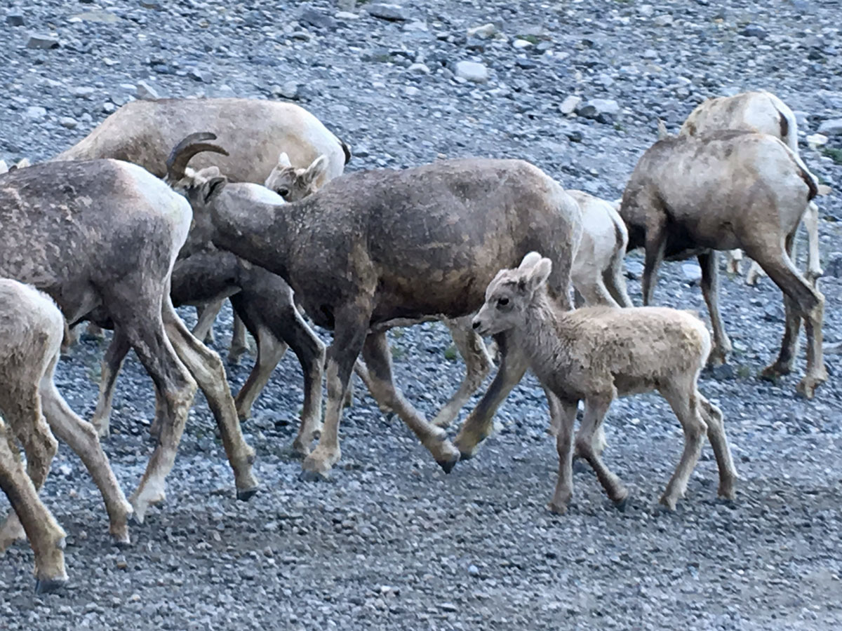
Great hike, we saw a lot of wild life (one coyote, a few marmots, mountain goats and goats and also some birds). Its a hell of a view from the Top!! You have to do it. It took us 6 hrs but we had several breaks for lunch and enjoy the views with some pictures.
Theodore R. 4 years ago
Amazing nature! Wonderful creation of God. A great place to explore!
JohnCan 4 years ago
Astonishing views! Windtower Hike is incredibly challenging.
Greenlife 4 years ago
It sure was windy on the top, and I love it.
MayP 4 years ago
Wind tower is simply perfect!
mallorykirzinger 4 years ago
This hike is totally underrated in my opinion. The trail up to West Wind Pass is relaxed and not technical, but the slog up Windtower is pretty taxing. It's mostly on loose scree, so take poles if you have them. So beautiful at the top though! I loved being right next to the summit of Mount Lougheed.
Richy_travels 4 years ago
Trails are easy to follow with clear instructions. Poles are great and outstanding views are here.
kelsih_99 4 years ago
really easy until you get past the pass, then it's a slog to the top! so worth it though. feels really close to surrounding summits. loved it, my quads didn't!
oskareglq 4 years ago
Nothing worth having comes easy! It was absolutely gorgeous! The trails will make you work hard to see the top.
Diana C. 4 years ago
It was fabulous in every espect and I adore it so much.