
Headwall Lakes hike
View Photos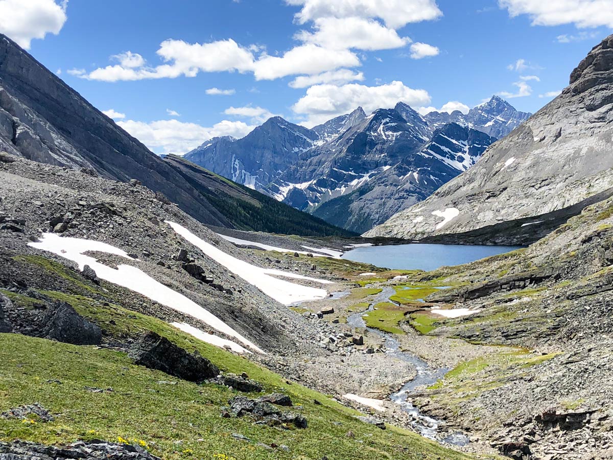
Headwall Lakes hike
Difficulty Rating:
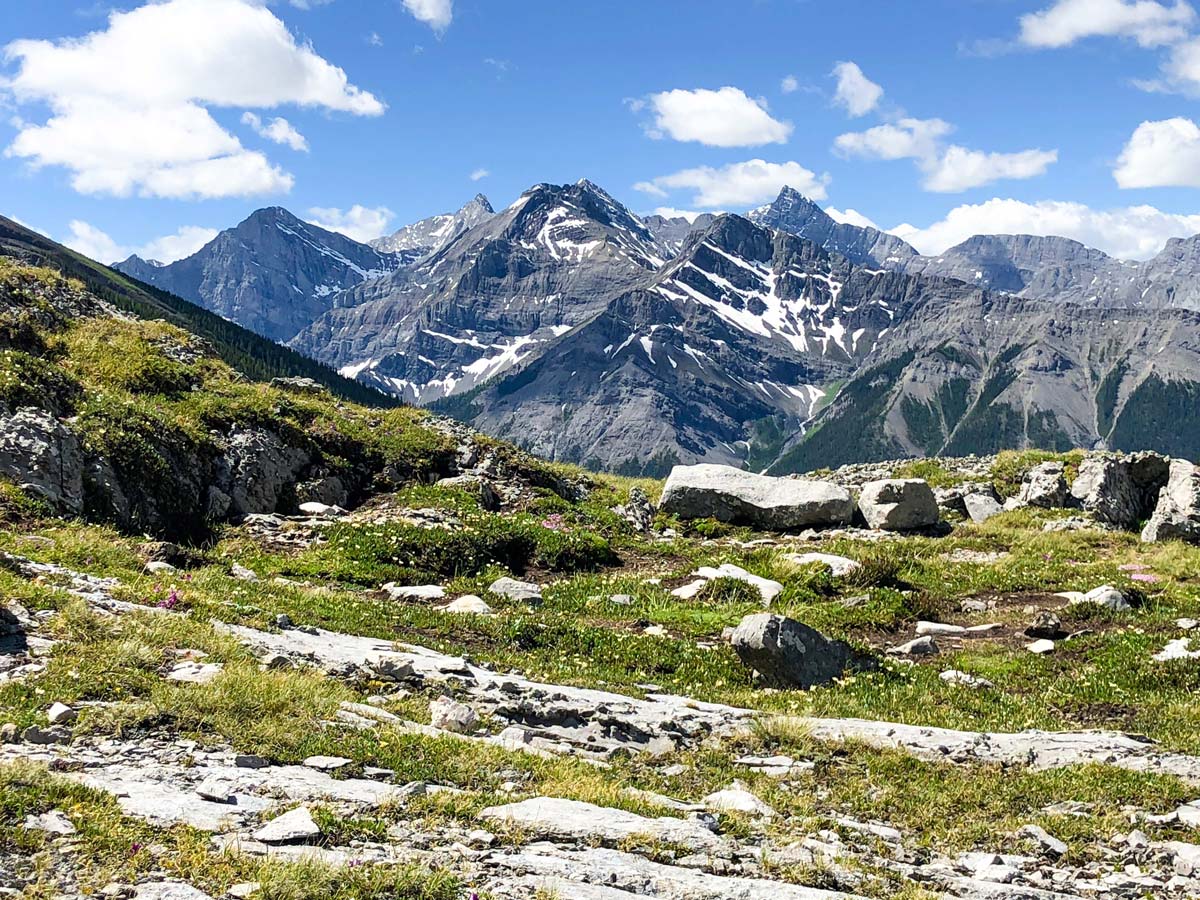
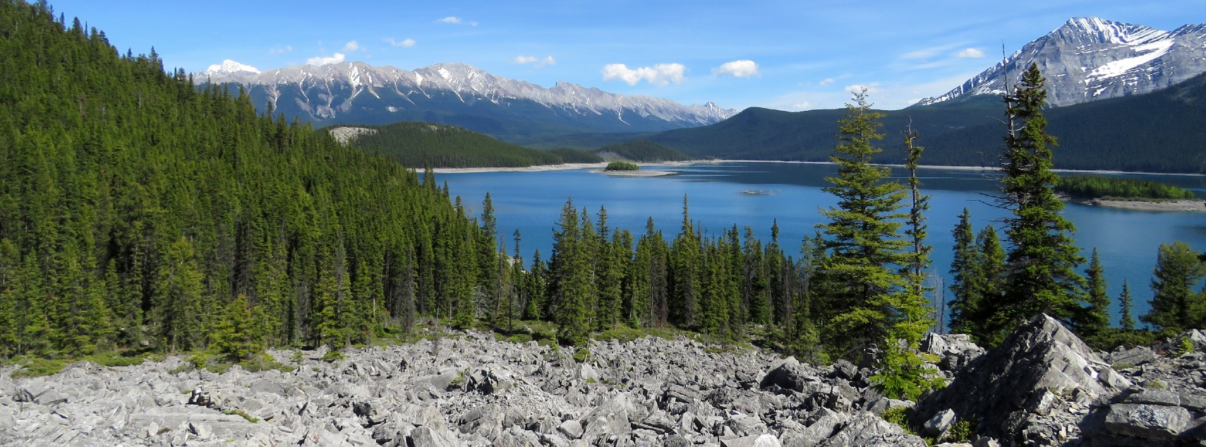
The Headwall Lakes hike is not as popular as it should be. This walk takes you up into the alpine to a barren and stunning limestone valley and the beautiful Headwall Lakes. Many people hike through this valley on the way to the summit of The Fortress.
Getting there
The trailhead is located on the unpaved Highway 742, also known as the Smith-Dorrien Trail, and is the same trailhead as the Chester Lake Trailhead. From Canmore drive towards the Nordic Centre. Continue past the Nordic Centre and travel 25.5mi before reaching the parking lot. If coming from Kananaskis Lakes in the south, the distance is approximately 12.4mi.

About
| When to do | June to early October |
| Backcountry Campsites | No |
| Toilets | At trailhead |
| Family friendly | No |
| Route Signage | Poor |
| Crowd Levels | Low |
| Route Type | Out and back |
Headwall Lakes
Elevation Graph
Weather
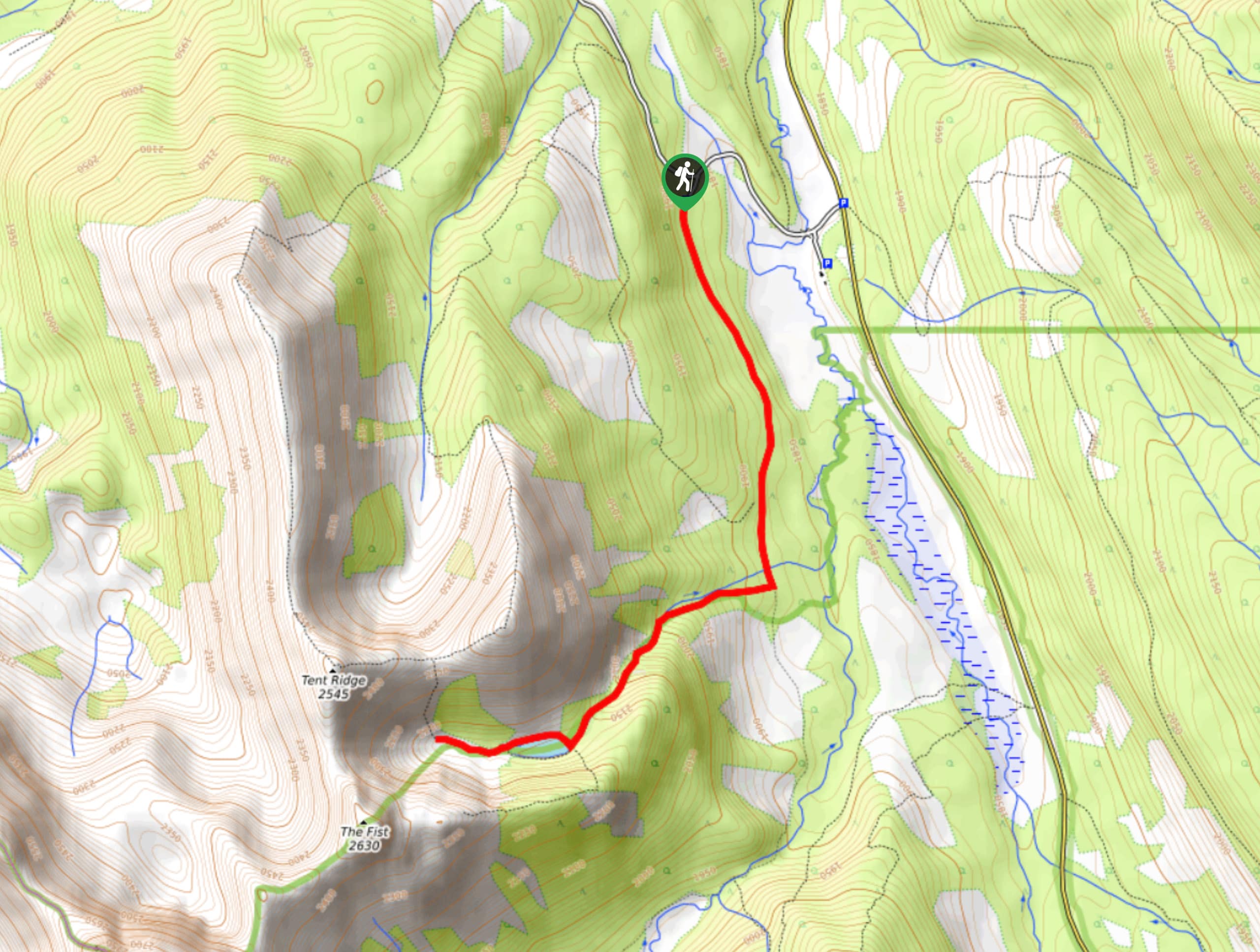
Route Description for Headwall Lakes
This trail starts at the popular Chester Lake Trailhead, which has toilet facilities. The parking lot fills up on beautiful weekends so get there early if it’s nice out.
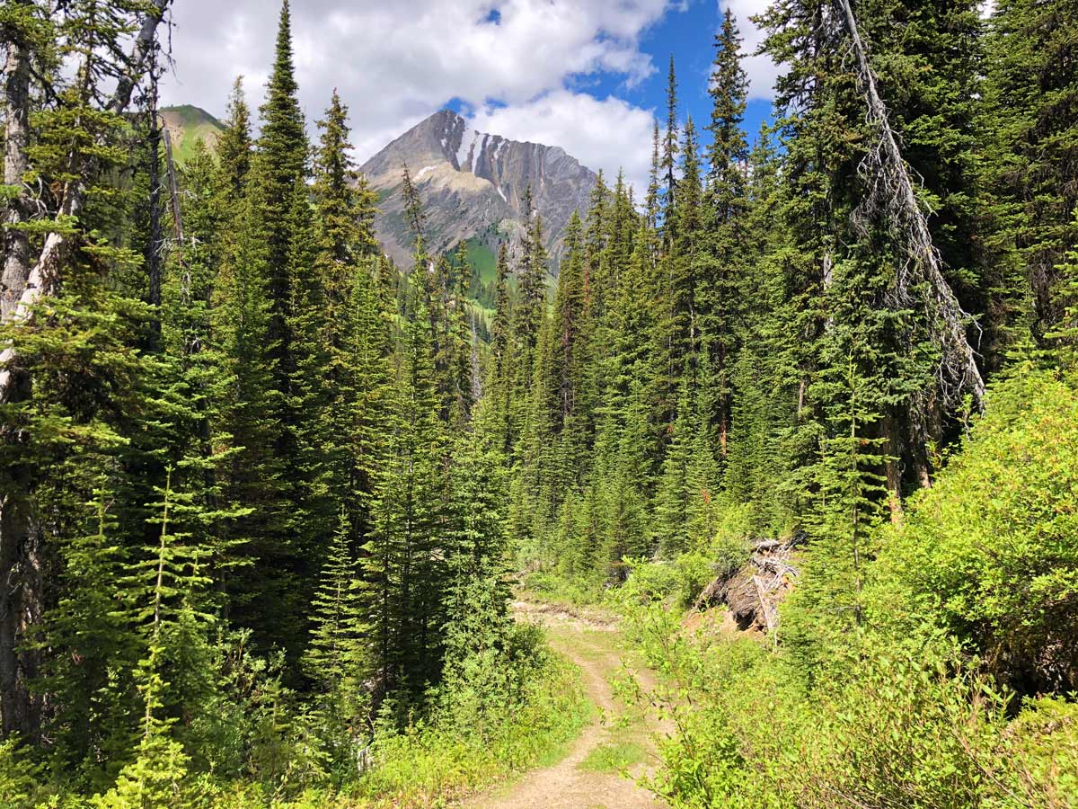
After parking, head-out from the SE corner of the parking lot, following a cross-country skiing sign. This first part of the hike is along a somewhat mundane fire road, and good conversation with your hiking partners helps this part of the hike go quicker.
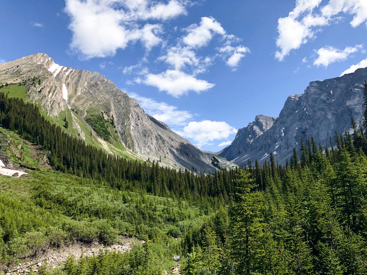
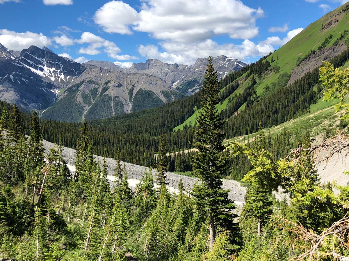
Follow these old logging roads as they go roughly parallel the Smith Dorrien Trail, heading SE for just under 1.9mi. You come to a T-intersection just before you get to Headwall Creek. Go left at this T-intersection and follow the trail as it descends to Headwall Creek. You’ll notice flood damage from the devastating 2013 Alberta Floods, and the original bridge is gone, replaced by a new bridge.
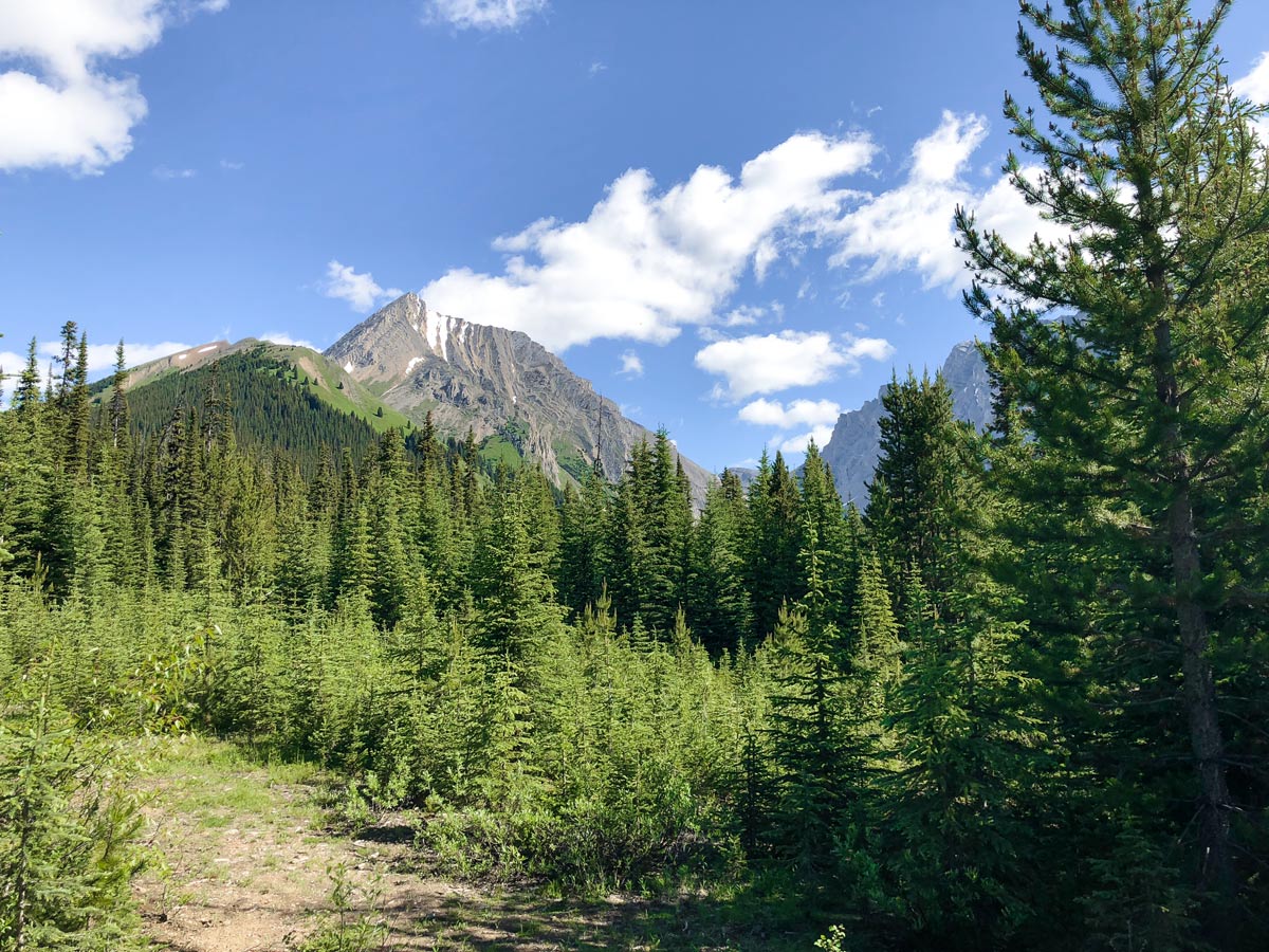
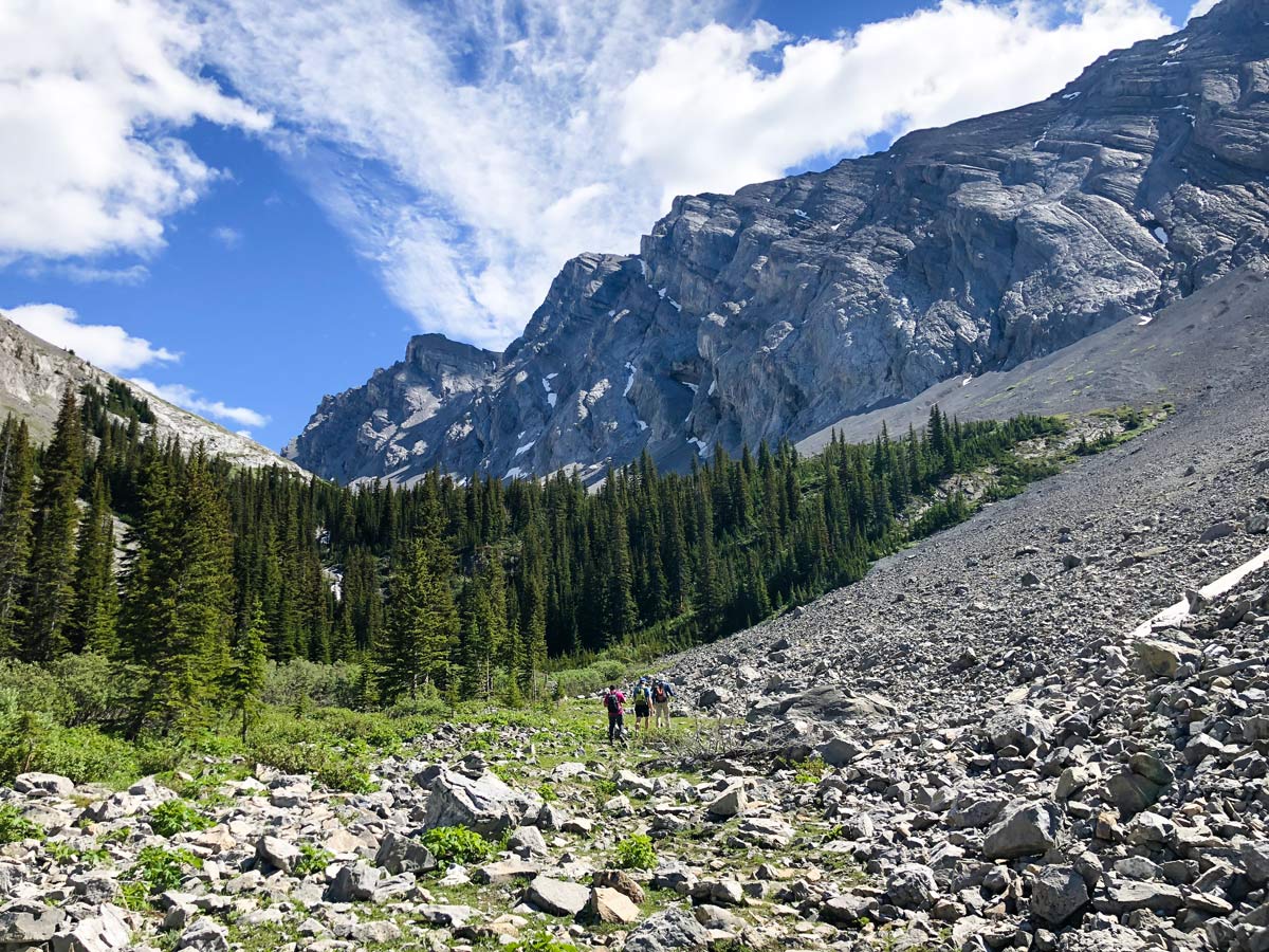
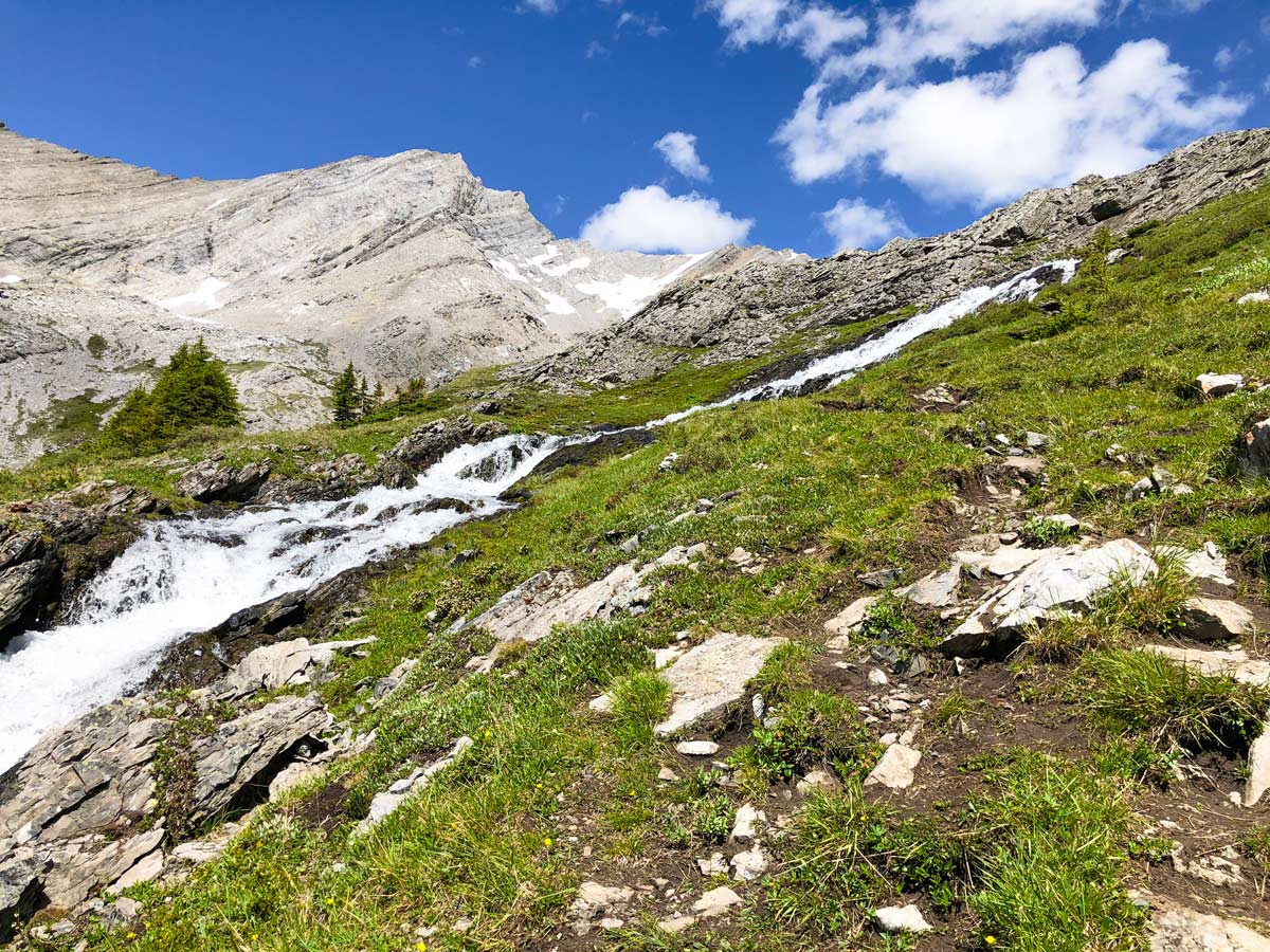
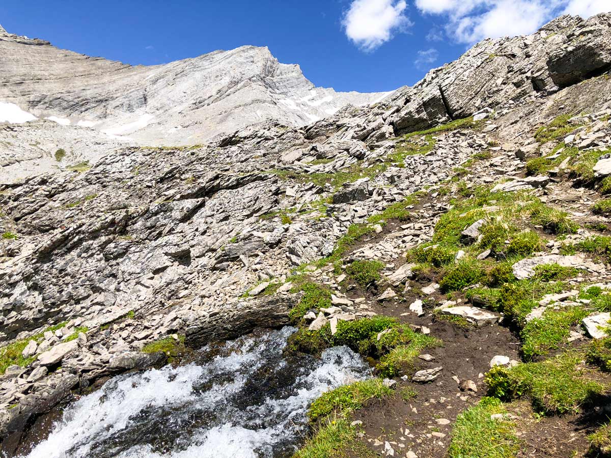
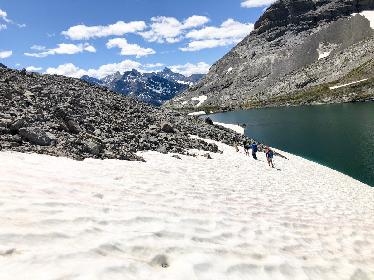
Cross over Headwall Creek and head left. Quite quickly the trail will veer right and head steeply uphill. When the trail levels out look for a cairn on your left (there may also be some flagging), where you leave the wide trail for a narrow path for roughly 1.2mi. This path can be tricky, still recovering from the floods of 2013.
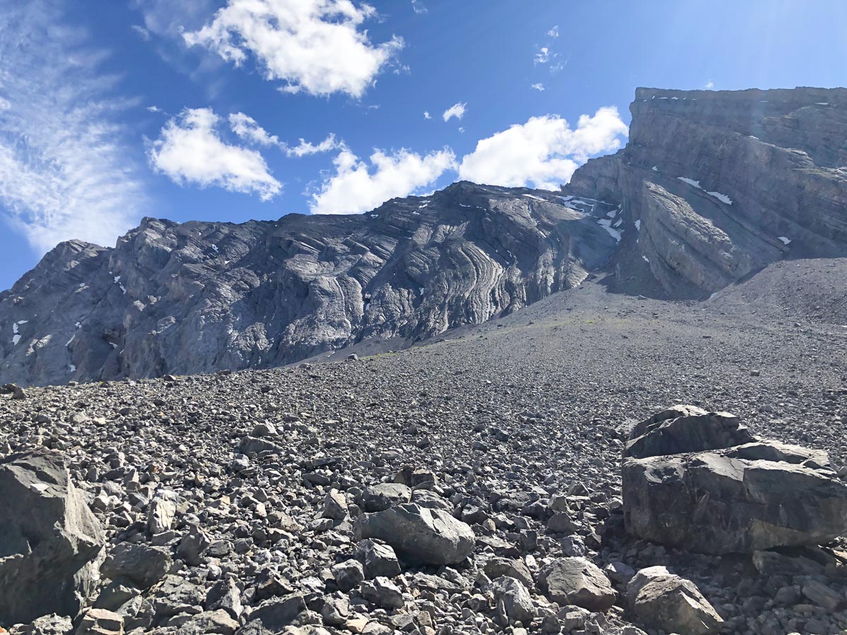
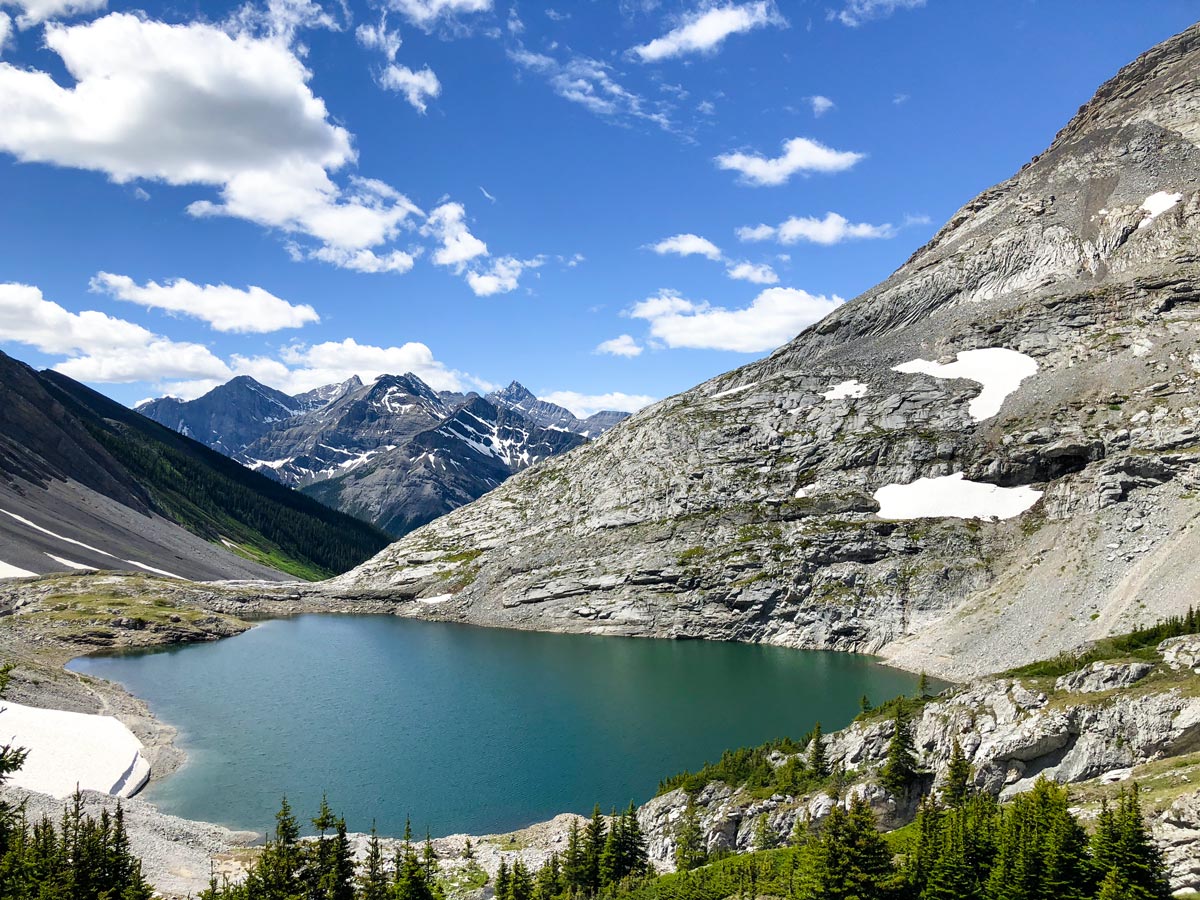
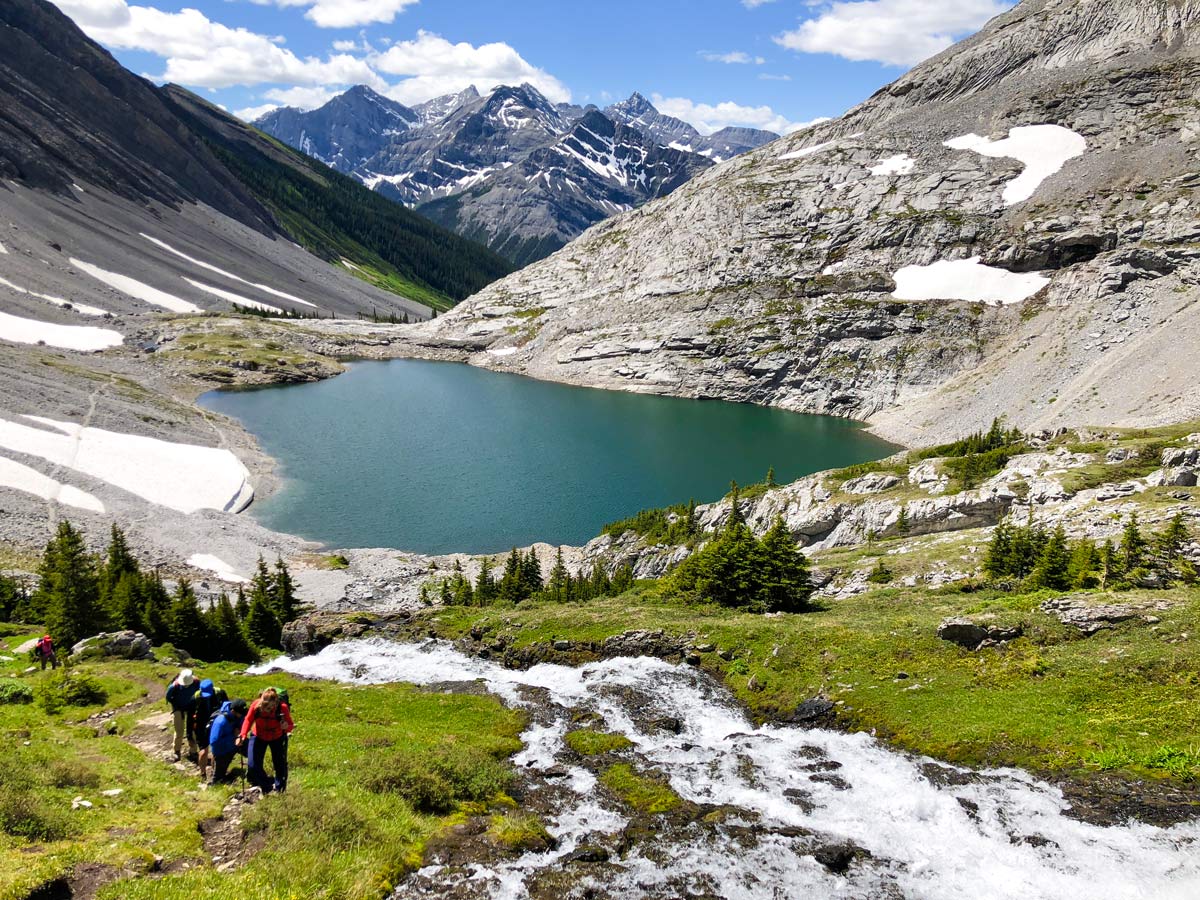
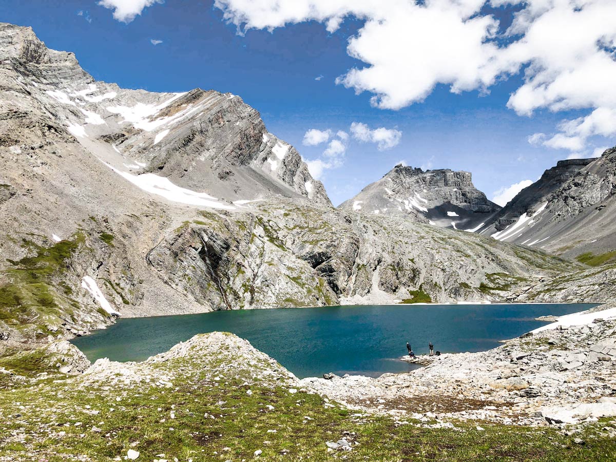
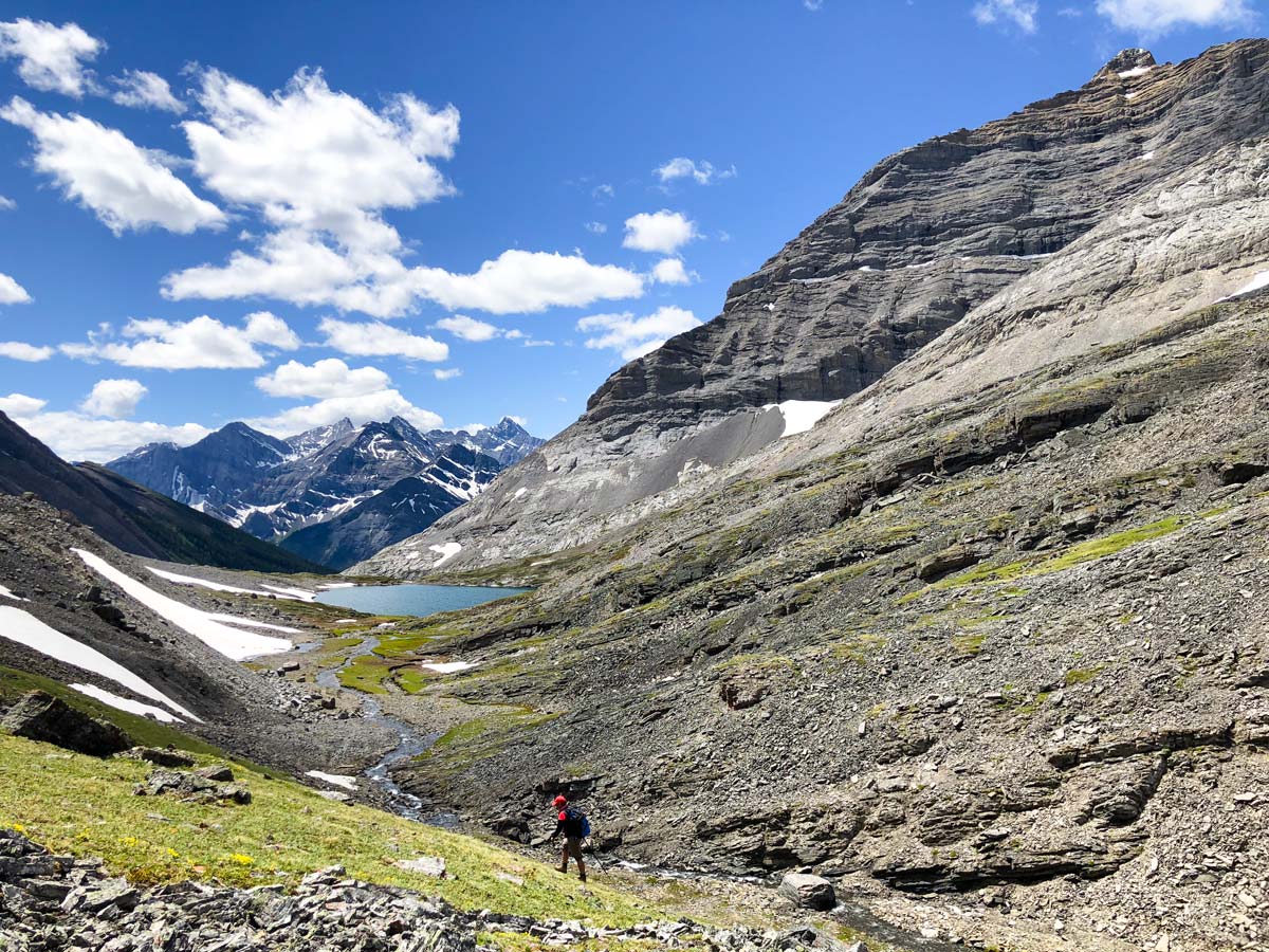
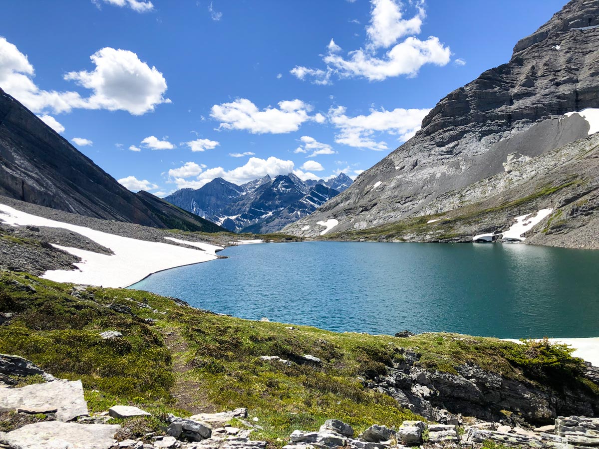
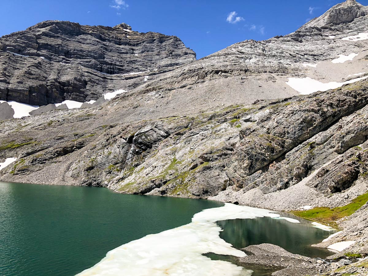
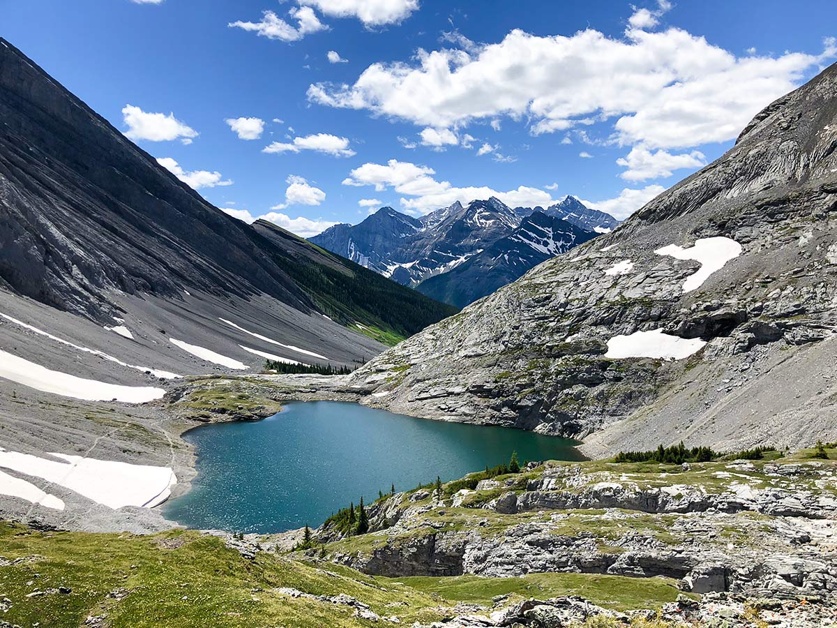
Eventually the path comes out of the woods beside a large scree slope, which you skirt to the left. Ahead is the first, and most difficult headwall, of the day. The headwall is steep, and the rocks are loose. This can be treacherous in wet weather. Soon after this first headwall you see the beautiful Lower Headwall Lake. This deep green lake nestled in a cirque is stunning.
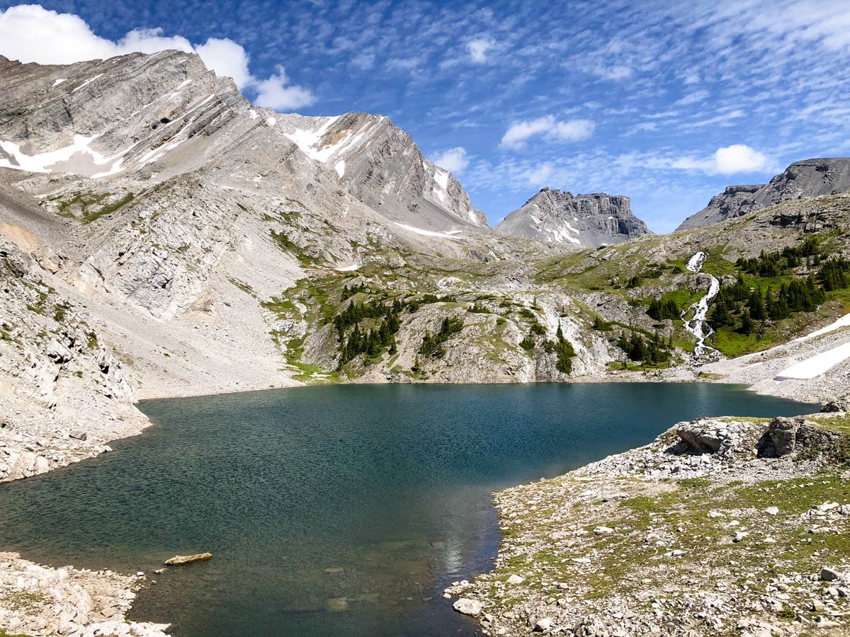
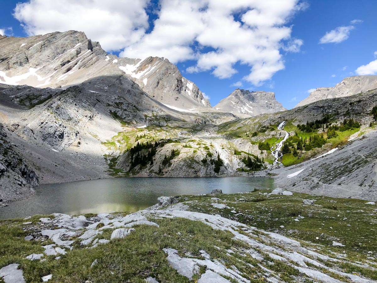
You could turn back after the Lower Headwall Lake, however the best bits are just a little farther on. Head around the right side of Lower Headwall Lake and ascend the steep path to Upper Headwall Lake. The view from Upper Headwall Lake is stunning! Walk around the lake on the right-hand side and savour the views.
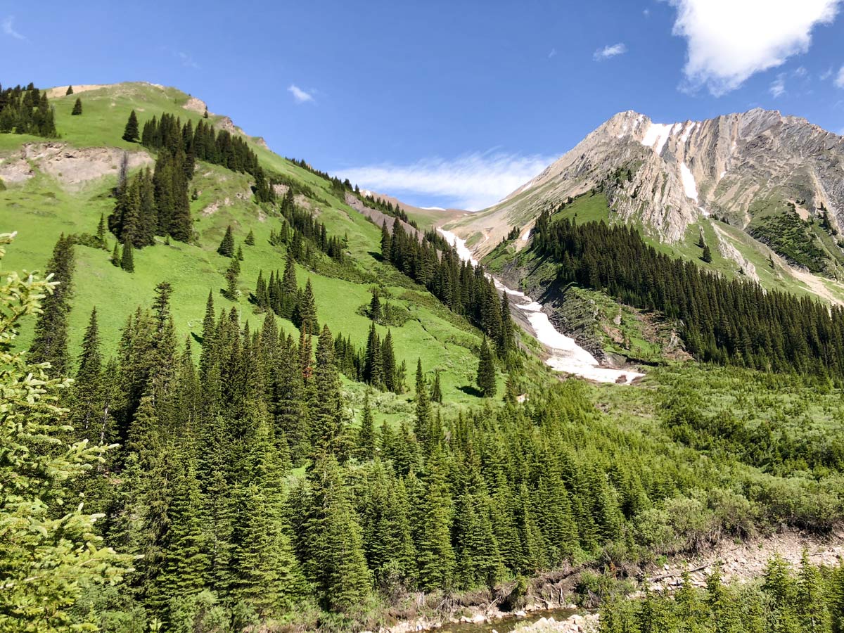
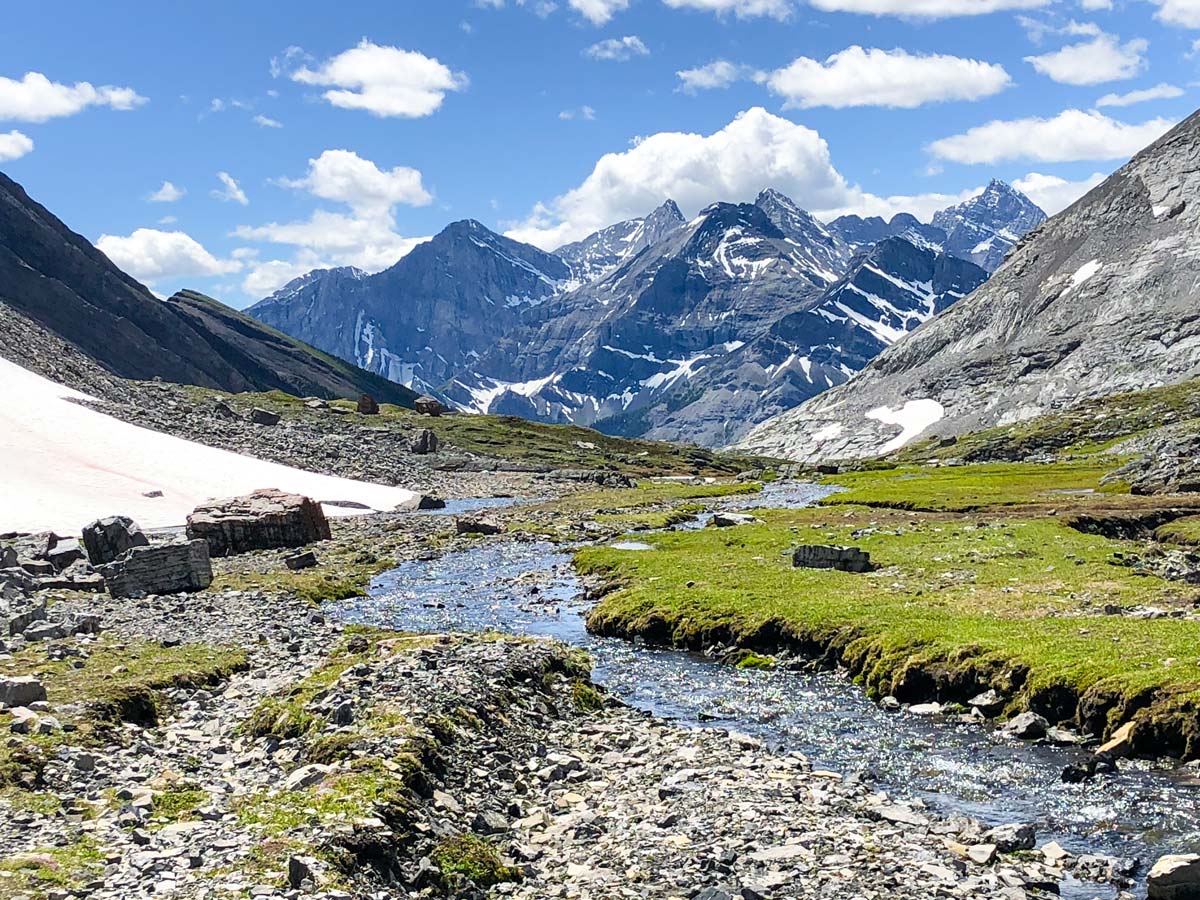
We love to continue up along Headwall Creek for roughly 0.7mi to further explore this beautiful valley, though this additional distance isn’t included in the total for day, nor is it shown on the map. Along this additional 0.7mi you will gain another 558ft of elevation. You can continue a bit farther to climb to the col between Fortress and Chester Mountains, a stunning view. You could also continue all the way up and ascend The Fortress, which is a scramble we rate as one of the 10 best in the Kananaskis.
Return the way you came, back to your car. The views are sublime as you descend, but take care to watch your step. The route down both of the headwalls are tricky, and would be unpleasant if wet or icy.
Once back on the logging roads, you need to take care if you parked your car on the Smith Dorrien, as it’s easy to pass by the trail on your left. If you go too far and end up back at the Chester Lake parking lot, merely return along the Smith-Dorrien.
Check out other amazing hikes in Kananaskis – Smith Dorrien:
Insider Hints
Get to the parking lot early as the Chester Creek parking lot can fill up early on weekends.
You can save 1.2mi of the route by parking along the Smith Dorrien, 2543ft south of the Chester Lake parking lot and taking the left-hand logging road to the trail. Turn right when you reach the trail.
This is the same approach as the route to The Fortress, a great scramble in the Kananaskis.

Similar hikes to the Headwall Lakes hike
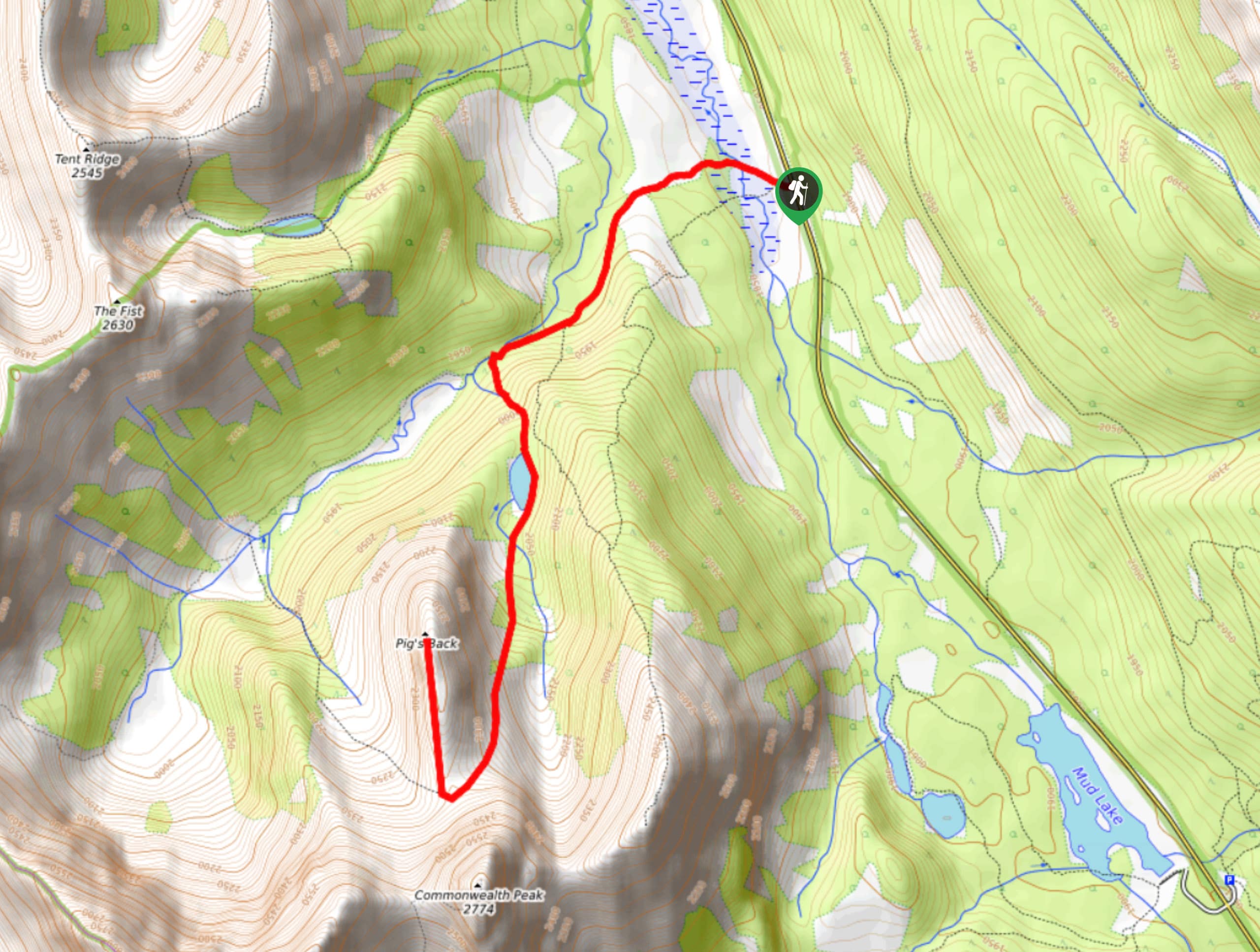
Pig’s Back Trail
The Pig’s Back is a route to a prominent feature along the Commonwealth Ridge Traverse. You will hike up Commonwealth…
Tryst Lake Trail
The trail to Tryst Lake is used year-round by many different types of adventurers. The summer trail is easy to…
Hidden Lake Trail
There’s an element of uncontained excitement when making your way to a destination with the name Hidden Lake. Just hearing…
SebClyde 4 years ago
It is one of the most solemn hikes I have experienced so far, but I mean it in a good way! It actually helped in taking in all the amazing scenery and getting rid of negative thoughts out of my head.
Greenlife 4 years ago
We admired Headwall Lakes' beauty. It was breathtaking.
PeterHopkins 4 years ago
Limestone Valley is truly remarkable. There is some challenge, but it's a great experience.
Diana C. 4 years ago
One of the less busy hikes, I enjoyed the views and the peacefulness of the place.
Willow F. 4 years ago
The headwall is quite difficult. Amazing scenery of the valley. It was a great experience.
Coll A. 4 years ago
Headwall Lakes is really astounding! The trail down both of the headwalls are tricky and would be unpleasant if wet or icy. I love how peaceful the place is.
Linby SK. 4 years ago
This hike takes you up into the alpine to a barren and stunning limestone valley. Many people hike through this valley on the way to the summit of The Fortress. Limestone Valley is truly mesmerizing.
Sean Kater 4 years ago
Very challenging because of the steep path and loose scree. Hiking poles are the best companion for this hike.
Elmer J. 4 years ago
It was a fine trip. Nothing too fancy.
NotMichaelScott 4 years ago
Underrated beaut. Definitely park on the logging road to save yourself some time.