
Sparrowhawk Tarns hike
View Photos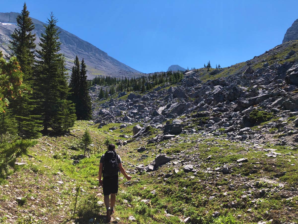
Sparrowhawk Tarns hike
Difficulty Rating:
The pretty hike to the Sparrowhawk Tarns is a hard trail to follow, however once you reach the tarns, the beautiful views make up for the route-finding challenges. Don’t wait until autumn, as the tarns dry up and are not as stunning.
Getting there
From the Canmore Nordic Centre, continue west and then south on the Smith-Dorrien (Hwy 742) as it winds up into the Spray Valley for 14.1mi. Turn right at the signed Sparrowhawk Day Use Area.

About
| When to do | June to early October |
| Backcountry Campsites | No |
| Toilets | At trailhead |
| Family friendly | No |
| Route Signage | None |
| Crowd Levels | Low |
| Route Type | Out and back |
Sparrowhawk Tarns
Elevation Graph
Weather
Route Description for Sparrowhawk Tarns
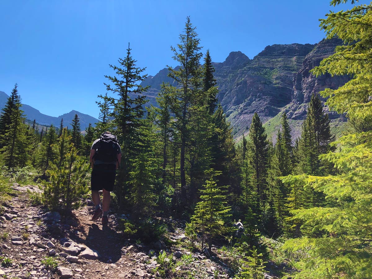
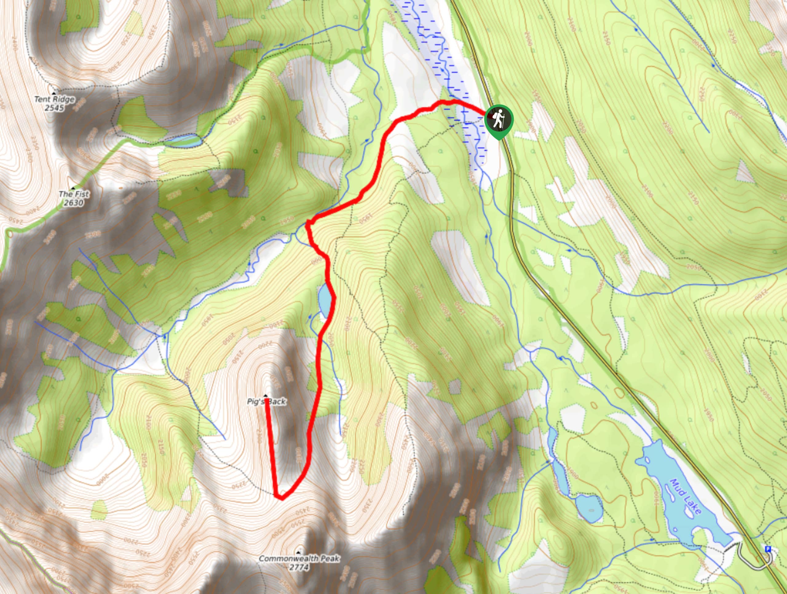
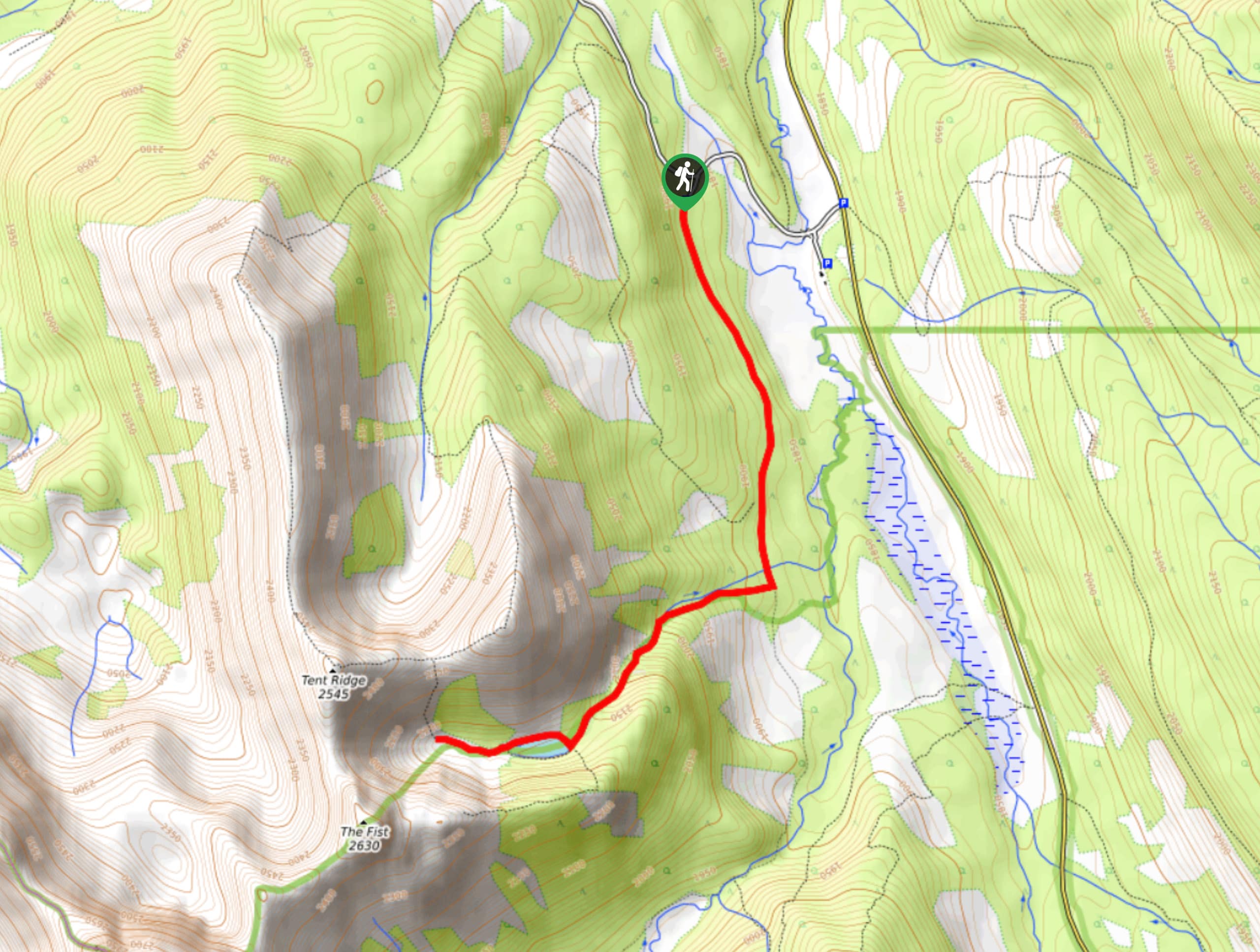
The hike to Sparrowhawk Tarns is a pretty hike, though route-finding can be challenging. Look at the map before you go, as knowing the general direction really helps you to know where to look for paths and cairns. There is a path, it’s just easy to miss on the way up. The way down from Sparrowhawk Tarns is much easier to follow.
From the Sparrowhawk Day Use Area, cross over the Smith-Dorrien and take the clear path the goes up. Very quickly you come to an intersection with the High Rockies Mountain Bike Trail crossing over your path, which goes straight ahead. The High Rockies Mountain Bike Trail is an exciting new trail for bike-packers and casual day-riders in the Canadian Rockies.
Go straight through the intersection and continue hiking up on the clear trail.
The path soon splits (roughly 0.6mi from the car), with the left going to Read’s Ridge. Go right to continue to Sparrowhawk Tarns.
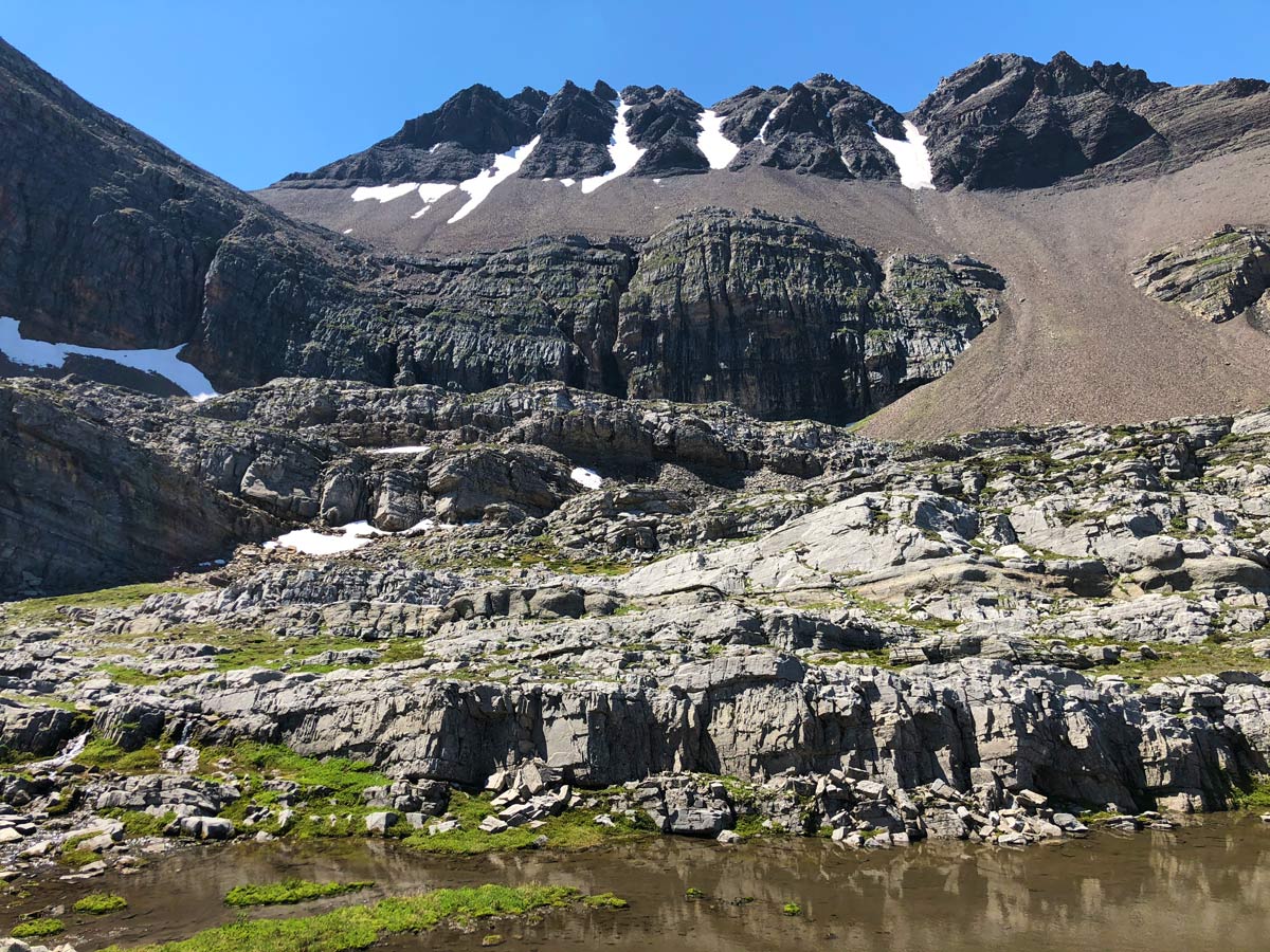
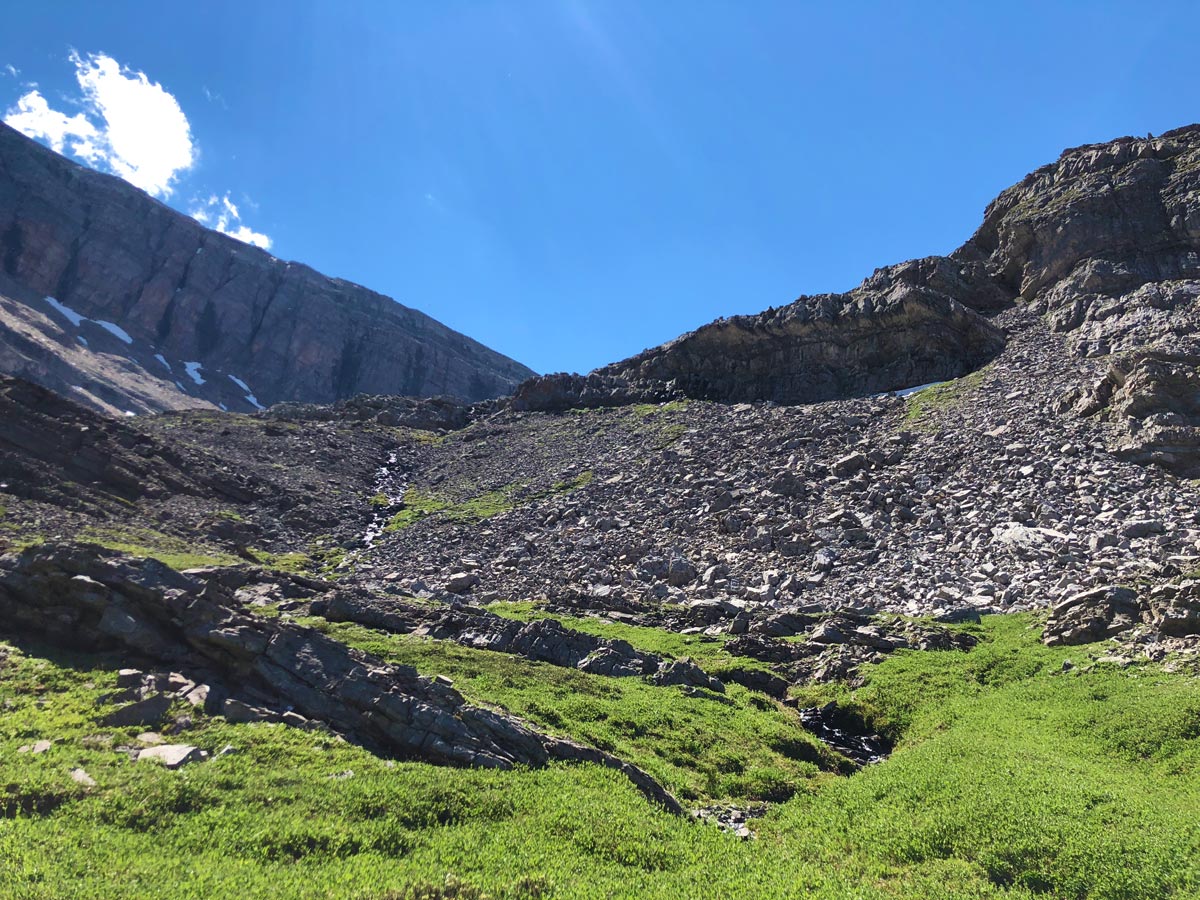
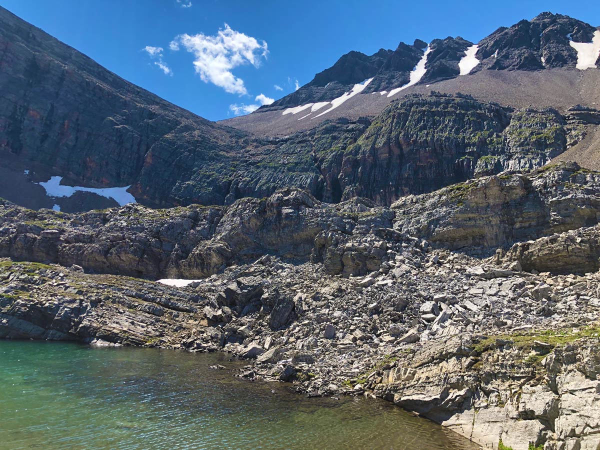
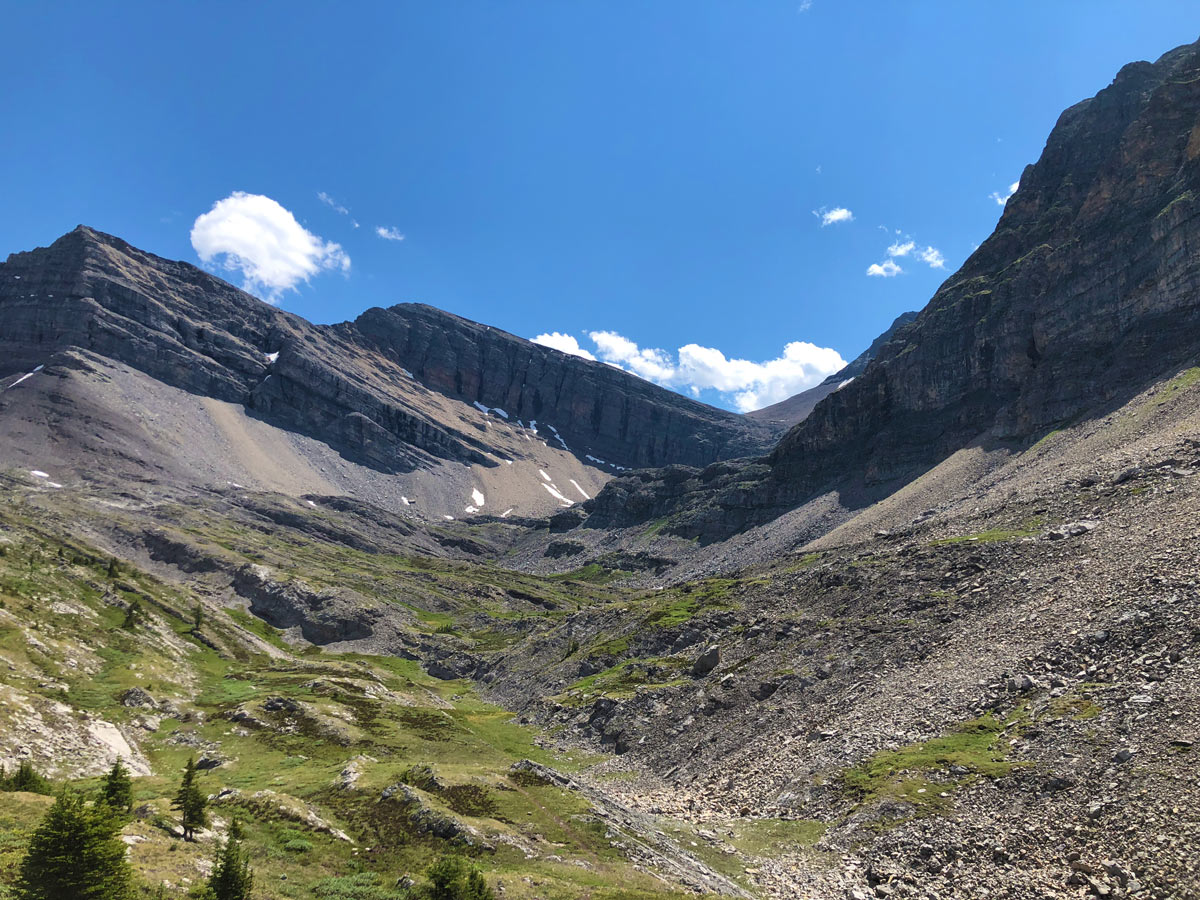
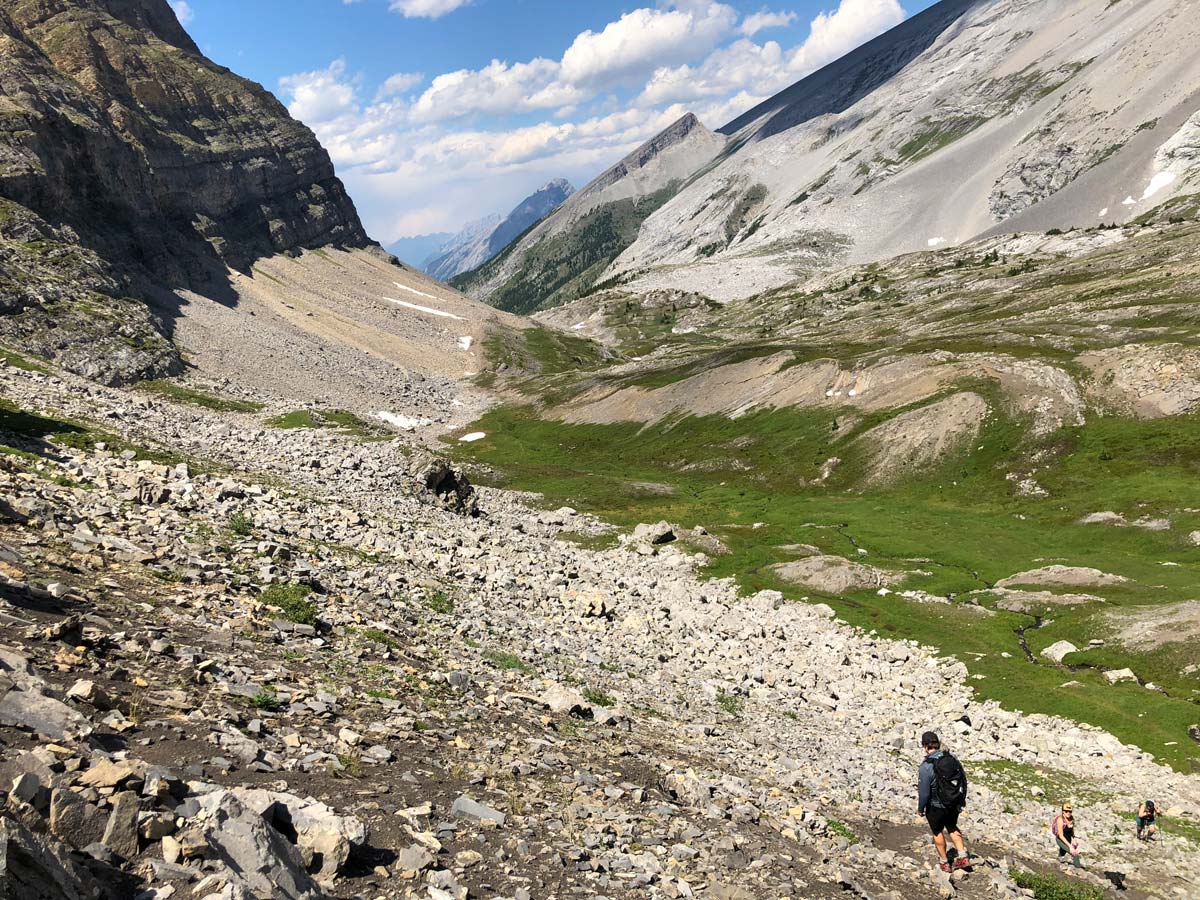
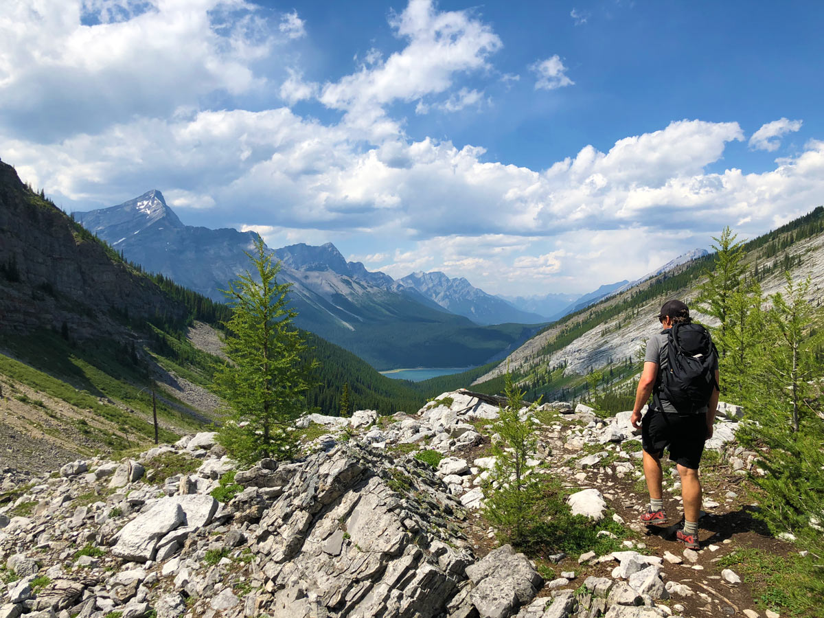
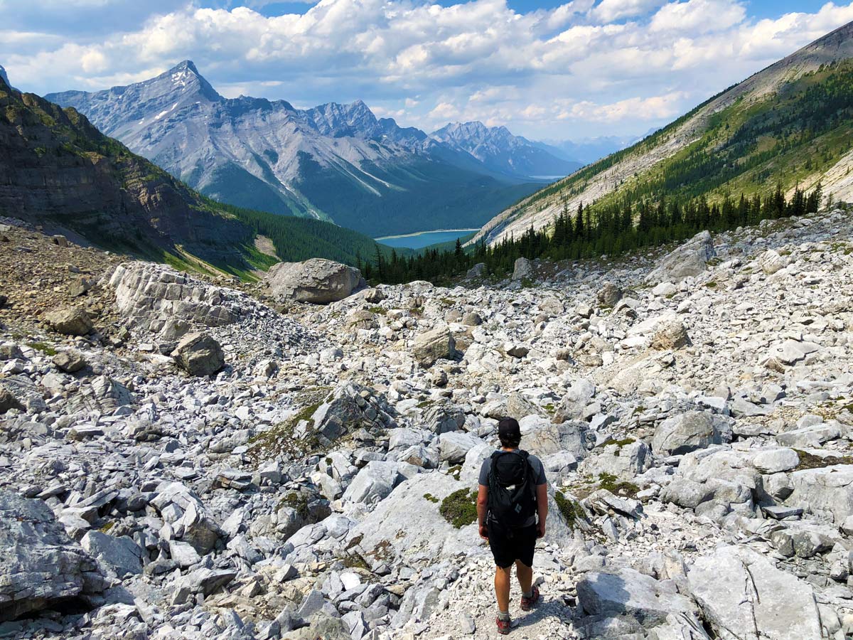
After about an hour from leaving the car, you come out of the forest and come to a boulder field. There are two ways to go here, we went left and contoured around this boulder field on the way up. You could also go right here and find the path that goes up through the rocks (you can see on the map that we took this route down). The path is hard to follow, so just keep going up the valley in the general direction.
As you ascend you’ll pass through some boulder fields that require careful footwork. Roughly 0.9mi’s after you come out of the trees, after a bit of downhill, look for a path cutting back up a small rock-band. This rock band requires one point where you need to use your hands.
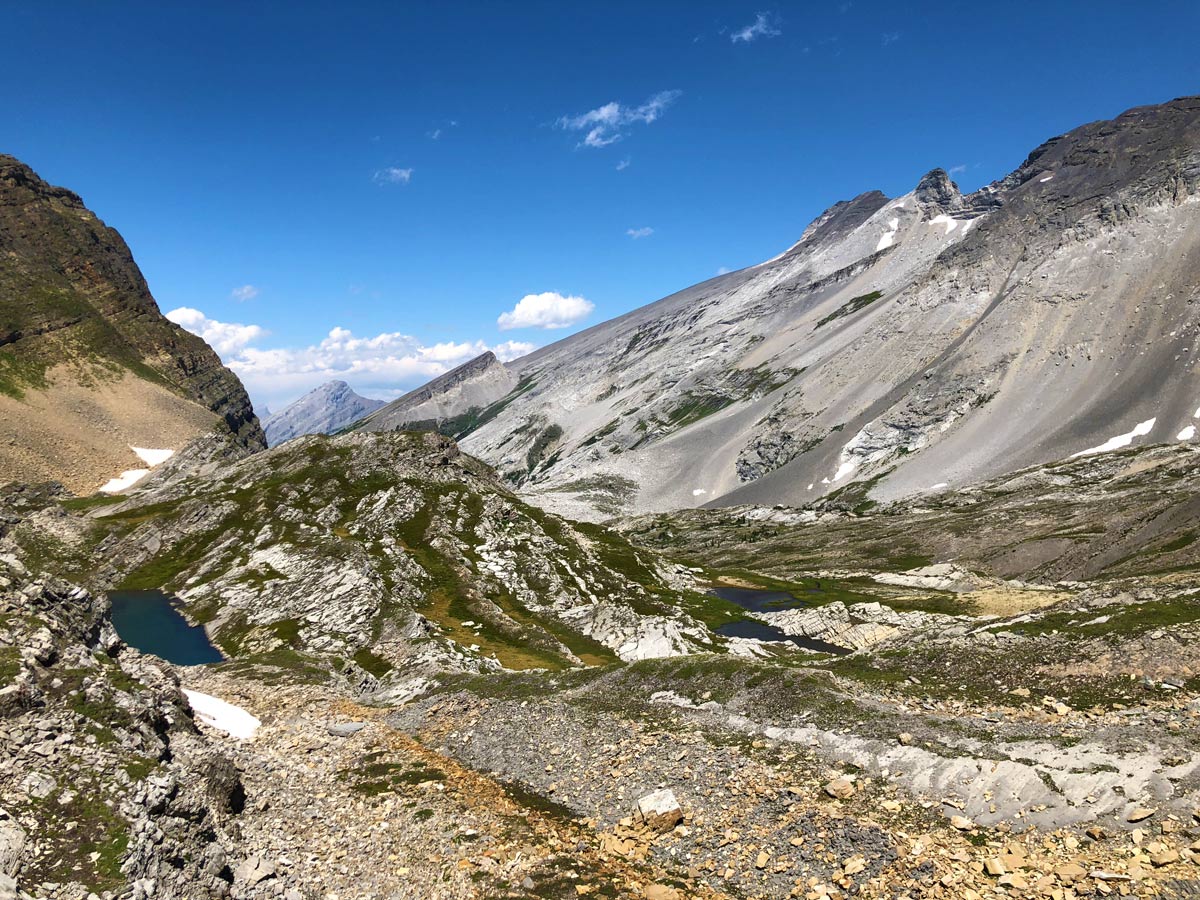
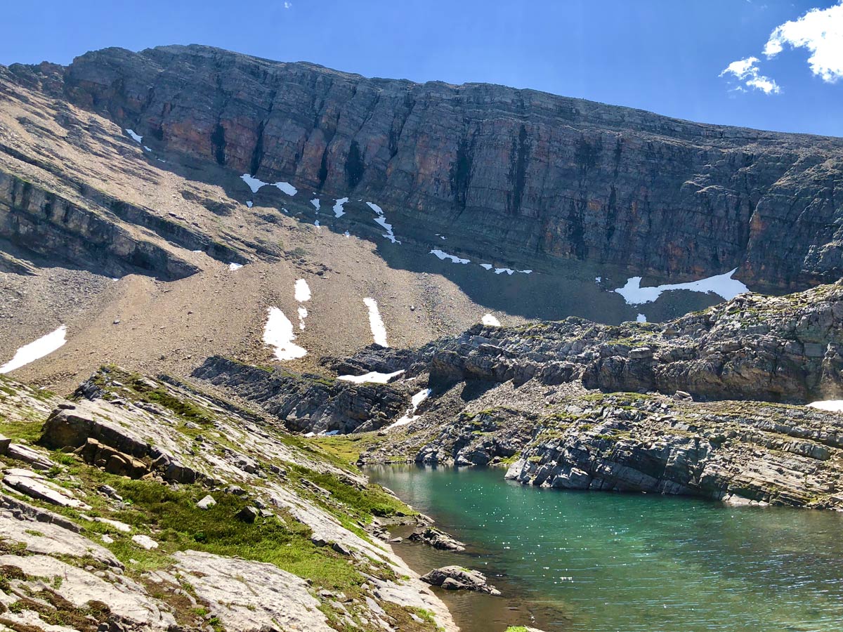
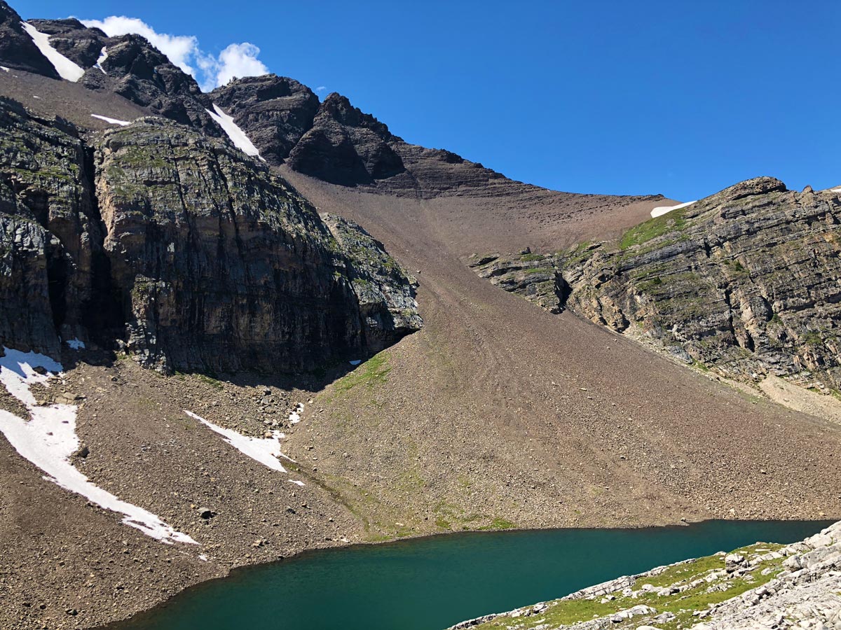
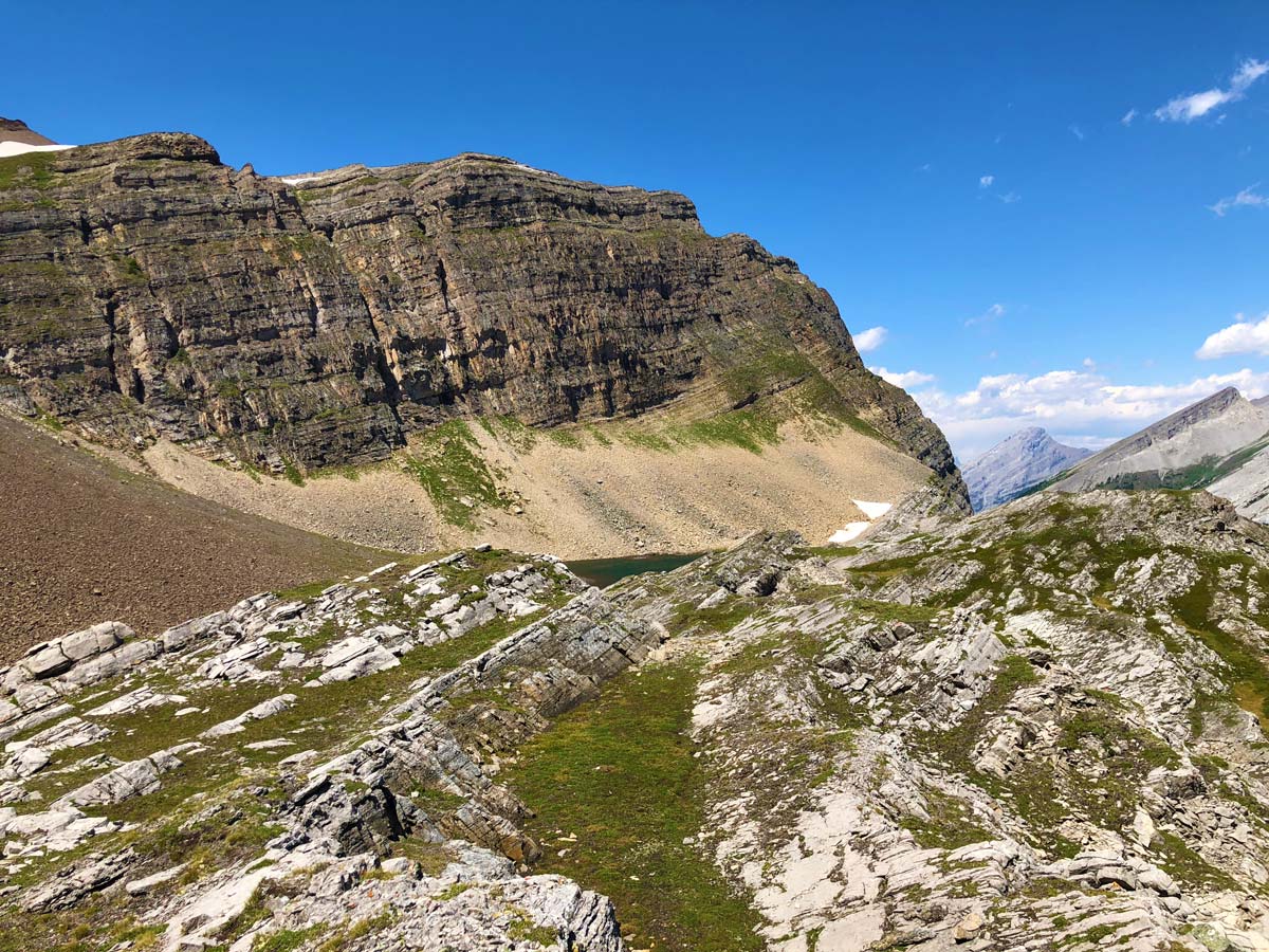
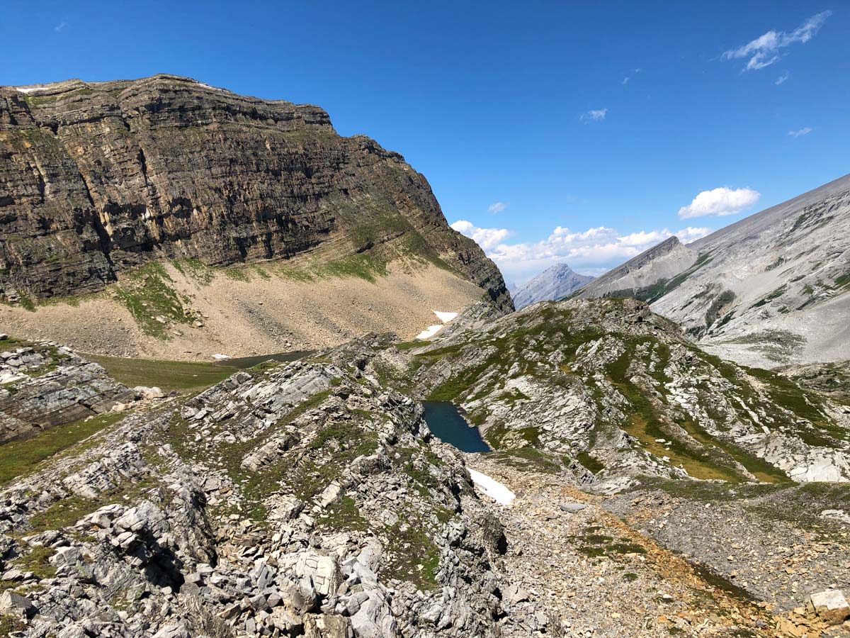
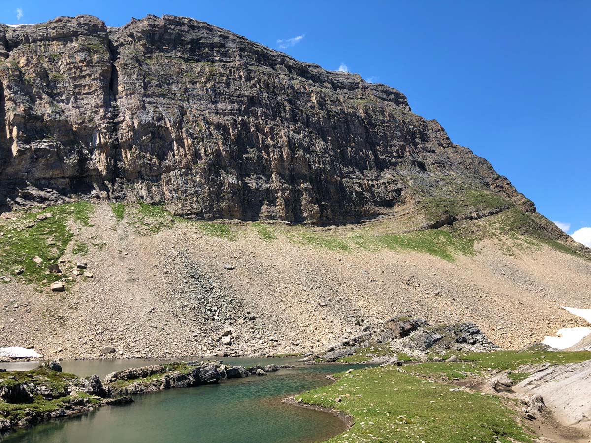
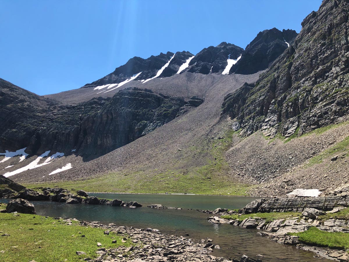
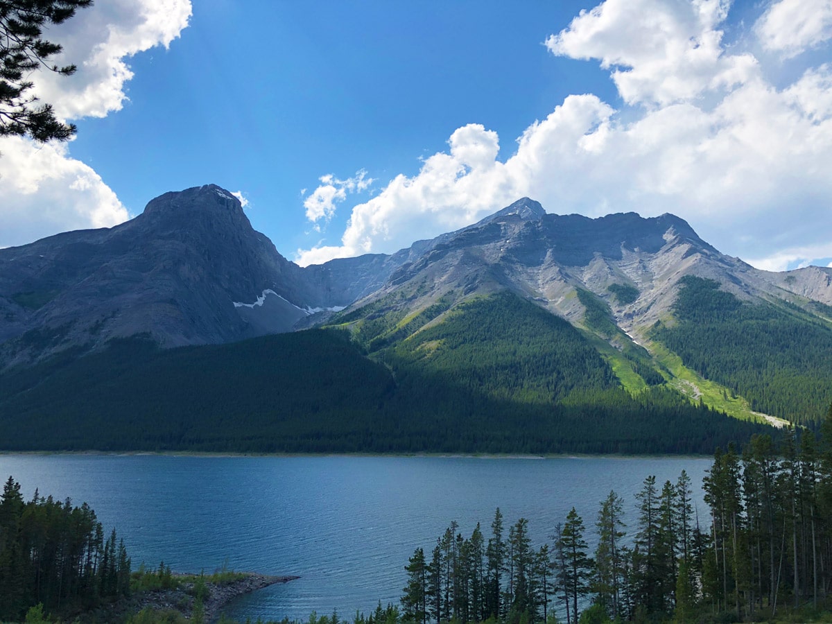
From here, make your way up and over to the right. Soon you come over a scree hill and you’ll look down on the pretty Sparrowhawk Tarns, overshadowed by Mount Bogart. While some people stop here, spend the effort and hike down and explore the tarns.
Wandering around the tarns is great fun, and each one has a different colour, and varying views of surrounding mountains as you explore. The Sparrowhawk Tarns are at their peak in the summer and can dry up by autumn.
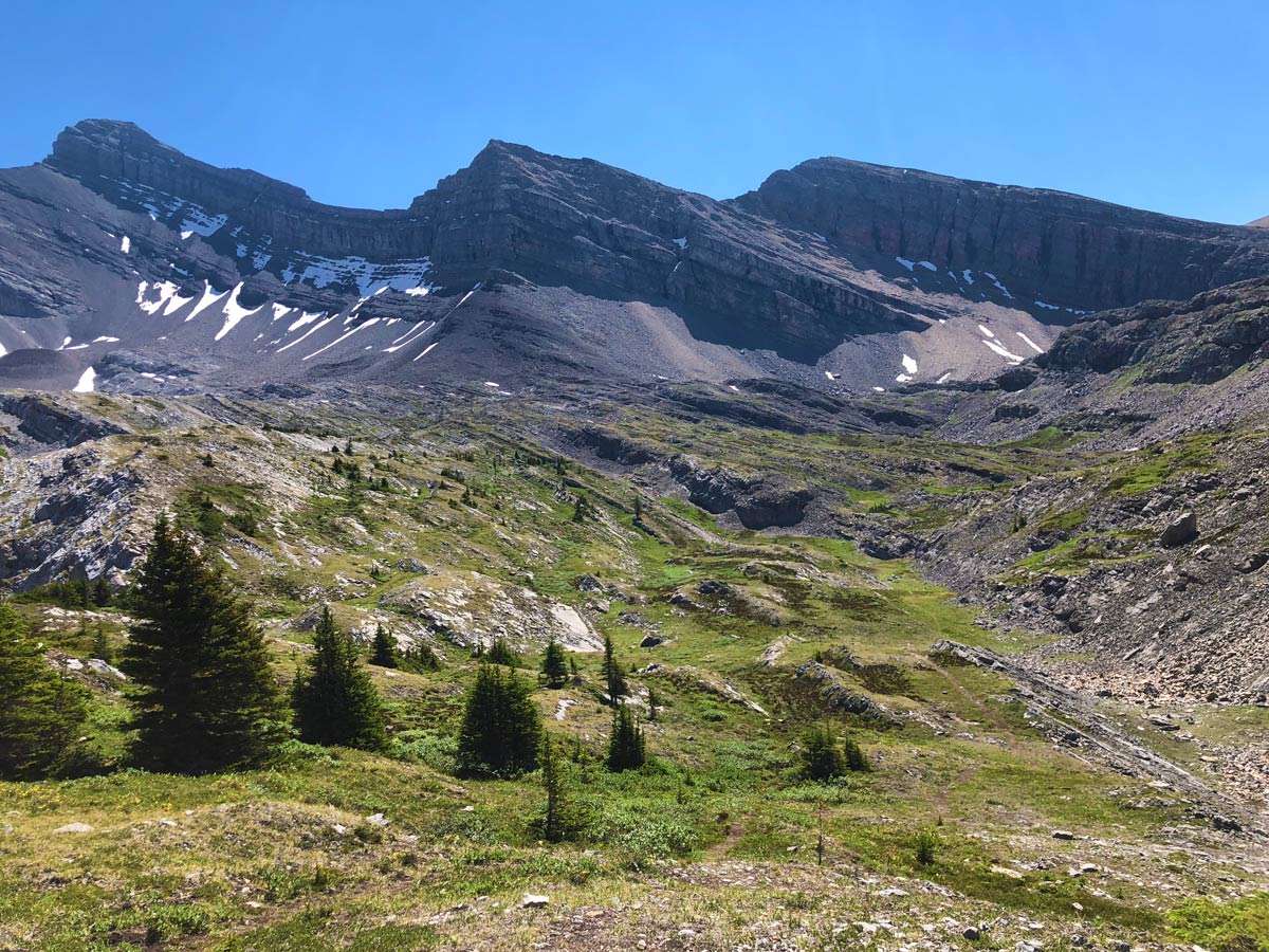
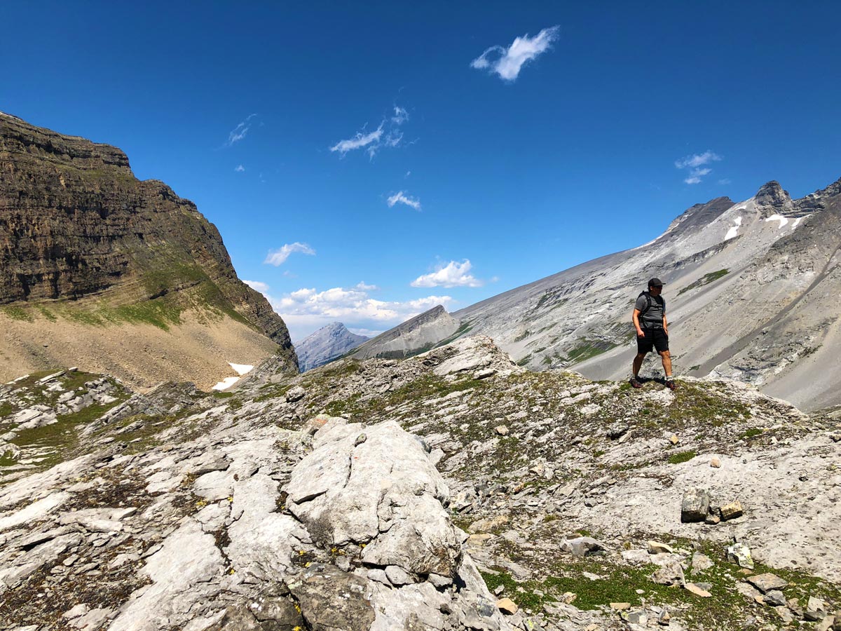
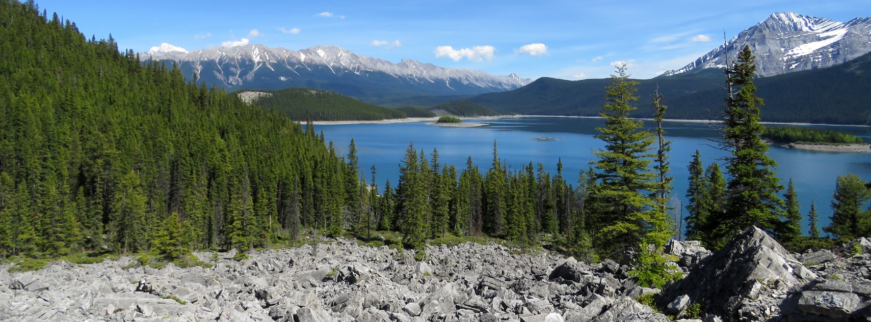
To return to your car, head back the way you came. You’ll see from our map that there are several variants as trails split until you get back in the forest. It’s a pretty walk back, with great views down to the Spray Lakes Reservoir.
Check out other amazing hikes in Kananaskis – Smith Dorrien:
Insider Hints
If there is one hike you want to have a map for, it’s this one. Once out of the trees, it’s hard to follow the trail and it’s useful to have a map to see where you are.
The tarns are greatly reduced by autumn, so this is a hike you want to do in the summer, while snowmelt is still feeding them.

Similar hikes to the Sparrowhawk Tarns hike
Pig’s Back Trail
The Pig’s Back is a route to a prominent feature along the Commonwealth Ridge Traverse. You will hike up Commonwealth…
Tryst Lake Trail
The trail to Tryst Lake is used year-round by many different types of adventurers. The summer trail is easy to…
Hidden Lake Trail
There’s an element of uncontained excitement when making your way to a destination with the name Hidden Lake. Just hearing…
hannahthorns 4 years ago
Sparrowhawk Tarns is an unpolished gem! It's lovely as it is, but it could get better!
Margaret Theroux 4 years ago
It's hard to stay on the trail, but with some route finding it's an enjoyable hike. Just keep an eye on the signs and the map and you'll be okay. Not many other people which was refreshing compared to some other hikes in the area.
Rosemery Ash 4 years ago
It was one of the less-traveled hikes. There was not a single soul when we visited.
Soli Petravron 4 years ago
Sparrowhawk Tarns got some difficult trails. But once you reach the tarns, the amazing views will make up for the route-finding challenges. Definitely worth the effort.
Jeffrey Reagan 4 years ago
Genuinely amazing experience! Everything looked so stunning!
noraliu 4 years ago
The scenery was breathtaking and the trails were fantastic! Enjoy!
Haffy K. 5 years ago
Great hiking experience. Everywhere you look, it's simply beautiful. The scenery was spectacular.
Tina Loo 5 years ago
Great hike! The first part, through the trees, is quite pleasant: but watch the signs to make sure you're on your way to the tarns and not going along the High Rockies trail (mountain bikes) or to Mount Sparrowhawk (which is different). When we did it, there was lots of flagging for pest control - don't let that fool you (we did it on 21 August 2019).. Once you're out of the trees, pick your way along the boot beaten path. It's a bit tricky when you get to the boulder fields but definitely do-able! Lots of pikas and marmots - and fossils! The rocks themselves are beautiful. Well worth doing.
Sidney A. 5 years ago
It's useful if you bring a map along the way. This trail is an underrated gem.
akaneogawa 5 years ago
Lovely spot that gives you a perspective on the surrounding majesty of Kananaskis!