Buller Pass hike
View Photos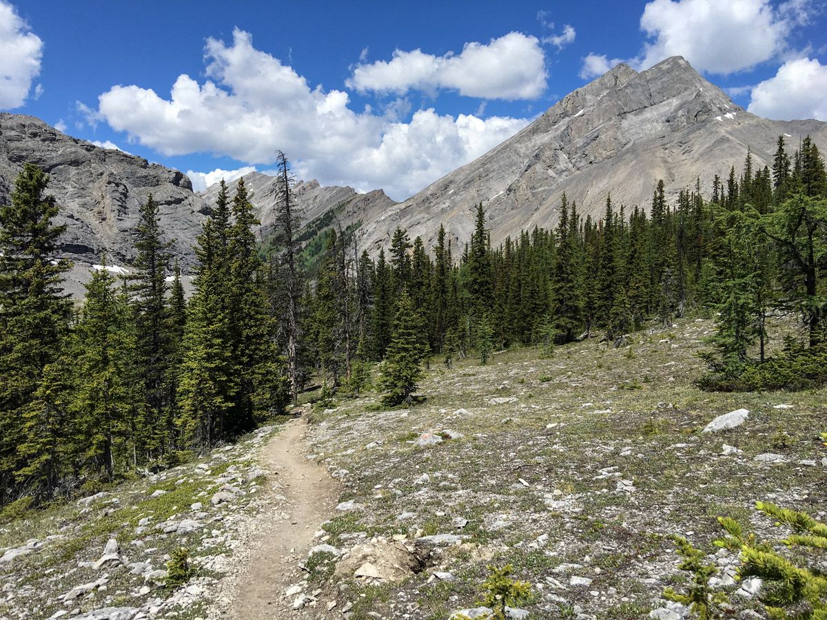
Buller Pass hike
Difficulty Rating:
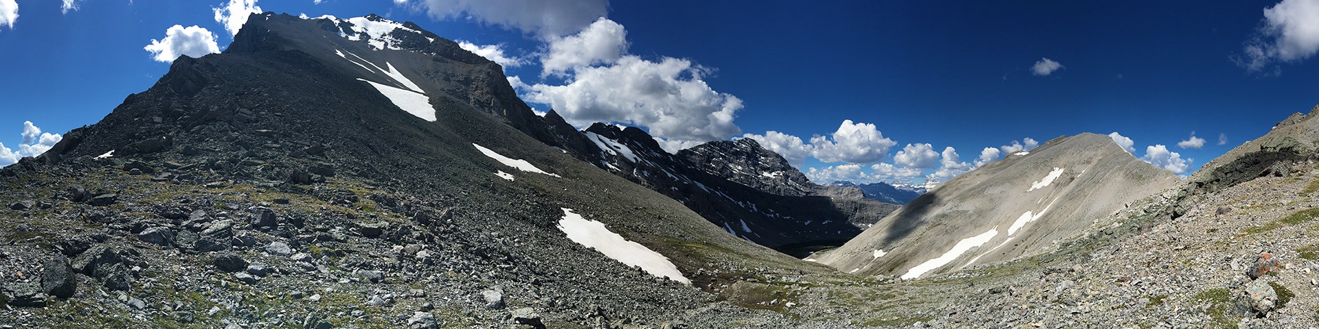
The hike to Buller Pass is one of the most spectacular in Canmore. It’s perfect for intermediate hikers, and despite the region still recovering from a forest fire, there are beautiful views and wildflowers throughout the trail. Once above treeline enjoy stunning views all the way to the pass!
Getting there
From the Canmore Nordic Centre, take the Smith-Dorrien Trail (Highway 742) 19.9mi all the way to the Buller Mountain Day Use Area. The parking lot is on the west side of the road.

About
| When to do | June through October |
| Backcountry Campsites | No |
| Toilets | Trailhead |
| Family friendly | No |
| Route Signage | Average |
| Crowd Levels | Moderate |
| Route Type | Out and back |
Buller Pass
Elevation Graph
Weather
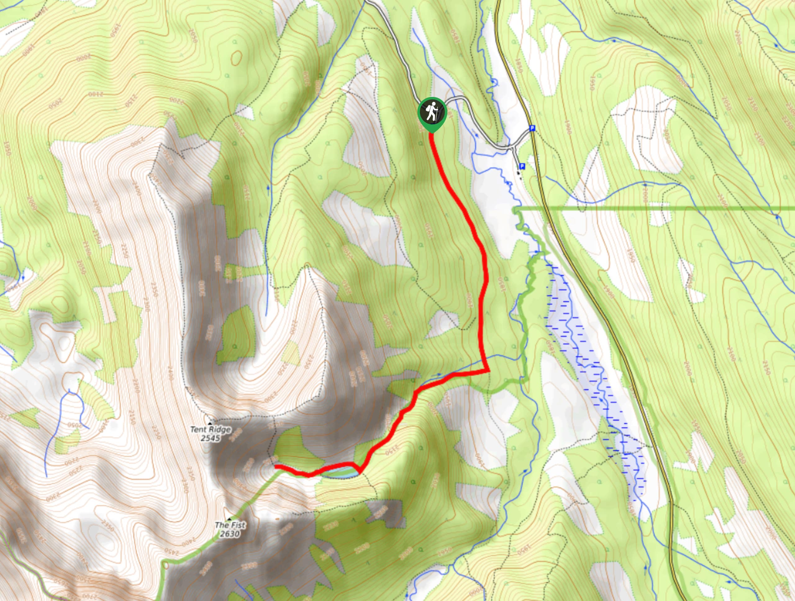
Route Description for Buller Pass
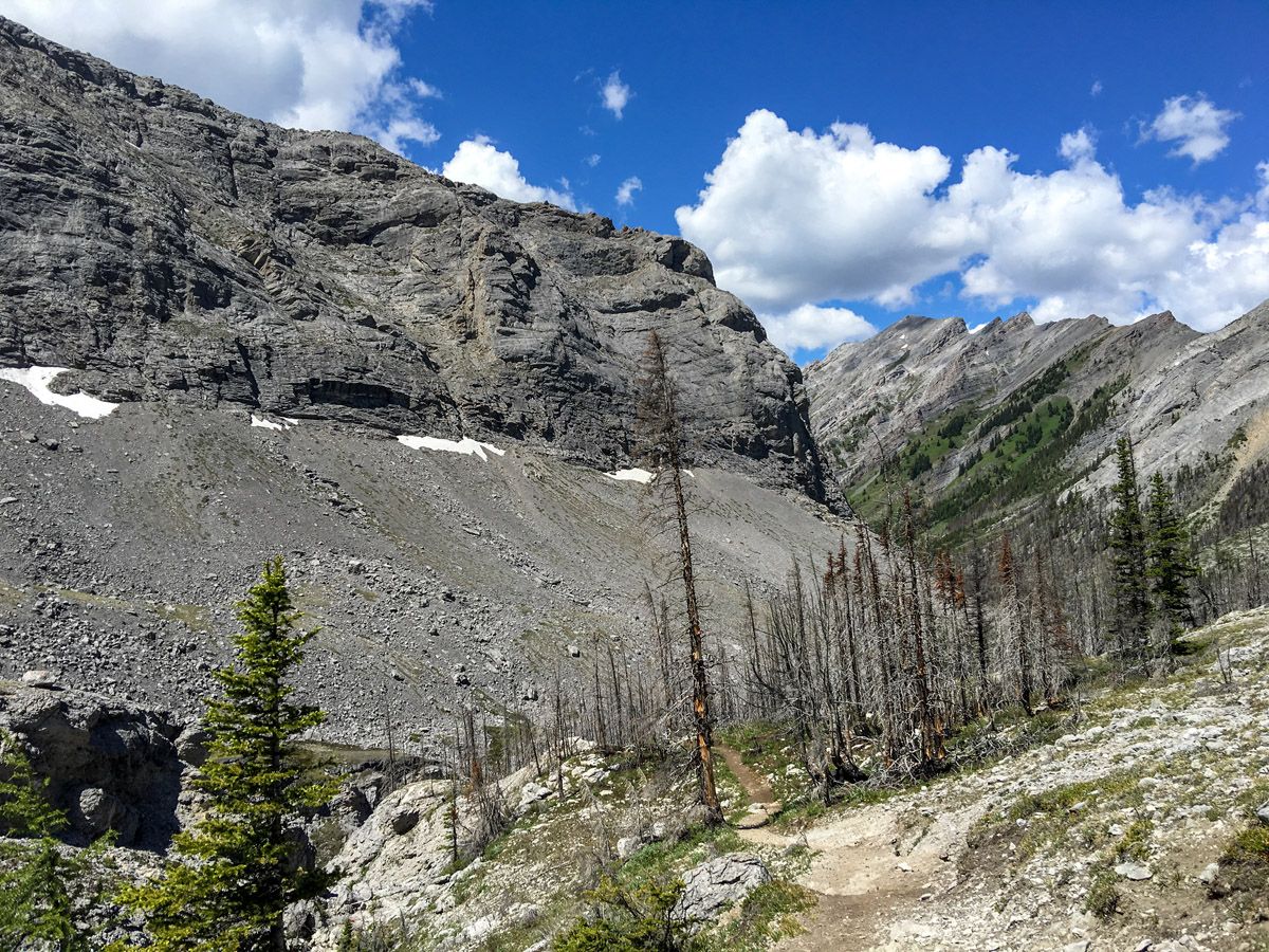
From the parking lot, head back across the Smith-Dorrien Trail. The hike starts out in a thick forest, gently climbing upwards towards the meadow, gradually increasing in grade as you approach. The climb feels surprisingly long, but the shade of the trees keeps the temperature milder. Additionally, along the way you’ll pass a waterfall, another great way to cool off during a hot summer hike.
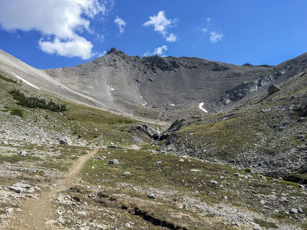
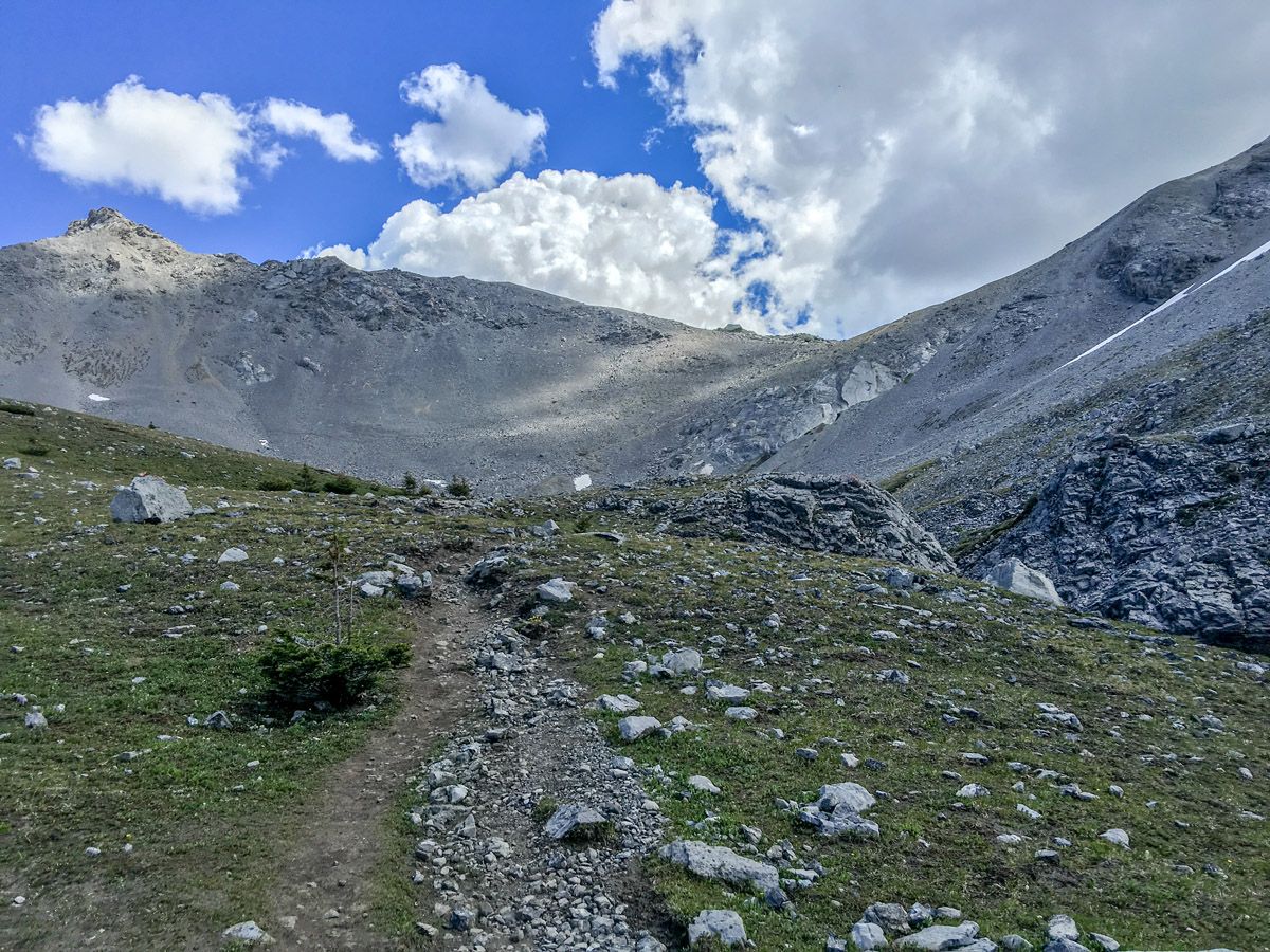
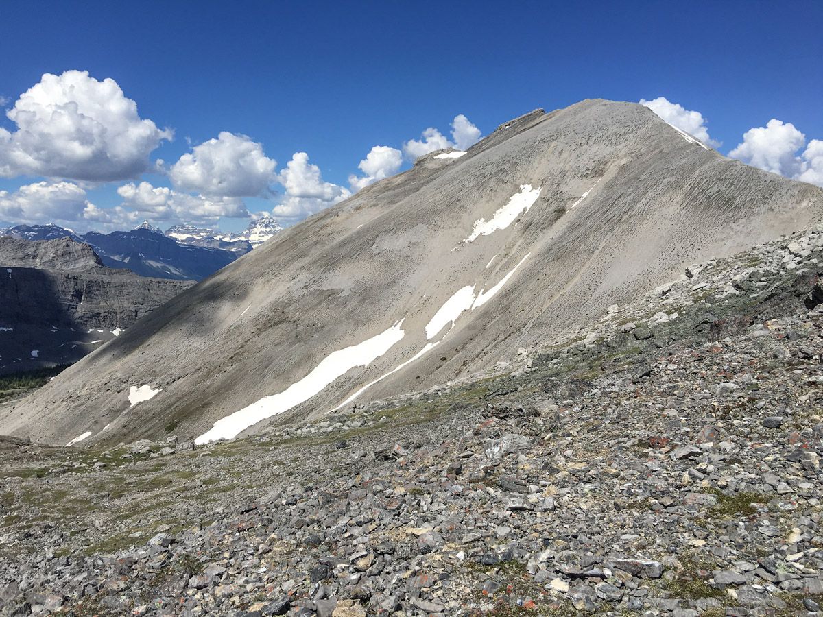
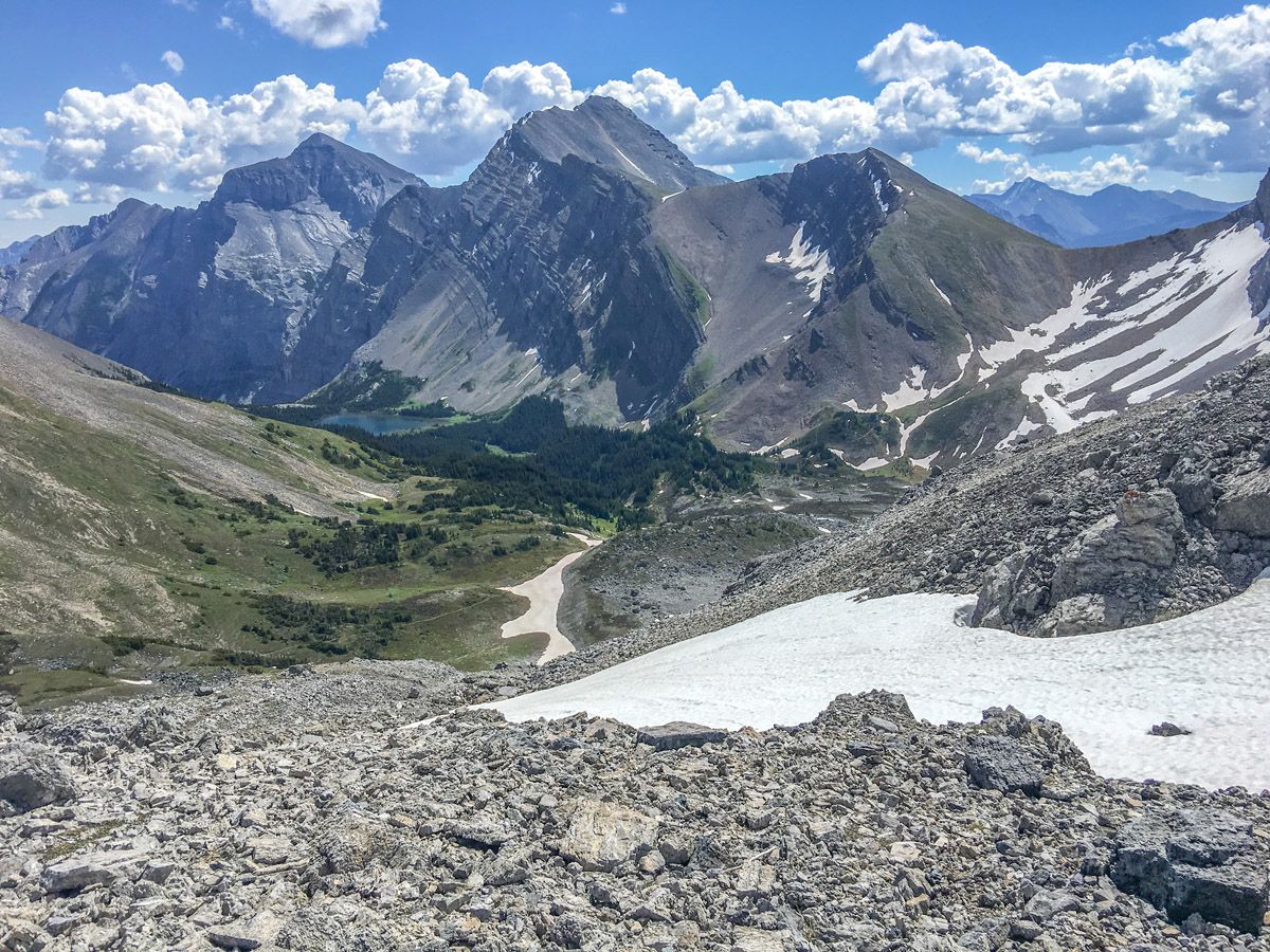
Right before the pass, you’ll encounter a flat, two-kilometer meadow. As you approach the pass, there are a number of switchbacks leading up to it and the pass itself is quite steep as well, with a scree slope near the top. Pace yourself. When you reach the top, take a lunch as a reward for all your hard work.
As you hike, you’ll also notice that the forest morphs from thick and lush to burnt out, with numerous wildflowers. The terrain then turns to an alpine meadow, and finally to the scree scramble above the treeline. Additionally, the overall difficulty of the hike gets progressively greater as you approach the pass. However, the trail is excellently marked.
Those with energy can continue on to Ribbon Lake, Guinn’s Pass or to North Buller Pass.
Descend on the same route you took up.
Check out other amazing hikes in Kananaskis – Smith Dorrien:
Insider Hints
Try to spot the marmots and chipmunks in the meadow – they are too cute!
If you are feeling adventurous, continue another 2.5mi down the other side of the pass to Ribbon Lake. Just keep in mind that you will have to do the pass another time.

Similar hikes to the Buller Pass hike
Pig’s Back Trail
The Pig’s Back is a route to a prominent feature along the Commonwealth Ridge Traverse. You will hike up Commonwealth…
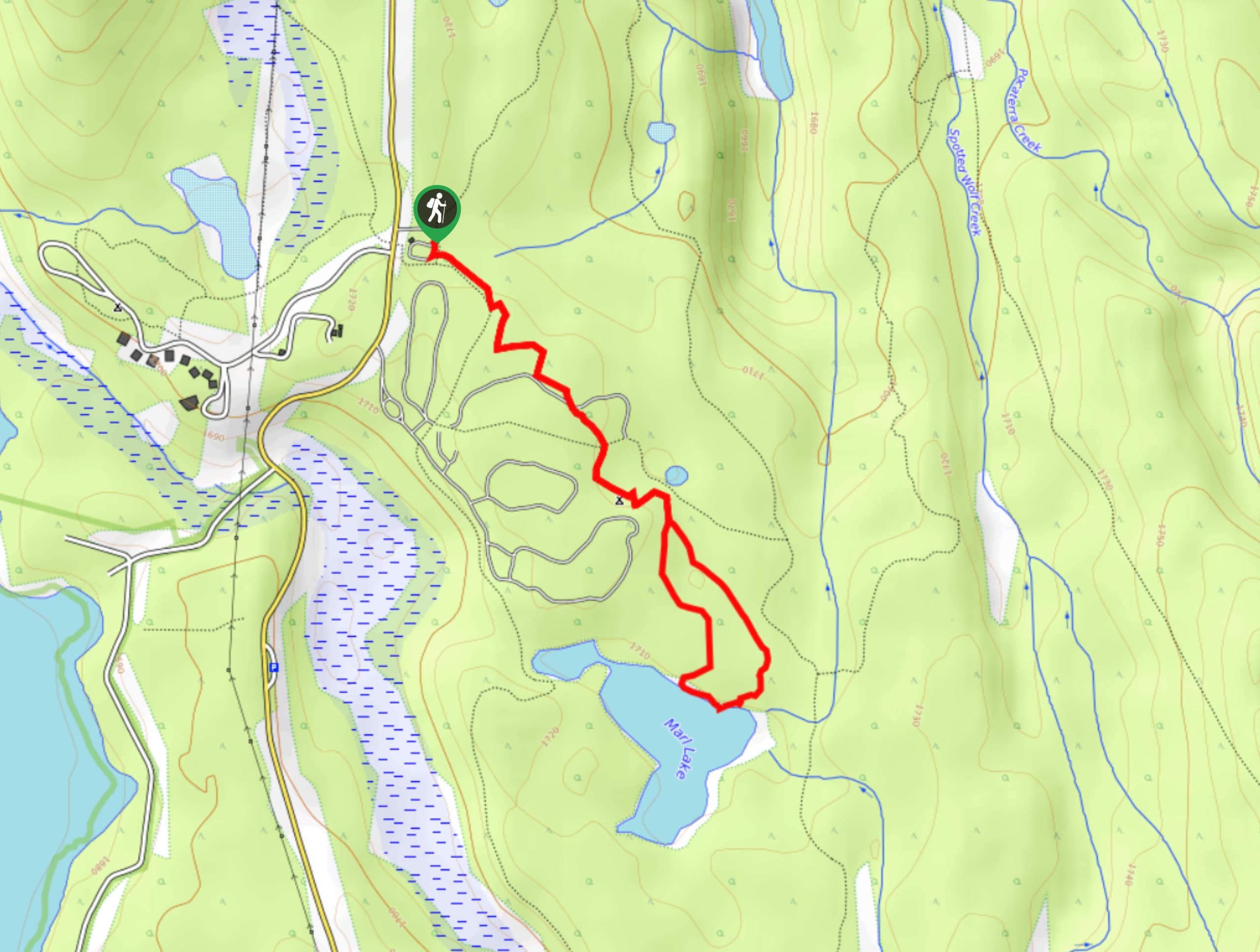
Marl Lake Trail
The Marl Lake trail is a moderately trafficked trail near Lower Kananaskis Lake that is accessible for all abilities. It…
Tryst Lake Trail
The trail to Tryst Lake is used year-round by many different types of adventurers. The summer trail is easy to…
MartiniC 4 years ago
Buller Pass has quite steep ascends and descends, but it comes with excellent adventure and views along the way!
hannahthorns 4 years ago
It was extremely windy when i went here but I enjoyed it a lot.
Coll A. 4 years ago
There's a waterfall where you can cool off during a hot summer hike. Some parts of the trail were steep. You can have lunch at the top.
lindsaaay 4 years ago
Pretty strenuous and it keeps getting harder as you ascend. Definitely try and go while the wildflowers are out, it's so beautiful. We wanted to go further after the peak but it was already a longer day. Next time!
LyleM 4 years ago
Had a lot of fun with this trail. Was challenging but well planned out. Steep climbs then slow inclines to allow you to catch your breath. Great views.
Lambert Y. 4 years ago
Most of the spots are open and exposed. Not many trees and greeneries to see, but quite enjoyable.
Sean Kater 4 years ago
It's quite amazing, but it would be better if there are more trees along the way.
Linby SK. 4 years ago
Buller Pass is for the adventurous soul. I really enjoyed the hike. It's challenging but rewarding.
Elmer J. 4 years ago
Hope it recovers soon! So much potential in it.
Pristine Blue 4 years ago
most of the trail was exposed to elements so make sure to use sunscreen to avoid sunburn.