
Beaver River Trail
View Photos
Beaver River Trail
Difficulty Rating:
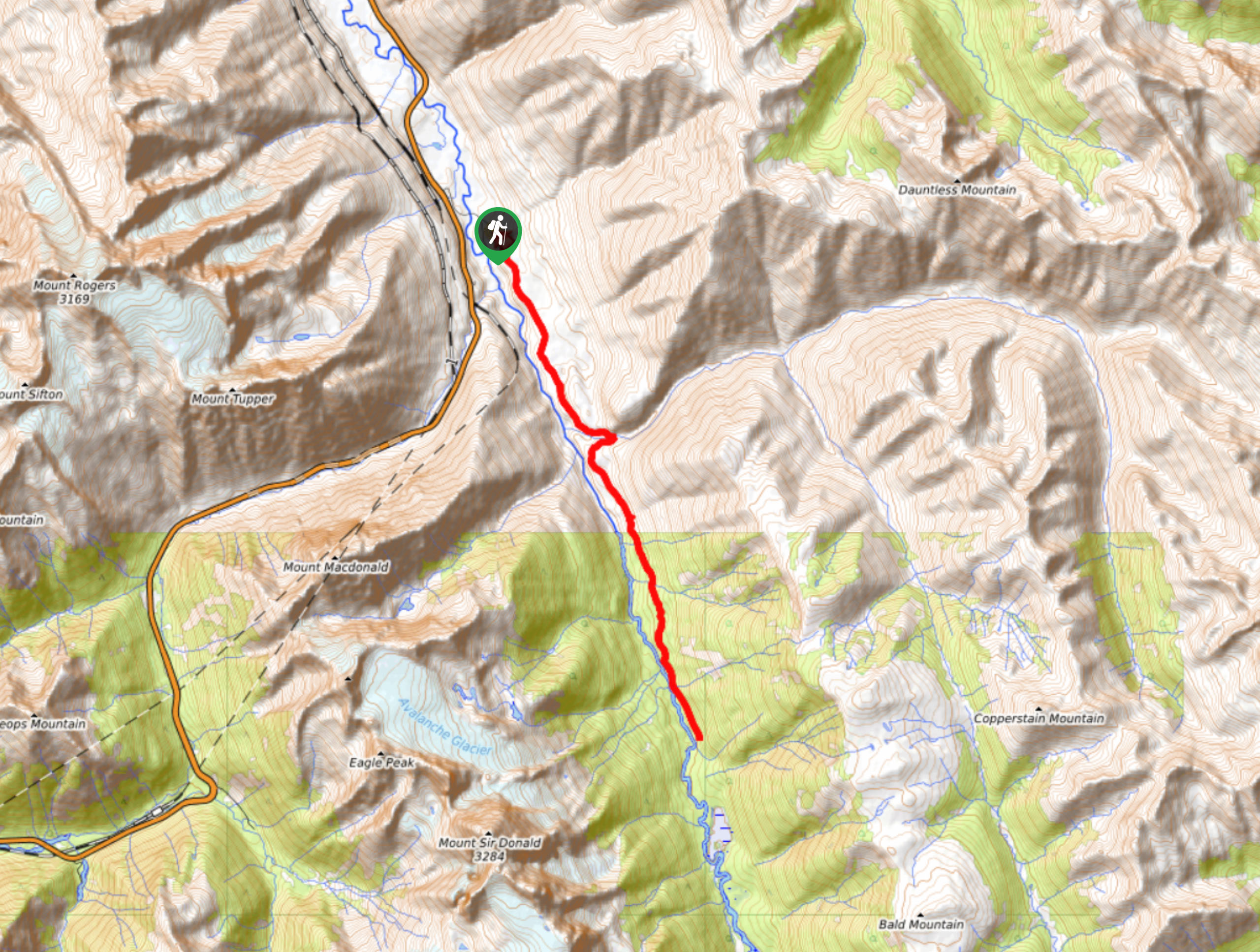
The Beaver River Trail is a 14.0miout-and-back hiking route that travels into the backcountry of Glacier National Park and provides some amazing views of the nearby mountains. Along the route, you will hike alongside the coursing waters of the river, while catching views of the natural beauty found within the park. This lengthy route is an awesome way to explore Glacier N.P. while building up the experience to try out some of its more difficult hikes.
Getting there
To get to the Beaver River trailhead from Revelstoke, drive east on BC-1 for and make a slight right onto Beaver Valley Road. After 1.0mi, you will find the trailhead at the end of the road.

About
| When to do | June-October |
| Backcountry Campsites | No |
| Pets allowed | Yes - On Leash |
| Family friendly | Older Children only |
| Route Signage | Average |
| Crowd Levels | Moderate |
| Route Type | Out and back |
Beaver River Trail
Elevation Graph
Weather
Beaver River Trail Description
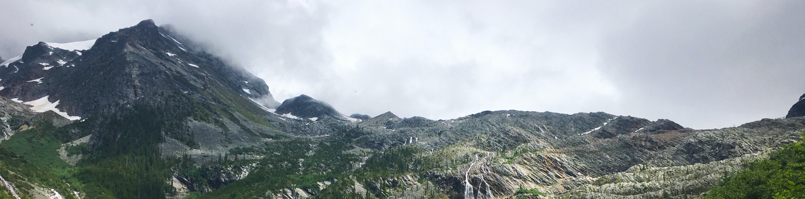
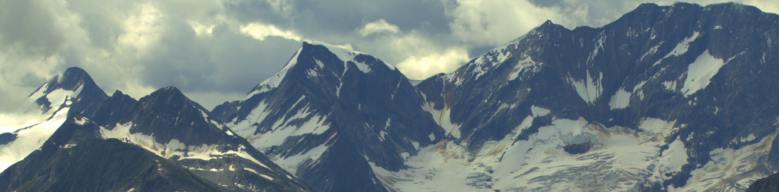
The Beaver River Trail is a scenic hiking route within Glacier National Park that travels into the backcountry alongside the rushing waters of Beaver River and provides hikers with scenic views of nearby mountain peaks. Along the trail, hikers will follow closely along with the sounds of the rushing river as they travel through the dense forest cover. This route has some moderate changes in elevation; however, the trail isn’t overly technical, making for an efficient hike through the scenic woodland landscape that can be enjoyed by hikers of almost every skill level.
In addition to the relaxing forest atmosphere, you will also be able to take in the majestic sights of some of the rugged mountain peaks in the area from their eastern side, including Mount Sir Donald, Uto Peak, and Terminal Peak. After you’ve reached the end of the trail, make your way back along the same route through the forest to return to your vehicle.
Similar hikes to the Beaver River Trail hike
Great Glacier Trail
The Great Glacier Trail is an 4.9mi out-and back hiking route in Glacier National Park that features waterfalls,…
Video Peak Trail
The Video Peak Trail is a scenic 8.4mi hiking route in Glacier National Park that takes you through…
Hermit Trail
Hike along the Hermit Trail for a physically demanding but ultimately rewarding journey up to an alpine campsite in Glacier…
Comments